Atmospheric River To Bring Heavy Rain And Snow To The Pacific Northwest As Quiet Weather Continues Elsewhere
Hello everyone!
Today will bring an end to our nationwide quiet weather streak. While the vast majority of the country will continue to enjoy sunny skies, heavy rain and some mountain snow will return to the Pacific Northwest as an atmospheric river sets up.
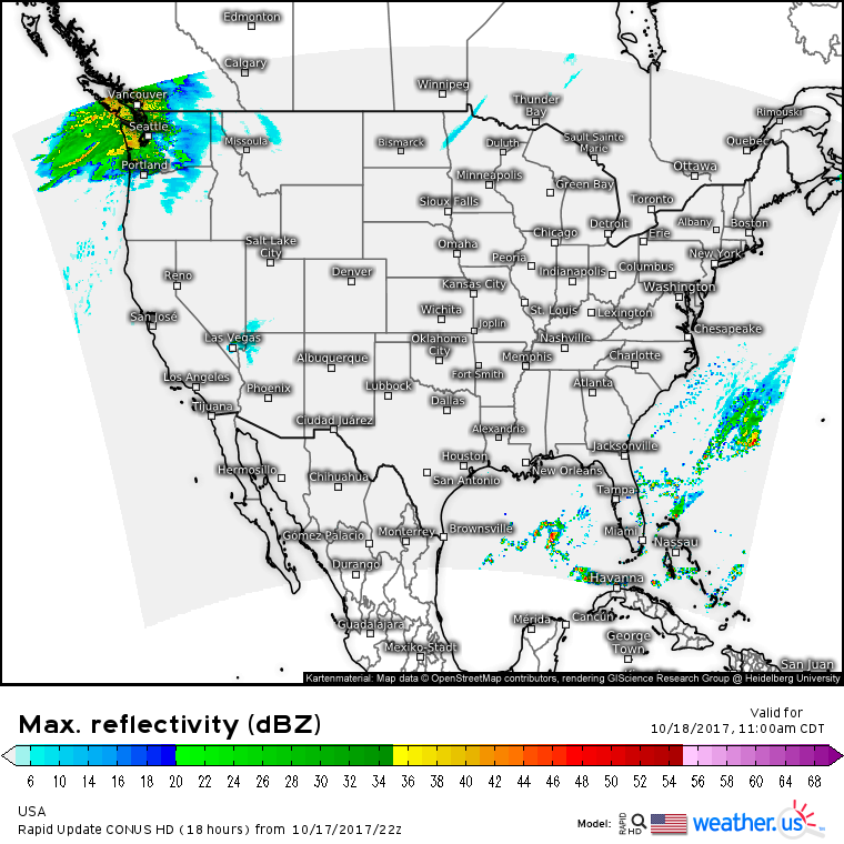
Here’s the nationwide overview for tomorrow. A cold front will continue to linger in Florida with scattered showers and storms, while quiet weather dominate almost everywhere else. The exception will be across Western Washington state where heavy rain, high mountain snow, and high winds are all expected.
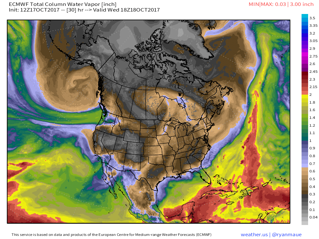
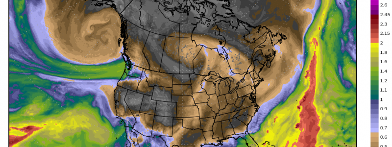
This ECMWF forecast map shows the atmospheric river responsible for this active weather quite well. Notice the long “river” of moisture (greens/blues) stretching from the tropical Pacific all the way into the Washington coast. As this river of moisture is forced to rise up the mountains of the Olympics and the Cascades, heavy precipitation will ensue.
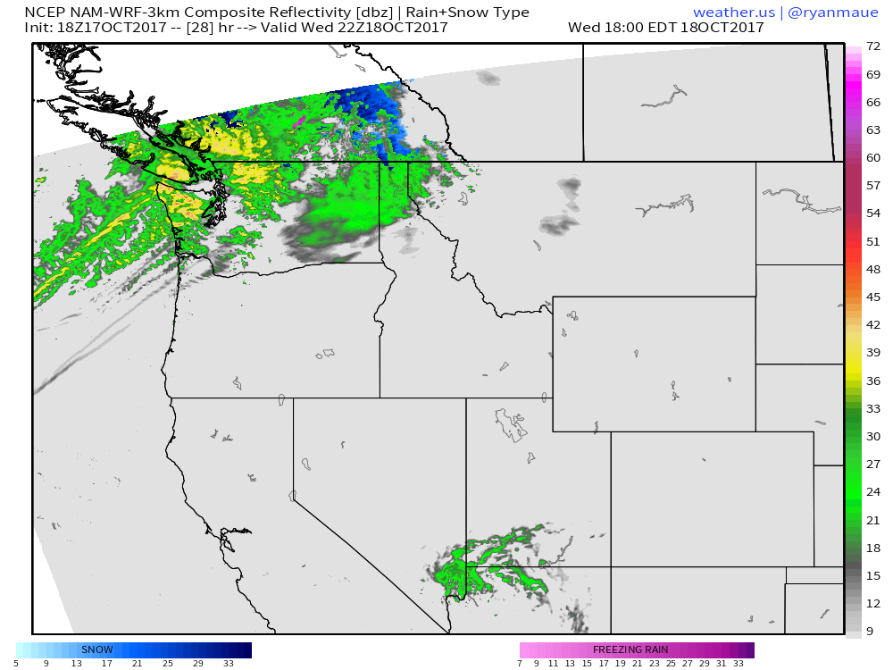
This simulated radar image shows the heavy rains falling across the mountains of Washington state. Because this airmass will be sourced from the tropics, it will be relatively devoid of cold air. This means that snow levels will be quite high, with rain being the dominant precipitation type across the state.
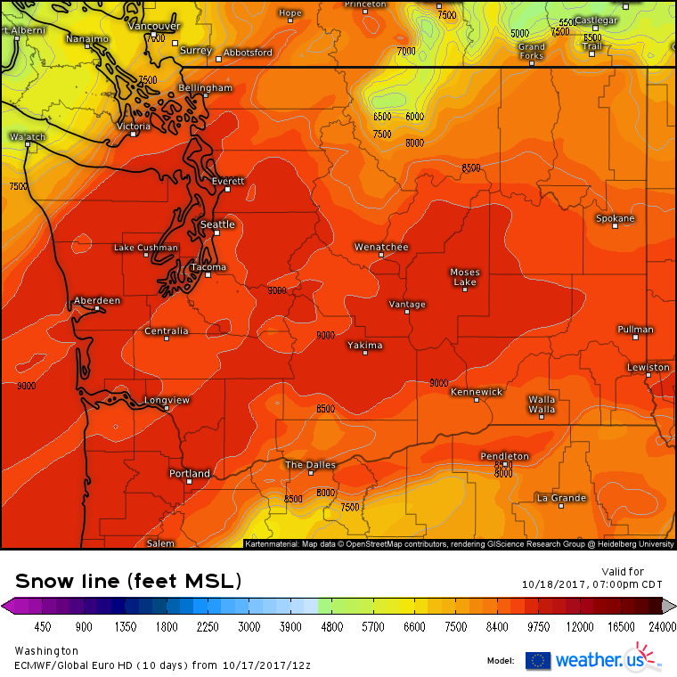
This map from the ECMWF model shows how far up in altitude you’d have to go to see snowflakes. Notice values right around 9,000 feet across much of Washington state this afternoon. Snow is unlikely to be a major issue outside of the summits.
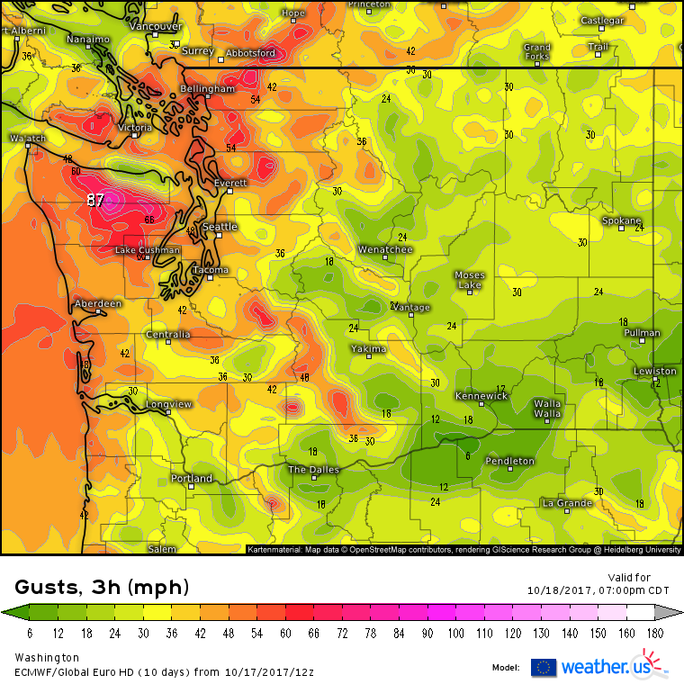
As low pressure moves just to the north of the Seattle area, high winds are also expected in addition to the heavy rain. Wind gusts over 50 mph are expected along the coast of Washington state, with 40-50 mph gusts expected farther inland, east of the Cascades. The higher elevations that can tap into winds above the surface will see much higher wind gusts, perhaps to hurricane force in parts of the Olympics. Winds will be lighter in the lee of the Cascades. These high winds will be strong enough to bring down some branches and trees, especially those weakened by dry conditions in this area during the latter half of the summer. Be prepared for the threat of power outages!
The atmospheric river is unlikely to let up for a while as low pressure remains locked in place over the Gulf of Alaska. This ECMWF total precipitation map shows well over a foot of rain (and liquid equivalent snow) falling across the high elevations of the Pacific Northwest in the coming week.
For more information on your local forecast: https://weather.us/
For more information on the local forecast for Maine and New Hampshire: https://forecasterjack.com/
-Jack
