Atmospheric River To Bring Heavy Rain and Possible Flooding To Parts of the East Coast Later This Week
Hello everyone!
An atmospheric river event is taking shape over the Appalachian mountains this morning, and it will be responsible for some very heavy rain as it drifts slowly east over the next few days. While widespread/major flooding is not anticipated, some rivers and streams are likely to exceed flood stage and minor/moderate issues are expected. This post will take a closer look at the meteorology behind this event as well as what to expect as it unfolds over the next few days.
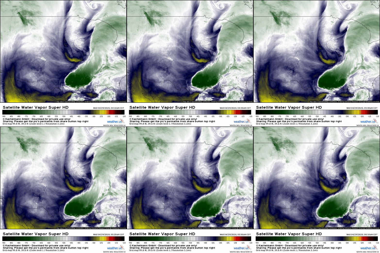
GOES-East WV satellite imagery this morning hardly looks like a classic atmospheric river event. A cluster of strong thunderstorms over Texas and Louisiana definitely stands out as being a region where ample moisture is present in the atmosphere, but where’s the long ribbon of moisture transport?
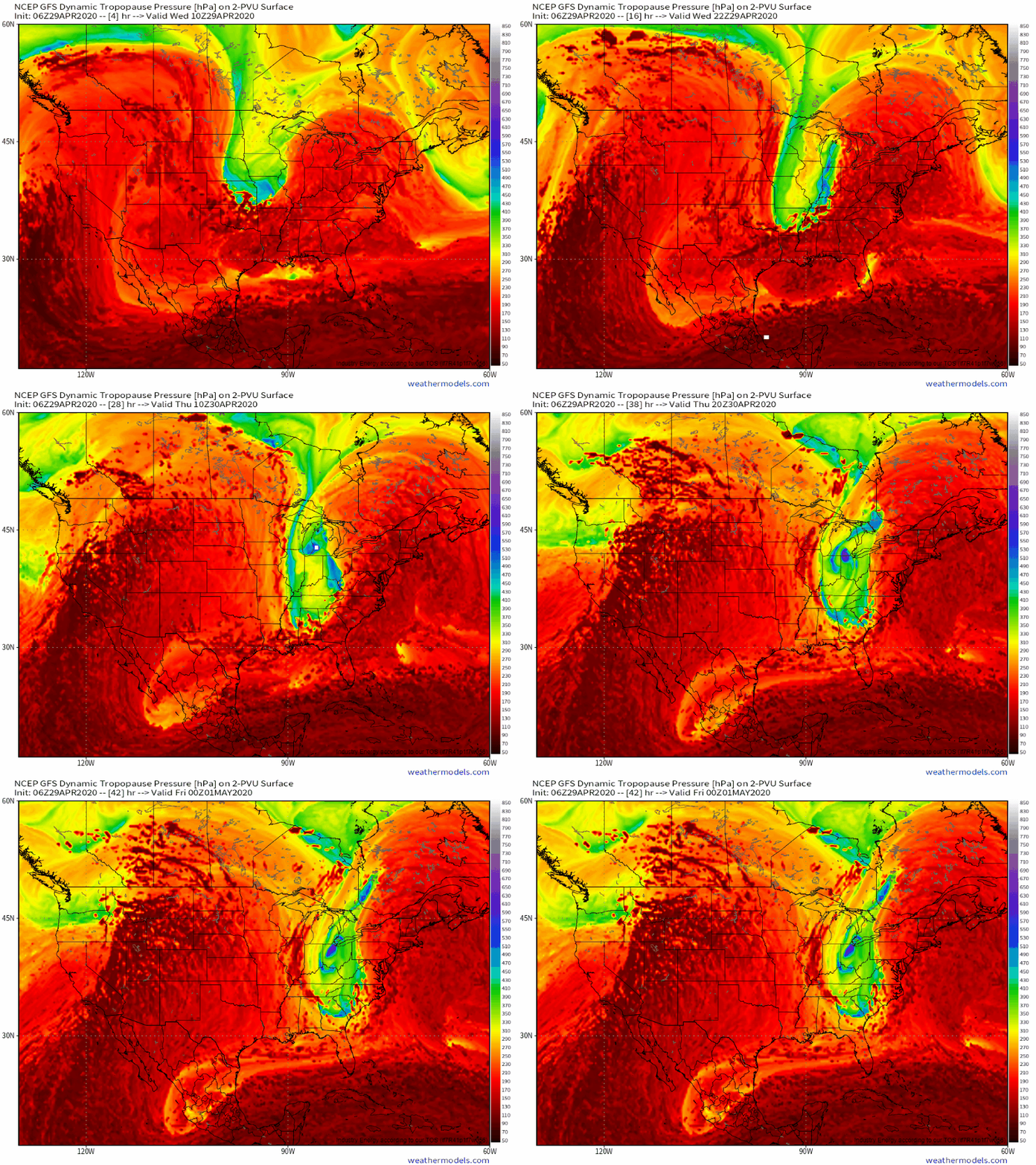
The answer is that it hasn’t formed yet. Note that the trough digging south through the Midwest resembles a bowling ball rather than an elongated dip. To support an atmospheric river event, we need the trough to elongate a bit which would support robust moisture transport over a long/narrow region rather than the current modest moisture transport over a very broad area.
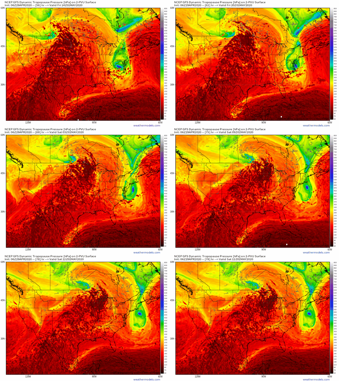
This elongation process will unfold over the next 24 hours or so as a supplemental disturbance dives south around the western side of the trough, a large ridge builds over the Rockies due to changes in the Pacific pattern, and another large ridge builds off the East Coast in response to a number of processes including the release of latent heat from the thunderstorms in progress along the Gulf Coast (which will move through the Southeast later today). As the trough gets strung out between the developing ridges, and that supplemental disturbance pinwheels around the southern edge of the trough to scoop up moisture from the Gulf of Mexico, we’ll begin to see our atmospheric river emerge.
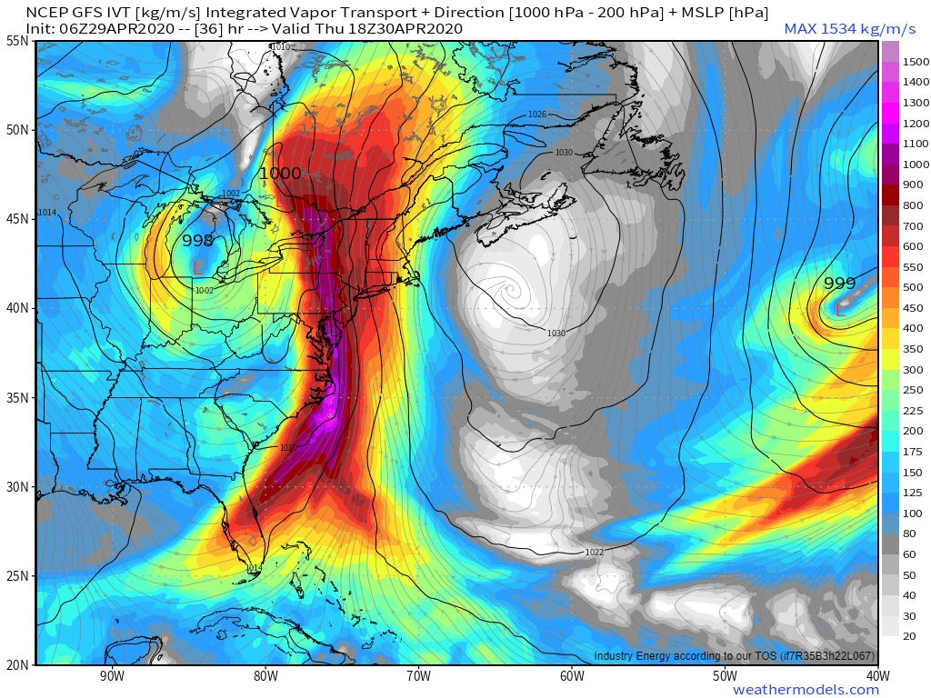
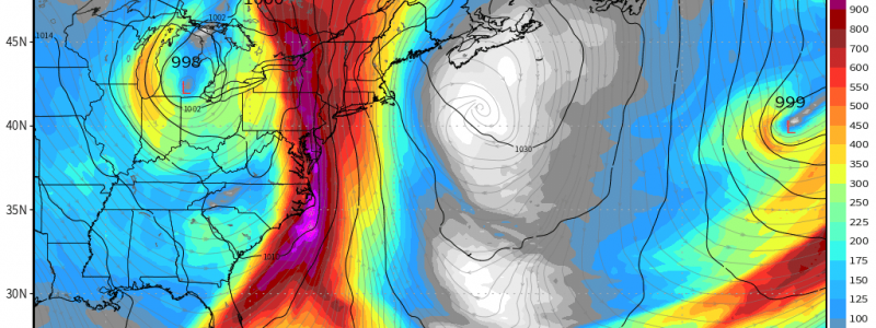
By tomorrow afternoon, that process will be complete. The best way to track and quantify atmospheric rivers is with the Integrated Vapor Transport parameter (this is actually what’s used to define atmospheric rivers). Generally speaking, values over 750 kg/m/s are notable and values over 1000 kg/m/s indicate a meaningful flooding threat (conditional on a few other parameters). Our atmospheric river event looks to fall squarely in the ‘notable’ category with IVT values between 750 and 1000 kg/m/s present through most of the AR (except for a few pockets of higher values near NC). It’s also helpful from a flooding perspective that the AR (and its associated wind field) is oriented parallel to the cold front that marks its western edge. This will help to slow the feature down and support “training” of rain bands and embedded thunderstorms. This training is how you get rainfall totals to really add up without deep convection (there won’t be enough instability for that once you move north of NC/VA).
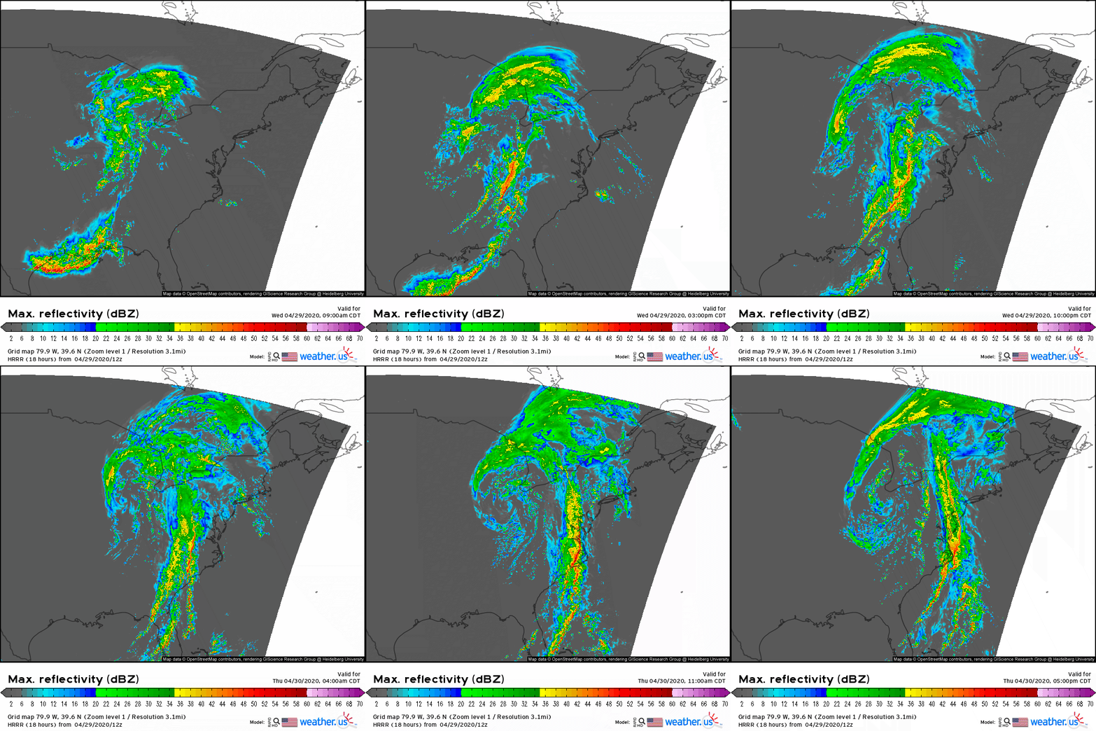
The HRRRv4 simulated radar forecast for the next 36 hours does a good job highlighting how our current disheveled mess of pseudo-organized convection/rainbands will coalesce into a narrow corridor of heavy rain tomorrow. Note that within that corridor, cells are moving generally northward as the axis of heaviest rain slowly shifts east. The northward movement of the individual cells is the “training” phenomenon I mentioned earlier. The slow eastward pivot of the larger corridor is what will prevent this from being a widespread flooding disaster.
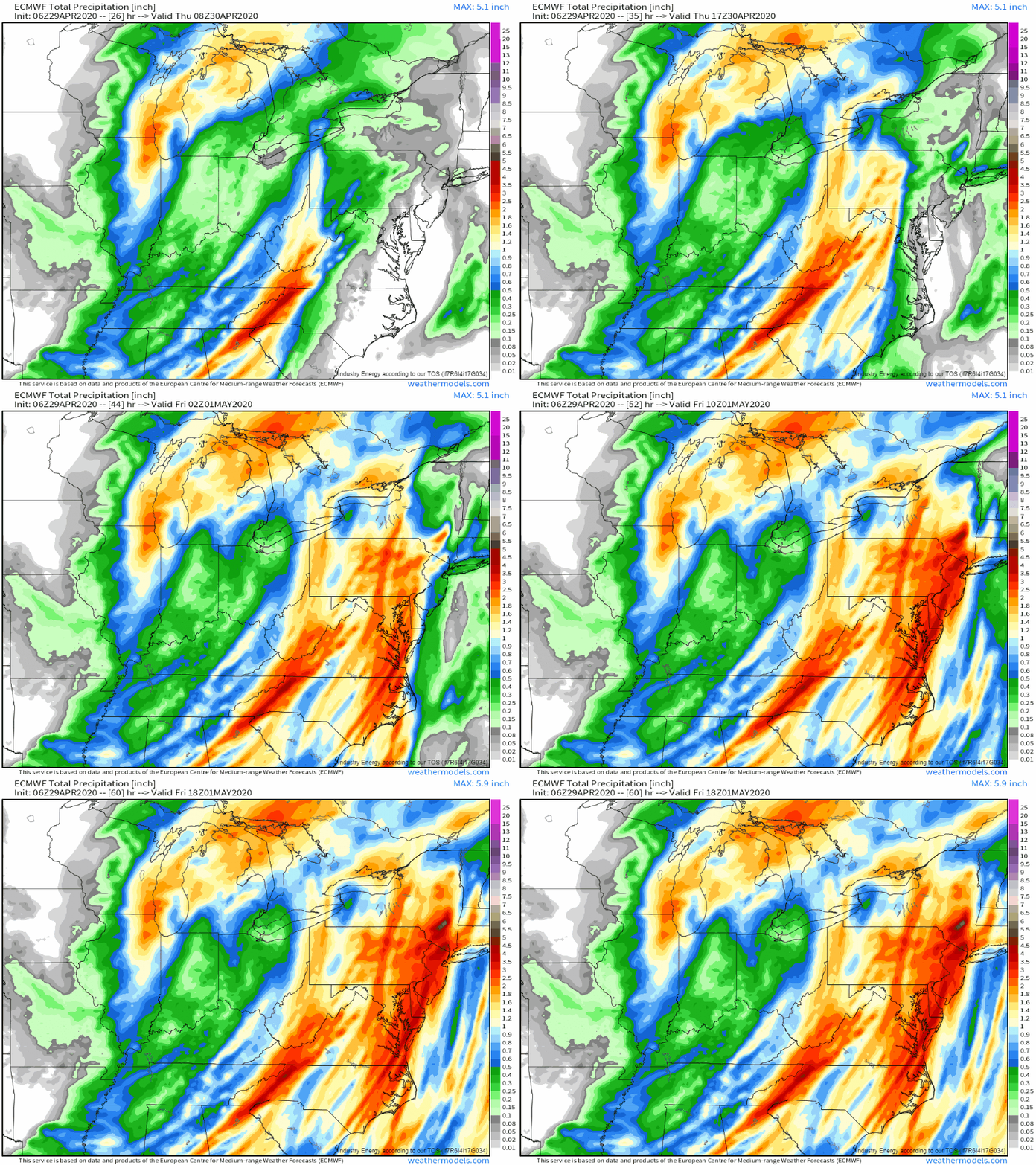
Here’s how the ECMWF expects rain to pile up tomorrow. Note that within the broad corridor of heavy rain, individual cells and their ability to train over any given location will result in locally higher/lower totals. By far the highest totals will be found in areas where orographic lifting can force precipitation even outside the main rainband (and enhance that heavy rain when it does come). The south/southeast facing slopes of the Catskills look to be the jackpot for this event and will likely pick up 3-5″+ of rain when all is said and done.
By Friday, the trough will be moving offshore and reverting to its previous “bowling ball” shape as the ridge out west breaks down and drifts east. As a result, the atmospheric river will both weaken and shift towards the east, putting an end to persistent heavy precipitation. Some showers will persist as the upper level low moves through and the cool air aloft supports some instability during daytime heating hours.
The system will finally move far enough east by Saturday that all but eastern New England will see sunshine and dry weather return.
-Jack
