Atmospheric River Sets Up A Rainy Week On The West Coast
Hello everyone!
A rainy stretch of weather is in store for the West Coast as a series of Atmospheric Rivers point streams of moisture towards the region. In this post, I’ll go over what’s causing the Atmospheric River train and what its impacts will include.
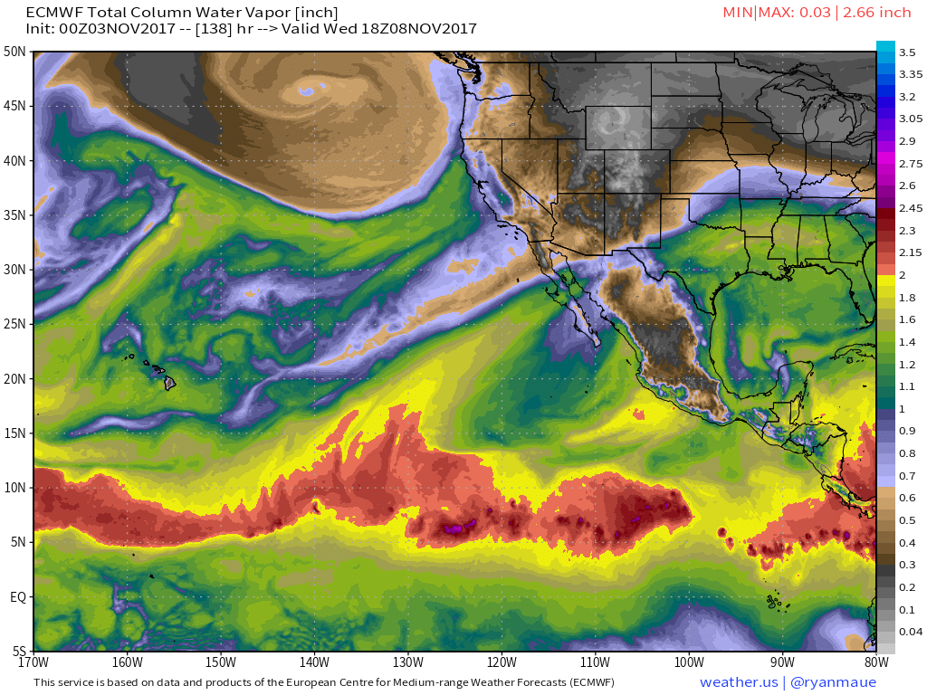
What does an Atmospheric River look like? There are two in this ECMWF forecast for the middle of the coming week. One extends from the tropics east of Hawaii to Baja California, while the other extends from the tropics west of Hawaii to the state of California. I’ll focus on the latter, because it will impact the US more directly.
This Atmospheric River is being driven by the large storm in the Gulf of Alaska, visible on the map above. Strong southwesterly winds on the southeastern edge of that storm are carrying tropical moisture thousands of miles from the tropical Pacific to the California coast.
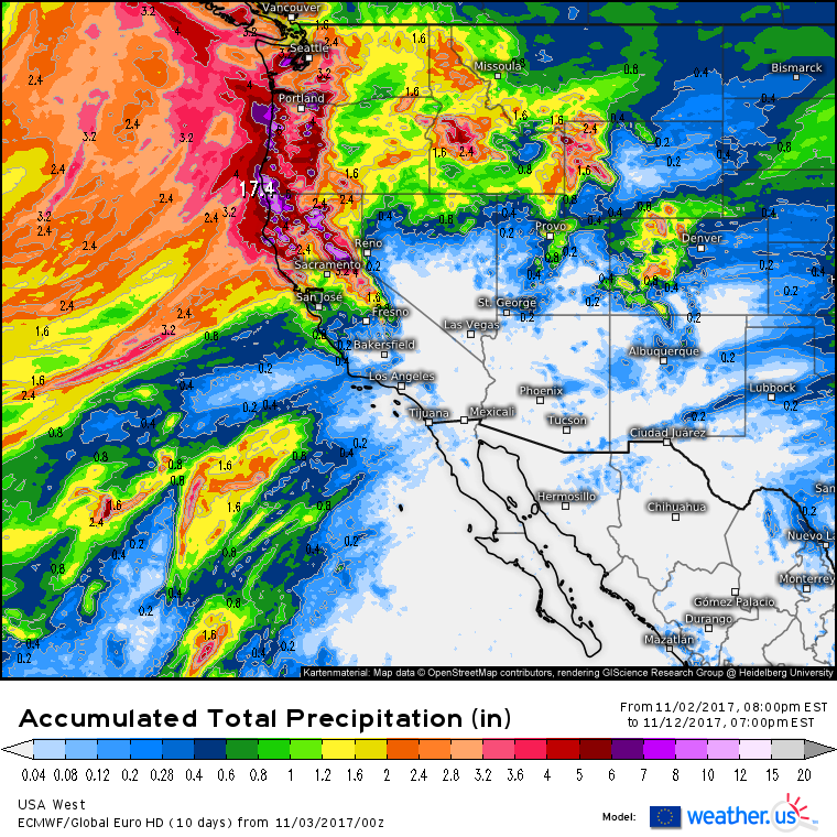
This accumulated precipitation map for the next 10 days highlights the results of the Atmospheric River. Widespread heavy rainfall totals of several inches or more are expected from Central California north to Seattle. The heaviest precipitation will likely fall in the coastal mountains of Northern California and Southern Oregon, where over a foot of rain is possible.
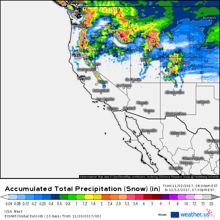
In the Sierras and Cascades, a lot of this precipitation is likely to fall as snow. Model forecasts point to the higher summits receiving over 4″ of liquid equivalent snowfall, which translates to about 4 feet in this situation (more on snow to liquid ratios and forecasting from QPF). This series of storms will be great for ski areas looking to build the base for the upcoming season!
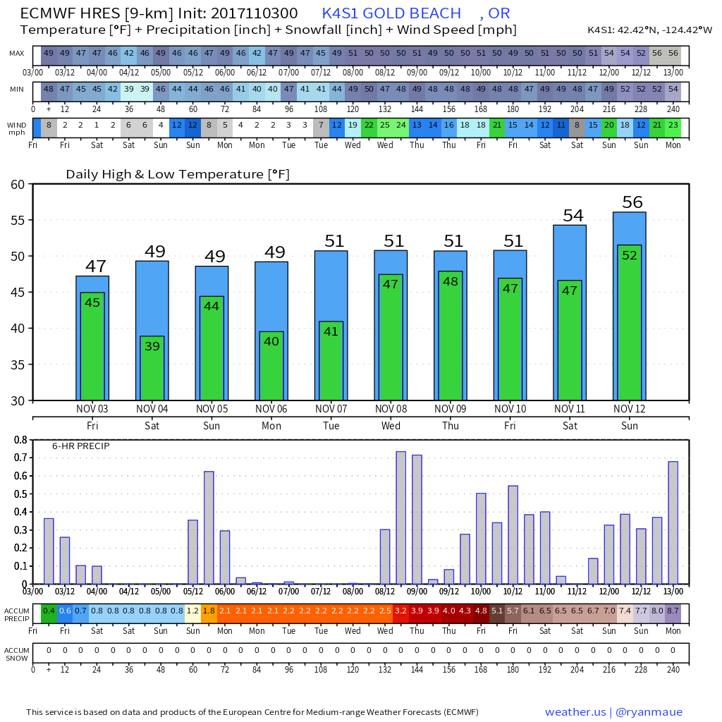
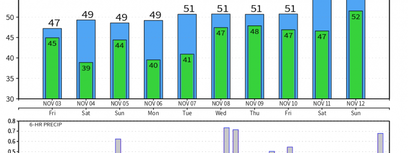
This forecast plot shows that not all of this precipitation will fall at once. There are likely to be a series of strong storms over the next 10 days, each bringing heavy precipitation. This forecast is for coastal Oregon, but you can get these plots for over 3,000 cities in the US over at weather.us’s sister site, run by COO Dr. Ryan Maue. The forecast above shows the first storm tapering off this morning, another arriving Sunday, followed by a break early this coming week. The Atmospheric River really kicks in beginning Wednesday as that storm develops in the Gulf of Alaska. After that happens, precip will kick into a higher gear as better moisture becomes available. Looking into the longer term, while breaks between storms are to be expected, there’s little in the way of hints for a major pattern change that would shut off rain chances for the West Coast.
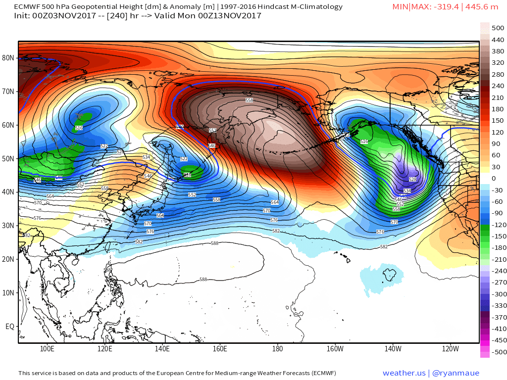
The forecast for 10 days from now shows a trough continuing to reload over the Gulf of Alaska, with southwesterly winds continuing to tap into moisture from Hawaii. Tis the season for heavy rain!
You can track the storms on GOES-16 satellite imagery, HD radar imagery, or with the wide array of modelling tools available at weather.us and wx.graphics.
-Jack
