Arctic Cold Front To Give The Northeast A Taste Of Winter This Weekend
Hello everyone!
Winter isn’t far off now as we move into the middle part of November. Portions of the Midwest and Northeast will be reminded of that this weekend as a potent shot of Arctic air moves into the region behind a strong cold front.
Powerful upper level energy will drive the intensification of a strong low pressure system over Eastern Canada on Thursday night. Behind this storm, a very large and very strong area of high pressure will be moving SE. The two features will be separated by a strong cold front, shown above as the kinks in the isobars (contours) that extend from Quebec down into New York. Notice the very tight pressure gradient behind the front, as shown by the tightly packed isobars (contours). This pressure gradient will drive strong northwesterly winds, which will usher in very cold air.
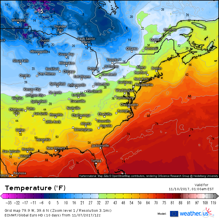
Temperature forecasts for Thursday night show the drastic contrast between areas ahead of the front and areas behind it. Ahead of the front, unseasonably mild temps will dominate with 40’s along the New England coast. Behind the front, temps will be dropping towards 0 degrees in Ontario. That airmass will modify a bit as it moves southeast, and while subzero temps will have to wait another few weeks, a chill will be in the air nonetheless.
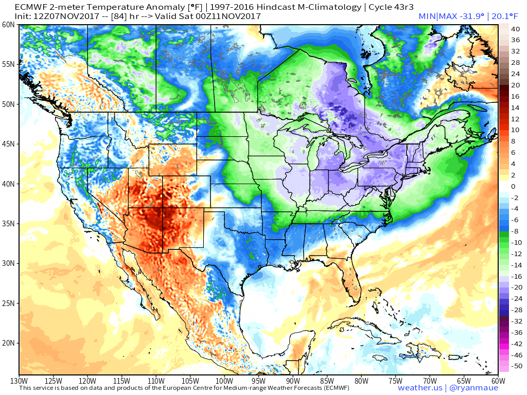
By Friday evening, temperatures will be 15-25 degrees below what we’d expect for this time of year across much of the Midwest and Northeast. This will feel especially cold given the recent prolonged stretch of mild weather. These will by far be the coldest temps we’ve seen thus far this season.
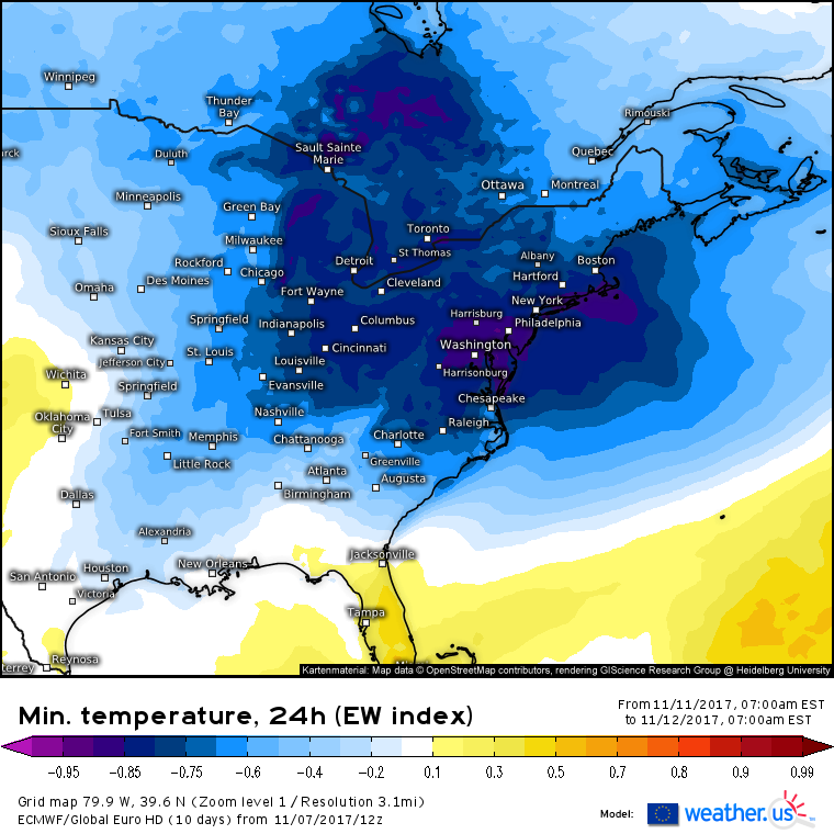
The Extreme Weather Index, another measure of how unusual an event is forecast to be, shows that temperatures Saturday night will be well outside the realm of what’s typically expected this time of year. While the coldest temperatures will be up in Canada, the coldest temperatures compared to normal will be found over the Mid Atlantic, as shown by EFI values below -.85.
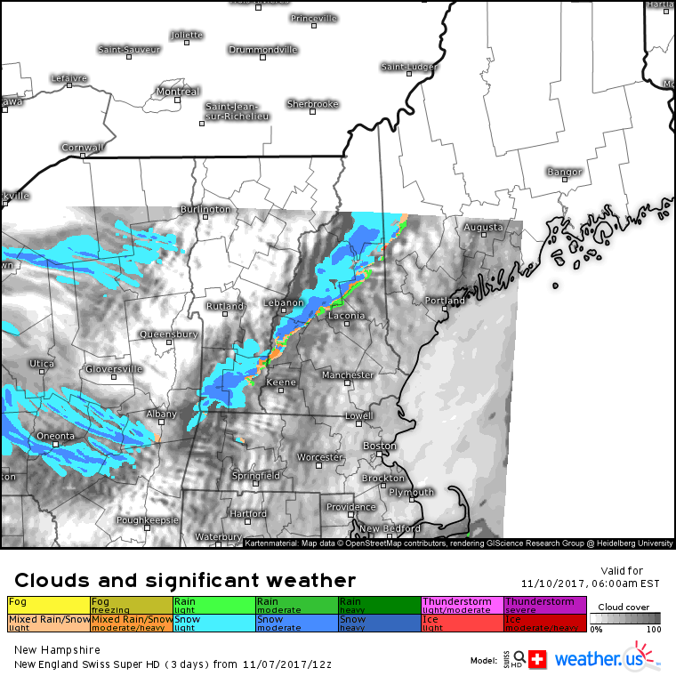
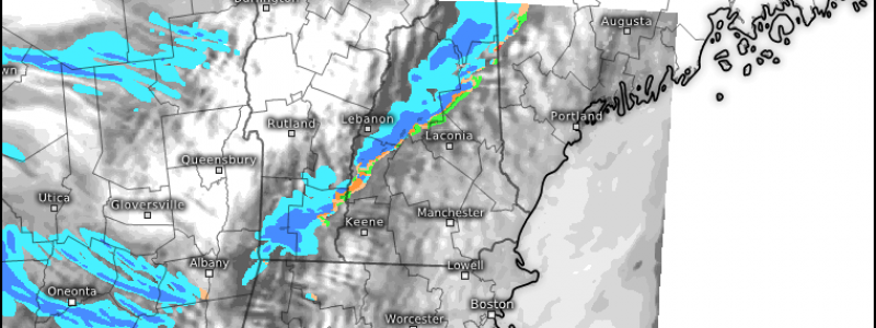
Along the front itself, upward motion associated with the incoming surge of cold air will be accentuated as the cold air runs headlong into the mountains of New England. This combined upward motion will produce snow squalls along the front itself Friday morning. These squalls will be confined to the mountains, and will fall apart as they move down the southeastern slopes towards the coastline. In the mountains, a quick couple inches of snow are possible as these squalls will produce some very heavy snowfall rates for a brief period of time.
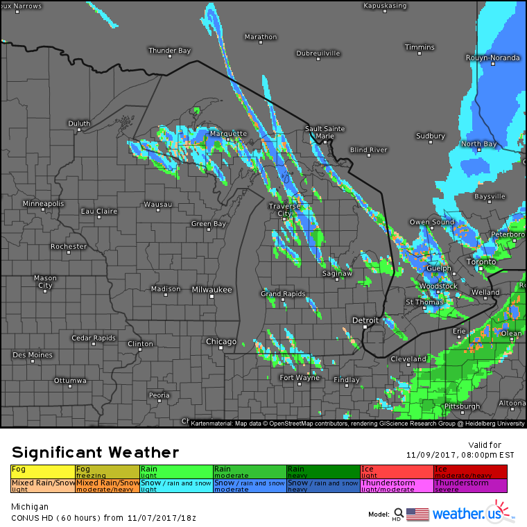
Farther west, lake effect snows are expected across parts of the Great Lakes as cold NW winds pass over the still-warm waters of the lakes. Lake Superior will produce the heaviest snow in this setup, due to the wind orientation (northwesterly). The UP of Michigan will likely receive some decent amounts from this system, with some spots possibly getting over a foot. Snow showers are expected downwind of the other lakes as well, though they won’t be nearly as prolonged nor as intense.
The cold air will quickly moderate as we head into the latter part of the weekend, and seasonably mild temps will return for the beginning of next week.
-Jack

