Another Strong Offshore Wind Event Expected In California Tonight And Tomorrow
Hello everyone!
Just a couple days after strong Diablo winds fanned the Kincade fire north of Santa Rosa, another round of strong offshore winds are expected in the typically favored parts of California tonight and tomorrow. This event will be focused more in Southern California compared to Sunday’s winds which were strongest north of San Francisco. This post will briefly outline the pattern supporting these winds, and will discuss when and where they will be the strongest. If you want a more in-depth background on strong offshore winds in California, I recommend reading back to Saturday’s update which talked a bit more about the science at play in these setups.
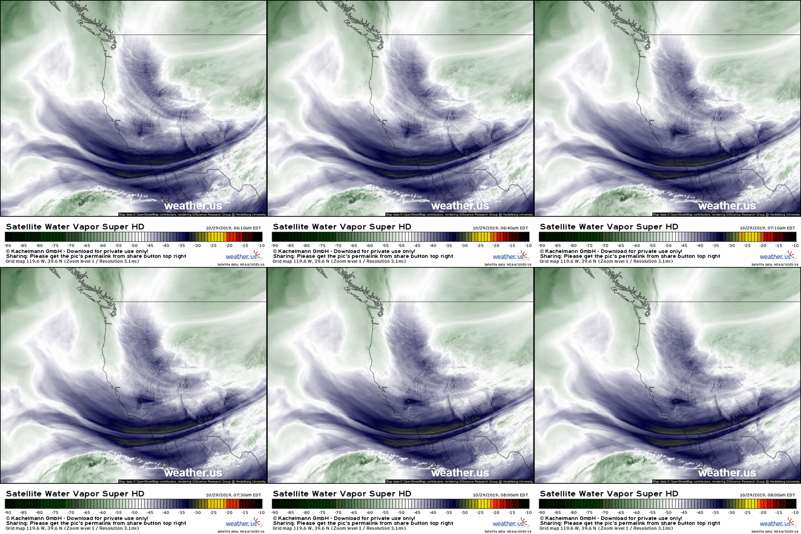
The first key ingredient for any offshore wind event in California is a cold airmass over the Rocky Mountains. GOES-East WV satellite imagery highlights plenty of northerly flow bringing that cold air south out of Canada. Once the cold air piles up over Nevada and interior parts of CA, the offshore winds can begin.
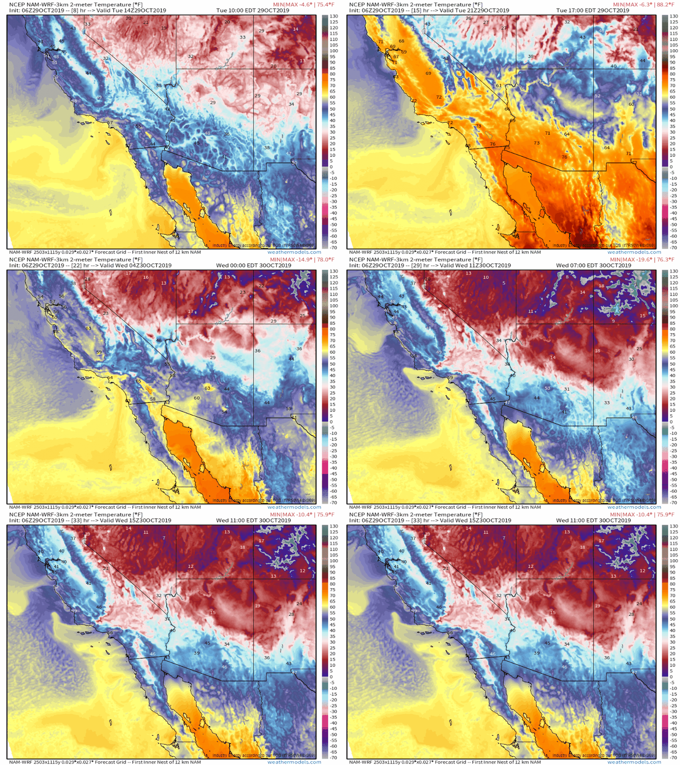
High resolution model data shows the big push of colder air happening overnight as the loss of daytime heating means cold air can move south more efficiently. Once that cold airmass reaches the mountains east of LA, strong Santa Ana winds will develop. Note that the cold air arrives a bit earlier today for northern parts of the state, but the temperature contrast across the Sierras and Northern Coastal mountains isn’t nearly as strong, which means that while winds will be gusty north of San Francisco, this event will be at its most intense closer to LA. GIF via weathermodels.com.
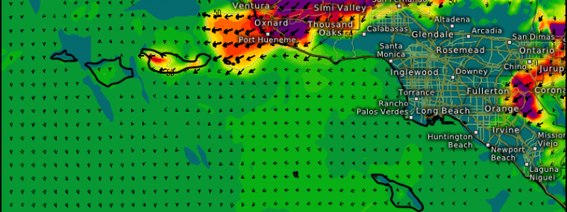
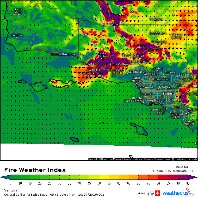
Strong winds will arrive in Ventura county and adjacent parts of the LA area shortly before midnight, local time. Our Swiss Super HD model shows gusts over 40 mph by midnight, with the strongest gusts over 50 mph occurring tomorrow morning.
The strong winds combined with warm temps and extremely low humidity will of course provide the ideal environment for wildfires. Fire Weather Index values once again will approach the maximum possible value of 99.9 for much of Ventura county throughout the entire event. This will test containment lines on the Tick fire and will also aggravate the Getty Fire which has been burning closer to the city of LA. Any new fires that might start tonight or tomorrow morning will have the potential to spread extremely rapidly, so make sure you have several ways of receiving evacuation orders if they come.
Strong winds will continue through Thursday, but won’t be quite as strong as those tomorrow morning. Calmer conditions will return Friday.
-Jack


