An Odd Supercell Outbreak, 23 Years Ago
Tornado season has cooled down some for the time being, with a giant midlevel trough planted over the central US that’s keeping much of the CONUS unseasonably chilly. The only real significant weather at the moment is a threat for flooding in the southeast, which Meghan discussed in her blog yesterday.
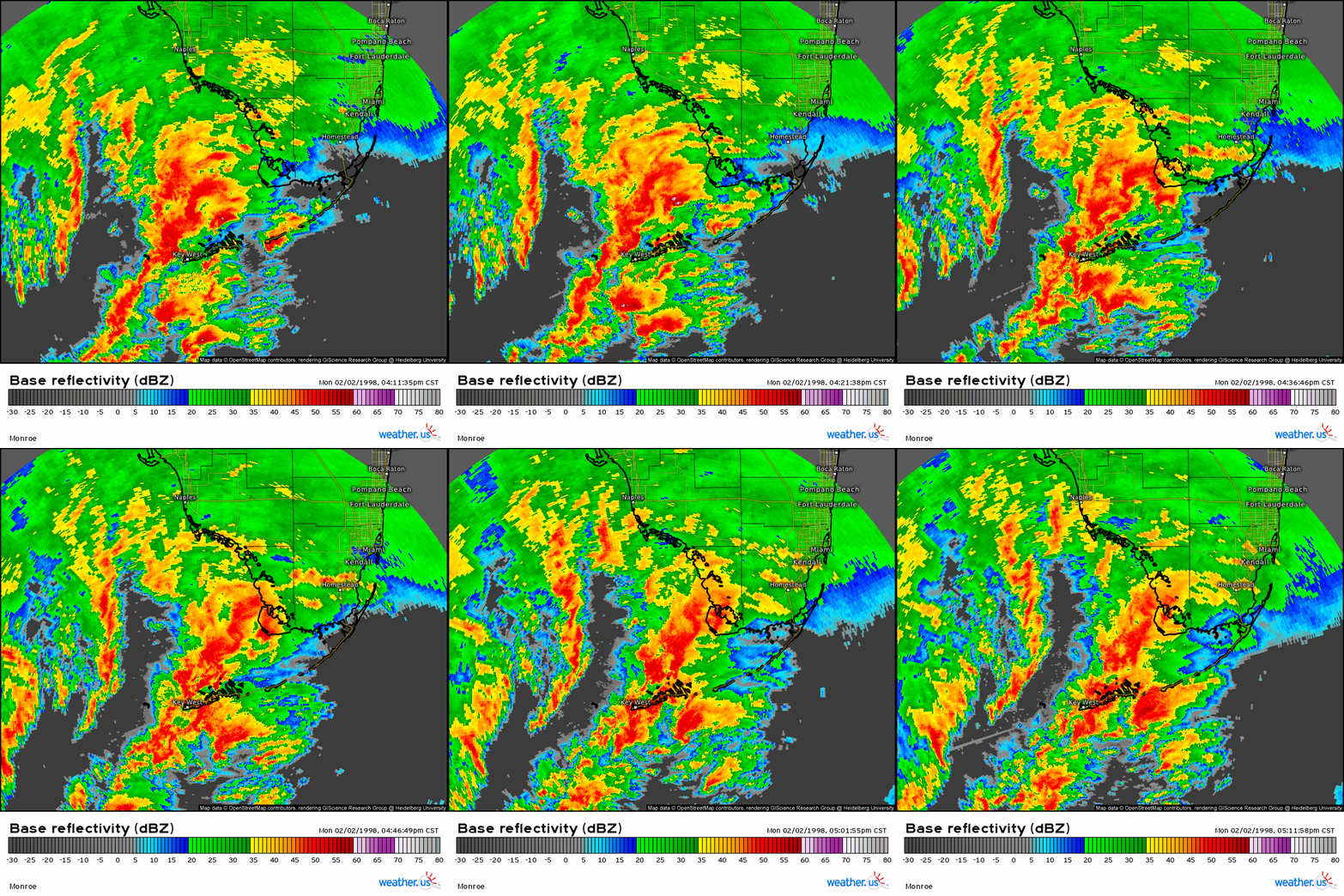
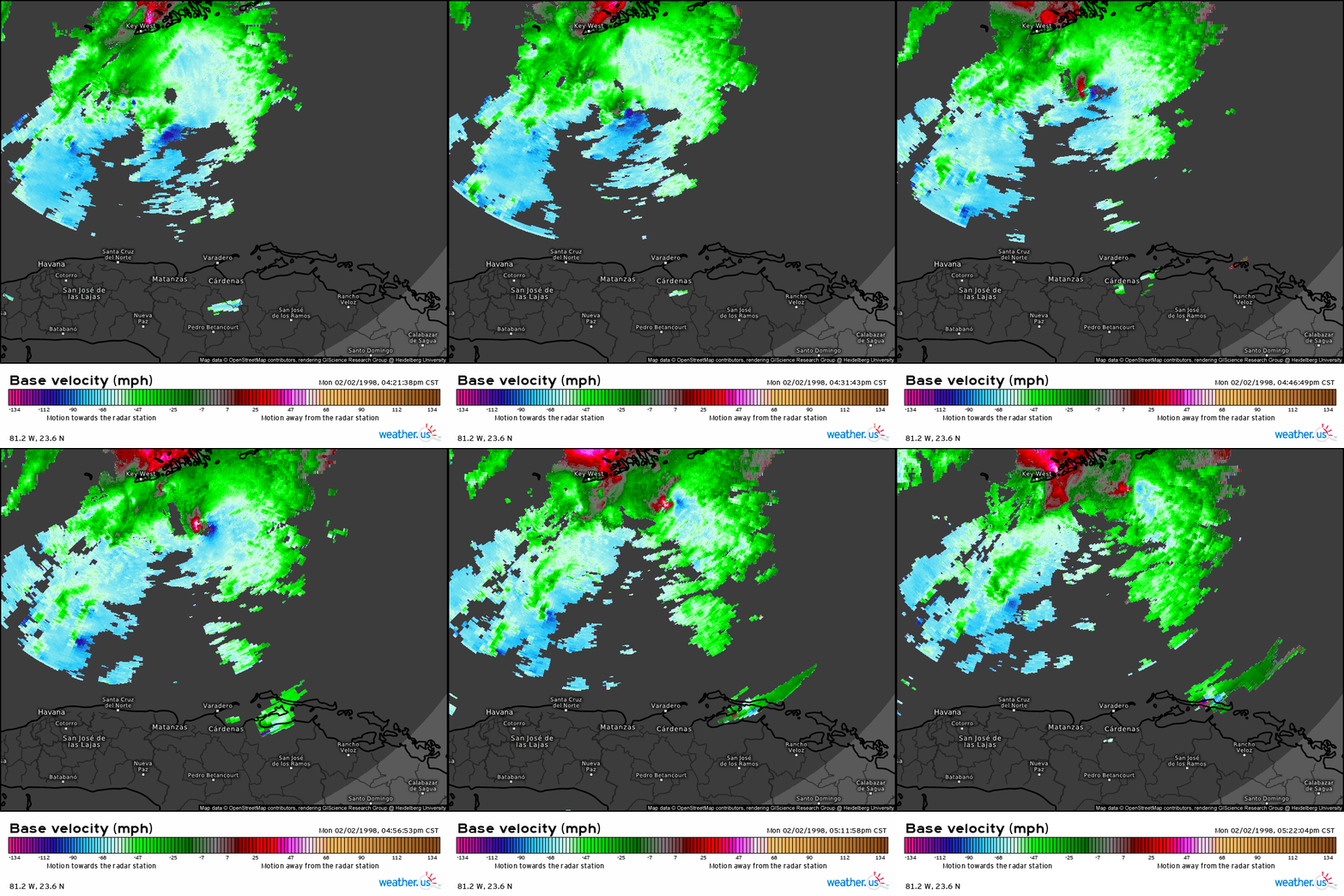
With this in mind, I feel at liberty to write a retrospective on one of the oddest, most one-of-a-kind supercell outbreaks in modern meteorology, which occurred on 2/2/1998. Dozens of potent mesocyclones developed over a relatively small region, including some of the strongest couplets ever seen on radar. What really made it so unusual was the location of said region- over the eastern Gulf of Mexico, into far southern Florida. Seriously.
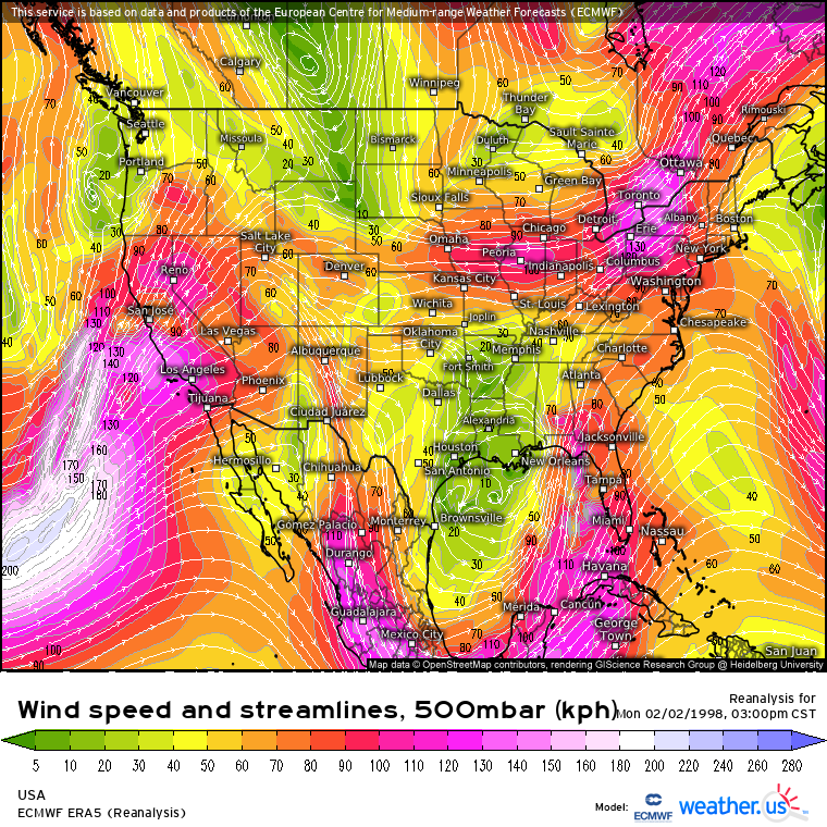
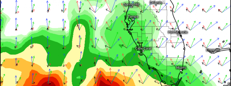
The synoptic conditions were rather supportive of severe weather, despite the very odd location. A closed low had pivoted well south of where the midlevel jet typically does, even for early February, and sat south of Louisiana. With typical mid-winter flow strength, a 65+ knot 500mb exit region sat over the southeast Gulf and parts of southwest Florida.
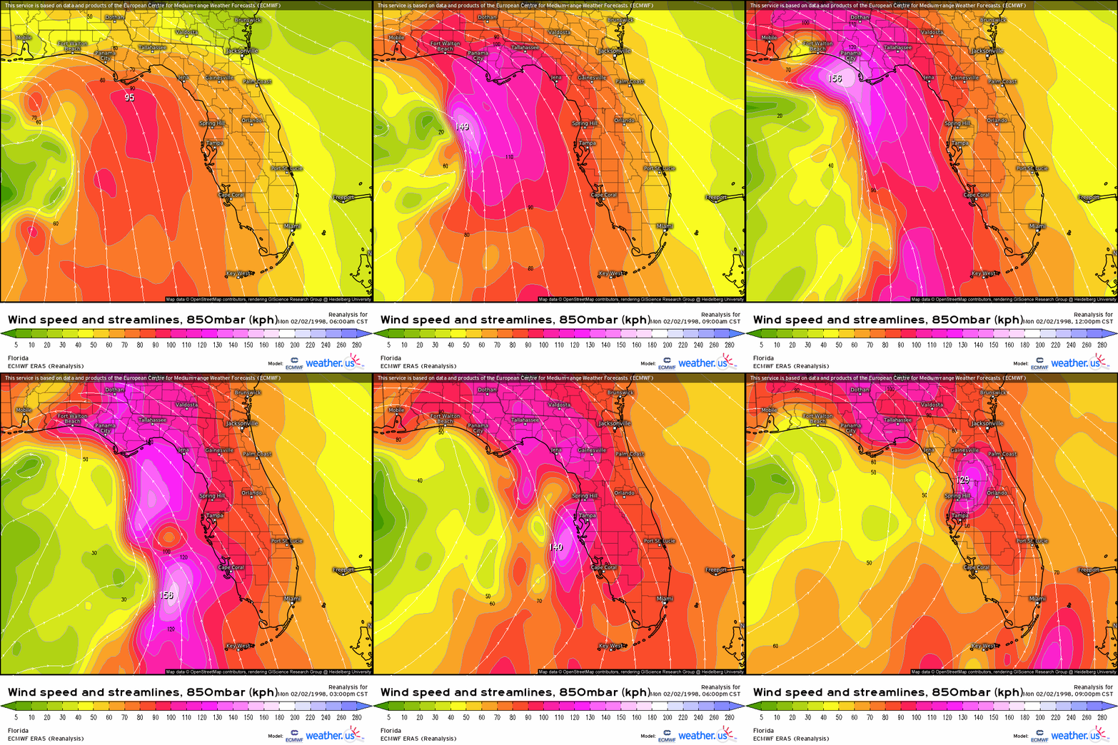
Steep diffluence in this area created a synoptic-scale vacuum aloft, which caused air over much of the eastern Gulf to begin rising, permitting expansive cyclogenesis. A diffuse but intense low-level cyclone developed, taking on the appearance of a strong gyre with several separate but deep zones of independent pressure minima.
As the afternoon progressed, the most intense of these minima pivoted northeast along the gyre’s periphery, likely undergoing a degree of convective enhancement at the hands of mass Gulf latent heat release. Immediately to its east, a strong belt of cyclonic flow was amplified significantly due to the locally enhanced
The intense belt of low-level wind would work with high-end bulk shear from the closed low’s exit region to promote an explosive kinematic regime over parts of the SE Gulf and SW Florida by that afternoon.
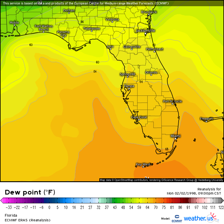
This southerly flow also helped advect moisture north. That being said, it isn’t hard to get high-end moisture in place when you are literally an island in a large, tropical Gulf, and so sufficient moistening of the air just above the Florida keys, and the near-water-surface air nearby, was sort of assured. In fact, dewpoints there matched or exceeded what the south-central US often sees in the heart of tornado season, hitting 70ºF for some.
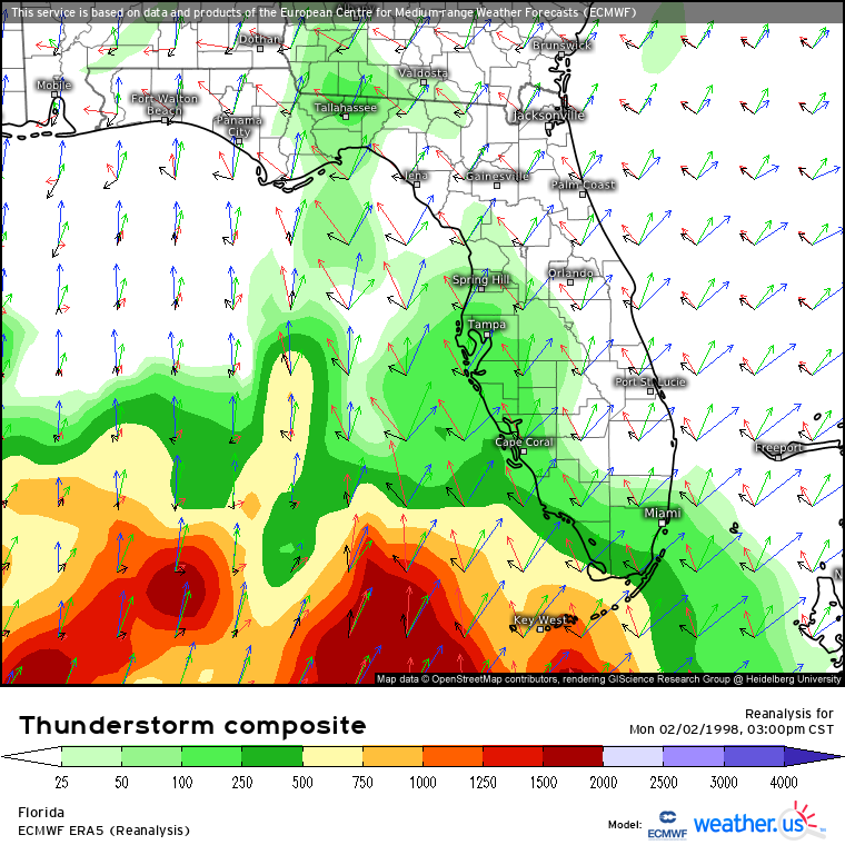
The result of all of this was an explosive environment for severe weather, located where such almost is never found. Vigorous updrafts amidst intense, deep moistening and modest lapse rates could propel upwards, rotating into fierce mesocyclones at the hands of high-end low level flow and remaining organized into long-lives supercells amidst 70 knot bulk shear. With low LCLs, minimal inhibition, and diffuse forcing, numerous tornadoes would appear possible in this environment.
As the low level pressure minima pivoted north, then, the open warm sector saw an astonishing display of supercells, which raked the mostly empty water just west of the Keys into the mid-afternoon.
Storms continued to develop and progress northeast as the parameter space improved with evening. Several were large, long-lasting, and terrifying looking, but many either missed land completely, weakened, or grew upscale before hitting population centers.
These weren’t just the mini-supercells typical of tropical systems, either. Many had incredibly robust rotations, including one southeast of the Keys that would likely have produced a violent tornado had it hit land. Luckily, it did not.
This all goes to show that the parameter space we associate with an intense supercell outbreak really isn’t as geographically limited as we may think.
