Advection: What Is It And Why Is It Important?
Hello everyone!
In discussions of large-scale weather phenomenon, particularly in the mid latitudes, advection is a concept that gets brought up a lot. This post will be a quick explainer of the process and what it can do to your weather.
Very simply, advection occurs any time an airmass moves. When a warm airmass moves into an area previously occupied by a cooler airmass, Warm Air Advection (WAA) occurs. Cold air replacing warm air is known as Cold Air Advection (CAA). Each of these processes unfolds differently, and produces different results.
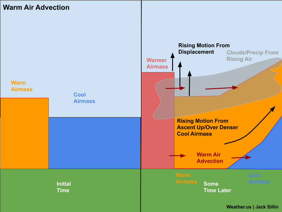
Warm air advection is generally characterized by upward motion, and thus produces the most inclement weather, so we’ll start there. First of all, it’s important to remember that warm air is less dense than cold air (this has to do with molecular energy), so the same amount of warm air takes up more volume than cold air. Thus when warm air begins moving into an area previously occupied by cooler air, less dense air is attempting to evict much denser air. This is very hard to do, and thus much of the approaching warm air gets directed upwards over the cooler airmass. This is one important contributor of upward motion to a warm air advection regime.
The other factor contributing to rising motion in a WAA regime is displacement due to a higher-volume airmass overtaking a lower-volume airmass. As progressively warmer air arrives in the low levels (once you get high enough in the atmosphere, there are no airmasses), it displaces some of the air at the top of the low level airmass (think of airmasses as bubbles which have not only horizontal bounds, but also a vertical limit) upwards. Between that displacement and the uplift over the low-level cold air, there’s plenty of rising motion associated with warm air advection regimes. As a result, they usually signal more inclement weather with lots of clouds, and precipitation if there’s enough moisture.
In the case of cold air advection, everything pretty much happens in reverse. The denser cool airmass overtakes the less-dense warm air, which forces a downward surge in the air moving forward. Additionally, as cooler and cooler air arrives, the low-level air takes up less and less space, so the air above must sink to fill the gap. All the downward motion generally inhibits the development of clouds and precipitation, leading to fairer weather.
It should be noted that the general patterns I’ve outlined here are merely that: general patterns. There are plenty of times when WAA doesn’t produce nasty weather (if the atmosphere is too dry to allow for clouds/precip for example) or when CAA doesn’t produce nice weather (if there’s warm air advection above the layer of cold air advection for example). Despite the exceptions, these are general rules of thumb that will apply in most situations.
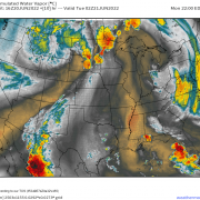
Below you’ll find an example of these general rules in action surrounding a strong cyclone in the Central US in March of 2019.
The red arrows represent the part of the cyclone where warm air advection is generally present, while the blue arrows show where cold air advection is generally present. Note the thick cloud cover of the WAA areas while the CAA part of the system is nearly cloud-free.
-Jack





Thank you for your ckear understanding. After the weatherman mentioned the word Affection, I thought “What is that”? Now, I know!
Thxs!
This is very helpful, thanks!
Nice explanation, thanks!