Active Weather Reaches The East Coast Today
Hello everyone!
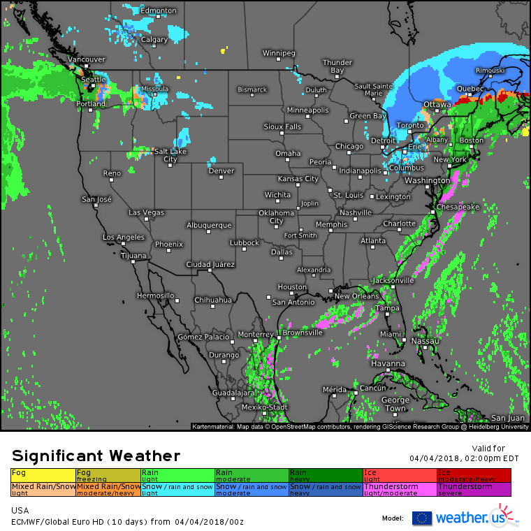
The storm system that brought a variety of high impact weather to the Central US yesterday is headed for the East Coast today. Severe storms will once again be a concern, as will strong winds due not to thunderstorms, but instead the circulation of the cold front itself. After snow bands depart Michigan this morning, wintry precipitation will mainly be confined to the remote high elevations of Northern New England, as well as Canada as the low’s center tracks up the St. Lawrence valley.
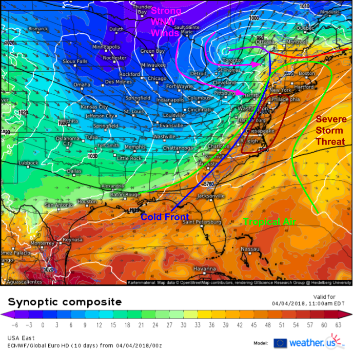
Here’s a look at the ECMWF’s synoptic composite product (what’s that?) for midday today showing the general setup and features to watch as our storm system moves into Canada. The storm’s strong cold front will be the main focus today as it brings severe weather to parts of the coastal Mid Atlantic, gusty showers to New England, and WNW winds gusting over 60 mph at times to a wide swath of the Northeast. There’s plenty of tropical air surging up the East Coast ahead of the front, which will result in warm temps today, and heavy rain associated with storms developing along the front.
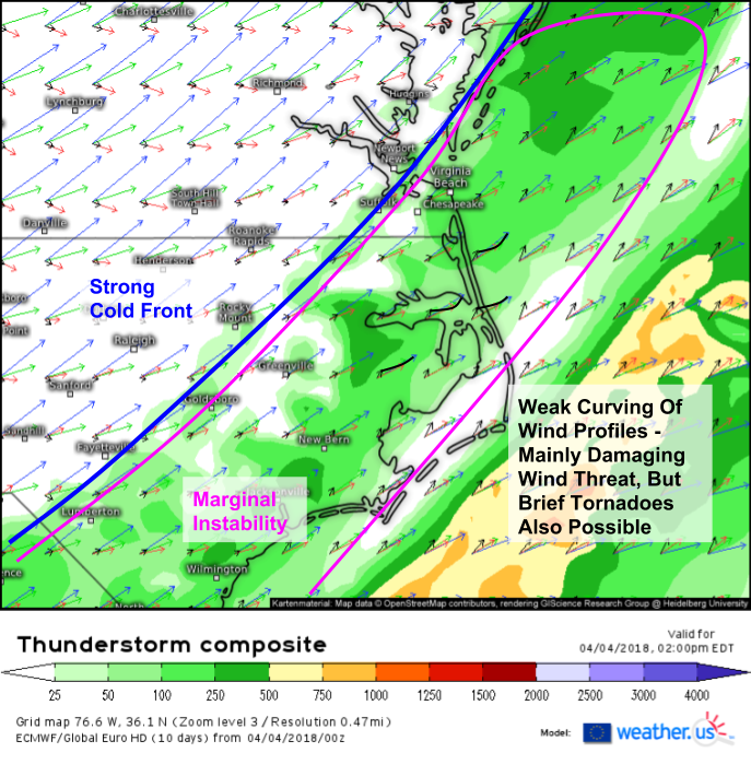
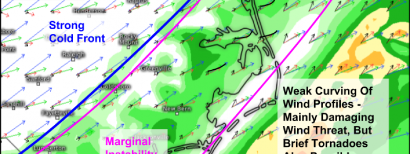
The greatest threat for severe weather will be in coastal parts of the Mid Atlantic today, and the ECMWF’s thunderstorm composite product (what’s that?) paints a good picture of the overall setup. Marginal instability will exist ahead of the front, which will provide just enough fuel for storms to get going as the front crashes east. There’s some turning noted with wind profiles, not enough for a widespread tornado threat, but enough to keep an eye out for rotation here and there. Storms will develop midday today, and will move offshore with the front early this evening.
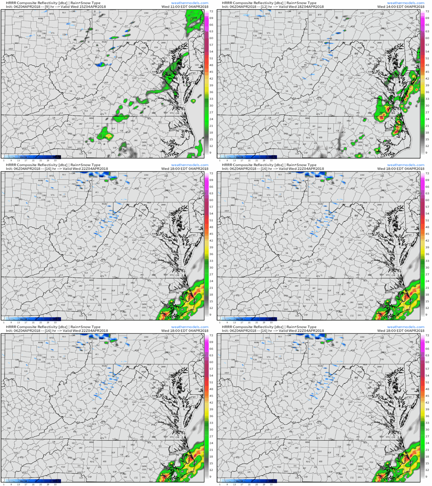
This HRRR simulated radar loop via weathermodels.com gives a good sense of how storms should evolve this afternoon. Coastal areas will have the longest window of heating before the front arrives, so storms will be strongest there. Storms will also wrap up fairly early this evening as the front races offshore. As the front exits the coast, attention will shift to the next threat posed by this system: strong large scale winds.
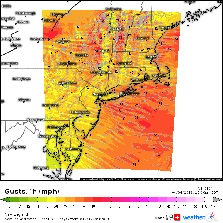
This map from the Swiss Super HD model shows wind gusts forecast at 10 PM tonight across the Northeast. Notice the large area with winds gusting 40-50+ mph. These winds will be strong enough to bring down some trees and branches, resulting in a power outage threat overnight tonight. Winds will primarily be out of the west, and the strongest gusts will be found in the higher elevations of New York and New England. Click the map at the link above to zoom in for a closer look at your area, and click again for county level detail near your town.
Outside of the East Coast system, today’s weather will be fairly quiet across the country with just some light rain/mountain snow in parts of the Pacific Northwest.
For a detailed look at what to expect locally in Western ME and NH from today’s storm, refer to this morning’s Forecasterjack blog post: https://forecasterjack.com/2018/04/04/freezing-precipitation-springlike-temps-thunderstorms-and-strong-winds-all-expected-today/
For more information on what to expect at your location today: https://weather.us/
-Jack
