A Tropical Low Brings Squalls To South Florida Today While TD-16 Looms Farther South
Hello everyone!
Today’s weather across the US will be generally quiet. Some showers and storms are possible along a cold front draped from the northern Mid Atlantic through the Ohio Valley and into the Southern Plains. No widespread severe weather is expected along this front, though lightning and heavy rains will cause issues wherever storms pop up.
Our focus is once again in the tropics today where we’re watching for two systems to impact the US. Currently, a strong tropical wave is bringing heavy rains and gusty winds to Southern Florida. these impacts will continue through the day today as the wave moves slowly west.
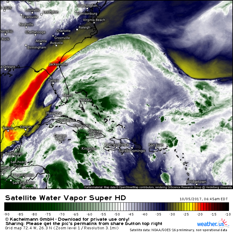
GOES-16 water vapor imagery (what’s that?) shows the tropical wave located between Cuba and Florida. Notice the area of very dry air to the west of the system. This dry air, combined with strong upper level winds, will prevent this wave from developing into a tropical storm or hurricane. Despite the lack of formal development, those heavy rains and gusty winds will continue through the coming day or two.
Track this system on radar with our HD radar product.
Farther south, the system to really watch is TD-16. The depression remains poorly organized this morning as it interacts with the Central American coastline.
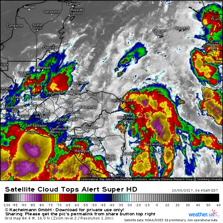
GOES-16 cloud top IR satellite (what’s that?) shows the depression centered just off the Nicaraguan coast this morning. An area of strong thunderstorm activity is noted east of the center, but it remains disorganized. So far no well defined core has emerged, and any banding features are weak and transient. Unfortunately, environmental conditions are favorable for that to change in the coming days.
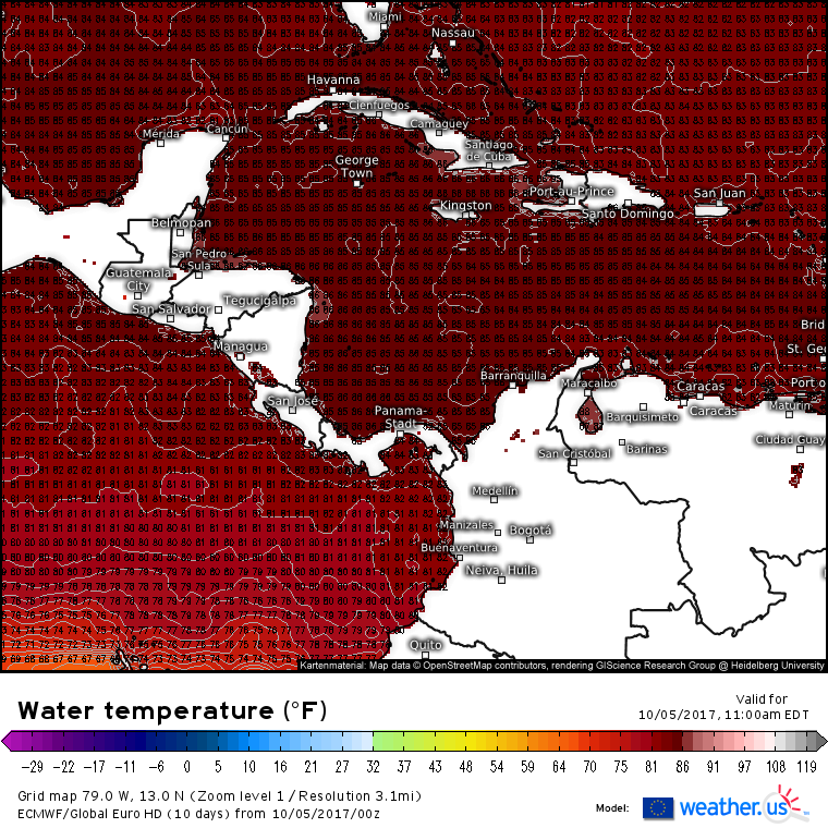
Water temperatures remain extremely warm in the western Caribbean Sea as well as in the Southern Gulf of Mexico. Tropical systems need ocean temperatures above 80F to develop and thrive, the water in TD-16’s path is well over that mark, ranging from 84 to 87F.
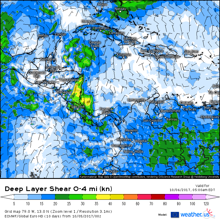
Wind shear in the storm’s path will be light. Tomorrow, the storm will be located over the western Caribbean sea, between Honduras and the Yucatan peninsula. Wind shear values in this area, excluding those generated by the storm’s circulation, are near zero as shown by the ECMWF map above. TD-16 will have little to no trouble with wind shear as it moves NNW.
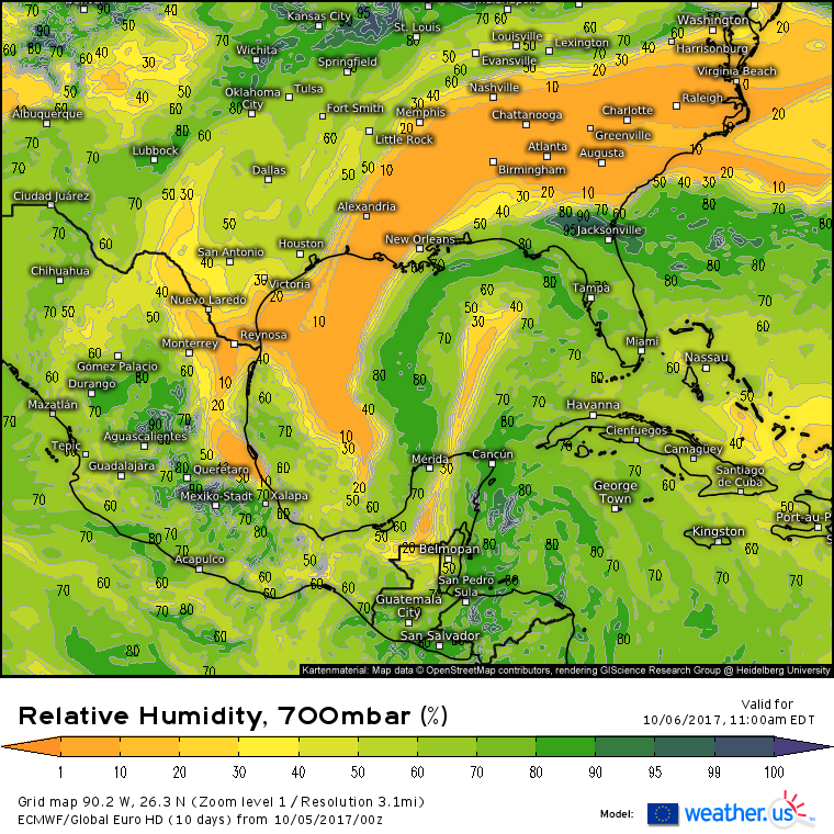
Dry air could be an issue for the system as it approaches the Yucatan Peninsula and moves into the Gulf of Mexico. Notice the dry air stretching from Guatemala to the NE Gulf. This is the dry air inhibiting development of the tropical wave near Florida this morning, and it may put a lid on how strong TD-16 can get. As the storm continues to move north, the wide expanse of Canadian dry air across the Southeast US will eventually prove fatal to the system as it heads towards the Gulf Coast.
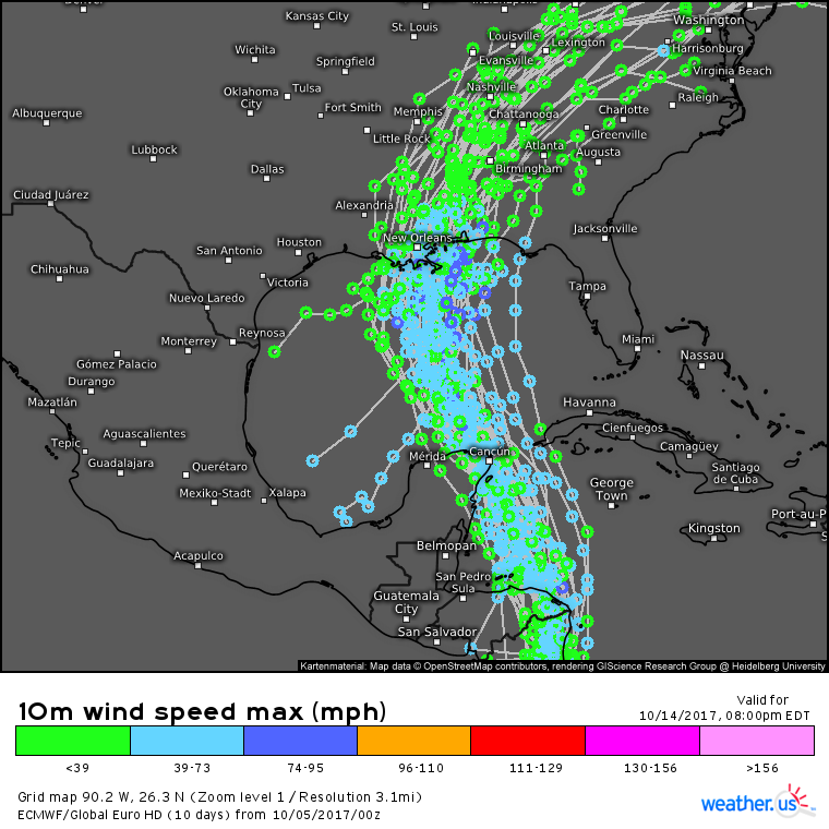
The forecast path of TD-16 has shifted west a little bit, though there remains some uncertainty as to exactly where the storm will make landfall. Right now, anyone from the Big Bend region of Florida over to western Louisiana should be watching this system closely. The current model consensus takes the center of the storm near New Orleans, which is a perfectly reasonable scenario.
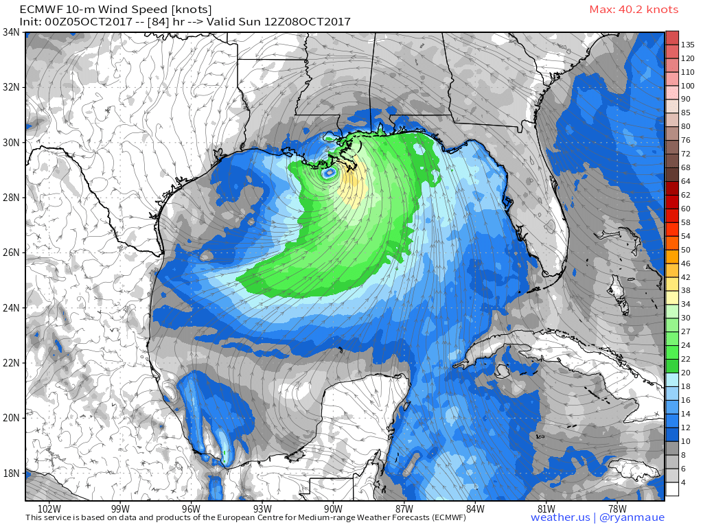
The intensity forecast remains even more uncertain than the track forecast. If the storm can put together an inner core and keep the dry air at bay, intensification into a mid-grade hurricane is possible. If the storm’s inner core doesn’t get organized, or if dry air is able to work into the core, the system will likely remain either a strong TS or a weak hurricane.
Either way, the storm will make landfall on the Gulf Coast Sunday morning before weakening as it races NE. This map look a little different? Check out the work of our COO Dr. Ryan Maue on our sister site http://wx.graphics/
Many more updates in the days to come as we know more!
-Jack
