A Few Strong Thunderstorms Possible In The Southeast Today
Hello everyone!
Yesterday morning’s post discussed the wintry side of a storm system that’s currently moving into the Ohio Valley, and will redevelop off the Mid Atlantic coastline tomorrow. On the warm side of that storm, some strong to severe thunderstorms are expected to develop this afternoon in parts of the Southeast. This post will take a quick look at the severe thunderstorm forecast, including where/when to expect storms and what hazards they might pose.
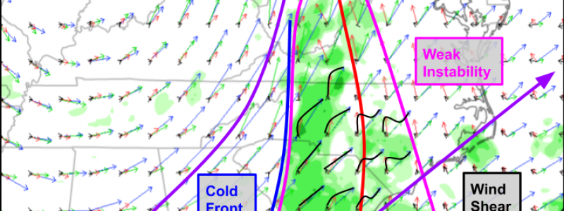
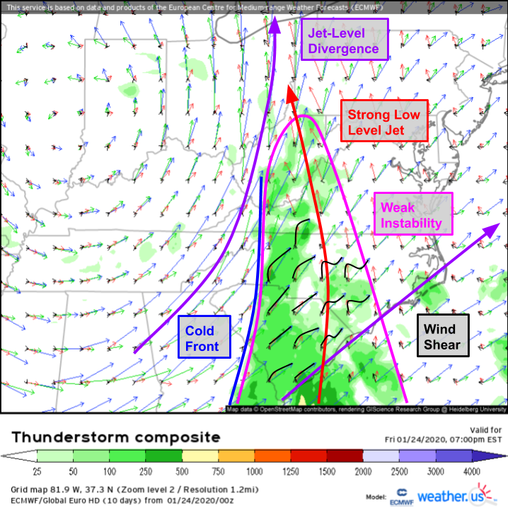
Whenever there’s a chance of severe thunderstorms, my first stop is the ECMWF’s Thunderstorm Composite chart, shown above (click here for that product’s tutorial video). The shading highlights a plume of weak instability (click here for more on instability and the parameter used to quantify it) extending from far SE Georgia east into central NC and north into WV. The exact amount of instability present will depend on how much sunshine is able to develop over these areas during the midday hours. Even if skies stay mostly cloudy though, there should be just enough CAPE to support thunderstorm development along an approaching cold front (click here for more on fronts).
Once those thunderstorms develop, they’ll find themselves in a shear environment favorable for organization into a squall line. Winds above the area of interest (within the instability plume) become stronger and more southwesterly (vs southeasterly) as you head higher into the atmosphere. That change in wind speed and direction with height is known as wind shear and is one of the ingredients necessary for severe thunderstorm development. This afternoon’s shear profile is generally forecast to be more unidirectional (meaning there’s more of a change in wind speed than wind direction) especially closer to the cold front itself. Additionally, the angle between the unidirectional shear vector (i.e. the common wind direction across a deep layer of the atmosphere) and the cold front is only about 20-30 degrees. Both shear profile attributes (unidirectional and oriented nearly parallel to the front) support the development of a line of storms later this afternoon.
There will be plenty of low-level shear in the atmosphere this evening across SC and parts of central/eastern NC. Storm-relative helicity is one way to measure how much low-level rotational energy a thunderstorm might have access to. The forecast values of 300-500 m^2/s^2 are seasonably high, and combined with rich low-level moisture will support the risk of a couple tornadoes in addition to the damaging wind, heavy rain, and lightning threats present in all parts of the line.
Here’s a look at how the HRRR expects this afternoon’s storms to evolve. The loop runs from 11 AM to 11 PM eastern time. Storms will develop early in the afternoon across parts of eastern GA and western SC before moving NE through SC into NC. Remember, there’s not a ton of instability for these storms to work with, so they won’t be as raucous as the storms this area usually gets during the late spring/summer, but a low-topped squall line can be seen in the forecast fields which makes sense given our analysis of the environment in this area. GIF via weathermodels.com.
You can follow along as the storms develop with HD radar imagery at weather.us. As always, make sure you have several ways of receiving NWS warnings should they be issued for your location.
-Jack


