Introducing The New Swiss HD Model
If you’re a frequent user of the many products we have available at Weather.us, you may have noticed something new become available in the past week or two.
If you haven’t noticed, or don’t frequent the site much, here’s your announcement:
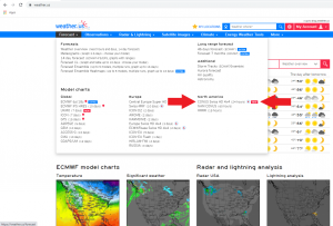
The team at weather.us along with our parent company, Kachelmannwetter, have released our brand new “in-house” model, The CONUS Swiss HD!
The Swiss HD model is a 4 km, high-res model focused on short-term forecasting. It is updated 4 times daily and is run for a period of 24 hours. It is exclusively ours – you won’t find it anywhere else!
While it has many familiar parameters available via other models on our site, we’ve added a few new ones more specific to short-term forecasting for you to add to your toolbox. In this blog we will take a look at some of them.
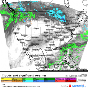
Clouds and Significant Weather
Available in the [Weather, Pressure] category, this particular parameter is an improvement upon the significant weather parameter available via the other models on our site.
It blends the cloud cover forecast with the forecasted weather conditions to produce a comprehensive look at what weather might be occurring along with the amount/extent of cloud cover to go with it. No need to flip between parameters to see how far that cloud shield might extend beyond where ever the precip is actually falling.
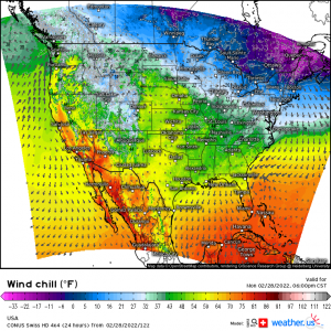
Wind Chill
Previously only available via the ICON, this parameter is now available in high-res via the Swiss HD. It is found in the [Temperature and Humidity] category.
This particular map displays the wind direction and magnitude and then combines it with the actual temperature to produce the wind chill or “feels like” temperature you see on the map. This parameter is particularly useful for those in colder climates where frostbite can occur rather quickly under a certain set of circumstances.
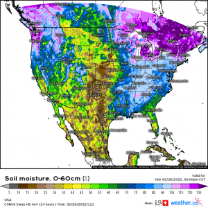
Soil Moisture %
Previously available via the GFS, the addition of this parameter to the Swiss HD allows for a high-res, more detailed look at soil conditions around the country.
Found in the [Soil Moisture %] category, this parameter is useful when rain is forecast and you need to determine how saturated the ground is. In the case of heavy, prolonged rainfall, this percent can determine whether or not flooding will become an issue.
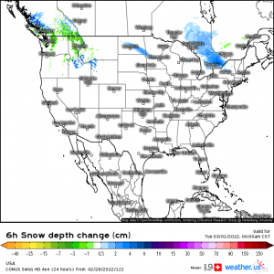
Snow Depth Change
Our new Swiss HD offers two new parameters to monitor the potential change in snowpack: 1-hr and 6-hr Snow Depth Change. Both are found in the [Precipitation] category.
It’s fairly self explanatory, but these parameters display the forecasted snow depth change via melting (negative change) or accumulation (positive change) over either 1-hr or 6-hr time frames.
Severe Weather Parameters
The category that received the most new parameters is undoubtedly Severe Weather. And just in time too as Spring and the traditional Spring severe season is just around the corner.
These are:
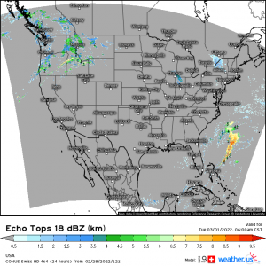
- Echo Tops
- Displays forecasted cloud top heights
- Supercell Composite Parameter
- Uses a variables such as Storm Relative Helicity, CAPE, and CIN and places them into an equation to produce an index that communicates the likelihood of supercell formation.
- Max Vertical Velocity
- Self-explanatory – forecasts the maximum updraft velocity that may be found in a storm
- Lapse Rate
- Previously available via the ICON only
- displays the forecast lapse rate, or change in temperature with height, over the lowest 0 to 0.6 mi of the atmosphere
- displayed in Kelvin
- Energy Helicity Index
- uses the forecasted CAPE and Storm Relative Helicity values to determine the potential a storm may have to rotate
- Significant Tornado Parameter
- uses multiple parameters such as CAPE, CIN, LCL height, SRH to calculate whether or not conditions are forecast to be supportive of significant (EF-2 or greater) tornadoes.
Flight Meteorology
This category has also been expanded with a few new parameters exclusive to the Swiss HD.
These are:
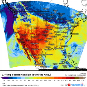
- Lifting Condensation Level
- Height at which water vapor becomes clouds
- Orographic Sinking/Lifting
- forecasts how air will interact with a mountain range or other elevation changes
- Average PBL Lapse Rate
- Average PBL Wind Speed
- Max PBL Vertical Velocity
Quite a few new parameters to play with, isn’t there? This isn’t a comprehensive list; there are a few more “new” parameters available to explore as well. Take some time and scroll through to see what you can find!
We hope you enjoy our brand new model and, as always, if you have any questions, feel free to drop us a line!
