Henri, Now a Hurricane, Approaches Northeast
Always a fighter, Henri has rebounded from decoupling northerly and then westerly shear to become the third hurricane of the Atlantic season. The storm is now lurching north on a seemingly unlikely track towards the heart of southern New England.
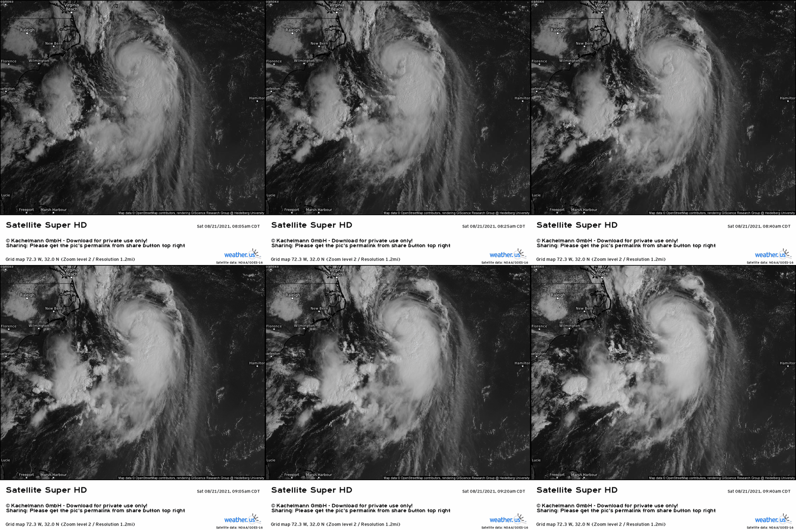
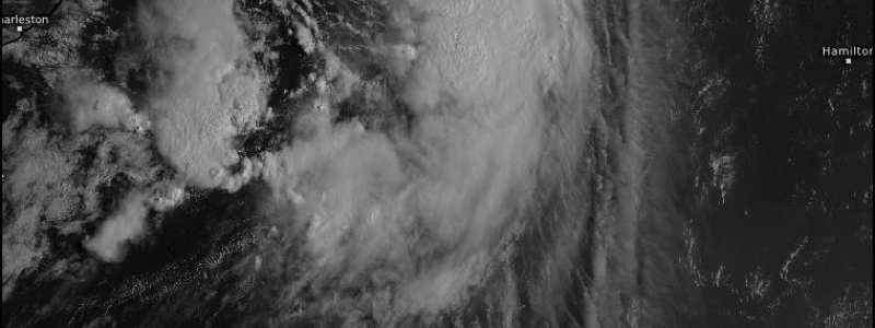
Satellite this morning shows a stacked, if somewhat anemic, core over the hurricane. Deep convection bubbling south displays both the disorganizing shear and the explosive energy held in the bathtub waters of the Gulf Stream.
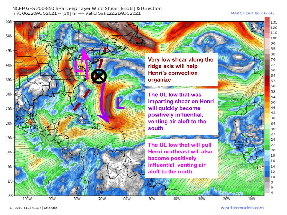
Warm ocean water isn’t the only thing going for Henri this morning. As discussed in my blog yesterday, the storm finds itself wedged between an upper level trough over the eastern US and an upper level ridge over the central Atlantic, a pattern that will likely dramatically increase synoptic incentive for outflow by venting air from the storm aloft. This venting will incentivize deepening and thereby strengthening of Henri today, especially now that the storm actually has an organized core.
As the upper level trough interacts with Henri over the next 12 hours, the storm will continue accelerating north while intensifying. Eventually, though, it will run out of supportive SSTs as it stumbles onto the continental shelf south of the New England coast, and will plateau- probably as a mid-range category 1 hurricane.
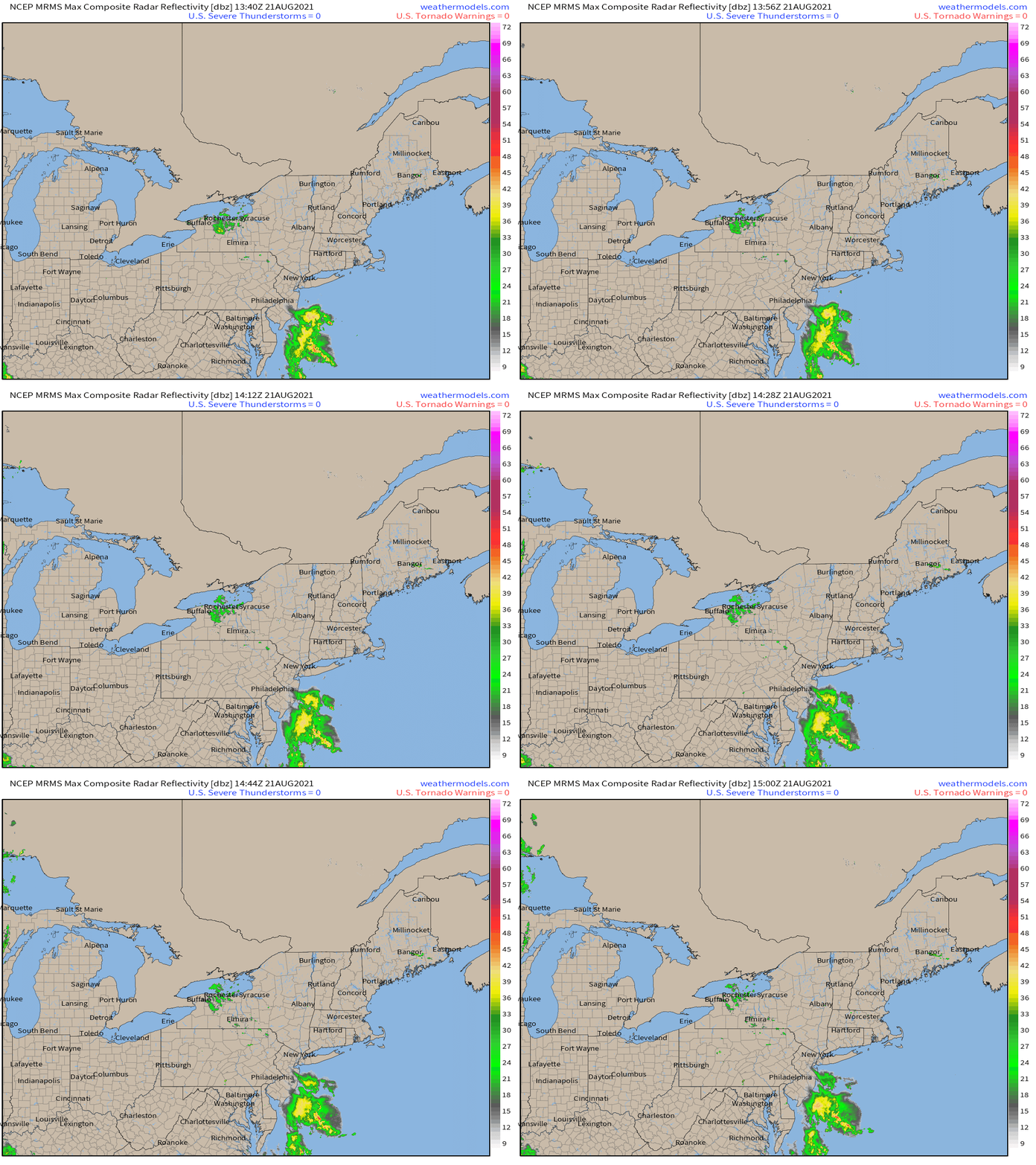
As the upper level trough and Henri continue interacting with each other today, an elongated region of near-surface low pressure will extend north towards the trough axis. Cyclonic flow around the hurricane will send deep moisture pulled into the air by the storm’s latent heat release surging towards a wind shift associated with the low level trough, with associated convergence leading to a narrow line of heavy, efficient tropical downpours- a firehose of prolific rain. The low level trough’s orientation should largely parallel the motion of the hurricane, keeping this band of rain fairly static over the next 24 hours. Currently, the nose of this moisture firehose lies just off the New Jersey coast, and can even be seen on radar.
While Henri speeds north today, the line of intense rain will likely set up shop somewhere over the northern mid-Atlantic, probably in the vicinity of Philadelphia. Where it does, hours of very heavy rain training into tomorrow morning could bring flash flood concerns. It’s a setup fairly reminiscent of the Joaquin-associated flooding that devastated the Carolinas in 2015, though impacts will be mitigated to an extent by the relatively quick timescale.
This will be the first threat to watch out for with the storm, but far from the last.
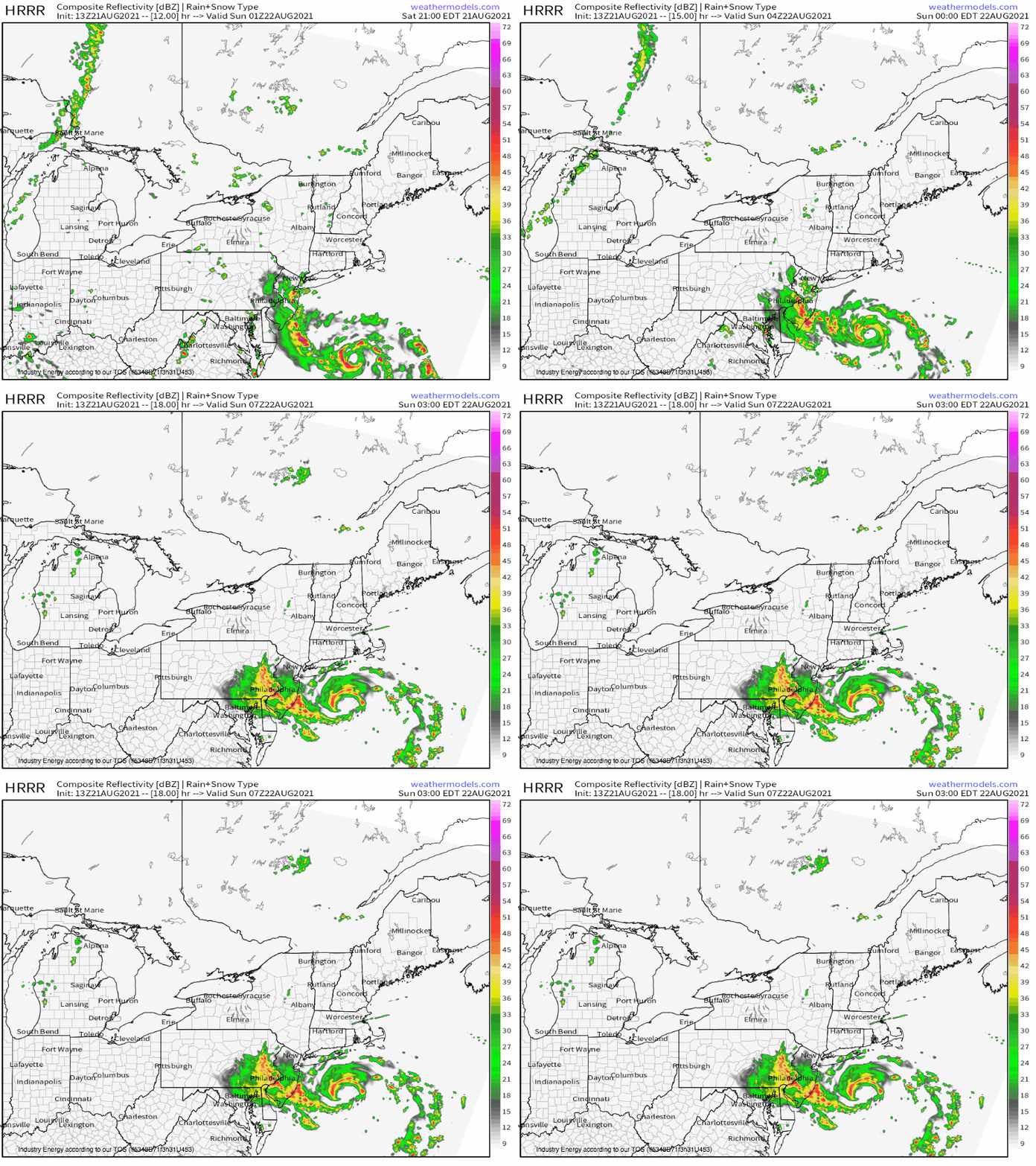
As Henri runs out of gas tonight, it will also begin seeing a deeper westerly component to flow due to the negatively tilting upper level trough. Henri will be incentivized to turn northeast, approaching the eastern half of Long Island from the southwest as shown in the HRRR run above.
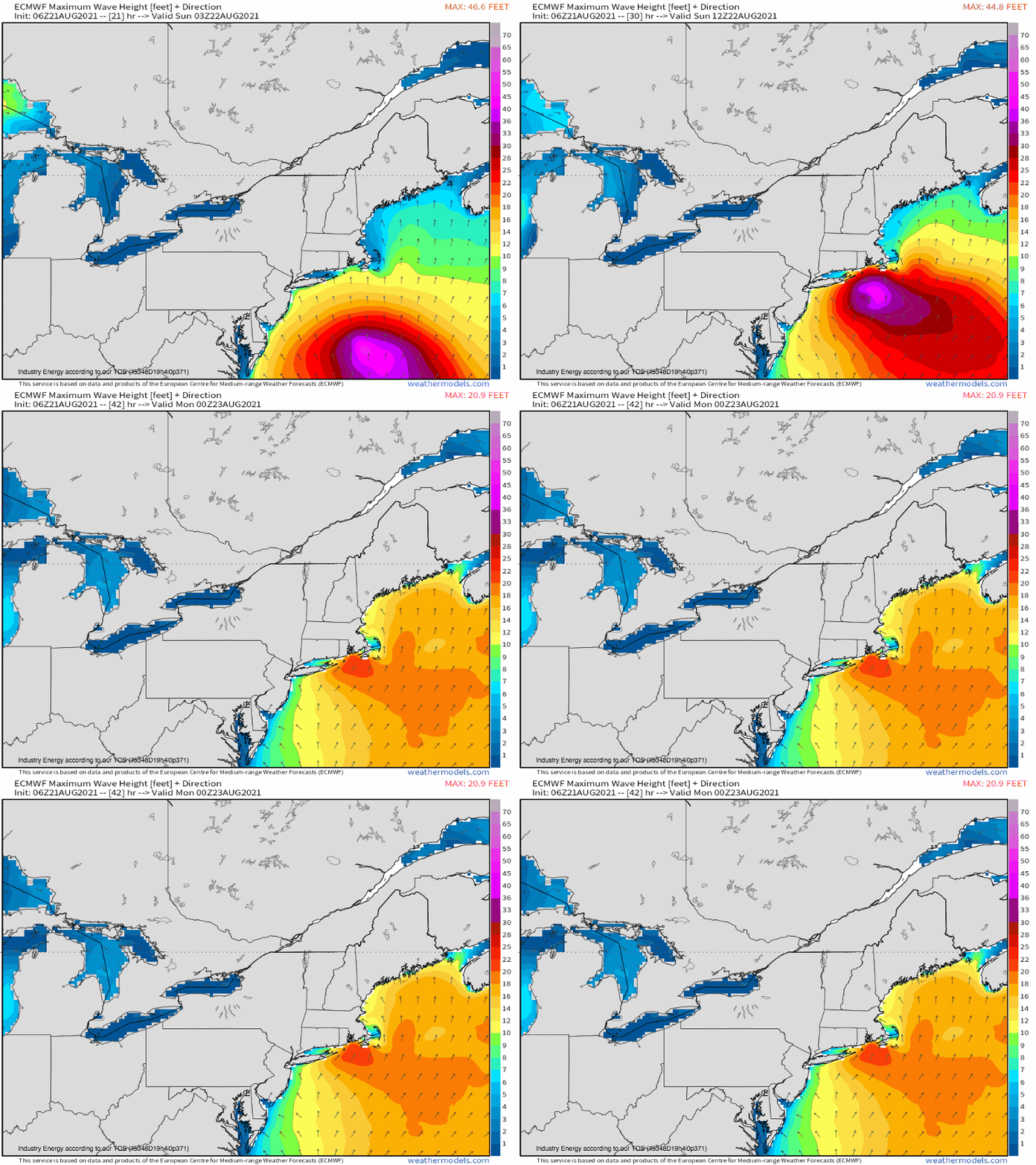
The storm will make landfall somewhere in Suffolk County as a strong tropical storm or weak hurricane tomorrow morning, depending on exactly how intense it can get today and how quickly it weakens tonight. A fairly substantial surge by Northeast standards will hammer a swath of coastline from Mastic Beach to Chatham with 3-5 ft of tide-contingent inundation, plenty sufficient to swamp homes, cover roads, and erode beaches severely.
As the storm’s wind field expands north into the Long Island Sound, an unusually intense surge will also hammer south Connecticut and west Long Island, with 3-5 feet into Fairfield and Flushing. This could be quite expensive, and could lead to a lot of property damage- storm surge this high in this part of the region is uncommon, and there’s a lot of population and expensive property here.
Additional measures to protect property are likely necessary, like removing boats or putting up sandbags, depending on the nuances of your situation and location. Be sure to stay tuned to advice from local officials, especially concerning voluntary or even mandatory evacuations. All measures should be taken by tonight before tropical storm force winds commence.
Henri will also begin producing significant wind damage to trees, power infrastructure, and potentially property as it crosses the Long Island Sound and makes a second landfall in Connecticut. A swath of 60-75mph gusts near the storm’s center, with 40-70mph gusts east and 30-55 gusts west, will knock down vulnerable deciduous trees into a mess of power outages and road blockages. Outages across most of Connecticut, Long Island, east Massachusetts, and Rhode Island will be about as widespread as they’ve ever been, tapering off to scattered into northwest Connecticut, east-central New York, far southeast Massachusetts, and west Massachusetts.
Wind damage to homes will almost certainly be minor even in the reasonable worst case scenario of a strong category 1, though residents should take care to secure objects prone to flying around, like umbrellas and trampolines.
Residents in these areas should prepare for power outages, stockpiling a few days worth of water bottles, perishable food, medication, and batteries. All of these measures should be taken by tonight before tropical storm force winds commence.
Freshwater flooding could well be the worst impact from Henri, however.
Just days after Fred dropped up to 6″ of rain in a swath across the river basins and urban centers of south-central New England, model guidance broadly supports a slow, right-hooking track over the area for Henri. This could end up quite dangerous, allowing prolific tropical stratiform rain to train north and west of the cyclone’s center as it crawls through the northeast. With limited ability to take in new rainfall, critical runoff is probable, especially if the highest rainfall totals fall along this swath.
There’s also a low probability of a track that enhances orographic lift along the Catskills or the hills of MA, NH, and CT. This could bring prolific rainfall (12+”) to slopes at risk of mudslides and flash flooding. Residents of this part of the northeast should stay tuned- while unlikely, this would be substantially impactful.
That’s all from me. Stay tuned to the NHC, your local NWS office, and rush all preparations to completion today.
