The Defining Weather Events of 2020
Co-authored by Jacob and Meghan
When people think back to 2020, some will remember the way the hurricanes simply would not stop crashing ashore, washing away homes in coastal Louisiana over and over and over, destroying power infrastructure along the I-95 corridor, and bringing catastrophic rain to North Carolina. For others, this was the year of an August windstorm without precedent, of flattened stalks of corn, of powerless days turning into weeks. Still others will remember how the summer lightning rolled ashore, turning the skies of San Francisco orange with an immense blanket of wildfire smoke. For some, living anywhere from the urban corridor of Tennessee to a prison in South Carolina, from the coastal mid-Atlantic to dozens of miles of forested towns in Mississippi, this was the year that the atmosphere showed pure violence, raking the landscape with tornadoes. But it isn’t all grim- many will fondly recall the type of generational snowstorm that coated the landscape with snow accumulations approaching four feet, the kind of storm that can so easily turn curious kids into lifelong fans of meteorology.
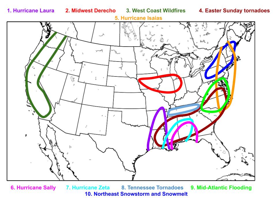
The United States weather of 2020 was clearly unforgettable, in so many ways. From expansive wildfires to rapidly intensifying hurricanes, ferocious derechos to record-breaking snow, violent tornadoes to catastrophic flooding; this year showed the most extreme, tragic, and destructive sides of the atmosphere. The two of us put together this list of what we consider the top ten most significant, unusual, destructive, and overall memorable US weather events of this blockbuster year.
10. Northeast Snowstorm and Snowmelt
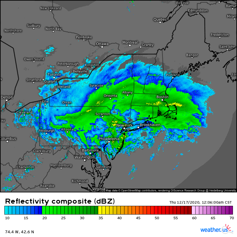
The snowstorm of December 16th-17th was broadly well modeled, with many depicting significant accumulations over a week out. But the nearly unprecedented onslaught that dropped more than three feet of snow in a wide, arcing band from central Pennsylvania to southeastern New Hampshire blew away almost all forecasts. Rather innocuous looking at both the low and upper levels, the nor’easter demonstrated how heavy snow really does boil down to cold temperatures, persistent forcing, and moisture. In fact, it was the nature of this forcing- concentrated around the 700mb layer- that allowed for both the nondescript surface/upper levels and the mind-boggling snowfall rates, due to the layer’s typical proximity to the thermal profile most favorable for high snowfall ratios. This band of so-called midlevel frontogenesis coincided with anomalous precipitable water, advected northwest from an unusually warm Atlantic, setting up a nearly perfect atmosphere for big snow. As this forcing pivoted through the interior northeast, oriented largely parallel to the cyclone that was slowly sliding east, accumulations often exceeded 6″ per hour. Where this band was most persistent, from central PA to interior southwest Maine, 2-4 feet of snow were commonly reported, with local totals to 40″ in four states (VT, NH, PA, NY)!! Lesser amounts, still often exceeding 10″, were common from parts of NJ northeast through NYC, CT, RI, MA, and ME, as many areas exceeded snowfall totals of any storm since 2018 or even 2017.
Just a week later, on December 24th, an extreme atmospheric river event ahead of a quickly deepening low level cyclone pumped 60°F temperatures and extreme atmospheric moisture content north into New England. Where topography and a slow moving cold front allowed persistent forcing for ascent, 2-3+” of rain fell. Coinciding with rapid snowmelt from the week before, rivers across interior NY and PA saw moderate to locally major flooding, with rivers approaching moderate stages elsewhere in the northeast. While rapidly changing weather is common in New England, the quick transition from extreme snowfall to record warmth and heavy rain proved jarring.
9. Mid-Atlantic Flooding
Hurricane Eta started November off by producing unimaginable devastation in Nicaragua and Honduras. The United States impacts, while not nearly as catastrophic, were also noteworthy, as a significant predecessor rainfall event (PRE) dropped extreme rain across parts of the mid-Atlantic, leading to widespread flash flooding.
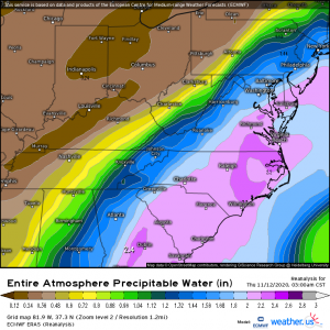
The setup, which developed late on 11/10, was incredible for PRE flooding. A significant, slow west to east moving longwave over the central US meant southerly midlevel flow over the mid-Atlantic increased along streamline, a setup that promoted broad synoptic-scale lift. Meanwhile, as a cyclone intensified under the influence of the aforementioned longwave, a strengthening southerly low level jet shifted over the mid-Atlantic. Eta, a strong tropical storm, was busy meandering over the eastern Gulf of Mexico, near the entrance region of both midlevel speed divergence and the southerly low level jet. This provided extreme tropical moisture to an atmospheric conveyer belt, which dumped it all out over North Carolina, Virginia, and Maryland. The trough’s high amplitude and slow motion, and Eta’s inability to decide which stage direction to exit, worked with regional topography and a very slow moving frontal boundary to produce persistent heavy rain, centered over central North Carolina. More than a foot fell in places, and significant flash flooding killed at least 11 and caused significant infrastructural and property damage.
8. Tennessee Tornadoes of March 2 and 3
The Tennessee tornadoes were something of a worst-case scenario for severe weather forecasting. Not only did they occur at night when the general public was asleep, but the severe threat was widely under-forecast and warnings were either issued with very little lead time or not issued at all.
A slight risk was issued for severe weather, including a tornado or two, but did not include the area in which the most violent tornado occurred. This area was barely under a general thunderstorm outlook. It was noted in the forecast that a capping inversion would likely contain the threat for most of the day and the chance of tornadoes was isolated, at best.
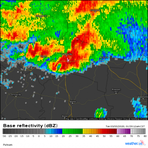
The first tornado touched down just after 10 pm CST in Western Tennessee inside Gibson County. Another followed shortly after. No warnings were issued for either of these tornadoes which were later rated EF1 and EF2 respectively. A third tornado came close on the second’s heels and tracked into the middle of the state. At this point, just after 11 pm CST, a tornado watch was issued for Middle Tennessee. A fourth tornado touched down followed by a period of weakening.
The supercell then reorganized, strengthened and put out a fifth tornado, which would become a strong EF3 that tracked through East Nashville, Donelson, and Mt Juliet. A tornado warning was not issued until after the tornado was on the ground and doing damage on the west end of the city. Five deaths and 220 injuries were attributed to this tornado, as well as heavy damage along the path. A sixth, weaker tornado followed shortly after.
The seventh tornado became the monster EF4 that devastated the town of Cookeville. Warnings were issued barely a minute before the tornado touched down, leaving the residents of the western edge of the city with very little time to shelter. Responsible for 19 deaths and 87 injuries, this tornado created a narrow, but deadly, swath of destruction. Entire neighborhoods were destroyed with block foundation homes being completely wiped away. The Cookeville tornado was the most intense tornado to occur in the US in the last three years.
Three more tornadoes of varying, but lesser, intensities formed before the parent supercell finally weakened as it dropped down off the plateau into the valley near Knoxville. When all was said and done, one parent supercell produced 10 tornadoes, with intensities from EF0 to EF4, over 275 miles in around four and a half hours.
7. Hurricane Zeta
Hurricane Zeta was the Atlantic Basin season’s 27th named storm, 11th hurricane, and 6th US landfalling hurricane. Zeta began as an area of low pressure in the Caribbean Sea on October 19. After general disorganization and some stagnation, the storm became a tropical depression on October 24 and rapidly intensified into a hurricane by October 26. Zeta then made its first landfall on the Yucatan Peninsula as a category 1 hurricane with sustained winds of 80 mph and a central pressure of 977 mb.
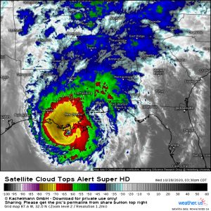
The hurricane traversed the Yucatan Peninsula and emerged into the Gulf of Mexico where it would do battle with dry air. Unfavorable conditions weakened the storm, leaving it with sustained winds of 60 mph and a pressure of 990mb. Zeta overcame the dry air that threatened to choke it and began to undergo a second round of rapid intensification, unexpectedly peaking as a Category 2 hurricane with maximum sustained winds of 110 mph and a central pressure of 970 mb. It was at this intensity that the storm made landfall near Cocodrie, LA, just southwest of New Orleans, on October 28.
Zeta’s eye tracked over New Orleans in an unusual direct urban landfall, bringing widespread hurricane force wind gusts and damage to trees, powerlines, and structures throughout the city. Strong tropical storm force winds also impacted the Alabama coast which was still in the process of recovering from Hurricane Sally a month earlier.
Zeta exited to the northeast, weakening to a tropical storm over Alabama. The storm later moved into the Atlantic as an extratropical cyclone and interacted with a cold front, bringing snow with accumulations of up to 6 inches to parts of New England.
Zeta was responsible for $3.8 billion in damage and 8 deaths.
A category 2 Hurricane Zeta prepares to make landfall in Cocodrie, LA.
6. Hurricane Sally
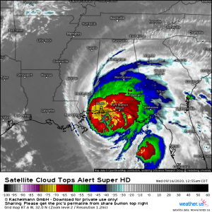
Hurricane Sally was the 2020 Atlantic Basin season’s 18th named storm and 7th hurricane. Sally was the first hurricane to make landfall in Alabama since 2004. By some strange coincidence, Sally made landfall on the same day Hurricane Ivan had in 2004 and in nearly the exact same place.
Sally began as a disturbance in the Bahamas. On September 11, the disorganized area of low pressure was named a depression: the 19th of the season. Depression Nineteen made landfall on Key Biscayne on September 12, then quickly moved into the Gulf of Mexico. Though it faced northwesterly shear, Sally attained hurricane status early on September 14 and quickly strengthened to a category 2 storm with 100 mph sustained winds and a central pressure of 987 mb. An extremely slow-moving storm at 2 mph, Sally began its final approach to the upper Gulf coast. By September 16, Sally made landfall near Gulf Shores, Alabama with peak winds at 105 mph and a central pressure of 965 mb. The slow forward motion meant the coast was battered with feet of rain in addition to long-duration high winds and surge flooding. Maximum rainfall reports neared 30″, a shockingly extreme volume of precipitation. The combination caused widespread property damage and infrastructural destruction, and Sally was responsible for $6.25 billion in damage and 8 deaths.
5. Hurricane Isaias
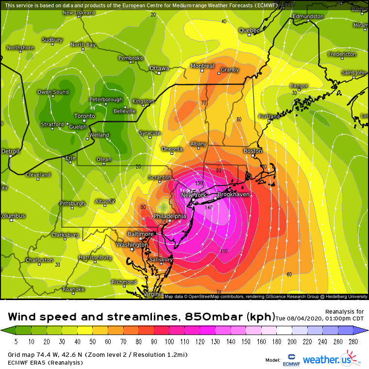
Isaias may not have even been close to the most intense hurricane of the extraordinary 2020 hurricane season, but the storm managed to bring significant impacts to much of the populous eastern seaboard on August 3rd and 4th. The interactions between the storm, no more than a weak category one at landfall, and a deep east coast longwave allowed widespread wind damage, flooding rain, and an unusually intense tornado outbreak to impact a swath from the Carolinas through Vermont and New Hampshire.
As a tropical system, Isaias continuously refused to cooperate with meteorologists, with frequent bouts of intensification followed by dramatic weakening. Initial impacts were below expectations in coastal Florida, where hurricane watches went unverified as Isaias remained a tropical storm relatively far from the shore. But as the storm approached the Carolinas, it quickly re-intensified into a category one hurricane, a strength it maintained to landfall. Impacts in the Carolinas were moderate, with surge and wind impacts causing widespread property and power infrastructure damage. Notably, an EF3 tornado impacted a mobile home park in North Carolina. Quickly after landfall, the hurricane weakened slightly to a tropical storm, but began interacting favorably with a midlevel trough. The hybrid nature of Isaias from this point onward allowed it to accelerate considerably while also segregating wind and rain impacts to opposite sides of the storm’s circulation. To the east, winds remained relatively strong even as the tropical storm moved inland; gusts approached 80mph as far north as Long Island, and extreme electrical infrastructure damage impacted much of the populous mid-Atlantic. In fact, New Jersey and Connecticut saw power outages to near-record levels. This sector of Isaias also featured an environment unusually exceptional for tornadoes, with 39 reported over the ~24 hours that the storm raced up the east coast. To the west, meanwhile, very heavy rain approaching a foot caused significant flooding in Pennsylvania, killing two. Overall, 18 were killed, and damage approached 5 billion dollars, making this among the most impactful events for the populous I-95 corridor since 2012’s Sandy.
4) The Easter Sunday Tornado Outbreak
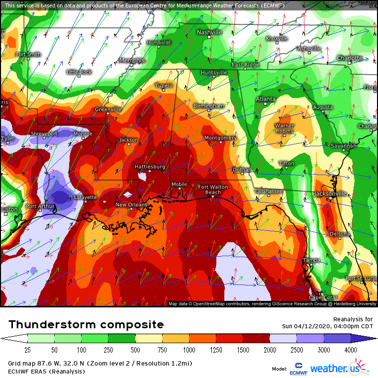
The United States has been in something of a violent tornado drought as of late. By April 2020, the country had gone an unprecedented six years without a single outbreak producing ≥2 EF4+ tornadoes (from June 2014), had just seen the only year without a single E/F4+ tornado in modern history (2018), and had seen only one SPC high risk since 2017 (in May 2019). But Easter Sunday this year saw an incredibly volatile atmosphere produce an outbreak that rivals many of those of even the roaring 1990s.
An intense shortwave pivoting through Texas overspread much of the southeast with divergence and powerful flow aloft, conditions favorable for convective development and organization. A mesolow pivoting around a strengthening low level cyclone allowed an intense 850mb jet to develop over the southeast, meanwhile, advecting Gulf moisture north beneath a significant EML. As 2000+ j/kg of surface based CAPE developed in response, and as the combination of intense southerly LLJ and strong westerly flow created long, looping hodographs, the stage was set for intense tornadoes. An intense QLCS produced a number of tornadoes, triggering a tornado emergency in Louisiana, before a pair of supercells developed over the open warm sector. Both produced long-tracking, violent tornadoes only a few dozen miles apart; the second, officially rated at 190mph, was the third widest in US history at an astonishing 2.25 miles. These storms, too, were swept up in the expansive squall line, and the event ended up logging 1024 severe wind reports in addition to the astonishing 183 tornado reports, which included a third, nocturnal EF4 in South Carolina. Overall, 38 were tragically killed, making 4/12/20 the deadliest tornado outbreak since 2014. The storms also caused unusually high-end damage for tornado outbreaks, ~3 billion dollars. Additionally, 183 unfiltered tornado reports made the event the most prolific since the 2011 superoutbreak.
3) West Coast Wildfires
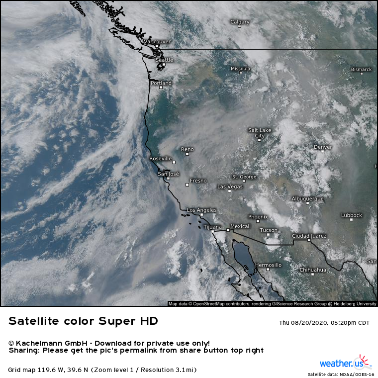
In a decade unprecedented for the severity and scope of western US wildfires, 2020 still managed to stand out. Unusually dry weather and warmth early in the year combined with a large tree die-out to prep forests with combustable fuels, and a mixture of climate change and decades of poor forest management created a background environment favorable for significant fire growth. These antecedent factors helped allow a rare August lightning storm to ignite a spectacularly destructive round of early-season wildfires, blanketing much of the state in thick smoke and inciting by far the largest fire complex in California. Scenes from the inferno included a San Francisco painted apocalyptic orange by a combination of thick smoke and shadows cast by towering pyrocumulonimbus clouds, and respiratory issues worsened by the terrible air quality likely led to hundreds of excess deaths.
As the year progressed, a more ‘typical’ series of synoptically driven wind events, with a ferocious intensity and persistence, continuously drove more and more fires across the west. Impacts weren’t just limited to California, either- an exceedingly rare early September high pressure intrusion allowed a Santa Ana-esque offshore flow event to incite wildfires across interior Washington and Oregon to an extent effectively unprecedented in modern forestry. With rain slow to come this winter, the fire season lasted well into the fall, with a series of November wind events adding acreage to an increasingly devastating season.
The dramatic statistics speak for themselves. Five of the six largest wildfires in California history occurred this year, including the absolutely massive August complex, which burnt more than double the acreage of the Mendocino complex. 4.4 million acres were burnt, an astonishing new modern record representing 4% of California’s land area.
2) The Midwest Derecho
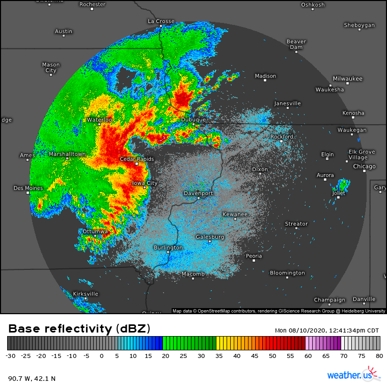
Early on August 10th, 2020, nobody could have foreseen that a cluster of storms developing over South Dakota, upstream of a ‘Marginal’ severe risk, would end up producing the most damaging convective storm ever. But that’s exactly what happened: a generational derecho flattened millions of acres of corn, pummeled Cedar Rapids, and caused more than twice as much damage as even the blockbuster June 2012 mid-Atlantic squall line.
By the time the cluster of thunderstorms organized into a bowing segment over western Iowa mid-morning, the downstream environment was characterized by Gulf moisture with dewpoints in the mid 70s, overlapped by a strong EML with lapse rates exceeding 8°C/km. In this environment, updrafts can very easily explode into intense thunderstorms, with surface based CAPE approaching an ‘extremely unstable’ 5000 J/kg. In this environment, convective energy release was able to produce incredibly powerful wind gusts. The maturing storms developed an extremely powerful rear inflow jet, with winds above the surface racing towards the bow echo at speeds above 100 knots. As the convective line tracked across Iowa, it produced winds that often exceeded 100mph, with Cedar Rapids likely experiencing gusts to a shocking 140mph. These speeds put the derecho among the absolute upper echelon of known convective wind events, and caused mind-boggling damage. In Iowa and adjacent Illinois, two million lost power, and cleanup efforts are still ongoing. Millions of acres of agricultural crops were also damaged severely or destroyed completely, a devastating blow accentuated by massive infrastructural losses in a derecho unusually close to harvest. Damage from the event is estimated around 7.5 billion dollars, a total completely unheard of for non-tornadic convective events. In fact, this was likely the second costliest weather event of the year- more expensive than a half dozen hurricanes, a high-end tornado outbreak, or record-breaking wildfires. The extreme wind speeds and unprecedented damage make it clear: this was a generational convective wind event. Four were killed, a number that could have been far higher without timely forecasts by the Weather Service, including an eventual moderate risk and a PDS severe thunderstorm watch, and some of the most strongly worded severe thunderstorm warnings I’ve ever seen.
1.Hurricane Laura
Hurricane Laura was the 2020 Atlantic Basin season’s 12th named storm, 4th hurricane, and 1st major hurricane. It tied the 1856 Last Island Hurricane as the strongest hurricane to strike the state of Louisiana and was the strongest US landfalling hurricane of the 2020 season.
Laura began as a tropical wave in the far eastern Atlantic on August 16. By the 20th, the would-be Laura, located east of the Leeward Islands, had organized enough to be classified as a tropical storm. A day later, the storm attained tropical storm status and was named. In the subsequent days, Laura struggled to organize and strengthen beyond tropical storm status. On August 23, a messy Laura made landfall in the Dominican Republic packing sustained winds of 50 mph. Laura emerged over water, managed to organize somewhat, and made a second landfall in Cuba on August 25 with winds of 65 mph.
After a brief trip across Cuba, Laura once again re-emerged over water, into the Gulf of Mexico this time, and began to undergo rapid intensification. Laura attained hurricane strength on August 25 and by August 27 was a strong category 4 storm with sustained winds of 150 mph and a minimum central pressure of 937 mb. Just shy of category 5 status, Laura then made landfall near Cameron, LA around 6:00 UTC on August 27. Laura was the first of two storms that would ravage the same area of the Louisiana coast in 2020.
The hurricane brought an unsurvivable storm surge to the coast, and extreme hurricane force winds caused widespread devastation, including the destruction of a NWS radar dome. As Laura moved inland, the storm produced a wide area of wind damage and did not degrade to a tropical depression until it reached Arkansas. Laura’s remnants later merged with an extratropical cyclone and dissipated off the east coast on August 29.
Laura was ultimately responsible for $16.1 billion in damage and 77 deaths, making it both the costliest and deadliest US weather event of the year.
Category 4 Hurricane Laura was the strongest US landfalling hurricane of the 2020 season.
