TD 14 Poised To Intensify In The NW Caribbean While TD 13 Struggles With Dry Air And Shear East Of The Lesser Antilles
Hello everyone!
We have two tropical entities to keep an eye on as we approach the weekend: TD 13 and TD 14. Initial thoughts on each system were posted yesterday when they hadn’t yet reached tropical depression status. Most of the thoughts presented in those posts are still valid. This post will provide an updated outline of what to expect from each system over the next few days. As per usual, plenty of questions still remain regarding the future of each storm, but a few of those questions are coming into sharper focus this afternoon.
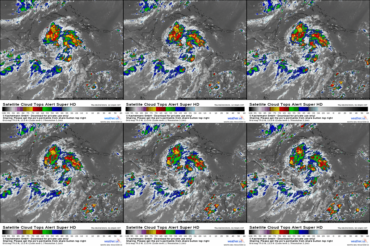
TD 14 is definitely the healthier-looking system this afternoon. It has an impressive amount of convective activity for mid-afternoon (approaching the diurnal convective minimum) and robust outflow channels fanning away in all directions from the storm’s center. The only thing holding the system back seems to be a lack of deep convection over its center which is located somewhere ENE of the Nicaragua/Honduras coastline. I suspect we’ll see a big burst of convection develop there tonight when diurnal conditions are more favorable. Given that the system already has curved banding features and well-established upper-level outflow, I think TD 14 is well-positioned to take advantage of the very favorable environment over the NW Caribbean.
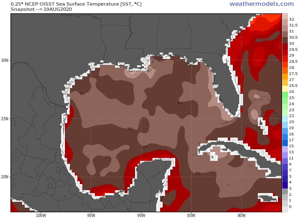 Sea surface temperatures in the NW Caribbean and adjacent parts of the Gulf of Mexico are extraordinarily warm, and contain an absurd amount of energy for tropical cyclones to tap should they consolidate enough to take advantage. Usually the benchmark for SSTs being warm enough to support tropical cyclones is about 26C. The threshold for being supportive of major hurricanes is somewhere around 28-29C. 30-31C (what we have in the NW Caribbean/Gulf of Mexico) is about as hot as the water on this side of the world can get. Furthermore, this warm water extends well below the surface which means that it would be very hard for the wind/wave action associated with a tropical cyclone to mix cooler water up to the surface.
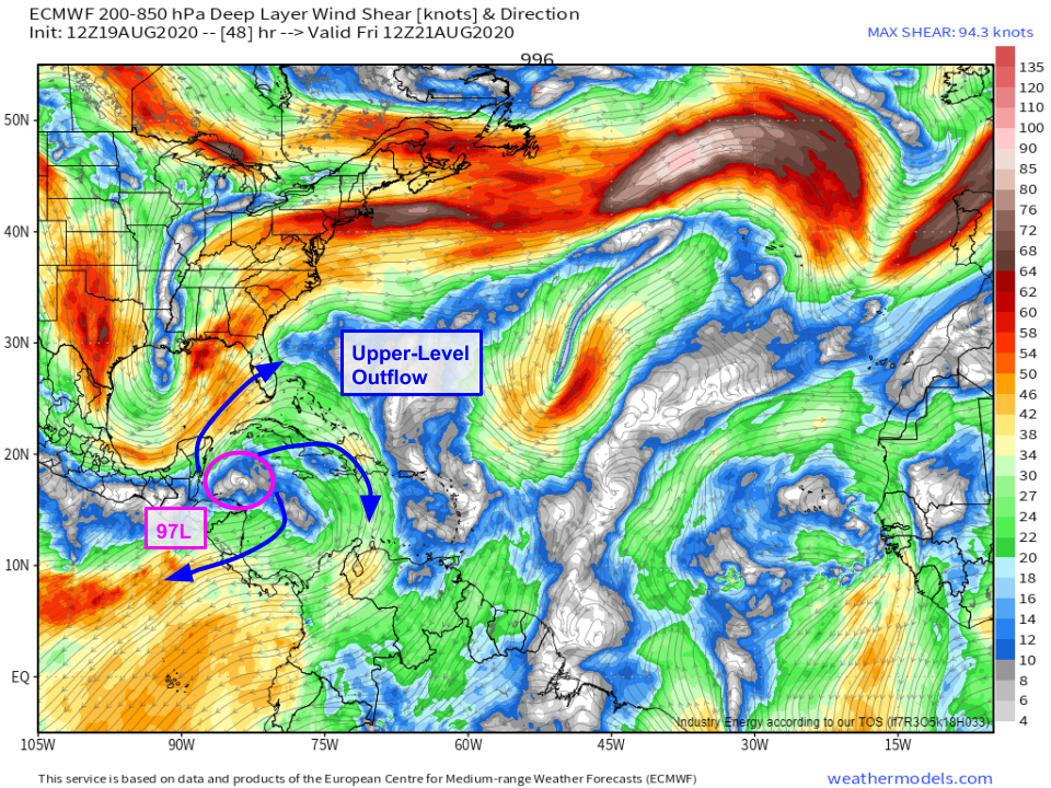 I posted this in yesterday’s update (so it says 97L instead of TD 14) but today’s guidance is nearly identical. As the system moves through the NW Caribbean tonight and tomorrow, it will continue to sit under a strong upper-level anticyclone which will help the storm flourish by preventing wind shear from disrupting the circulation and by venting air away from the storm in the upper troposphere.
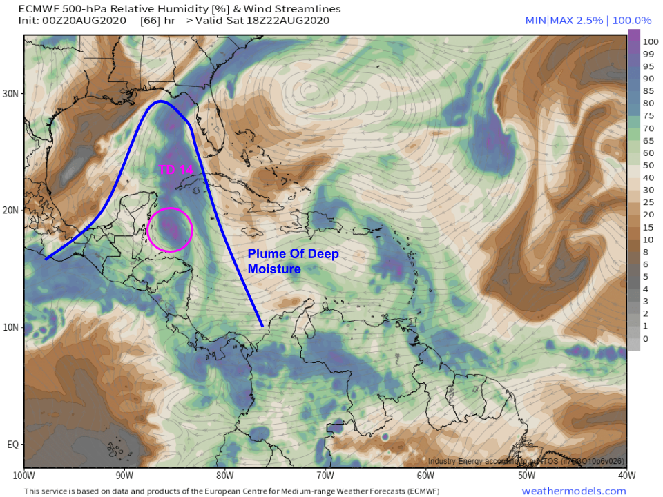 TD 14 won’t have to worry much about dry air either. The system is well-insulated from dry air in the mid-levels as it’s embedded within a moisture plume drawn north from the deep tropics by a trough over the western Gulf of Mexico. The air to the west/southwest of the system isn’t as moist as might be perfectly ideal, but there’s no reason to believe that TD 14 will struggle with dry air like Isaias did earlier this season, for example.
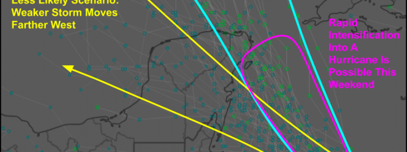
 EPS guidance shows two generally plausible scenarios for TD 14. The system will either be relatively weak (TD or low-end TS) and drift NW or WNW over the Yucatan Peninsula, or it will be stronger and move more NNW towards the Yucatan Channel between Cancun and Cuba. Based on the system’s current structure and the favorable environment in which it will reside this weekend, I’m inclined to favor the stronger scenario. This could involve rapid intensification into a hurricane as the storm approaches the far NE tip of the Yucatan Saturday-Sunday.
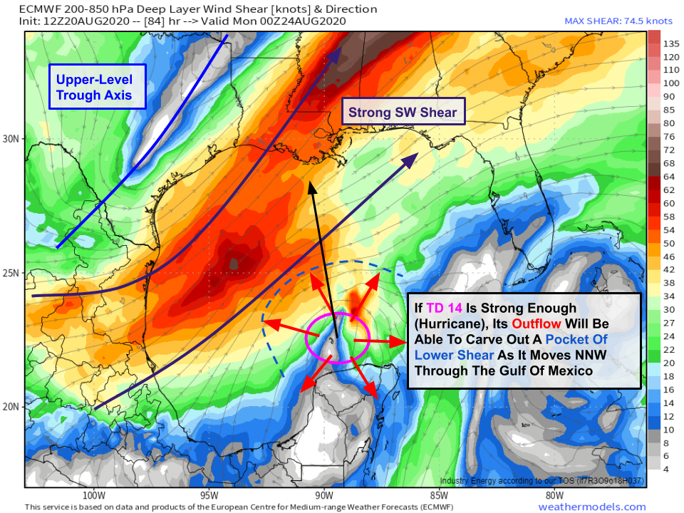 By the time the storm gets into the Gulf of Mexico, it will be interacting with an upper-level trough over Texas. That trough will send a burst of wind shear towards TD 14. This is another “fork in the road” for the system. If the storm is weak, it will likely succumb to the shear or at least will remain a low- or mid-grade tropical storm. Parts of the Gulf Coast would have to worry about some wind and rain, but this wouldn’t be a major event. This solution is shown by most model guidance. The other possibility is that TD 14 is able to rapidly intensify before reaching the Yucatan and doesn’t spend enough time over the peninsula to substantially weaken. In this scenario, the storm would be producing enough upper-level outflow to carve out a pocket of lower shear for itself. In this scenario, the storm would likely be able to remain strong as it moves NNW through the Gulf of Mexico, and parts of the northern Gulf Coast would have to worry about a more serious storm. Given the favorable environment over the Caribbean, I don’t think this scenario should be discounted as heavily as model guidance suggests. Residents of the Gulf Coast, particularly in SE Texas and Louisiana, should be paying close attention to forecasts and should be reviewing their hurricane plan to make sure they’re ready to take action early next week.
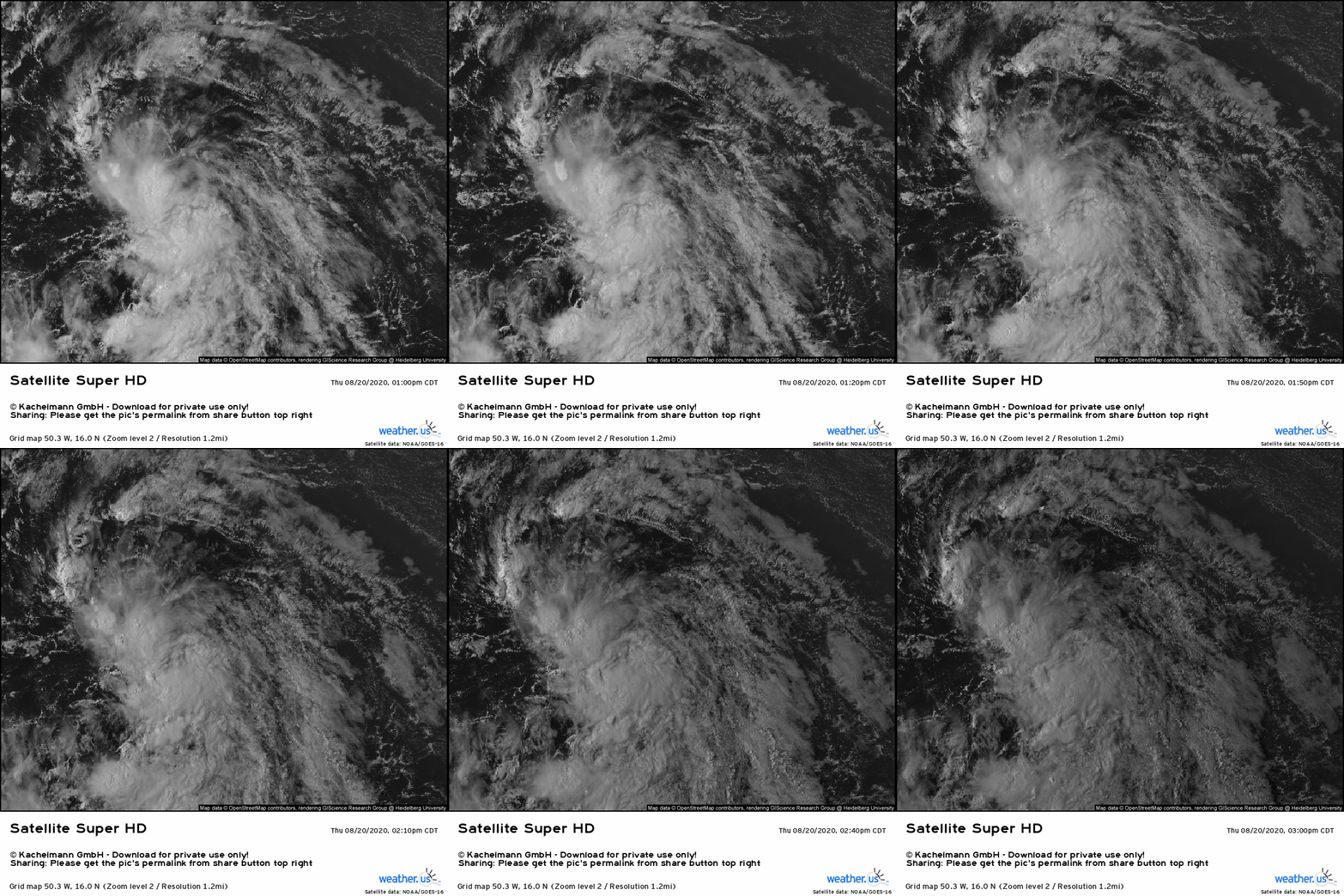
East of the Lesser Antilles, TD 13 is struggling with some dry air and wind shear this afternoon. This was expected as the storm slides around the southern edge of an upper-level low. Overall, I don’t have a ton to say about the system that wasn’t already said yesterday. If the storm can hang onto a circulation until it moves past the ULL and into the SW Atlantic this weekend, it also has a shot at rapid intensification thanks to very warm sea surface temperatures and a favorable upper-level pattern. That said, if it continues to struggle with producing and maintaining deep convection, it very well could slide through the Greater Antilles which would pretty much keep a lid on further development until the Gulf of Mexico. I’ll revisit this system in more detail tomorrow once we watch it interact a bit more with the ULL.
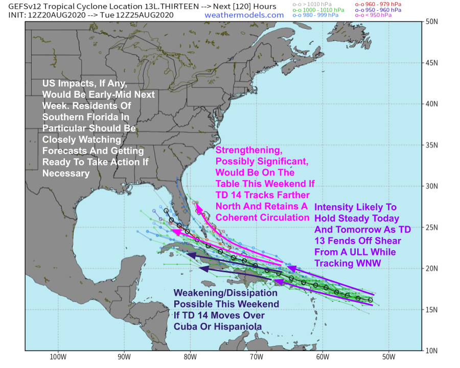
Until then, I think the GEFS v12 (parallel) has the best handle on the range of possible outcomes for TD 13. Most members show little change in strength tonight/tomorrow as the storm moves WNW. This weekend will see the system either drift west into Cuba or Hispaniola and significantly weaken/dissipate or continue moving WNW into the southern Bahamas. If it arrives in the southern Bahamas with a coherent center of circulation, it could take advantage of the warm water and very favorable upper-level environment for intensification. If it is an open wave, re-development would be slower and may not occur until the storm arrives in the Gulf of Mexico next week.
Much more discussion of both TD 13 and TD 14 to come over the next few days.
-Jack
