Invest 98L Close To Tropical Depression Status East Of The Lesser Antilles
Hello everyone!
The tropical Atlantic is heating up right on schedule as we approach the climatological peak of hurricane season and a wave of favorable conditions passes over the basin. There are two disturbances to watch closely for development during the latter half of this week into this weekend. The first, 97L, is currently located in the central Caribbean and will move west-northwest towards the Gulf of Mexico. The second, 98L, is located east of Barbados and will move west-northwest through the northern Lesser Antilles before making a run into the SW Atlantic. This post will discuss the forecast for 98L. Information on 97L can be found by clicking here.
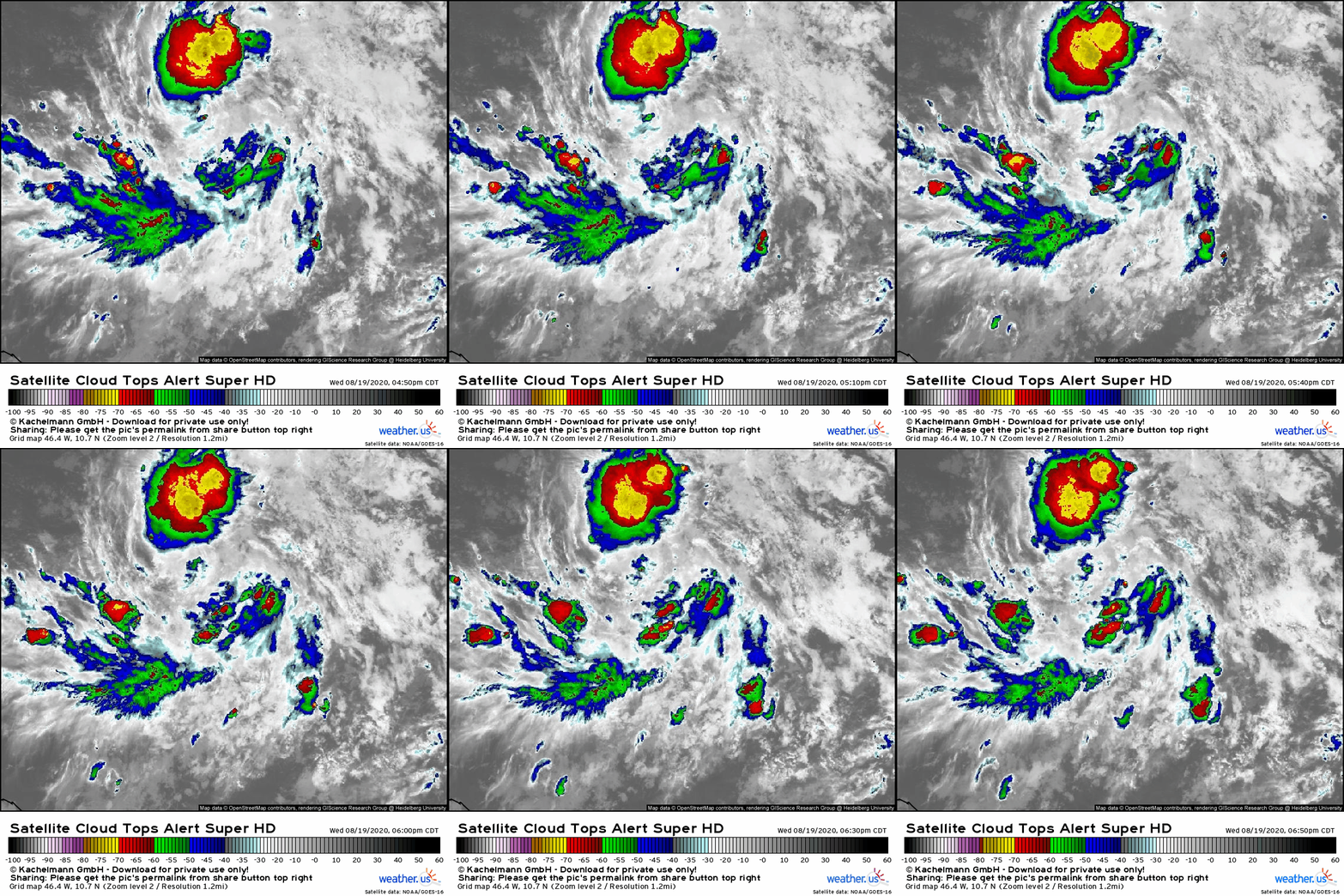
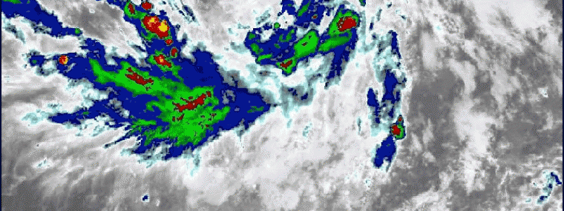
Satellite imagery shows a robust circulation beginning to develop along 98L’s wave axis. The storm is struggling a bit to produce organized convection near that incipient center, but that should change tonight due to the diurnal cycle and SSTs ticking slowly up as the storm moves NW. How much convection is able to develop near the center tonight will play a big part in determining what the longer-range future of the system looks like. The stronger it gets now, the stronger it will be later.
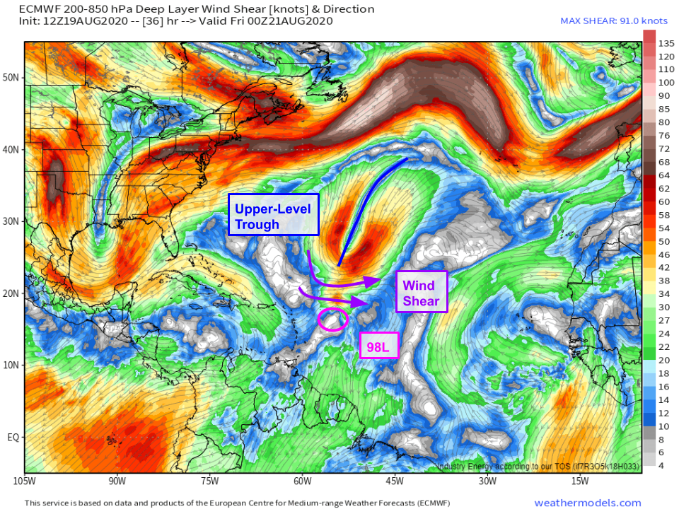 The primary short-term challenge for 98L, once it develops, will be wind shear associated with an upper-level low. The storm will encounter this shear tomorrow, and the extent to which it will be able to develop tonight will play a large role in determining the extent to which the shear will be able to weaken its circulation. A stronger storm won’t be impacted by the shear nearly as much as a weaker circulation, or one that hasn’t quite formed at all. The storm’s exact track and where along the wave axis the circulation ends up forming will matter quite a bit too. If the circulation forms farther north, closer to the ULL, it will be more severely sheared. If the storm moves faster to the NW, in opposition to the west-northwesterly shear, it will feel the influence of the shear in a stronger way. So there are questions regarding 98L’s interaction with this ULL, and answering those questions will be important to figuring out what happens to the storm in the medium range.
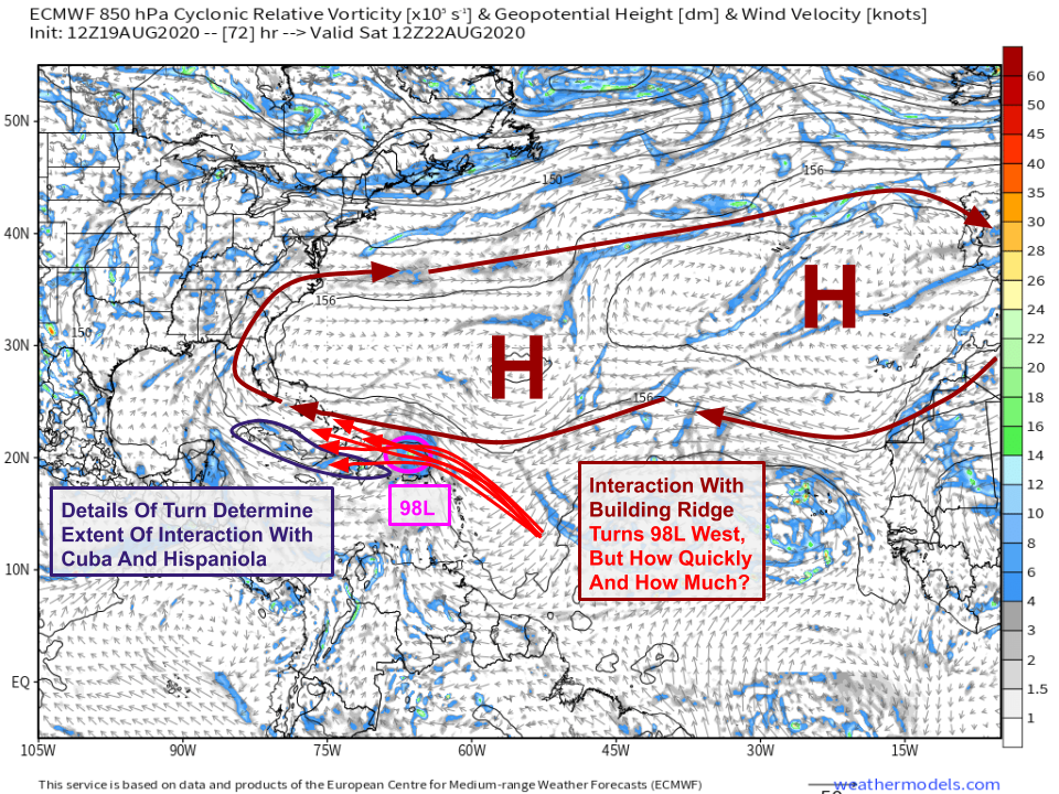 By Saturday, the system will take a turn towards the west or west-northwest in response to a ridge building over the central Atlantic. The exact timing of that turn and how sharp it is will be very important for what happens further down the road. As we know from tracking and discussing previous storm systems, when tropical cyclones move over Hispaniola or Cuba, their circulations become disrupted or destroyed. If that happens, 98L will likely remain weak and disorganized as it drifts into the Gulf of Mexico. While that wouldn’t preclude more significant development later, it would make it a bit harder for the system to become a huge issue. If 98L remains north of the islands later this weekend, the door would open to a much stronger system.
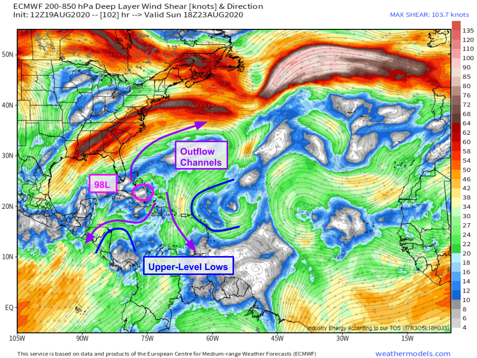 If 98L is able to remain north of the islands, it will enjoy an extremely favorable environment over the Bahamas as two upper-level lows and a jet streak over the East Coast team up to produce three strong outflow channels. SSTs in this region are extremely warm (>30C!) and there shouldn’t be too much dry air around. Of course, none of this matters if 98L is over Cuba or is desheveled enough after interacting with the upper-level low tomorrow. But if the storm is able to emerge relatively intact this weekend, we could be looking at a serious threat to southern Florida.
As with 97L, the potential for significant impacts doesn’t mean that now is the time to start seriously worrying. Keep an eye on forecasts to see if those more impactful scenarios become more likely, but until then, know that the most likely scenario is either that the storm struggles just north of the islands in the face of dry air and wind shear tomorrow/Saturday or that it moves over the Greater Antilles this weekend and doesn’t develop significantly. So long as that’s the case, the threat to the US in the medium-range is relatively low. Of course that could change, and you should be ready in case it does. Take a few moments tonight or tomorrow to look over your hurricane plan and make sure you’re ready in case 98L becomes a more substantial threat.
-Jack
