Lopsided Cristobal Drifts Towards The Gulf Coast Today, Will Bring Heavy Rain, Storm Surge, And Gusty Winds To Much Of The Northern Gulf Coast
Hello everyone!
Tropical Storm Cristobal is drifting north through the Gulf of Mexico today en route to landfall along the Louisiana coastline sometime later in the day tomorrow. The general forecast for the system remains on-track based on available data today. This post will serve to provide a quick update regarding what to expect for those in the storm’s path over the next couple days.
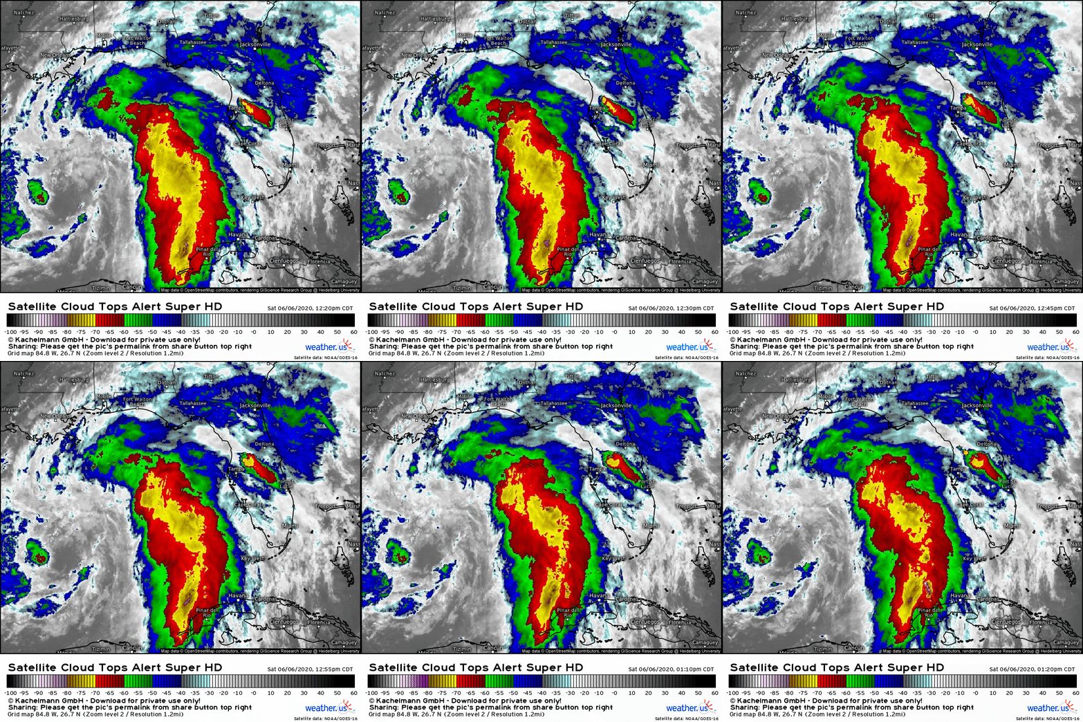 Cristobal hardly resembles a tropical cyclone on satellite imagery this afternoon. The system’s most intense thunderstorm activity is found well east of the center of circulation which is surrounded by just a few clouds and perhaps weak showers. One could even make the (rather compelling) argument that this is not a tropical cyclone, but is actually subtropical. Either way, the key takeaway is that the heaviest rain, strongest winds, and highest surge associated with Cristobal will be found well east of where the center makes landfall.
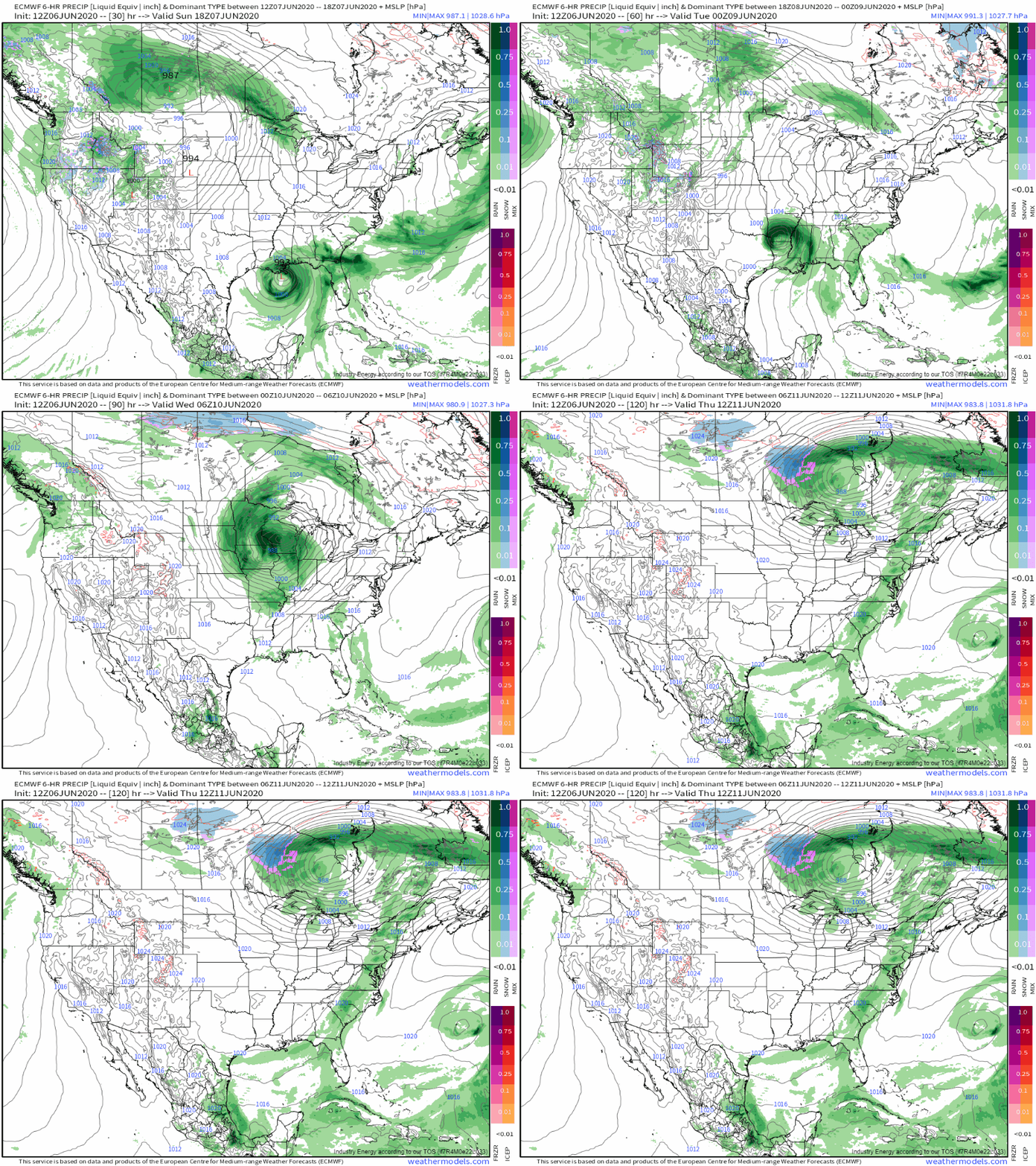
Forecasts from the ECMWF show that the system will remain lopsided as it approaches the coastline tomorrow morning. The model thinks that some consolidation of thunderstorm activity around the center might occur prior to landfall, but given southwesterly wind shear and ample dry air wrapping into the system’s circulation from the west/southwest, I’m not sure I totally buy that forecast. The system’s “tail” or band of strongest thunderstorm activity will move into Florida tomorrow morning with heavy rain, gusty thunderstorm winds (gusts >58 mph indicating “severe” thunderstorms are likely in the stronger cells), and some storm surge flooding especially near the Big Bend region. At the moment, it sure looks like this part of the storm will be the most intense, though I wouldn’t totally discount the possibility that convection could organize closer to the center sometime tonight. The “runner-up” for worst conditions will be southeastern Louisiana, located just northeast of the center. Wind gusts there are also likely to top 60 mph, perhaps even without the aid of thunderstorm circulations.
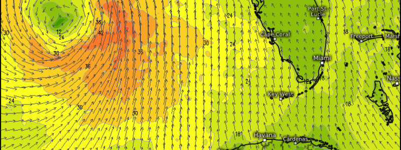
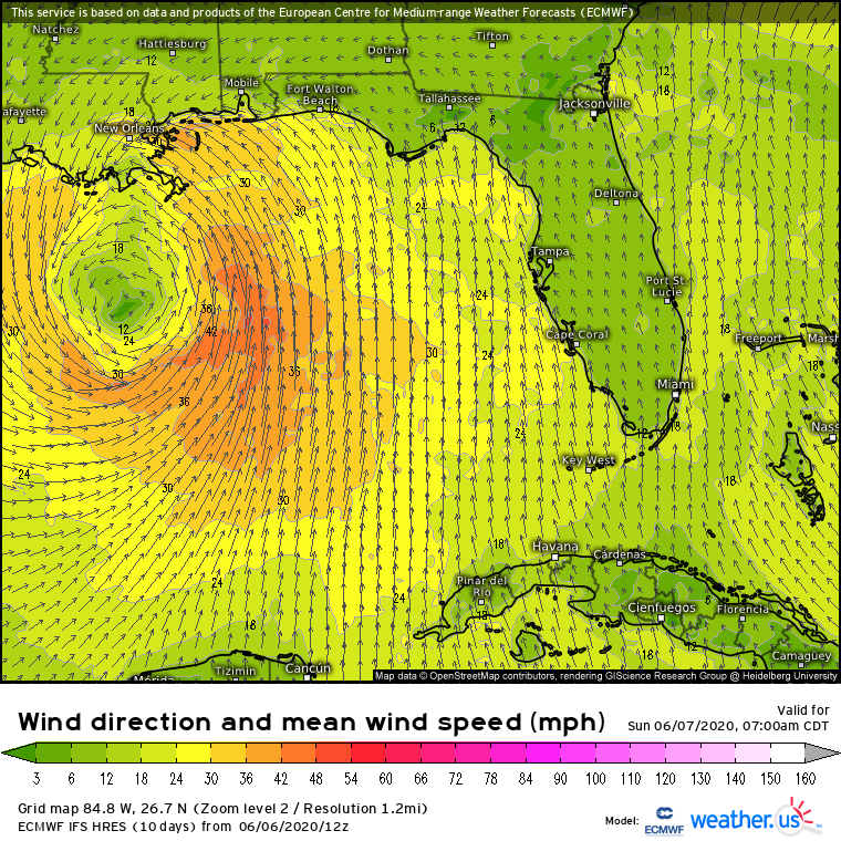 The biggest consequence of the system’s broad circulation will be that a lot of water will be converging on the eastern Louisiana coastline from the mouth of the Mississippi River over to New Orleans as well as east through the panhandles of Mississippi and Alabama. Note that in this area, the coastline resembles the shape of a funnel. Cristobal’s broad wind field means that even as the storm center heads for central/western Louisiana, strong southeasterly winds will be pushing water down the aforementioned funnel which will lead to storm surge flooding. It’s very important to note that this area has an extensive system of levees/dikes/pumps/etc. to keep flood waters at bay. There is no indication at this time that Cristobal’s surge will be large enough to endanger any part of this system, which is designed to cope with strong hurricanes. however, this system doesn’t protect the entire coastline, just selected population/infrastructure centers. So if you live outside these flood protection areas, be ready for high water. The latest storm surge guidance from the NHC suggests that this area could experience 3-5 feet of storm surge flooding.
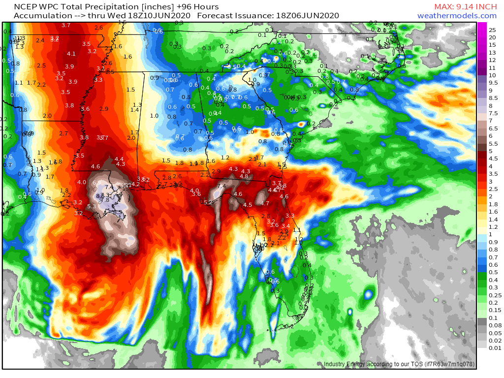
Much of the Gulf Coast will also have to deal with very heavy rain as Cristobal’s outer bands move onshore. Current forecasts show a wide swath of 3-5″ totals likely from northern Florida all the way to central Louisiana. Southeastern Louisiana and parts of the Florida Panhandle look to be the regions most likely to “overachieve” with regards to rainfall totals. 5-10″ of rain are expected here with locally higher amounts possible where individual storm cells happen to set up for an extended time. I’m particularly concerned about flooding in southeastern Louisiana where the combination of tidal flooding and extreme rainfall will put flood control systems to the test. Again, these systems are designed to handle storms much stronger than Cristobal, but many of them work by taking water out of very populated places and dumping it in slightly-less-populated places. So if you’re outside the flood protection bubbles, you could be in for some serious high water.
After moving onshore in Louisiana tomorrow night, Cristobal will accelerate northward towards Wisconsin where it will merge with a strong non-tropical system to bring heavy rain and gusty winds to much of the Midwest/Great Lakes region. Flooding rain and severe thunderstorms will occur along and east of its path through Arkansas, Missouri, Illinois, and Iowa, though as the system moves north and accelerates, those impacts will gradually dampen. By the middle of the week, the system which ingested Cristobal’s remains will begin to die out over Ontario and we can finally say goodbye and good riddance to the third tropical cyclone of the 2020 season.
How long will we have to wait before we worry about our next tropical storm (which will be named Dolly)?
 EPS guidance suggests that Dolly may form early this week northeast of Bermuda, but even if that happened, there would be no impacts to the US. Otherwise, we look to get a bit of a respite in the tropical Atlantic moving into the middle part of June. This is what we would expect climatologically speaking as the peak of hurricane season doesn’t get going until August and by any measure, we’re already well ahead of schedule as far as tropical cyclone activity goes.
-Jack

