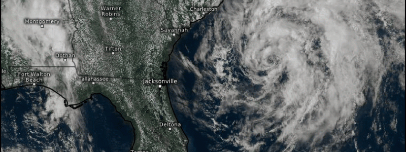
Arthur Expected To Head Out To Sea After A Brush With The Outer Banks Tomorrow
Hello everyone!
We’ve watched the first tropical storm of the season slowly come together over the past several days, and now the system’s final track is more or less locked in. While it looked in recent days like the system might attempt a left turn into the Mid Atlantic this week, guidance is now nearly unanimous in suggesting that the system will instead make a sharp right turn into the open Atlantic. However, that doesn’t mean we’re totally out of the woods. As the system turns northeast, it will brush the Outer Banks with a round of heavy rain and gusty winds tomorrow morning.
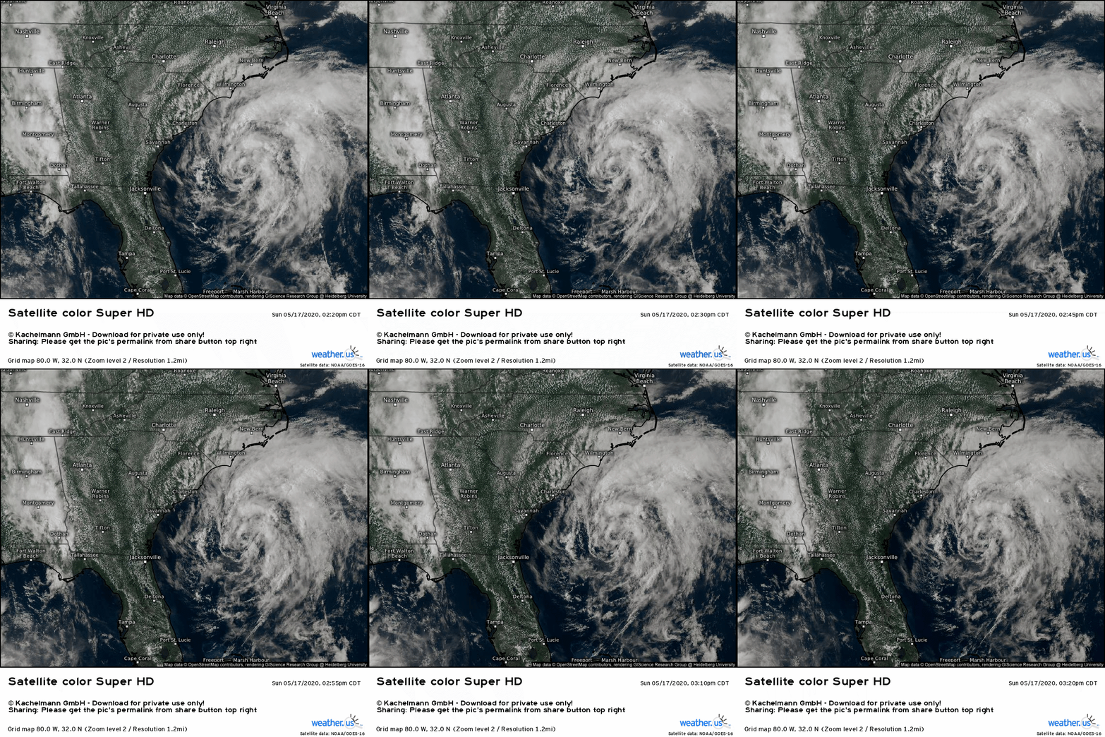
Satellite imagery is not exactly flattering for Arthur this afternoon. While the system now has a well-defined swirl of low-level clouds, it’s missing the intense thunderstorm activity that usually fuels tropical cyclones. There are some low-topped showers near the storm’s center, but they are far from impressive. Why is the storm struggling? There are two factors at play: dry air in the mid-levels to the west of the storm which makes it hard for thunderstorms to stay intact, and cool sea surface temperatures which limits the amount of instability (fuel) available to thunderstorms developing within the system’s larger-scale circulation.
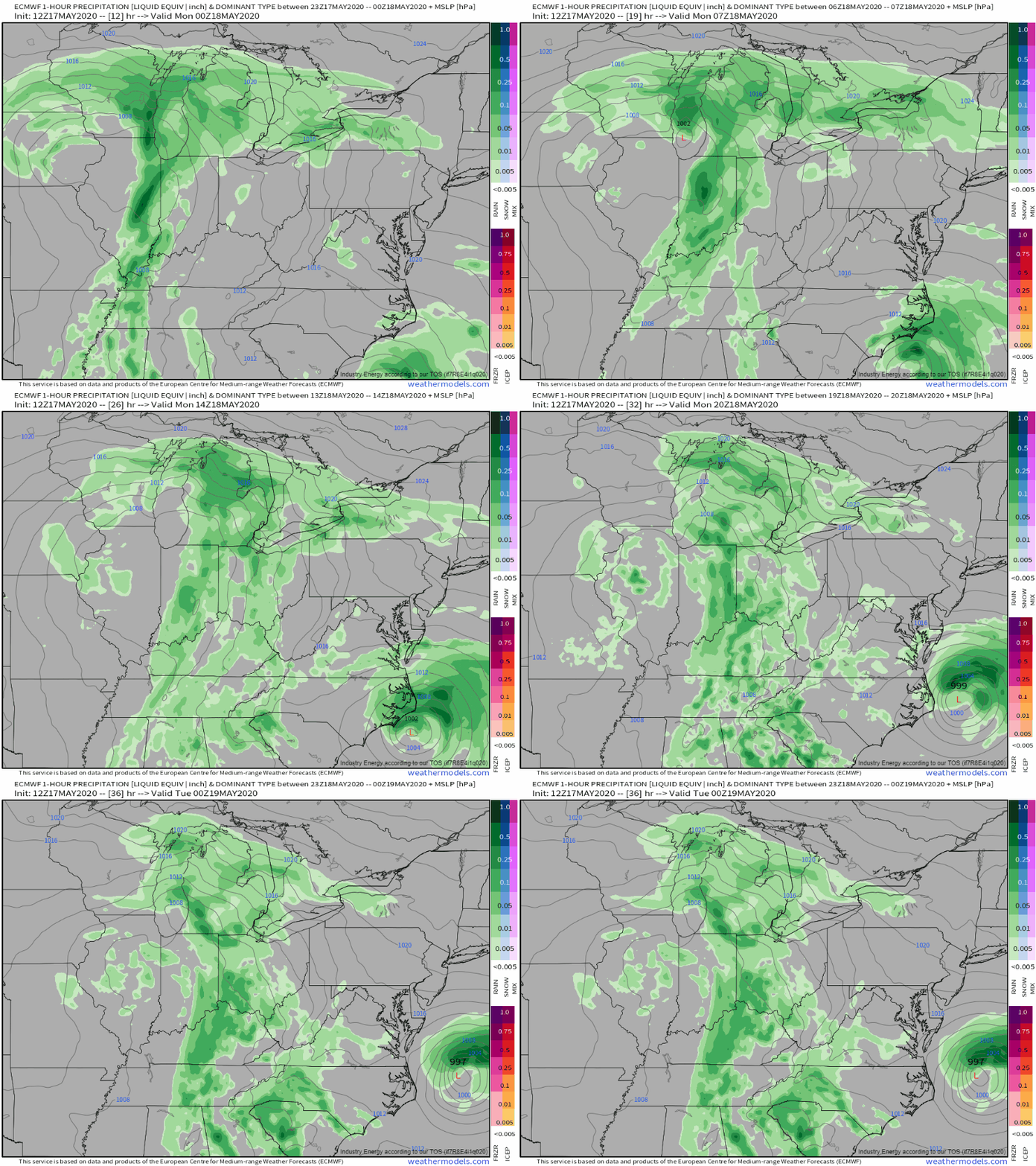
Here’s a look at how the ECMWF model expects Arthur’s brush with the Outer Banks to go. Rain will arrive later this evening followed by a gradual increase in winds, peaking around 40-50 mph tomorrow morning. Both rain and wind will rapidly subside tomorrow afternoon/evening as the storm makes its turn to the east and heads out to sea.
Tutorial Video: Forecast Ensemble
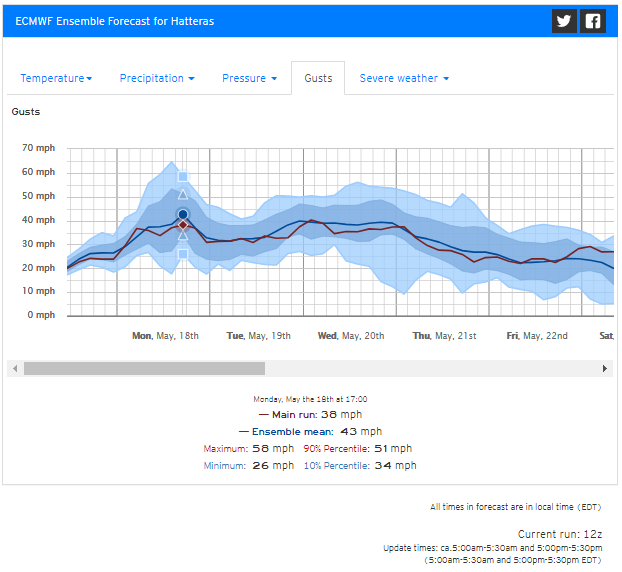
Here’s a look at our Forecast Ensemble product for Hatteras North Carolina showing a brief period of wind gusts in the 40-50 mph range as the storm passes tomorrow. Interestingly, the gusts associated with Arthur on Monday will only be 5-10 mph stronger (at best) than the winds on Tuesday-Wednesday associated with an area of non-tropical low pressure forming over the southern Appalachians. Winds really aren’t a big threat from this system, though isolated power outages can’t be totally ruled out.
So why is Arthur headed east not west? The ECMWF’s 500mb vorticity forecast for Tuesday morning does a good job explaining. In yesterday’s blog, I talked about the four features tugging Arthur in different directions. In any four-way tug-of-war, a slight advantage gained by any of the four forces (or disadvantage suffered by another) can make a huge difference to the final outcome. In this case, the upper level low tugging Arthur west is now expected to be centered near Peoria IL instead of the southern Appalachians. Additionally, the disturbance near Nova Scotia looks to dig farther southwest than expected yesterday. The net effect of these two subtle-yet-important changes is that Arthur will be pulled east instead of west.
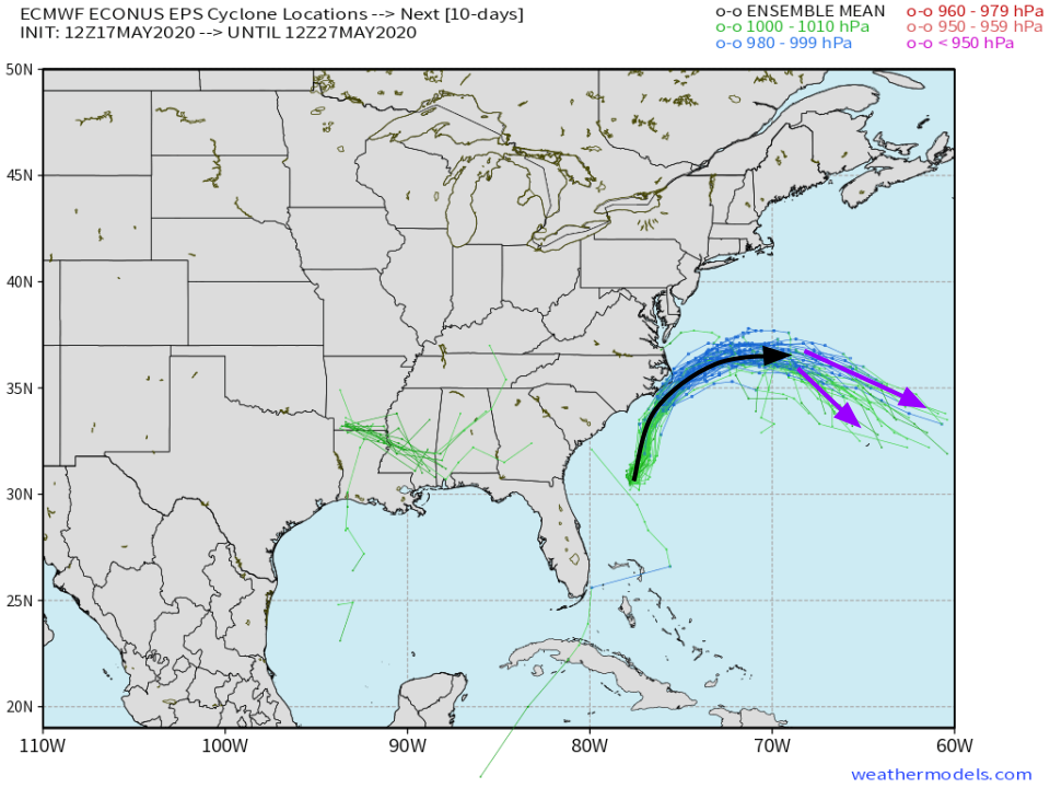
For final assurances, we can check EPS storm track forecasts to confirm that every one of the 51 ensemble members, meant in total to cover the range of possible outcomes for any given forecast, are now expecting Arthur to curve out to the east. There’s still some uncertainty regarding the exact point of Arthur’s final demise (purple arrows), and it may bring some breezy showers to Bermuda later in the week. Either way, it won’t be a problem for the East Coast after tomorrow’s rain and wind along the Outer Banks.
For more information on the flooding risk posed by the upper-level low, please check out this afternoon’s other post here.
-Jack
