Severe Storms Expected in the Northeast Today
Hello everyone!
While we continue to keep an eye on the subtropical disturbance off the Florida coast (click here for yesterday’s update), the Northeast is gearing up for a severe weather event set to develop later this afternoon/evening. This post will take a quick tour of the forecast setup and will, as always, include a bit of “behind the scenes” info regarding why severe weather is expected in addition to what the actual forecast is.
As per usual, we’ll start with a look at GOES-East water vapor satellite imagery. The first feature to note is the upper level disturbance over the Great Lakes. This is the feature that will be responsible for this afternoon’s storms. The disturbance will be moving east-northeast around the periphery of a strong upper level ridge over the southeastern US/southwestern Atlantic. This will ensure that the strongest forcing for severe storms will remain north of places like DC and Philadelphia.
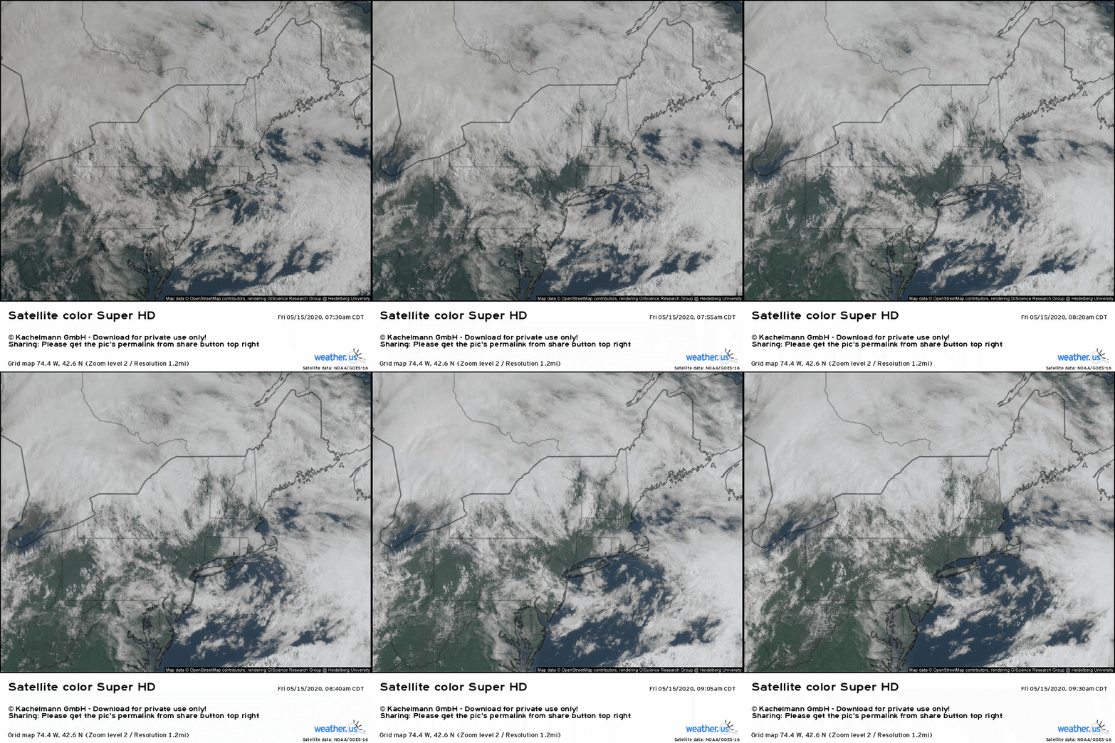
Switching the satellite view over to the visible spectrum, we can see abundant low-level cloud cover rapidly burning off over much of the Northeast this morning. The sunshine streaming in as these clouds recede will boost temps into the 70s and 80s across our area of interest (eastern OH through much of northern/central PA into much of New York and central New England). This surface heating is a key ingredient needed for near-surface air parcels to become unstable, at which point they can become fuel for thunderstorms.
Tutorial Video: CAPE/Instability
Tutorial Video: Thunderstorm Composite
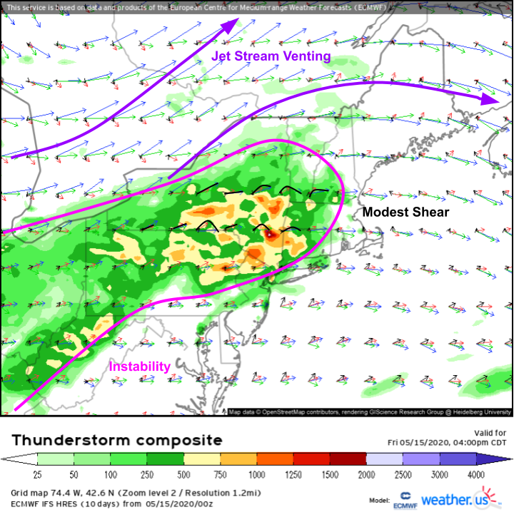
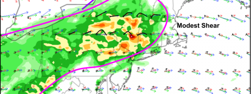
Speaking of instability, there should be just enough for severe storms by this afternoon as per the ECMWF’s Thunderstorm Composite forecast. Instability will be most robust in central and eastern New York as well as west-central New England. This is the region where storms are expected to be most intense. As far as the kinematic (wind) environment is concerned, storms will get a nice boost from the right entrance region of an upper-level jet streak over Ontario/Quebec. Shear through the rest of the atmosphere is a bit weaker, but will still support rotating updrafts especially closer to the warm front in eastern NY/New England.
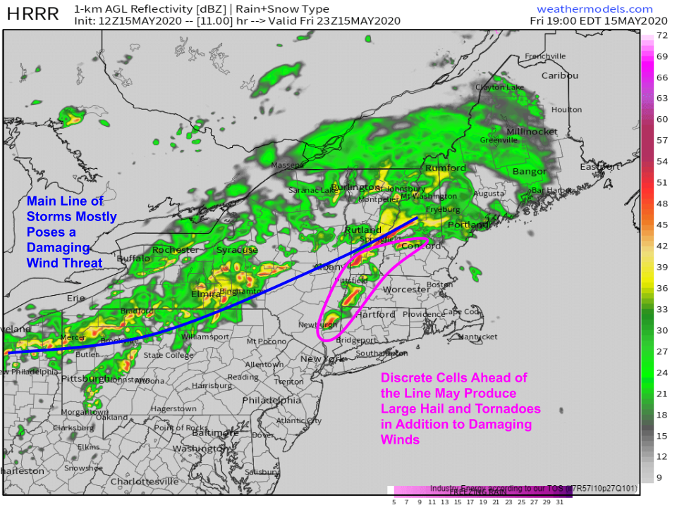
Here’s a look at the HRRR’s forecast simulated radar for this evening. Most of the storms should be focused along the ENE-WSW oriented cold front. These storms will primarily be linear in structure and will pose mostly a damaging wind threat. The storms to watch with particular care will be any that develop out ahead of the main line. These cells are more likely to be discrete, and may end up becoming supercellular as they approach the warm front over eastern NH/MA. These cells may produce large hail and tornadoes in addition to damaging winds.
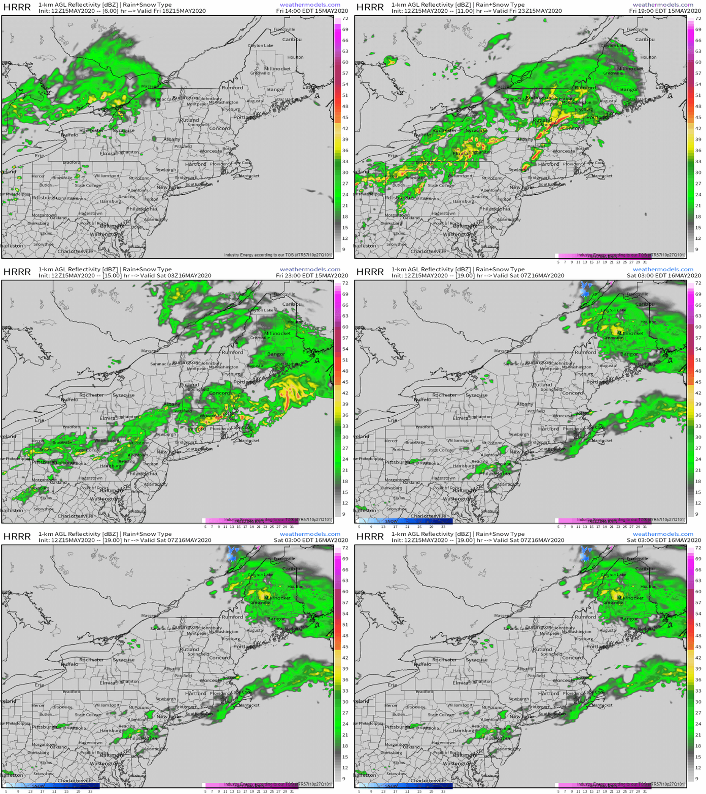
Here’s an animated version of the simulated radar forecast discussed above. Note that storms will reach peak intensity later this afternoon over central NY and western New England and will weaken as they approach the coast tonight.
-Jack

