Rare Mother’s Day Polar Vortex Appearance To Bring Freezing Temperatures and Snow to the Northeast This Weekend
Hello everyone!
An interesting (albeit quite annoying for those in its path) weather event is on tap for this weekend as a piece of the tropospheric polar vortex detaches from its rightful home in the Arctic and makes a beeline for the northeastern US. At the leading edge of the cold air, a storm will rapidly develop in New England and has the chance to bring substantial accumulating snow to the higher terrain of interior New York and New England. Flakes could fly all the way to the coast if everything comes together just right. This post will take a closer look at the incoming cold airmass as well as the storm that’s likely to form along its leading edge.
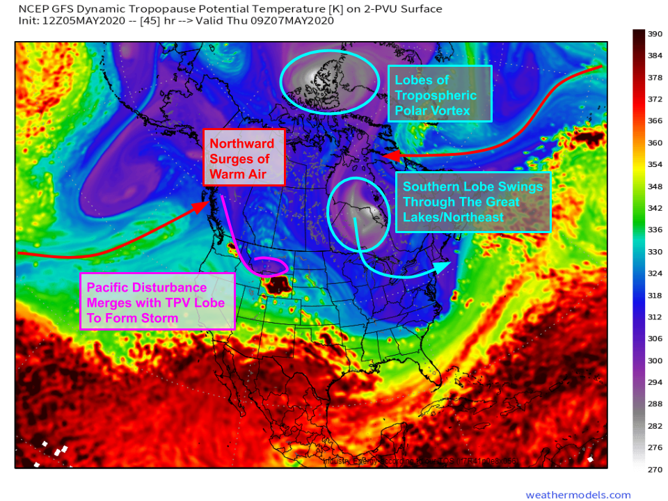
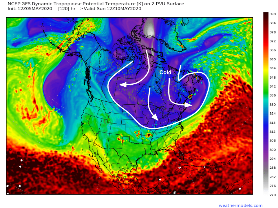
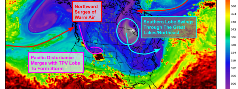
This dynamic tropopause forecast from the GFS explains why such cold air is headed south this weekend. Dual surges of warm air are headed north from the Atlantic and Pacific oceans. As this maritime air moves inland over the North American continent, it will split the remnant Tropospheric Polar Vortex (TPV) into two lobes. The first lobe will remain at its usual post over the high Canadian Arctic. The second lobe will be forced south as the warm air surges collide over Hudson Bay. When this TPV lobe moves south, very cold air will follow. To further complicate the situation, a disturbance moving through the northern Rockies will join up with our TPV lobe and support the development of a storm in the Mid Atlantic as the cold air arrives later on Friday.
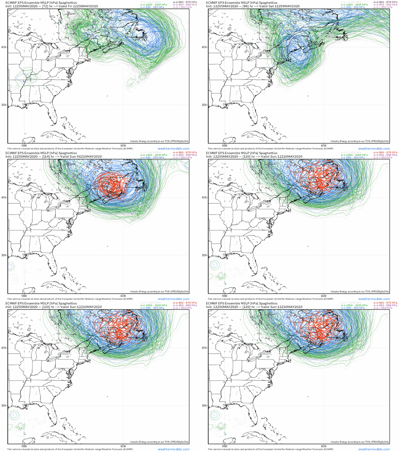
EPS ensemble members unanimously show the storm rapidly intensifying as it tracks from the central Appalachians through eastern New England and into the Canadian Maritimes, though some uncertainty does remain regarding the storm’s exact track and intensity.
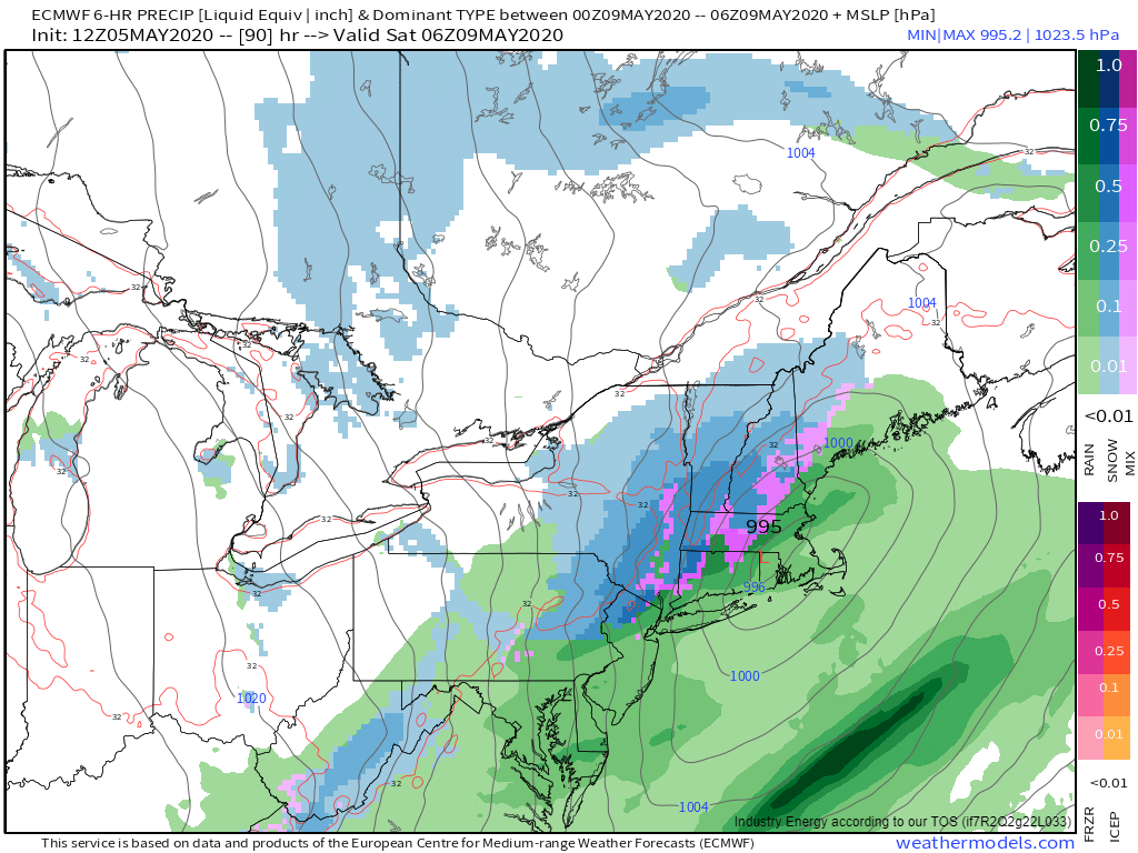
As the storm intensifies, it will produce bands of heavy precipitation especially just northwest of its center. This precipitation will fall as rain in the I-95 corridor and snow up in the higher terrain of the Catskills, Adirondacks, Greens, Whites, and the mountains of Maine. Some snowflakes could mix in as far south as the Worcester Hills and the hills of northwestern CT though little/no accumulations are expected there.
As the storm exits into New Brunswick, northwesterly winds will pick up on Saturday. Gusts could exceed 40 mph especially downwind of the Appalachians where downsloping will help mix stronger winds from aloft down to the surface.
These winds will push the coldest portion of this airmass through the Northeast. High temperatures will be a full 20 to 30 degrees below average from Maine all the way into the Mid Atlantic.
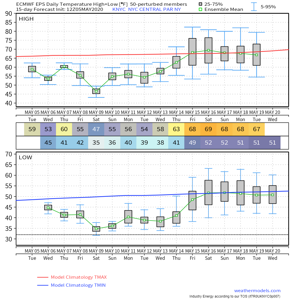
In New York City, ensemble guidance suggests high temperatures not exceeding 50 degrees on Saturday. That’s colder than the average low temperature for the city on May 9th! Lows meanwhile will drop to within a few degrees of freezing, threatening to damage sensitive plants that may already be in the ground.
While the core of the cold will shift northeast into Canada by Sunday, there will be plenty of chilly air ready to linger into next week. While temps won’t be quite as cold as Saturday, temperatures are unlikely to return to near normal until at least later next week.
-Jack
