Late-Season Snowstorm To Impact the Northeast Today and Tonight
Hello everyone!
A late-season snowstorm is just beginning this morning across parts of the Northeast. The system will peak in intensity this evening as it moves northeast off the New England coast. While substantial accumulations will be relegated to the higher terrain of interior areas, flakes will be flying all the way to the coastline from Connecticut all the way up into Maine. This post will take a look at the storm system in its current form as well as the forecast for the next 24 hours as it moves northeast.
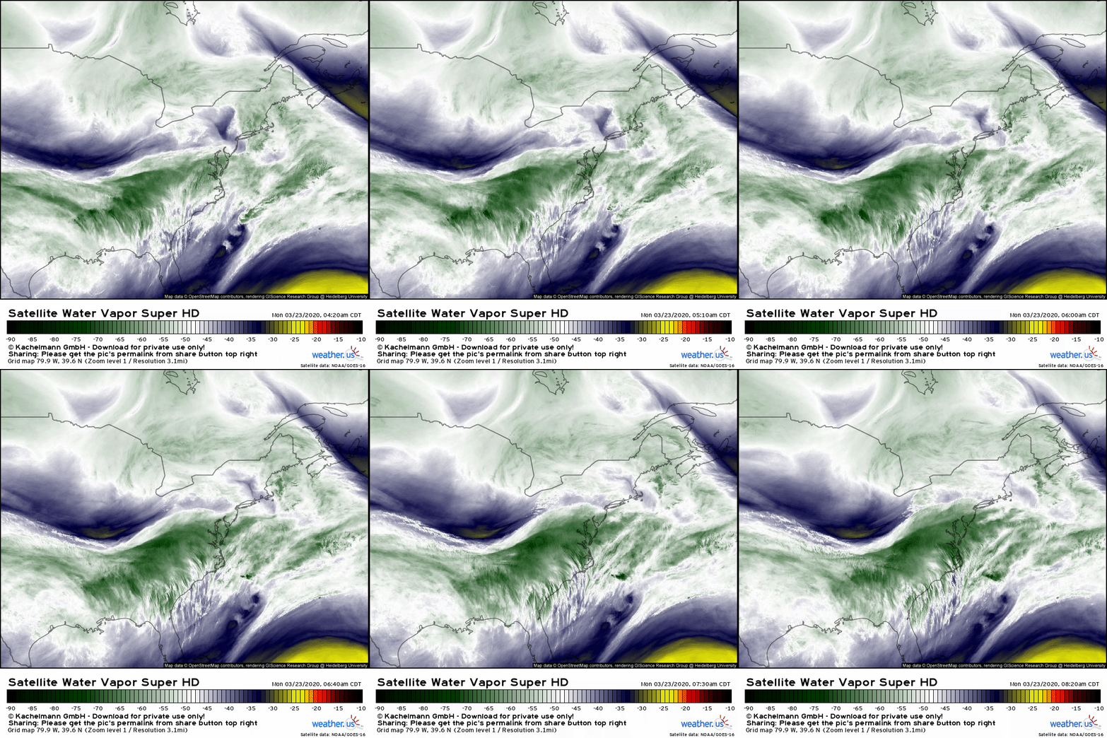
GOES-East satellite imagery clearly highlights the strong upper level disturbance that will power the storm’s development today. Ahead of that disturbance, lots of moisture is streaming in from the Pacific where the system originated a few days ago. While all the ingredients are in place for rapid intensification, the system will remain relatively modest in strength because ancillary disturbances needed to support an intense cyclone will continue moving east over Canada instead of diving south into the system’s core. The fast movement of the storm and its lack of access to supporting disturbances mean that its impacts will be somewhat limited.
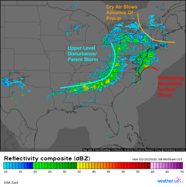
Composite radar imagery pictured here shows two areas of precipitation impacting the East Coast this morning. The first is located over coastal parts of the Mid Atlantic and is associated with the developing surface cyclone off North Carolina. The second is located farther west and is associated with that strong upper level disturbance we saw on WV imagery. As the upper level disturbance approaches the coast tonight, the surface storm will begin to intensify and produce a larger shield of steady precipitation. Another feature can be seen on radar imagery is the erosion of the precipitation shield’s leading edge over New England due to a steady tap of dry air from Canada.
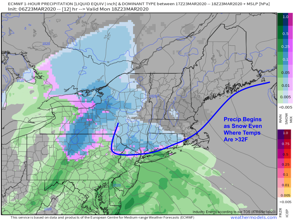
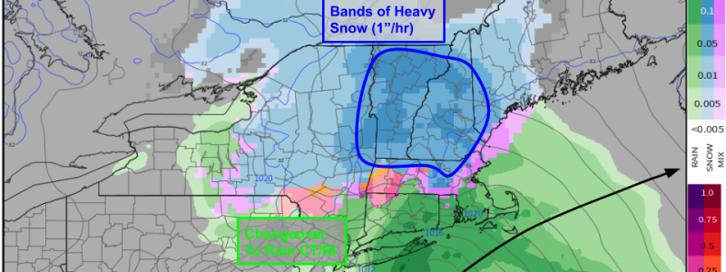
Precipitation type forecasts from the ECMWF model and observations across southern CT/NY this morning indicate that the aforementioned dry air will enable an initial burst of snow even when temperatures are slightly above freezing. How is this possible? The answer lies in a process known as evaporational cooling which you can read more about here. This initial burst of snow may drop as much as 2″ of snow this afternoon in parts of CT/RI and adjacent parts of southern NY/MA before precipitation changes over to rain this evening.
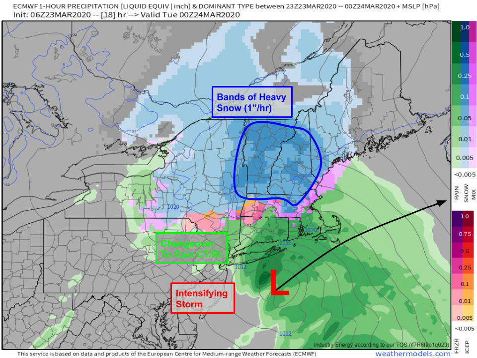
This evening is when the storm will be intensifying most rapidly as it moves northeast. As a result, we can expect bands of heavier precipitation to spread northwest of the cyclone’s center. This heavier precipitation will fall as snow in NH/VT/ME as well as north of the Mass Pike in MA. Snowfall rates in these bands are likely to exceed 1″ per hour and may even make a brief run at 2″ per hour as intense dynamics develop in the mid-levels of the atmosphere. Farther south, CT, RI, and southern MA/NY will see snow change over to rain. Thus most of whatever snow accumulates this afternoon will promptly be washed away.
The system is a fast-mover and snow will wrap up in western New England late tonight and eastern New England early tomorrow morning.
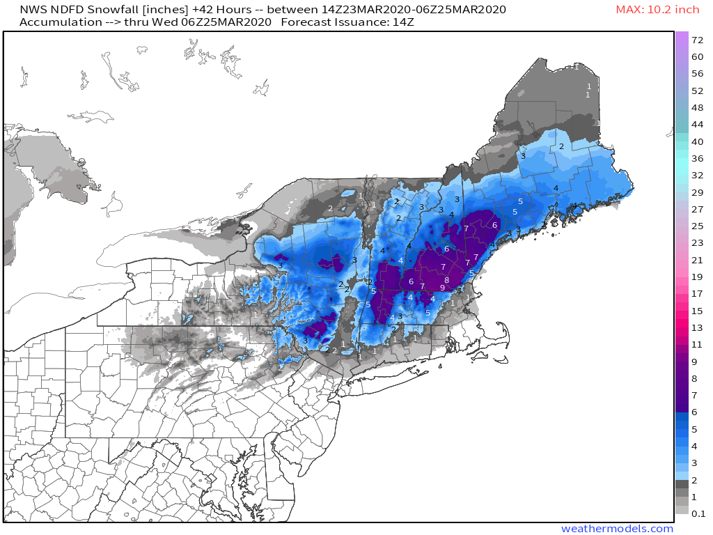
Here’s a look at how much snow is expected from this system by local NWS offices. The jackpot appears to be centered in southern NH away from the immediate coastline. Up to 10″ is possible here due to persistent heavy banding close to the low’s center. Totals >6″ are expected in the higher terrain of the Catskills, Adirondacks, Berkshires, Greens, and the Worcester Hills. Because temps will be so close to freezing, the snow from this system will be of the heavier/wetter variety. As a result, once we see totals exceeding 6″, we’ll have to start worrying about power outages as branches snap under the weight of the snow. Areas shaded in purple on the map above have the best chance of seeing >6″ and thus power outages.
Thankfully, this system isn’t particularly intense so winds shouldn’t be a major issue either during the storm or in its aftermath tomorrow.
-Jack
