Ocean Storm To Bring Light Snow To Parts Of The Northeast On Its Way Out To Sea
Hello everyone!
A powerful ocean storm will develop off the East Coast today, but it will move just far enough to the east that most areas will escape heavy snow. The one exception will likely be Cape Cod where over 6″ could fall as the northwestern edge of the heavy precipitation shield scrapes far southeastern MA tonight. This post will briefly outline what to expect from this system and why this won’t end up being a bigger storm for the Northeast.
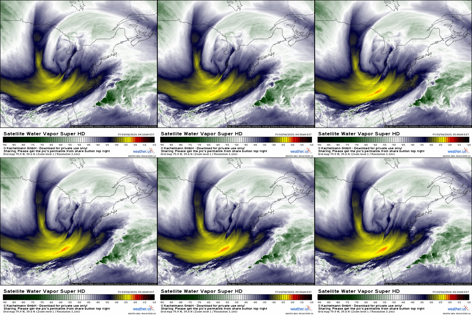
It’s easy to see each element of the system coming together on GOES-East WV imagery this morning. The big swirl over the Great Lakes is the primary upper level low while the secondary disturbance that will actually form the storm is located a little northwest of the orange spot near GA/SC. South of that secondary disturbance, the subtropical jet stream has plenty of moisture available to be drawn northward as the storm develops later today. At first glance, it would seem as though all the ingredients are in place for a major storm in the Northeast. Why won’t that happen?
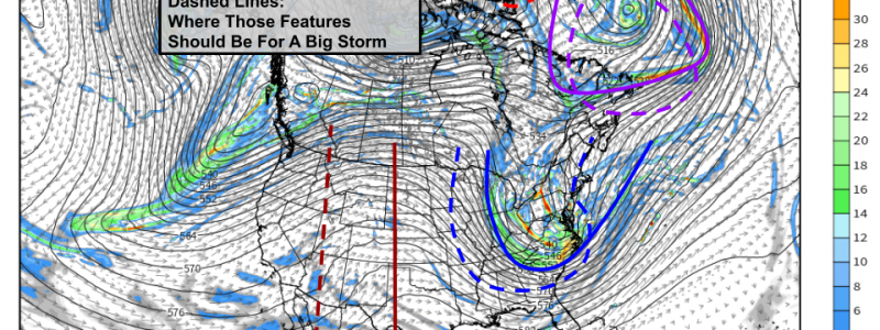
Here’s a look at the ECMWF’s upper level forecast for this afternoon. Some key features are marked out in red, blue, and purple. The blue feature is the disturbance responsible for actually creating the storm. Notice how it’s a bit too shallow and a bit too far east for a big storm. That’s because the other features marked on the map, responsible for slowing the system down and pushing it back to the west, are all either too weak to push very hard, or are too far east and thus can’t push hard enough to give us a snowstorm.
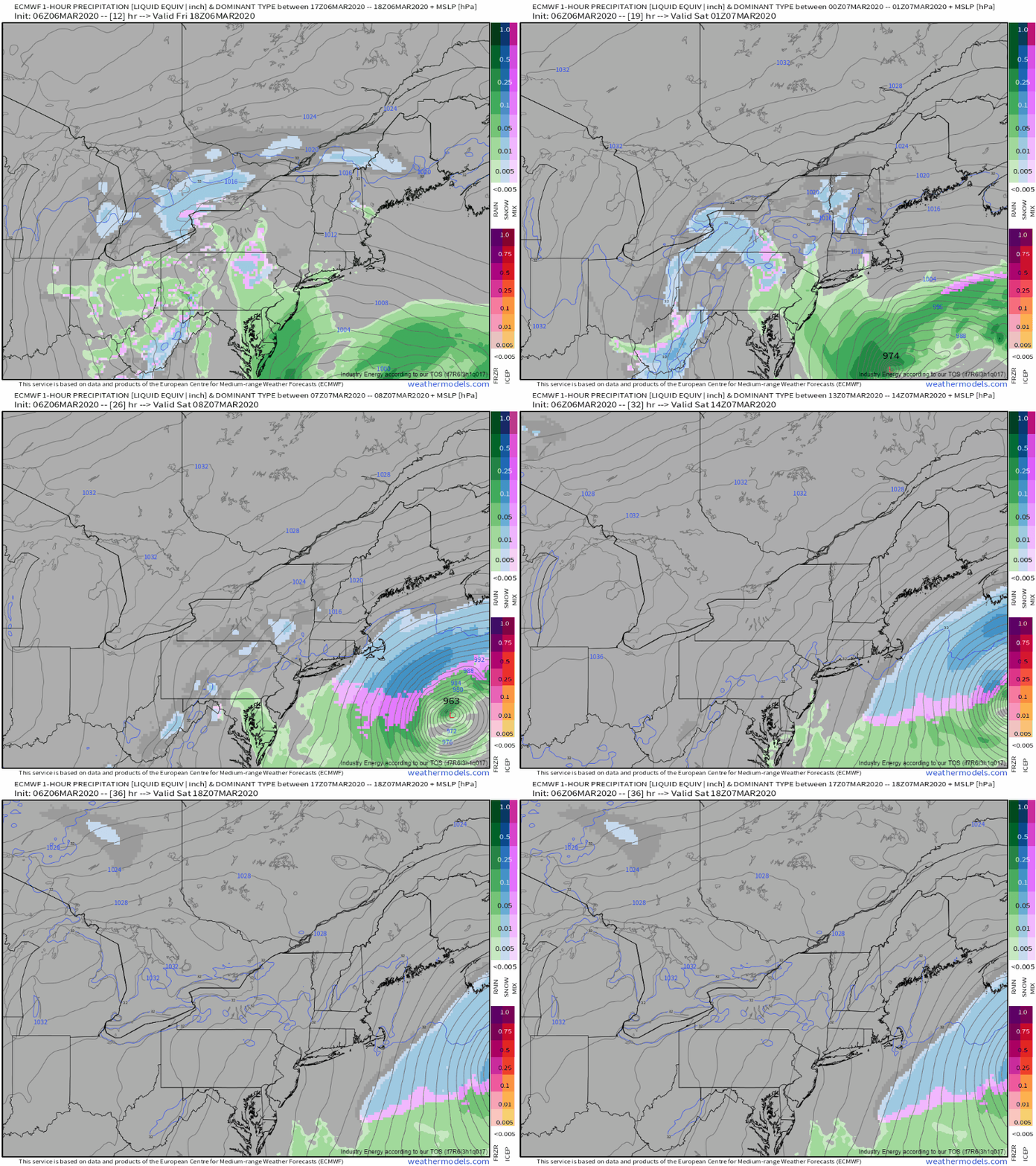
So what will happen? Hourly forecasts from the ECMWF show a broad area of weak precip developing over western parts of the Northeast and northern parts of the Mid-Atlantic this afternoon as the primary low weakens and the secondary low offshore takes over. That precip will fall mostly as rain south of Central PA, and mostly as snow in Northern PA/Central NY/western New England. Bands of moderate to heavy snow will impact Cape Cod and the surrounding islands later tonight into tomorrow morning before departing midday tomorrow.
If you look carefully near the bottom right of the animation, you’ll see the center of the storm moving quickly east-northeast. Notice the number that appears near the storm’s center as it moves. This is the system’s minimum central pressure, a measure of its intensity. This system is forecast to strengthen until it has a minimum central pressure of ~960 mb which puts it on the higher end of the storms we typically find along the East Coast in the winter.
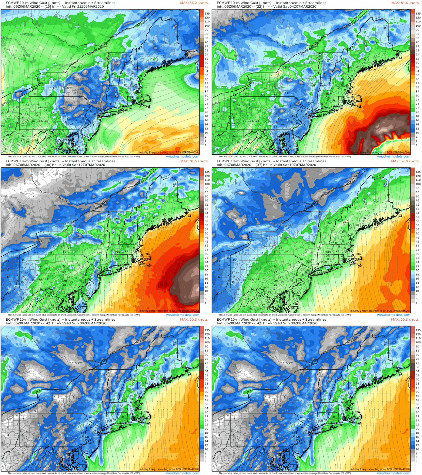
Why does the strength of the storm matter if it’s going to move too far east to give (most of) us heavy snow?
The loop above provides the answer. While the storm will be too far offshore for heavy snow (except for Cape Cod), its intensification will support gusty winds across the Northeast tomorrow. Gusts will be highest in eastern MA, and wind damage to trees/power lines should be confined to that area. However, pretty much the whole northeast will see gusts in the 25-35 mph range which is certainly enough to be annoying even if it doesn’t knock the power out.
Winds will subside as the storm moves east on Sunday.
-Jack


