Storm Dennis Could Challenge All-Time Record For Strongest North Atlantic Storm
Hello everyone!
While not expressly related to US weather, the event set to take place over the North Atlantic this weekend is too unique not to mention. An area of low pressure will race across the Atlantic Basin tomorrow and Saturday while rapidly intensifying. By the time that storm reaches Iceland tomorrow evening, it will have a shot at beating the all-time record for lowest surface pressure in the North Atlantic. For a region of the world known for its massive storms, this is quite a feat! This post will focus on the meteorological processes behind this possibly record-setting event.
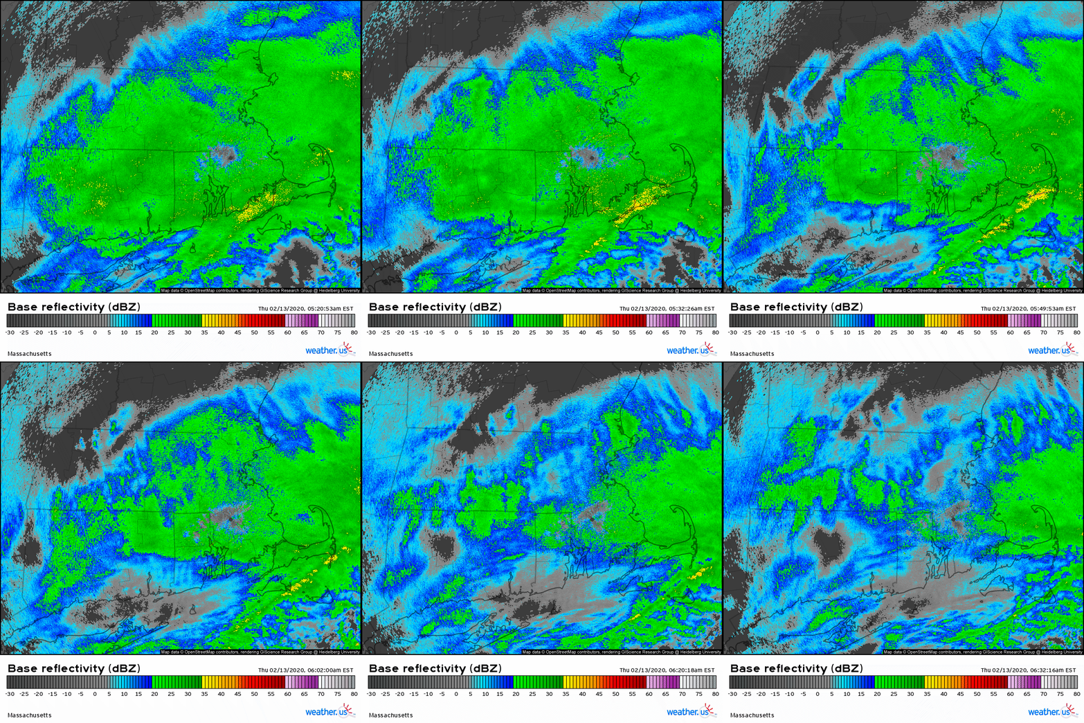
The storm itself is currently moving east of Cape Cod, MA as of 6:30 AM EST 2/13. The radar loop from KBOX gives us our first clue regarding why this storm is going to be so intense. If you look closely at nearly any part of the loop above, you’ll notice regions where there appear to be ripples in the precipitation field. These areas of alternating lighter/heavier precip are signatures produced by gravity waves which can occur at any level of the atmosphere where sufficient thermodynamic conditions are present along with strong winds. We’re mostly interested in the strong winds condition here. Without looking at any other data, we already know that strong winds are present aloft. Those strong winds will be key to supporting Dennis’ rapid intensification tomorrow and Saturday.
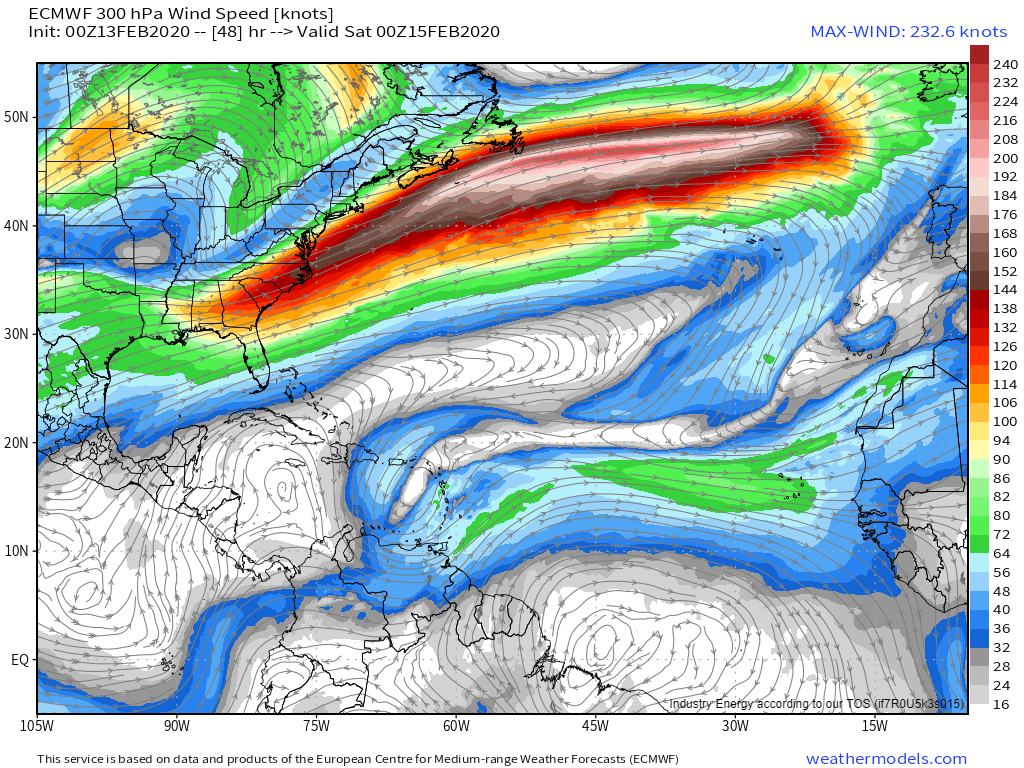
The strong jet streak responsible for this morning’s MA gravity waves will move offshore by tomorrow. It will be nearly as intense as the jet streak that supported Storm Ciara’s explosive development and the record-setting subsonic flight from NYC to London last week. Any time you have a jet streak this strong, you look for stormy weather either in its southern entrance region (that’d be near Bermuda in this case) or in its northern exit region (west of Ireland). Other ingredients aren’t in place for storm development in the western Atlantic, but all the ingredients will be in place over the northeastern Atlantic.
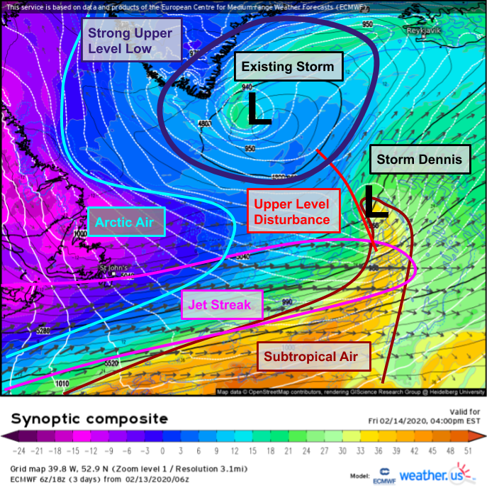
The ECMWF’s Synoptic Composite forecast highlights the variety of features key to Storm Dennis’ rapid development on Friday afternoon. The jet streak discussed above is clearly visible in the 300mb wind fields (arrows on map, longer = stronger winds). Another jet streak, not nearly as intense, is located northeast of the system. Whenever a storm is located in the northern exit region of one jet and the southern entrance region of another, it’s a prime candidate for rapid intensification. It’s also important to note that Dennis will be developing on the southeastern flank of an existing intense cyclone spinning southeast of Greenland. As Dennis rotates around the eastern side of that system, it will absorb the existing cyclone and as a result will become an even larger storm.
Here’s a loop showing Dennis’ development from the weak system over Cape Cod this morning to the rapidly deepening cyclone west of Ireland tomorrow to eventually absorbing the pre-existing North Atlantic storm south of Iceland on Saturday. Note that this loop was put together using EPS mean data so it doesn’t show the absolute lowest pressures due to slight disagreements regarding the location of the low’s center. The shading on the map represents the normalized sea level pressure anomaly, a measure of how unusual a forecast MSLP value is for a given location. Folks with a statistics background will know just how unusual a -4.5 standard deviation anomaly is, but if you aren’t familiar with stats, the big takeaway is that it’s really really unusual to get a -4.5 SD anomaly. It’s particularly impressive over the North Atlantic in February where “normal” is defined by big storms.
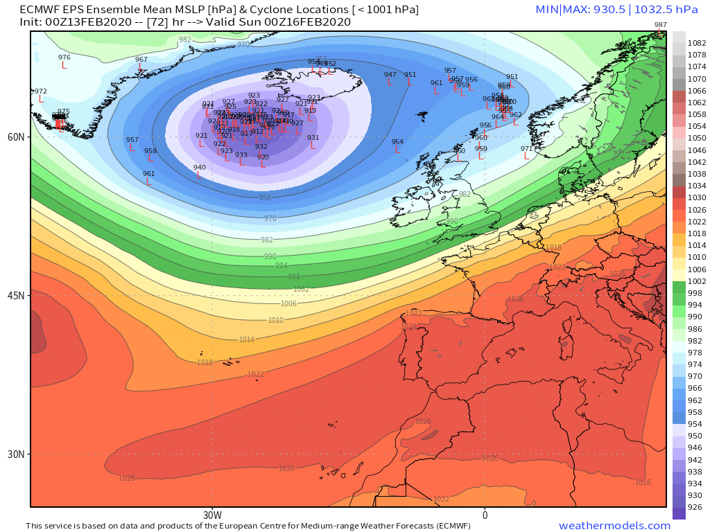
Here’s a look at where each ensemble member expects the storm to be on Saturday night and what its intensity might be. For ensemble members run at a lower resolution than the standard deterministic guidance, having nearly every member forecasting a minimum pressure in the low/mid 920’s is pretty impressive!
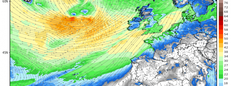
Storms with very low pressures are notable usually because those pressures produce a tremendous amount of wind. After all, winds are a response to horizontal change in pressure so the bigger that change, the stronger the winds usually are. Interestingly, winds when the storm is at its peak intensity aren’t forecast to be particularly remarkable given that the storm’s central pressure will be equivalent to that of a category 5 hurricane. A small region south of the storm’s center may see winds sustained near 50 kts or 58 mph. The storm’s wind field will be impressive for it’s breadth. Tropical storm force winds (sustained >34 kts or 40 mph) will extend across the entire Atlantic Ocean from Canada to Norway.
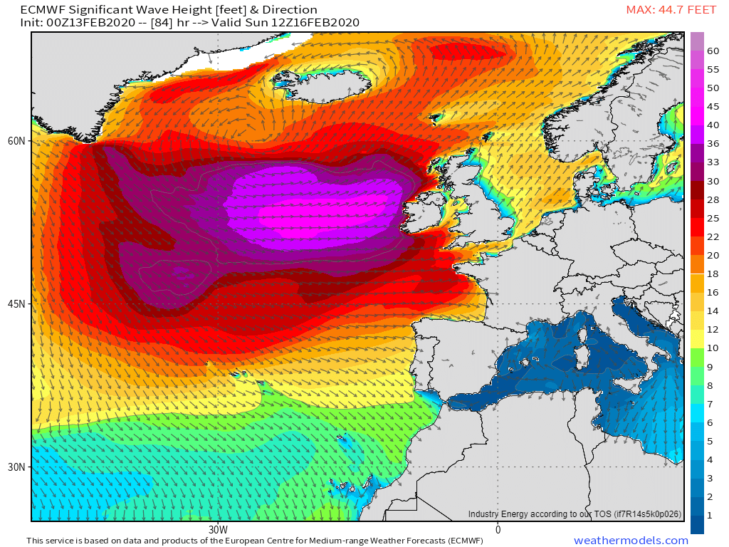
These winds, blowing across an incredibly long expanse of water, will generate some astonishing waves by Sunday morning. ECMWF wave forecasts show significant wave heights (the mean height of the highest 1/3 of waves) around 45 feet west of Ireland. Probably best to stay out of the water until those die down.
-Jack
