Weekend Storm Headed Too Far East For Major US Impacts
Hello everyone!
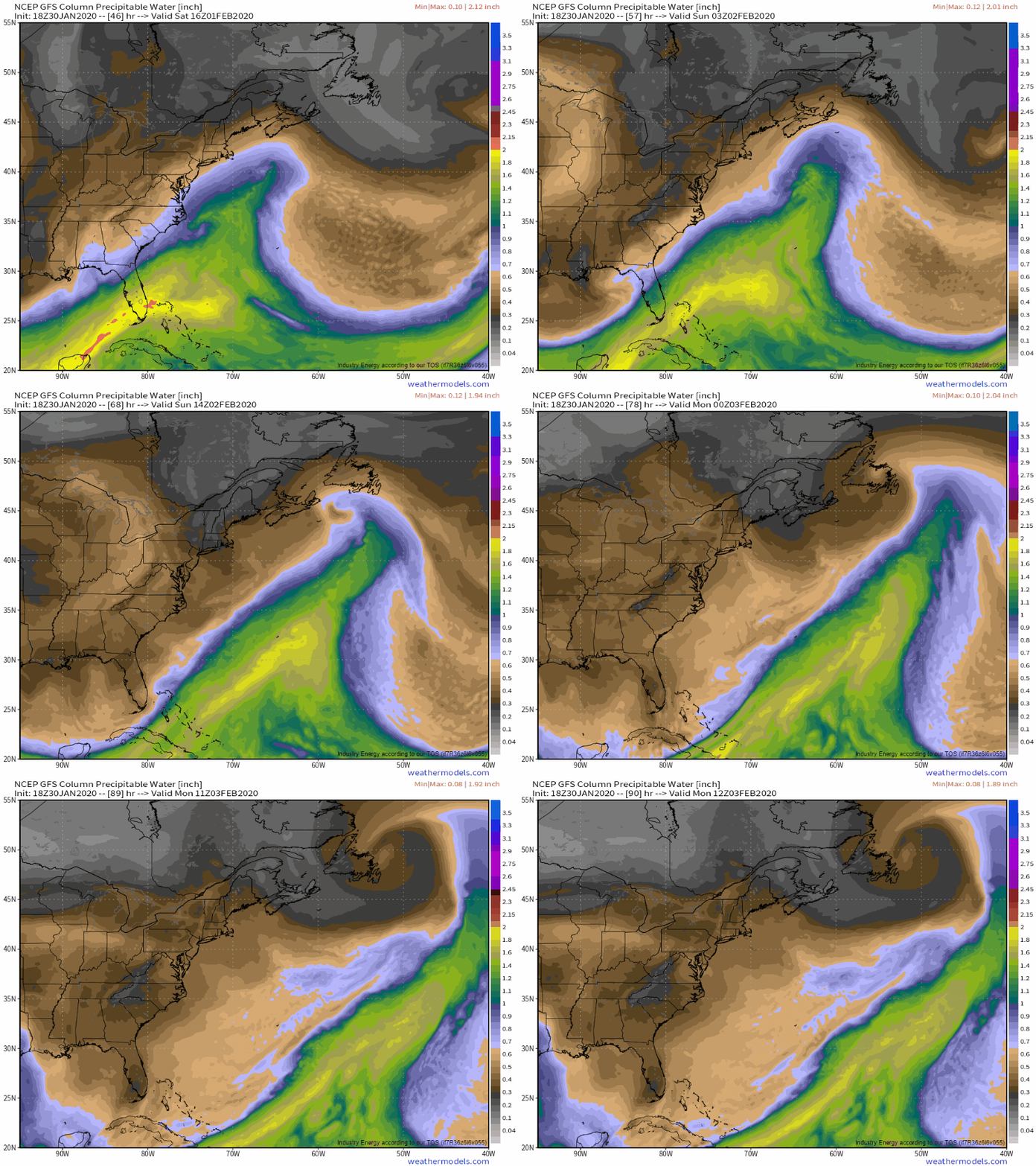
After a long several days of closely following model guidance and observations, it’s now quite clear that the storm forming off the East Coast this weekend is headed too far offshore for major US impacts. This post will briefly outline why the system didn’t come together as it could have, but this blog is intended to focus on the US rather than places like Atlantic Canada where this system will hit as a powerful blizzard and thus I won’t do a detailed breakdown of each aspect of the system and its forecast.
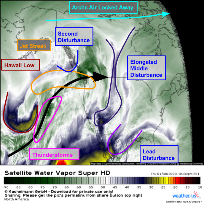
All the elements previously reserved to 500mb vorticity maps are now visible on WV imagery this evening. As discussed on Tuesday, thunderstorms have formed ahead of an upper level low north of Hawaii. Warm outflow from those thunderstorms has amplified a jet streak headed into Washington and adjacent parts of British Columbia. Also headed into British Columbia is the disturbance we were watching to capture the storm and bring it back to the west (were that going to happen). Farther southeast, two lead disturbances are drifting through the Central US as expected.
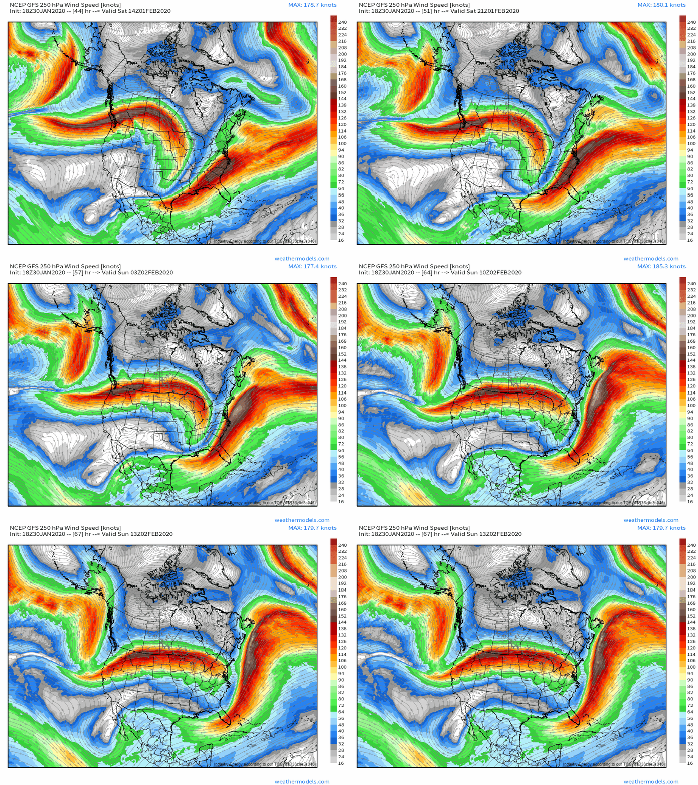
By Saturday, these features will be racing through the East Coast just out of sync enough to delay the rapid intensification stage of the storm’s development. The whole mess is getting pushed east so fast by the zonal jet over WA/BC and adjacent parts of the northern Rockies that by the time it gets its act together, it will be too far east for substantial impacts here in the US. You really wouldn’t have to tweak this setup very much to get a big storm, but as we discussed all the way back on Saturday, to get a storm in this pattern everything needed to go right. We ended up just a hair off on the timing, so we’re out of luck regarding a major snowstorm.
The storm will eventually intensify into a respectable entity, but not until Newfoundland (seems to be a common theme of this winter doesn’t it).
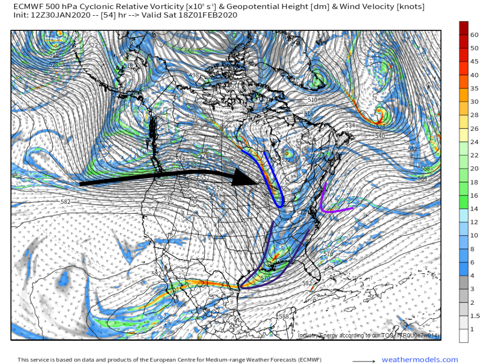
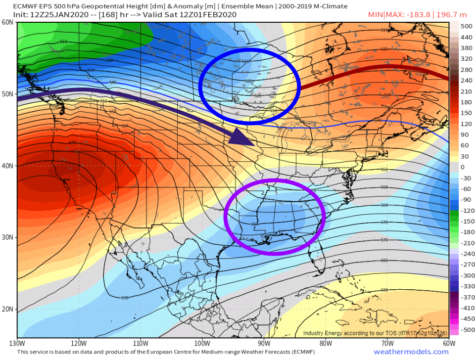
Our two disturbances are mistimed and both getting shoved rapidly east by that giant jet streak running from the Pacific into the Great Lakes.
This graphic I posted on Saturday with the words “the presence of a strong zonal (west-east) jet along the US/Canada border argues in favor of the disturbances remaining separate” turned out to have done a pretty good job anticipating what would happen. The two disturbances will remain separate due to the fast zonal flow, and off our storm will go into the Atlantic.
While the interesting storm that could have happened will live on only in archived model imagery, I hope following along with this system’s forecast from a relatively long ways out (7+ days) was interesting and informative. We covered a lot of ground over the past several days, including ensembles, upper level disturbance interactions, various discussions on the jet stream, and much more. Even though some of the speculation offered in the previous posts will turn out to be just that (speculation), there’s lots of good info in there. If you missed any of the posts in recent days, you may find the exercise of reading back with knowledge of the final outcome interesting. You’ll see the clues we were able to pick up on, the red herrings that briefly threw us off the scent of the true signals, and all the discussion in between.
Links to: Saturday’s preliminary discussion, Sunday’s chat about ensembles, Monday’s forecast discussion, and Tuesday’s forecast discussion.
I’m headed out on travel this weekend so my next post will likely come at the start of next week. I’m sure there will be at least something interesting to keep an eye on!
-Jack
