Major Severe Weather Event Will Unfold Tonight and Tomorrow Across The Deep South
Hello everyone!
A major severe weather event will unfold over the next 36-48 hours across much of the Deep South ahead of a developing storm system moving from the Southern Plains towards the Great Lakes. While heavy snow and some ice will fall along this system’s northern side, by far the greatest threat appears to be the severe storms expected to form along the storm’s southern flank. This post will take a deep dive into the severe weather forecast for today and tomorrow, including both what to expect and some of the meteorology that explains why.
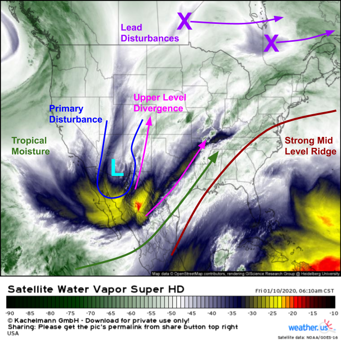
As per usual, we’ll start our discussion by looking at WV satellite imagery captured by GOES-East a little earlier this morning. The primary disturbance responsible for the upcoming storm is clearly visible over far SE Arizona. Strong upper level divergence ahead of this disturbance will help set the stage for the upcoming severe thunderstorm event by indirectly drawing Gulf moisture northward, and beginning the process of pushing warm/moist air near the surface upward. Also visible are two lead disturbances pushing into Ontario and Quebec as well as the strong mid-level ridge over the Southeast that will force the storm to track northeast instead of due east.
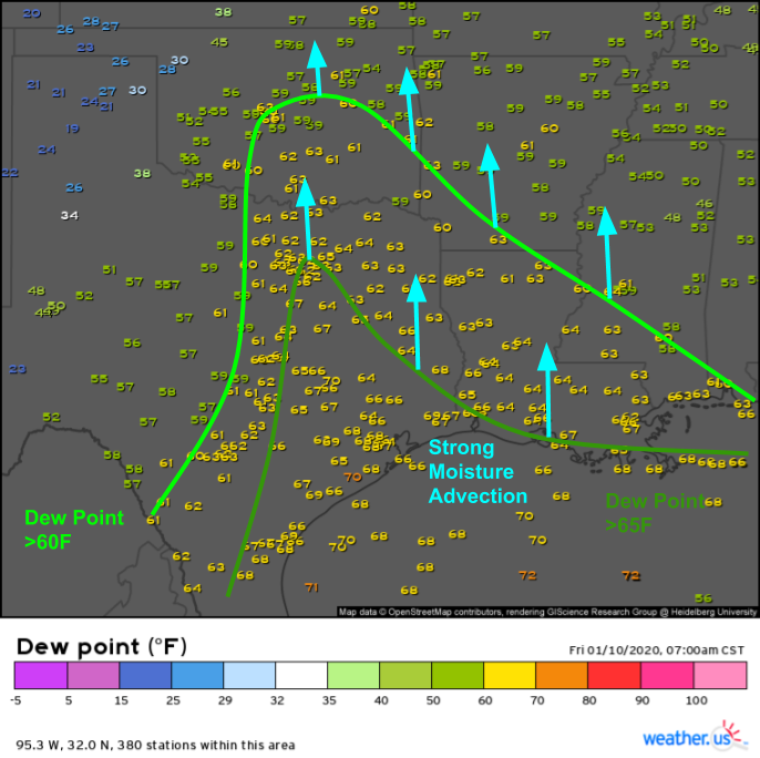
Even with strong divergence aloft, intense storms won’t form without low-level moisture. Dew point observations are the best way to get a handle on low level moisture. Dew points above 60F are supportive of severe storms, while dew points over 65F are even more favorable. Steady south/southeasterly breezes across the entire Southern MS Valley will continue pushing this moisture northward, and dew points will continue to rise east of the cold front, currently located in western Texas.
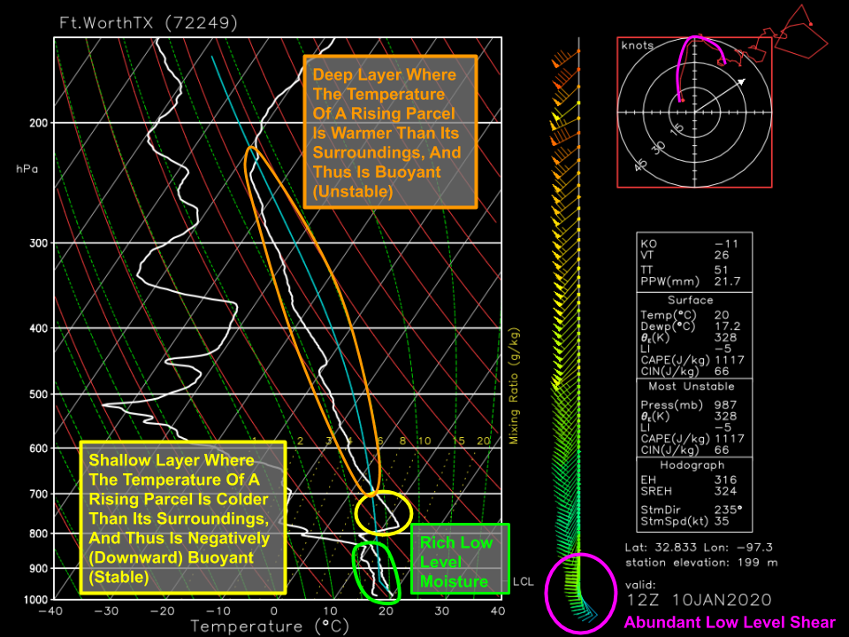
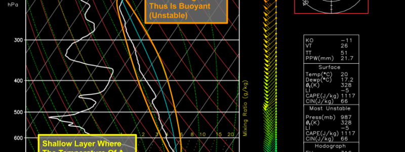
This morning’s sounding out of Fort Worth Texas shows an environment ripe for explosive thunderstorm development later this afternoon. A deep layer of steep lapse rates (temperatures decreasing quickly with height) exist in the mid/upper levels of the atmosphere, which means that parcels rising from the surface (following the blue line) will be warmer than their surroundings, and thus will feel a strong buoyant force in the upward direction. However, a layer of warming temps with height, known as an inversion, is noted around 800mb. This means that surface parcels moving between 800 and 700mb will be colder than their surroundings, and thus will feel a downward buoyant force that inhibits upward motion. To overcome that stable layer, we’ll need an external source of strong upward motion or strong heating of the surface by the sun to take the edge off the inversion. Curious what that diagram actually shows, or need a quick refresher on Skew-T’s? Check out this post for a more detailed explanation of the graphic used to plot upper level observations.
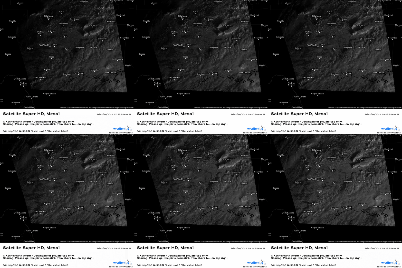
Visible satellite imagery captured by GOES-East every minute shows patchy breaks in low-level cloud cover across east-central Texas. As the sun continues to rise, expect a bit more clearing to develop in response to increased mixing. As temps warm over the next several hours, the atmosphere will become increasingly unstable, and the ability of the stable layer to hold back storm development will decrease. By the time the cold front approaches the I-35 corridor during the mid/late afternoon hours, we’ll be all systems go for explosive thunderstorm development.
As storms develop this afternoon, this is the shear environment they’ll encounter (as forecast by the ECMWF). Trying to predict storm mode (linear vs discrete) is far more complicated than what I’ve shown here, but without more advanced tools, we can get a pretty good idea of general trends by looking at the relationship between the deep layer shear vector in a given area and the boundary on which storms will be initiating (in this case, the cold front). In northern Texas where the shear vector is roughly parallel to the cold front, initially discrete cells are likely to transition to a linear storm mode quite quickly as they linger near the front where other storms will be forming at the same time. Farther south, the shear vector will be a bit more offset from the cold front, and there won’t be quite as much upper level forcing for ascent. This means that fewer storms are likely to form (at least initially), and they’ll have a bit more room to breathe. As a result, discrete cells will likely persist longer in the San Antonio/Austin area than they will near Dallas.
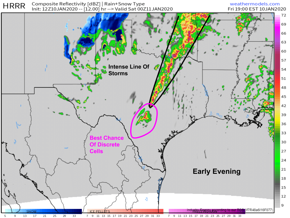
As we move into the early evening, a squall line will likely be in progress over northeastern Texas while discrete cells move east of San Antonio. The squall line will pose an extremely serious threat both from damaging winds as well as tornadoes that develop from mesovorticies as the squall moves east. The discrete cells farther south (and possibly right ahead of the squall line) will pose all available severe hazards including tornadoes, large hail, damaging winds, frequent lightning, and heavy rain. This map is available at weathermodels.com.
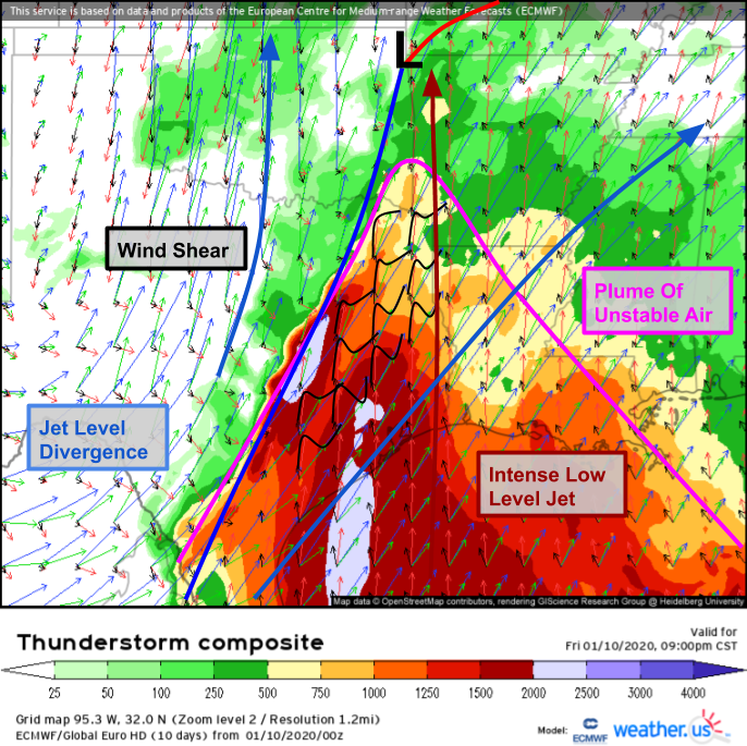
The environment across eastern Texas, southeastern Oklahoma, southwestern Arkansas, and western Louisiana this evening will be extremely favorable for severe storms even after the sun goes down. The ECMWF’s thunderstorm composite forecast for 9 PM CST shows instability persisting despite the loss of surface heating (likely due to strong moisture advection) and wind profiles that are just about as extreme as they come for a severe weather event. Strong jet-level divergence will keep storms well vented, and an intense southerly low level jet will enhance low level shear as well as transport warm moist air northward from the Gulf. Need a quick refresher on the Thunderstorm Composite product and what exactly it shows? Check out this video for more information.
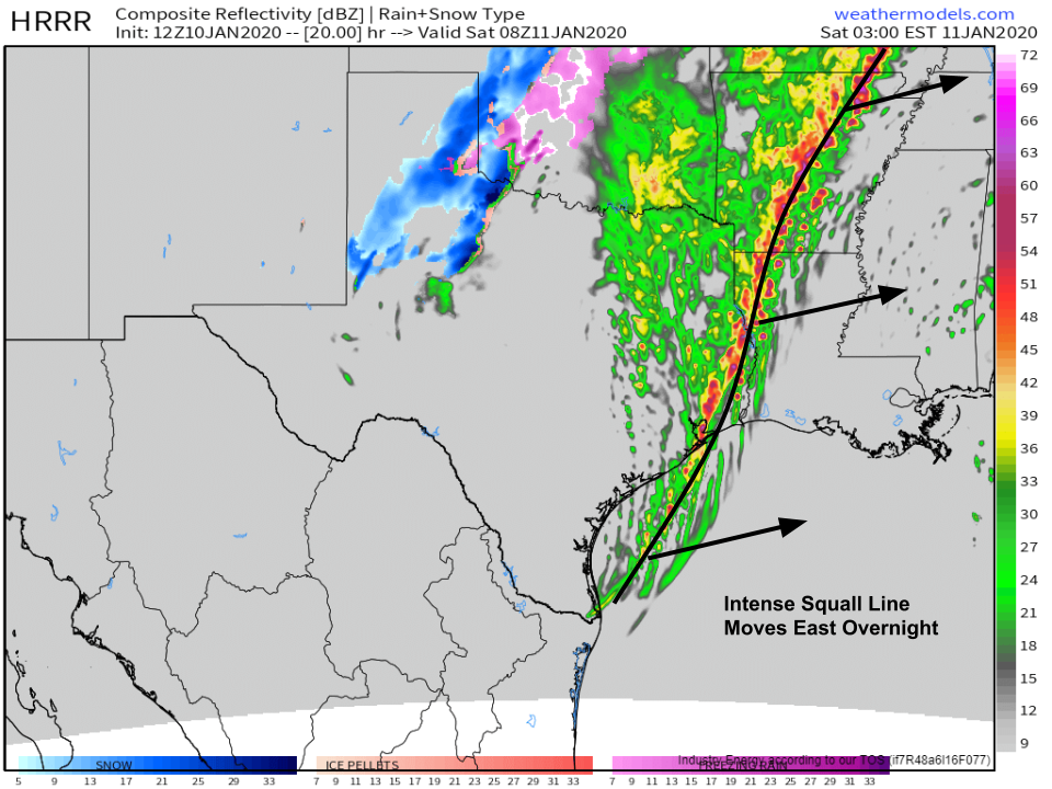
Eventually, even the discrete cells moving through south-central Texas will coalesce into the squall line which will be moving quickly east. Residents of Louisiana, Arkansas, and southeastern Texas won’t see severe weather until the overnight hours. As a result, it’s critically important for folks in these areas to have a way of receiving warning information even if you’re asleep. Damaging winds over 75 mph and tornadoes will pose a significant threat to those in the path of the squall line, but if you take some time today to prepare and review your severe weather plan, you’ll be ready when the storms arrive. This map is available at weathermodels.com.
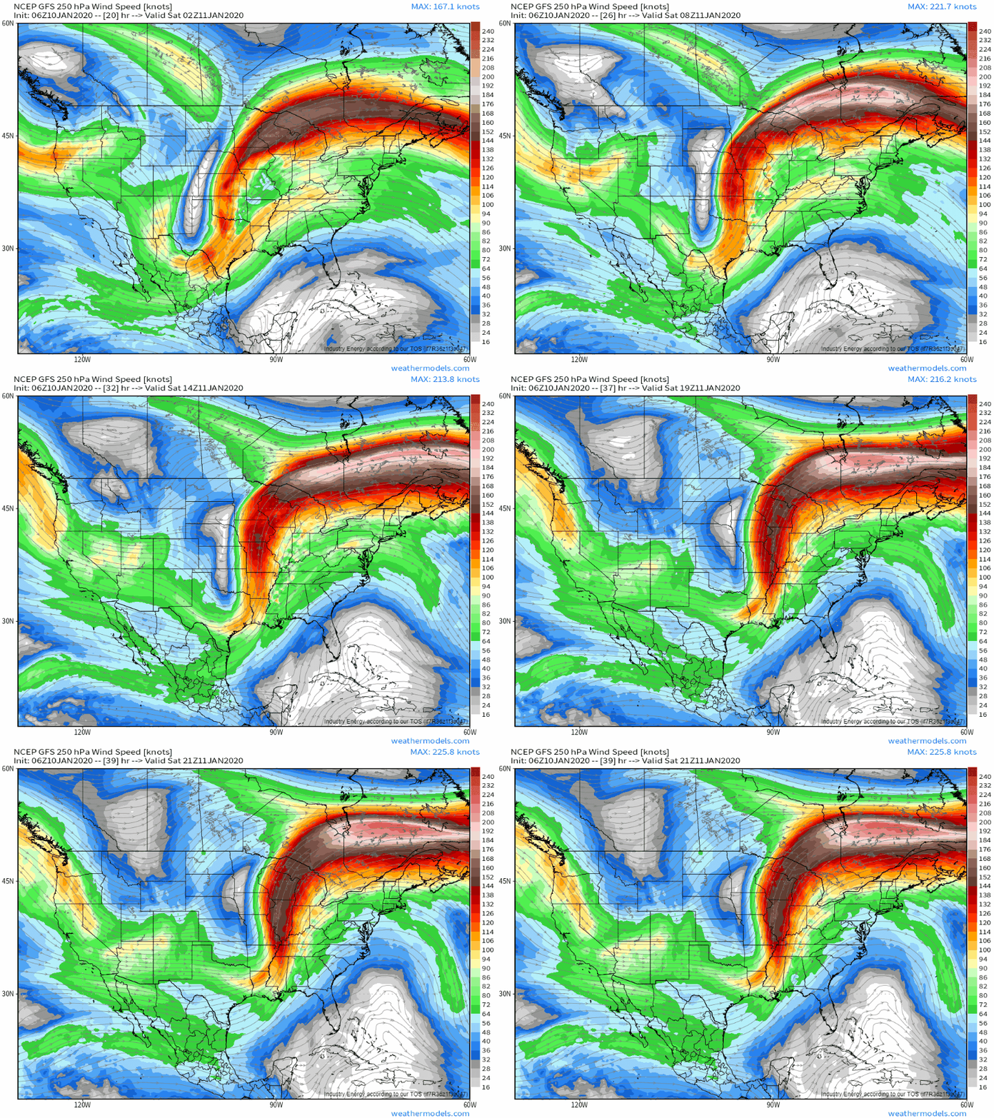
Tonight, latent heat released by the squall line will help strengthen an already-powerful jet streak in the upper levels of the atmosphere that will extend from Arkansas to Newfoundland. The circulation associated with the entrance region of this strong anticyclonically-curved jet streak will strengthen along with the jet itself, as parcels entering the jet will need to accelerate even more than they did initially. This GIF is available at weathermodels.com.
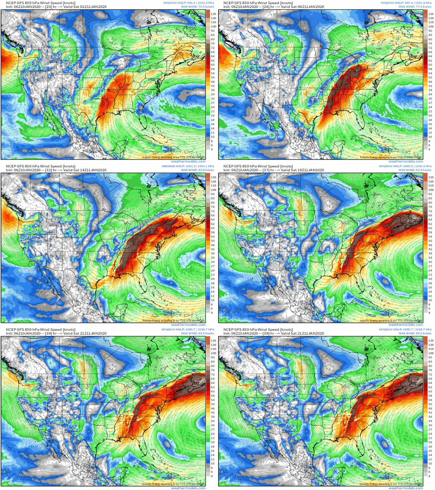
The most notable consequence of this process will be the strengthening of the southerly low level jet ahead of the front. By tomorrow morning, winds at 850mb could exceed 80kts across parts of the Mississippi and Ohio valleys. As with the low level jet over Texas tonight, this feature will ensure a continued supply of warm/moist air from the Gulf as well as low-level wind shear to support tornadoes. This GIF is available at weathermodels.com.
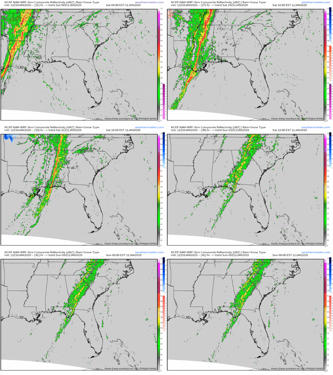
The squall line will remain strong as it moves through Mississippi and Alabama tomorrow morning, as shown by the simulated radar loop above. By tomorrow afternoon, the strong ridge over the Atlantic we mentioned way back when we were analyzing this morning’s WV loops will have pushed the upper level disturbance driving this whole storm well north into the Great Lakes. As the separation between the upper level dynamics associated with that feature and the warm/moist air provided by the Gulf of Mexico increases, the squall line will weaken. By the time the line moves into Georgia, the severe threat will have diminished considerably though isolated damaging wind gusts will still be worth watching out for. This GIF is available at weathermodels.com.
Be sure to keep an eye to the sky across the south today and tomorrow!
-Jack
