Phase One Of This Weekend’s Strong Storm Will Bring Snow, Ice, Wind, and Storms To The Plains Tonight Through Sunday
Hello everyone!
This post will discuss the impacts of “phase one” of the upcoming strong storm which will impact the Central US this weekend. For an overview of the system as a whole, please refer to this post. Phase one of the storm will bring snow, ice, strong winds, and severe thunderstorms to parts of the Plains beginning this afternoon/evening and continuing through Sunday afternoon.
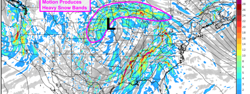
The ECMWF’s Synoptic Composite forecast for tomorrow afternoon does a great job highlighting the large-scale dynamics that will support the storm’s development. As the upper level trough currently located over the Rockies emerges onto the Plains, thunderstorms are expected to develop in the Texas and Oklahoma panhandles. The energy released by these thunderstorms will help “buckle” the jet stream into two jet streaks which will be “coupled” which means that the part of jet streak 1 most favorable for upward motion will be located over the same part of Kansas as the part of jet streak 2 that’s most favorable for upward motion. This “coupling” of the jet streaks will help the storm quickly develop as it moves northeast tomorrow. Looking at the shaded parameter (theta-e) to get a sense of the atmosphere’s temperature and moisture content, it’s clear that there will be no shortage of deep tropical moisture for this storm to work with. There will, however, be a shortage of Arctic air which is evident from the lack of theta-e values below 0C (note that you don’t need theta-e values below 0C to get snow, but the colder the better).
Despite the marginal thermal environment, strong mid-level frontogenesis NW of the low will produce a band of very heavy snow. This band shows up well on the ECMWF’s forecasts for mid-level vertical velocity shown above. Snowfall rates of 1-3″ per hour are possible in this band and as a result, travel will become extremely difficult between western Kansas and northeastern Minnesota on Sunday afternoon. This band of snow will stall and pivot as the storm reaches its mature phase on Sunday afternoon. The exact location of this stall/pivot will determine who gets the most snow.
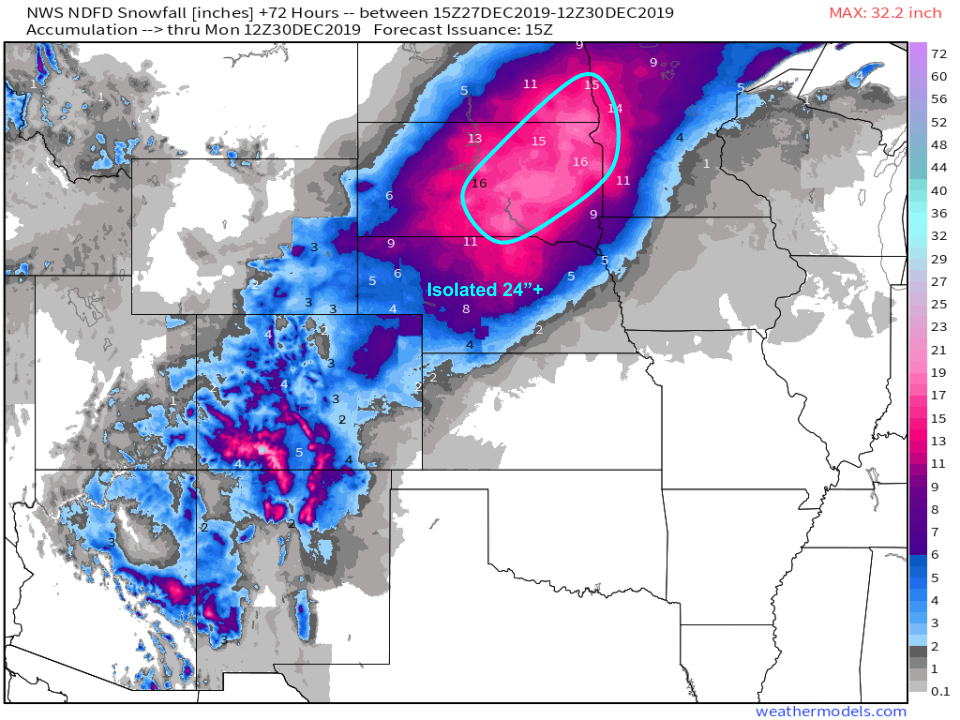
Here’s a look at the NWS’ snowfall forecast for the first part of the storm through Monday morning. A general 8-16″ is expected under that heavy snow band, and there will likely be a few spots that crack the two foot mark depending on how long the band is able to stall/pivot over any given location. Snowfall amounts will be lighter to the southeast where mixing will occur, as well as to the northwest where moisture and lift will be more limited.
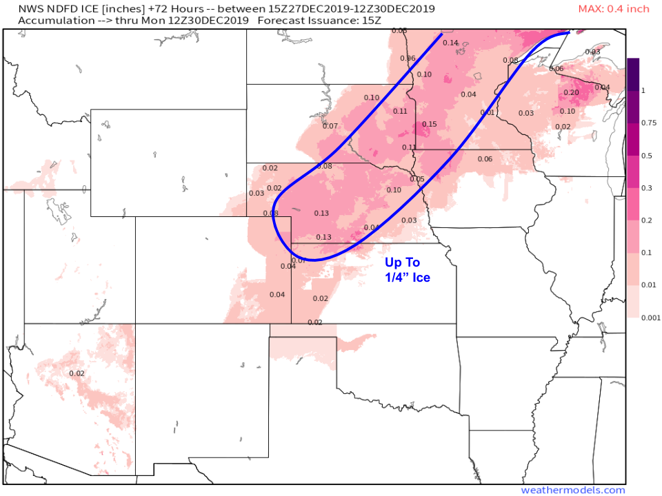
Ice will also be a concern with this part of the storm, and NWS forecasts show a fairly wide corridor of ice accretions between .1 and .25″. This is not enough ice to cause serious power outage concerns, but it will certainly be enough to make roads and sidewalks slippery, especially if they are untreated with salt or sand.
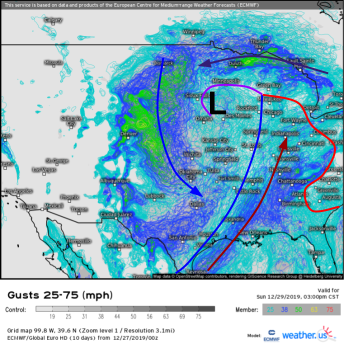
The final noteworthy aspect of phase one of the storm will be the wind. EPS spaghetti plots suggest that a wide swath of the Plains will see gusts over 50 mph as the storm peaks in intensity on Sunday afternoon. These winds will blow around the freshly fallen snow, resulting in considerable drifting and reduced visibility even after snow stops falling.
The first phase of the storm will weaken Sunday night before becoming absorbed into the second phase of the storm on Monday. More information on phase two of the system can be found here.
-Jack


