Major Blizzard Expected Across The Northern Plains Tomorrow
Hello everyone!
The powerful storm that slammed into California and Oregon on Wednesday will emerge onto the Plains tomorrow, and will bring similarly impactful weather to a large swath of the northern Plains over the next few days. Blizzard conditions are expected in this area as more than a foot of fresh snow is blown around by winds gusting above 40 mph. This post will discuss some of the forces behind the storm as well as how much snow can be expected in the Plains. If you’re interested in forecast info specific to your town, please head on over to weather.us and type your town’s name into the search box to get your personalized forecast.
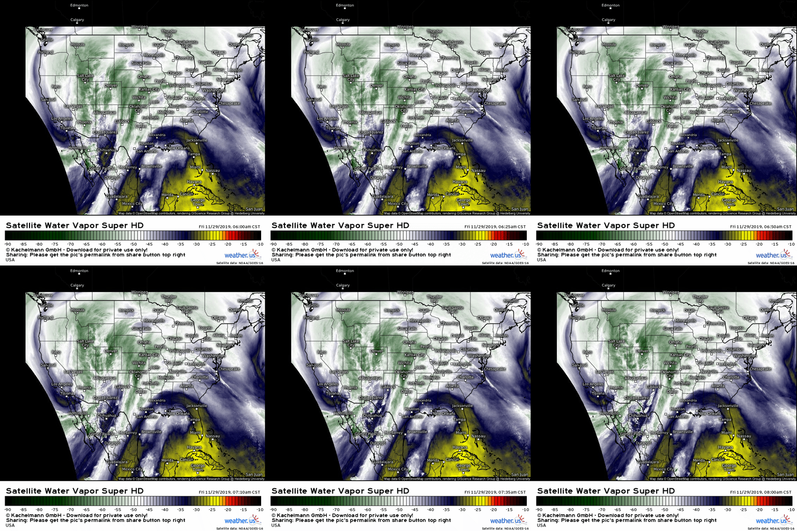
GOES-East WV satellite imagery is our first stop this morning, as usual. The large and powerful trough that will be responsible for the upcoming blizzard is clearly visible over the Rockies. A particularly strong disturbance is embedded within that trough, and is currently located near Phoenix AZ. That’s the ‘seed’ of the developing blizzard, and it will have a very favorable environment to grow in size and strength over the next couple days. Also visible in this loop is the storm’s plume of tropical moisture from the Eastern Pacific, which will help fuel bands of heavy precipitation, much of which will fall as snow.
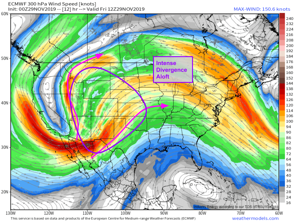
The upper level environment over the Rockies and western Plains this morning is extremely favorable for rapid storm development. Note the strong jet streak moving into northern Mexico, and the large region of diverging winds to the north and east of that jet. Air in this region will be rising in response to this jet divergence, which will help the storm develop quickly tonight. Map via weathermodels.com.
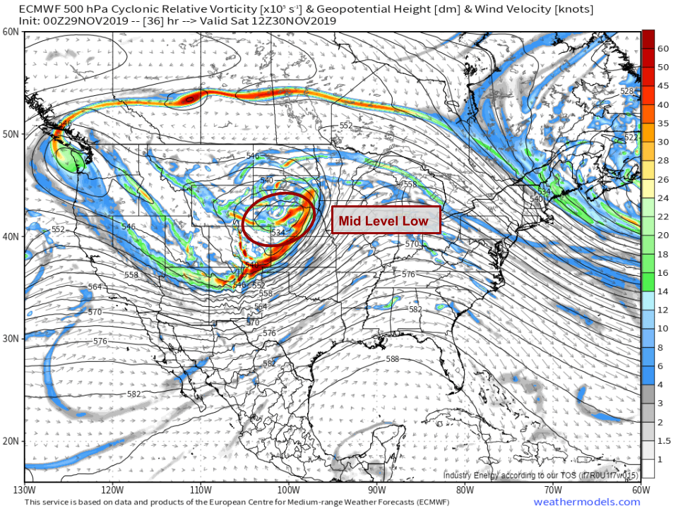
Moving a little lower in the atmosphere, a strong mid level low will develop as the disturbance currently near Phoenix pivots northeast. The 500mb vorticity map above shows this low and its associated energy over Nebraska by tomorrow morning. Bands of heavy snow can be expected to the north and northwest of this mid level low due to a process known as frontogenesis. What is frontogenesis and why does it produce heavy snow? Check out this post for more information. Map via weathermodels.com.
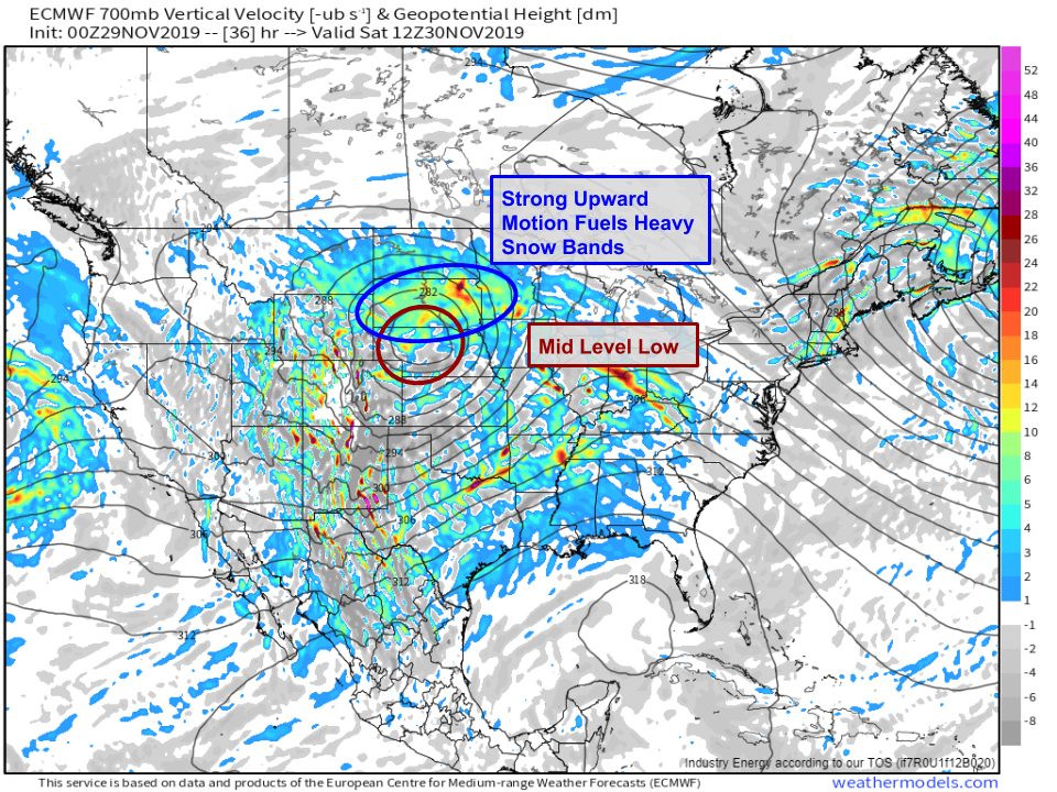
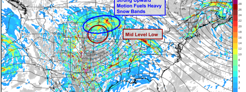
The upward motion associated with the frontogenesis NW of the mid level low is readily apparent on the ECMWF’s 700mb vertical velocity forecast map above. Warm colors indicate rising motion, while grey colors indicate sinking motion. The broad area of rising motion forecast over South Dakota tomorrow morning is due to the frontogenesis, and will produce bands of heavy snow. Snowfall rates of 1-2″ per hour are likely in these bands, and driving tomorrow morning will be extremely difficult in these areas. Be sure to plan ahead if your plans include travelling through South Dakota! Map via weathermodels.com.
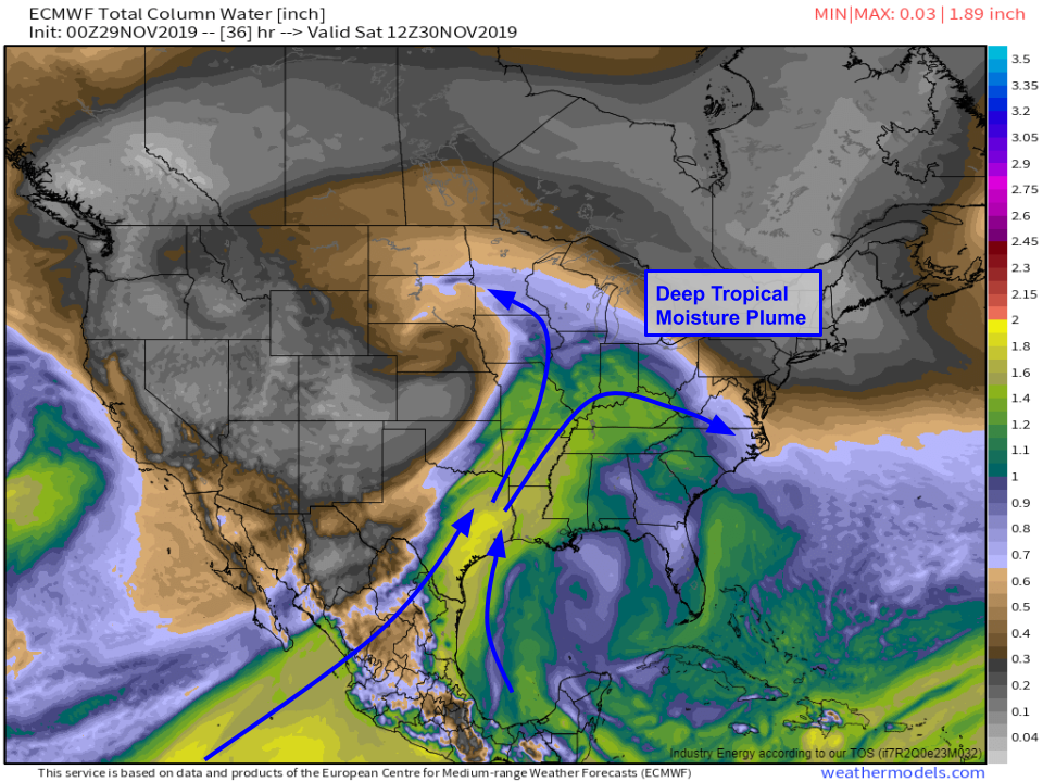
As I mentioned earlier, this storm will have access to a deep plume of tropical moisture from both the Eastern Pacific and the Gulf of Mexico. Precipitable water forecasts like the one shown above are the best way to visualize the movement of moisture. In addition to supporting the bands of heavy snow in South Dakota, this plume of moisture will also provide fuel for heavy rain in the southern Mississippi Valley. Isolated flash flooding is possible, but overall it doesn’t seem like this will be a high-impact flooding event as the window for heavy rain over any particular area remains relatively narrow. Map via weathermodels.com.
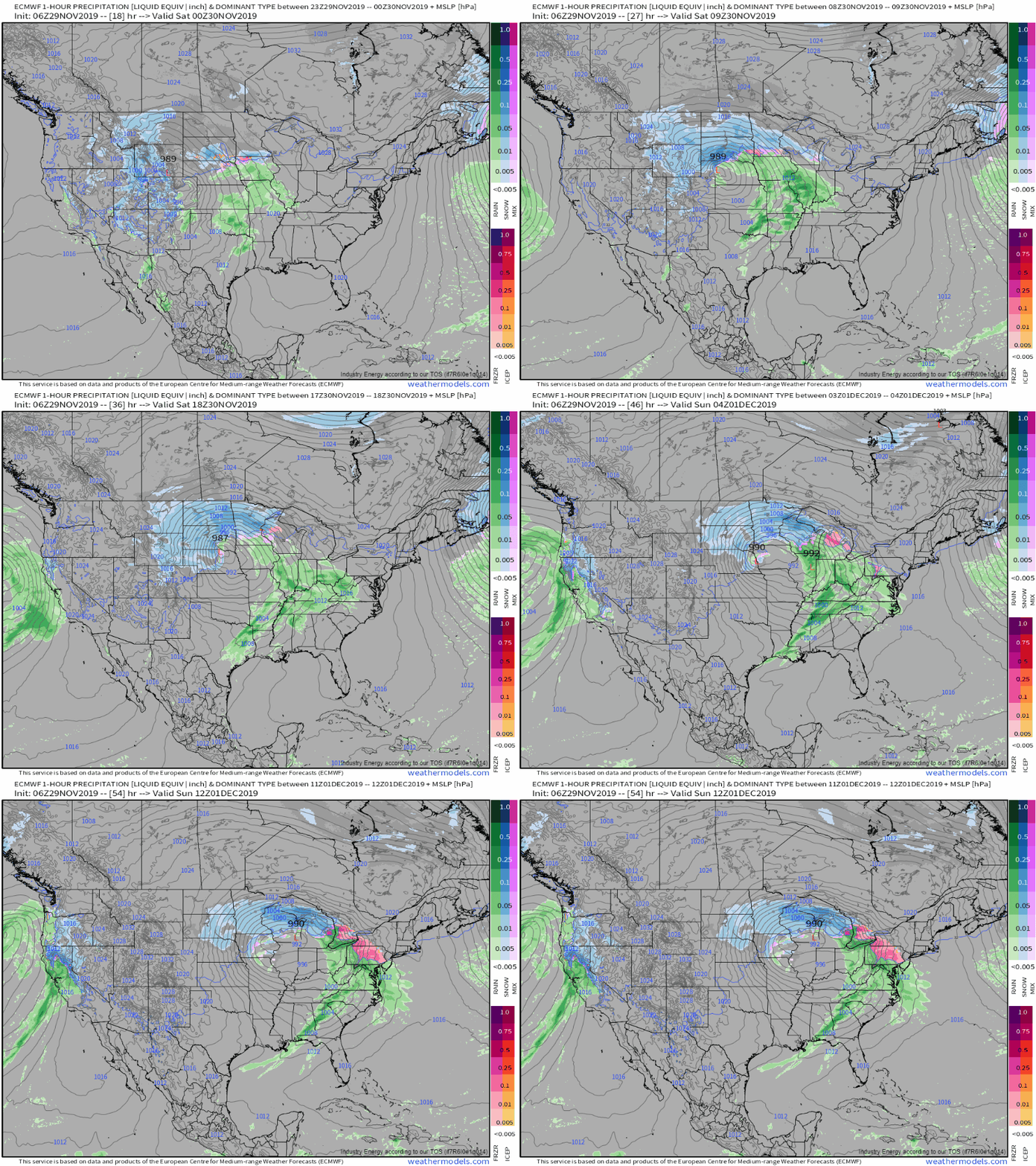
Here’s an overview of what all of the above discussion means in practical terms. Low pressure will rapidly develop tonight over NE CO/SW NE in response to the Phoenix disturbance and the upper level divergence. Frontogenesis on the NW side of the storm will produce strong upward motion, which combined with the plume of tropical moisture will result in bands of heavy snow over the Dakotas and adjacent parts of Minnesota. The storm will peak in strength tomorrow afternoon before weakening as it moves towards the Great Lakes on Sunday. The system will bring more impacts to the Great Lakes and Northeast later this weekend into early next week, but I will leave that discussion for another post. GIF via weathermodels.com.
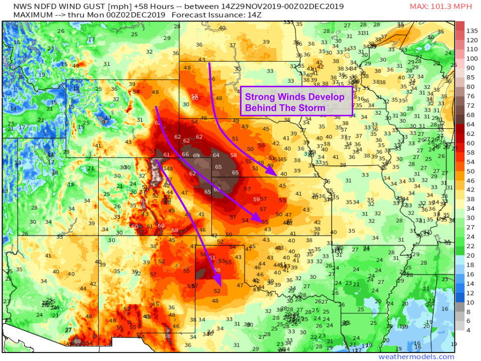
As the system departs tomorrow evening/Sunday morning, strong NW winds will develop across a wide swath of the Plains. NWS forecasts above indicate that 60 mph wind gusts are possible anywhere between the Texas Panhandle and the Black Hills of South Dakota. Some power outages are possible with these winds, but the biggest impact will be for areas that were under the heavy snow bands earlier in the day. Wind gusts of 45-60 mph across South Dakota will blow around the freshly-fallen snow, resulting in considerable drifting and reduced visibility even after the snow stops falling. Map via weathermodels.com.
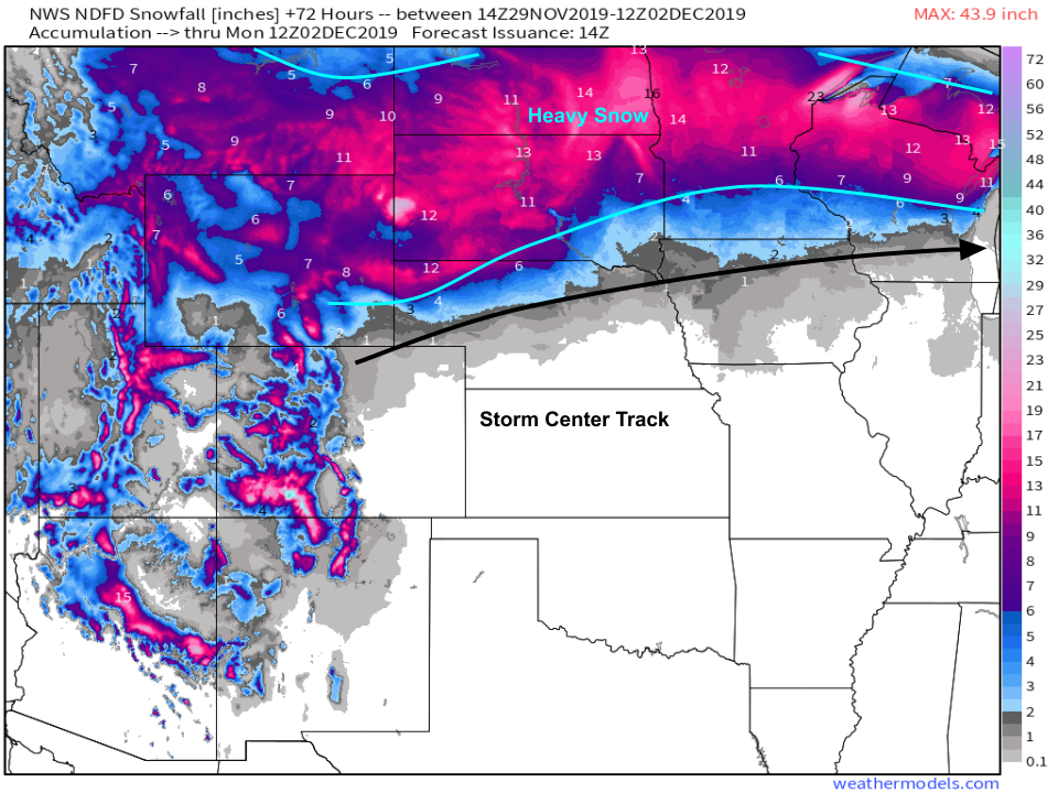
So how much snow will actually fall? Here’s the NWS’ forecast for the next 72 hours which covers the Plains portion of the event we’ve been discussing here. The snow will fall north of the storm center’s track, with the jackpot likely falling somewhere in SD or ND where those frontogenesis bands are most persistent. In these areas, accumulations in excess of 18″ are possible, though most spots will fall closer to the 12″ mark. Amounts will taper off as you head closer to the Canadian border where the lifting from frontogenesis won’t be quite as intense. Similarly, less snow is expected closer to the low’s track where warmer air will hold down snow-liquid ratios and may result in mixing with rain. Map via weathermodels.com.
-Jack
