First Eastern Snowstorm Of The Season Likely To Impact The Interior Northeast Late This Week
Hello everyone!
While flakes have been flying in the Rockies since early September, the East has yet to experience its first snowstorm of the season. That is expected to change later this week as a wave of low pressure develops along the leading edge of a cold airmass moving in from Canada. This post will discuss some of the dynamics powering this storm, as well as what to expect from it, and what uncertainties are still present. As always, if you’re looking for detailed information specific to your town, head on over to weather.us.
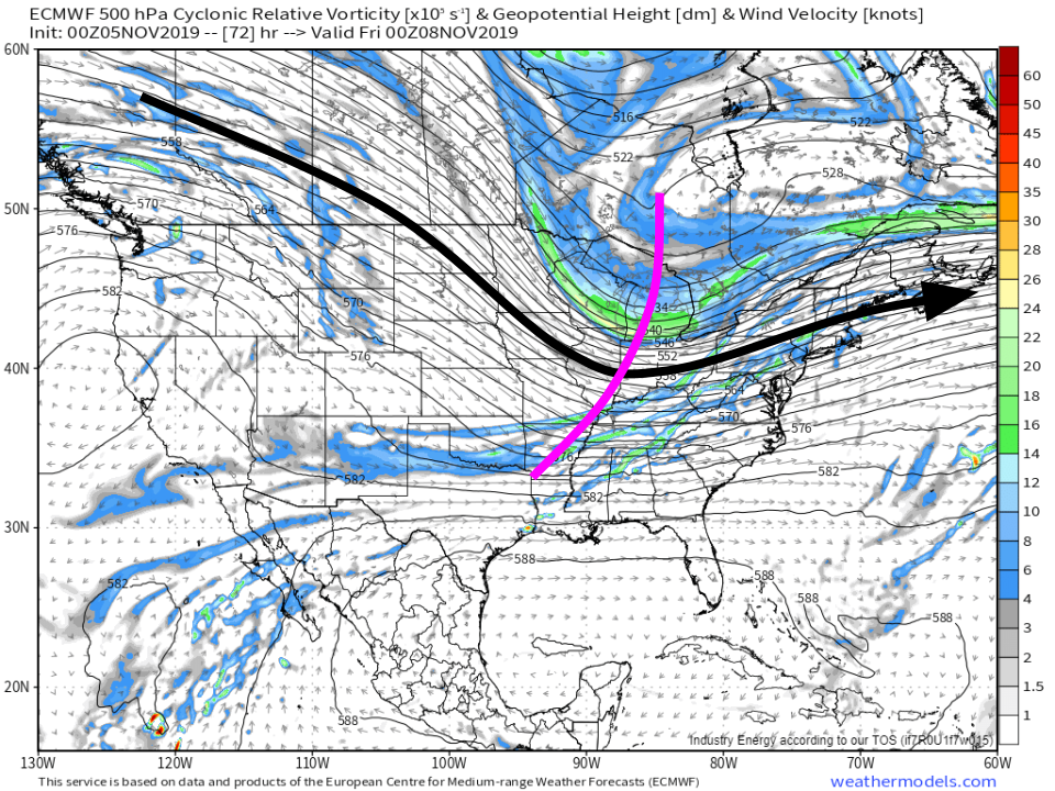
500mb vorticity forecasts from the ECMWF do a good job highlighting the general setup for this snow event. The prevailing jet stream is marked with the large black arrow, while the disturbance embedded within the jet that will bring the snow is marked in pink. Immediately, we can tell that this is likely to be a fast-moving event from the forward lean (NE/SW orientation) of the disturbance, as well as the relatively zonal (E-W oriented) jet configuration. The storm that forms ahead of this disturbance won’t be able to stick around for a long time, nor will it be able to intensify very much given the transient nature of the upper level support. Map via weathermodels.com.
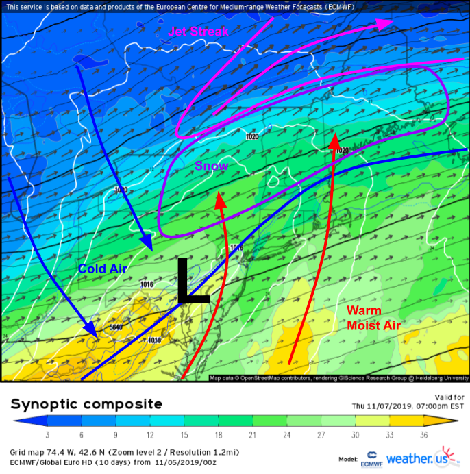
With that in mind, there will be robust support for heavy snowfall right ahead of the disturbance as it approaches the Northeast on Thursday evening. An anticyclonically curved (turning to the right as you move east) jet streak will be located over SE Quebec, just north of the developing surface low located near Philadelphia. This means that most of the Northeast will sit in the jet’s right entrance region, which is particularly favorable for rising air and thus precipitation. Additionally, colder air will be filtering in from Canada on northwesterly winds, reinforcing an already-chilly airmass leftover from a cold front moving through today (Tuesday). The area most likely to see accumulating snow is thus demarcated by the overlap of cold air, availability of moisture, and rising air, which I’ve outlined in purple on the map above.
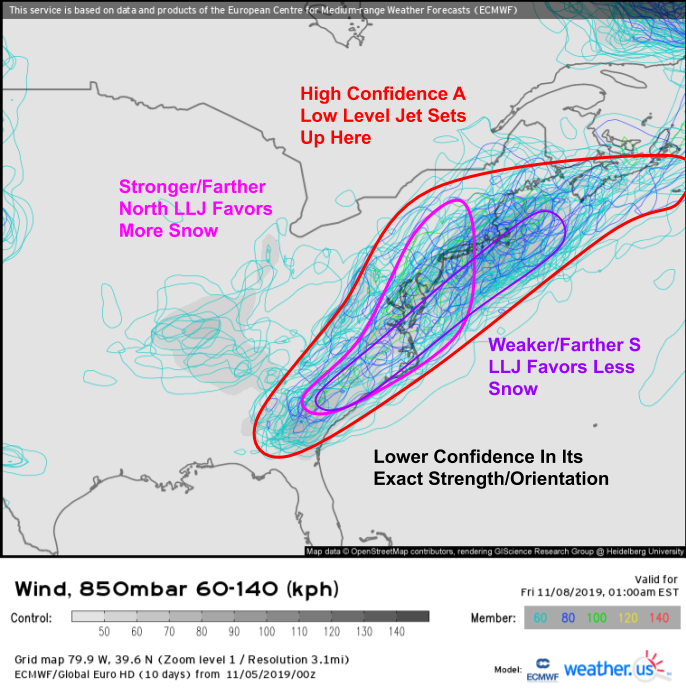
There is still some uncertainty surrounding this forecast, particularly regarding how amplified (strong) that disturbance can become as it swings through the Great Lakes. The stronger the disturbance is, the more moisture we’ll be able to bring north and squeeze out in the form of rain/snow. The EPS spaghetti plot above shows a wide range of possible outcomes for the strength and orientation of the low level jet that will be bringing the moisture northward. As is typically the case, the most likely outcome falls somewhere between the most amplified (pink circled) and the least amplified (purple circled) ensemble member forecasts. We should be able to get enough moisture and lift for a solid moderate snow event, but this won’t be a blockbuster blizzard by any means.
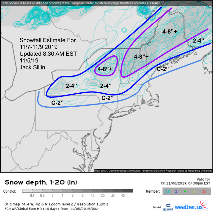
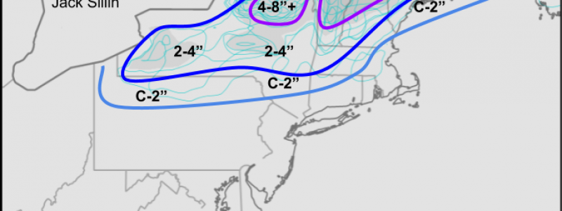
As far as snowfall amounts go, here’s a general look at what I’m expecting. This is primarily an interior event, so while I can’t rule out a few flakes in the Boston area, you’ll have to head for the hills to see any accumulation. The Maine mountains will likely do best with this storm, and up to a foot of snow is possible there. That’ll be a big help for ski areas looking to get the lifts spinning in the next couple weeks! Farther southwest, a >6″ snowfall event is likely for the White, Green, and Adirondack mountains while lower elevation parts of upstate NY, VT, and NY will generally see 2-4″. Lighter amounts are expected the farther SW you move down the Hudson valley and into PA.
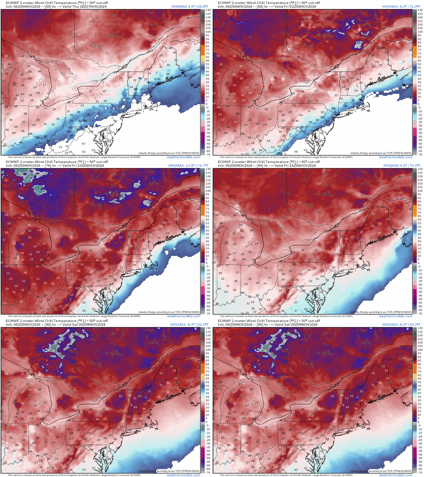
Behind this system, the coldest airmass of the season will arrive on gusty northwest winds during the day Friday. This animation shows wind chill values Thursday afternoon through Friday evening. Time to get the winter coats out! GIF via weathermodels.com.
-Jack
