Tropical System To Bring Wind And Rain To Parts Of The Southeast Tomorrow And Saturday
Hello everyone!
With last night’s nor’easter now wrapping up over New Hampshire, our attention will shift to the Gulf of Mexico where a tropical or subtropical system is expected to develop today. This system will get tangled up with an upper level low currently moving down the Rio Grande valley, so it is not expected to become an intense hurricane. However, it will still bring some rain and wind as it moves ashore this weekend, and its impacts may be significant in some places depending on how much it can consolidate over the next 36 hours.
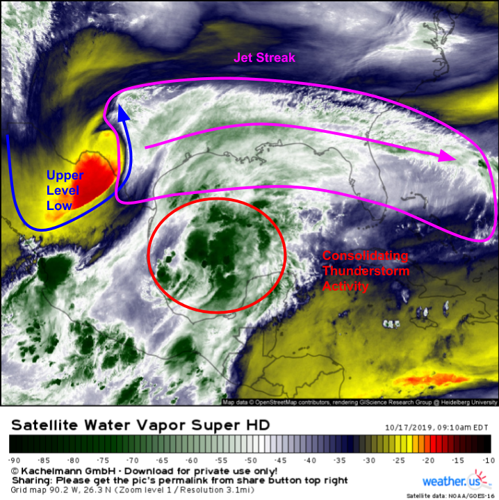
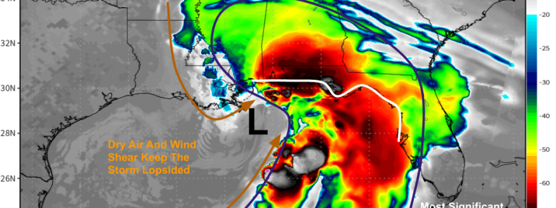
GOES-East water vapor satellite imagery this morning shows the developing system and its surrounding environment well. The storm itself is trying to form under the area of showers and thunderstorms I’ve circled in red. It’s likely that this system will close off a center of circulation and be named by the NHC at some point today. To the NW of those thunderstorms, an upper level low is clearly visible along the Texas/Mexico border. This low will bring its dry air and strong upper level winds closer to our developing tropical system during the day today. Finally, a jet streak is noted above much of the Gulf Coast. This jet will help grow and ventilate the storm even as it struggles with dry air entrainment.
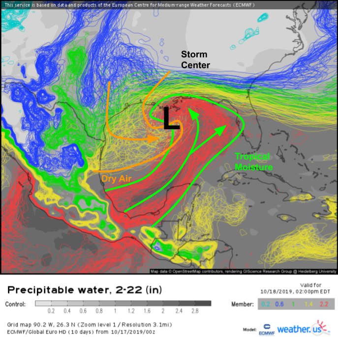
EPS precipitable water forecasts do a good job showing the general lopsidedness expected with this storm. There will be lots of deep tropical moisture flowing north on the eastern side of the storm, and there will be plenty of dry air moving down the western side. Just how much dry air will punch into the storm’s center remains uncertain (note the disagreement on the spaghetti plot above), but we do know that there will be enough to keep this storm from becoming a strong hurricane.
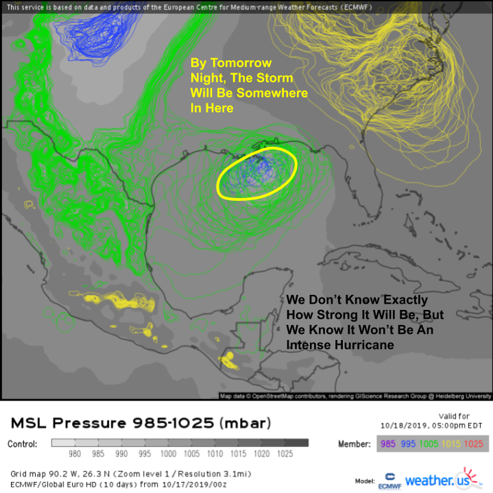
The whole system will be moving off to the NE over the next 36-48 hours in response to broad southwesterly flow ahead of the aforementioned upper level low. By tomorrow afternoon, the center of the storm will be located somewhere south of New Orleans. Ensemble guidance is fairly confident in the storm’s track, but less so regarding the intensity. Because of the storm’s interaction with that upper level low, we can say with high confidence that this will not rapidly intensify into a strong hurricane. However, we don’t quite know if it will remain an open disturbance or if it will consolidate enough to become a strong tropical storm. I think based on current organizational trends as well as the supportive jet streak which will help the storm with ventilation, this will likely end up a strong tropical storm or perhaps low-end hurricane at landfall tomorrow evening.
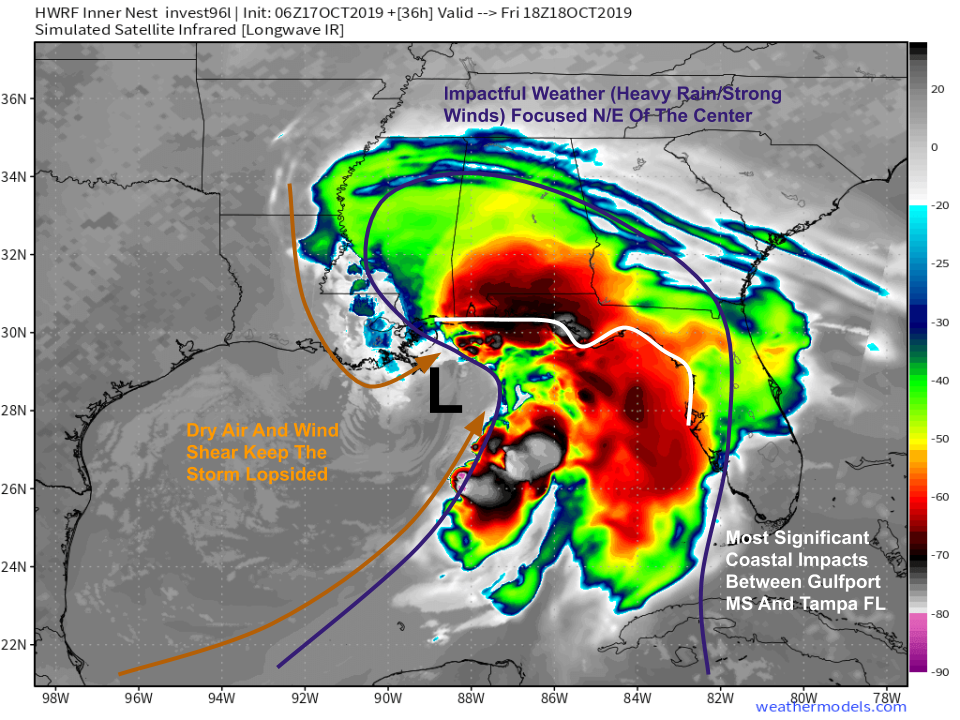
As far as impacts go, the jet streak will help the storm grow in size while the upper level low will push most of the ‘heavy weather’ to the north and east of the storm’s center. Heavy rain and strong winds will be felt well east of wherever the center happens to move onshore, while locations not all that far west of the landfall point will barely see any impacts. Right now, the most significant impacts look to be between Gulfport Mississippi and Tampa Florida, though that corridor could shift around a few miles depending on exactly where the system ends up going. Map via weathermodels.com.
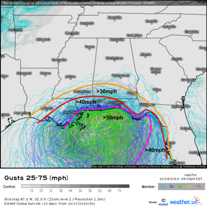
As far as winds go, here’s a rough estimate of what to expect based on the latest EPS guidance. Of course these numbers will change somewhat depending on how strong the storm gets, but based on current forecasts this should be a good start. Keep in mind that individual storm cells will be able to bring down stronger winds even hundreds of miles from the center. Just because Tampa will likely be outside the main wind field, 50 mph gusts are certainly possible as individual thunderstorms move through and try to mix down some of the stronger winds aloft. The best bet for strong winds will be between Tallahassee Florida and far southeastern Louisiana. I think 50 mph is the most likely outcome here, but if the storm consolidates a bit faster, a narrow corridor of higher winds is possible.
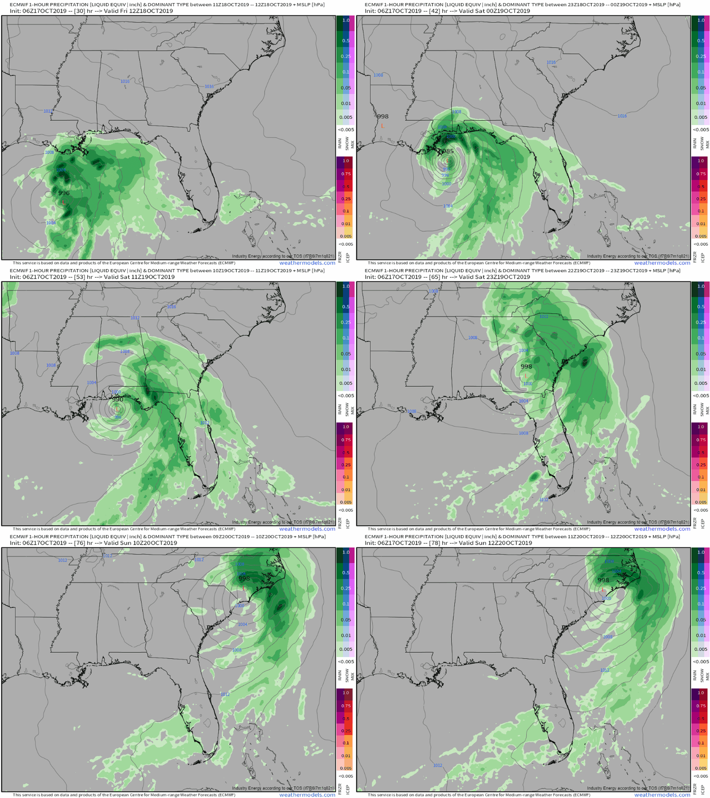
As far as rain goes, the ECMWF hourly pressure/precip loop above shows that this storm is expected to be a relatively fast-mover. Rain will only last perhaps 12 hours in any given location, so while it will fall heavily, extreme totals are not expected. GIF via weathermodels.com.
The latest forecast from the WPC supports this conclusion with most parts of the southeast expecting 1-2″ of rain from this system. There will of course be some locally higher totals where individual cells linger, but overall this isn’t a proficient rainmaker. Most of the storm’s rain will fall along and southeast of the center’s track, so if you’re more than 50 or 100 miles west of the center, you’re probably out of luck as far as rainfall goes this weekend. Much of the Southeast is now experiencing drought conditions, so the rain will be beneficial. Map via weathermodels.com.
Clear skies will return by Sunday as the storm moves off the Carolina coast.
-Jack
