First Major Nor’easter Of The Season To Bring Heavy Rain And Strong Winds To The Northeast Tonight
Hello everyone!
The season’s first major nor’easter is now developing over the Southeast and will bring significant wind and rain to parts of the Northeast tonight. Many nor’easters rapidly intensify, and this will be no exception. The system’s central pressure is expected to fall by more than 20mb in less than 12 hours tonight, far exceeding the established criteria for ‘bombogenesis’ (24mb in 24hrs). This rapid drop in pressure will set the stage for strong wind gusts, especially along exposed parts of the coastline. The storm will also be tapping into some deep tropical moisture which will support very heavy rainfall. This post will quickly outline what to expect from the system over the next couple days.
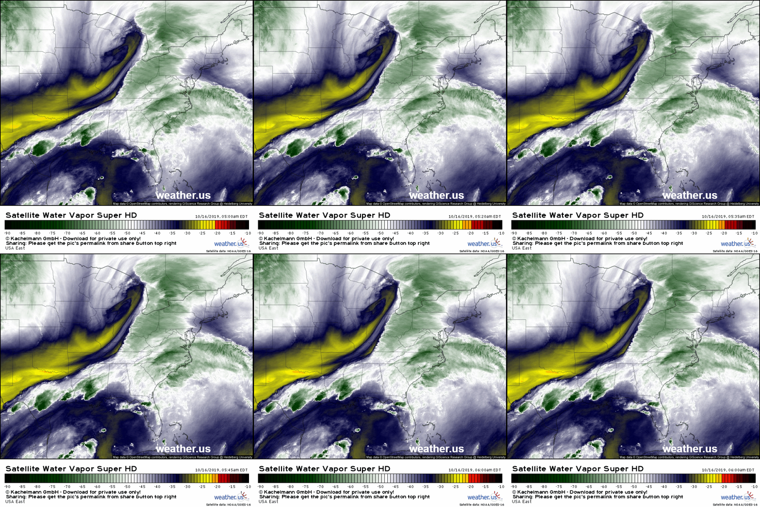
GOES-East water vapor satellite imagery this morning shows all the pieces of the storm beginning to come together. An upper level low pressure system can be seen over Michigan while a frontal boundary is highlighted by thunderstorms in Texas and Louisiana. As the upper level low continues to dig southeast into the frontal boundary, a new area of low pressure will form and intensify. This process is expected to begin in earnest about 12 hours from now, though if you really squint at station pressure observations, you can find the first hints of that new low over Georgia.
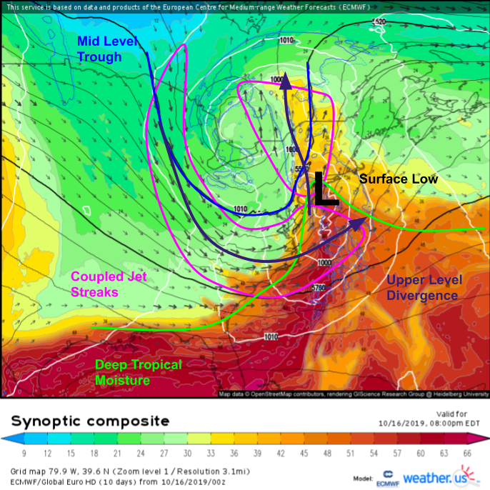
The ECMWF synoptic composite forecast for tonight highlights the dynamical processes that will be driving the system’s rapid intensification. The surface low will be located ahead of a strong mid level trough (with plenty of mid/upper level energy), and it will be located underneath strong upper level divergence. Why is that important? When the upper level wind field is divergent, an area of low pressure forms as air leaves a given area faster than it can be replaced. Air must then rise from farther down in the atmosphere to fill this “gap”. That rising motion drives surface pressure falls, requiring a horizontal wind response in the lower levels. This process happens most efficiently in the right entrance and left exit regions of jet streaks (local wind maxima embedded within the larger jet stream). When the right entrance region of one jet streak overlaps with the left exit region of another jet streak, as is the case here, the jet streaks are referred to as “coupled”, and rapid cyclone development is likely.
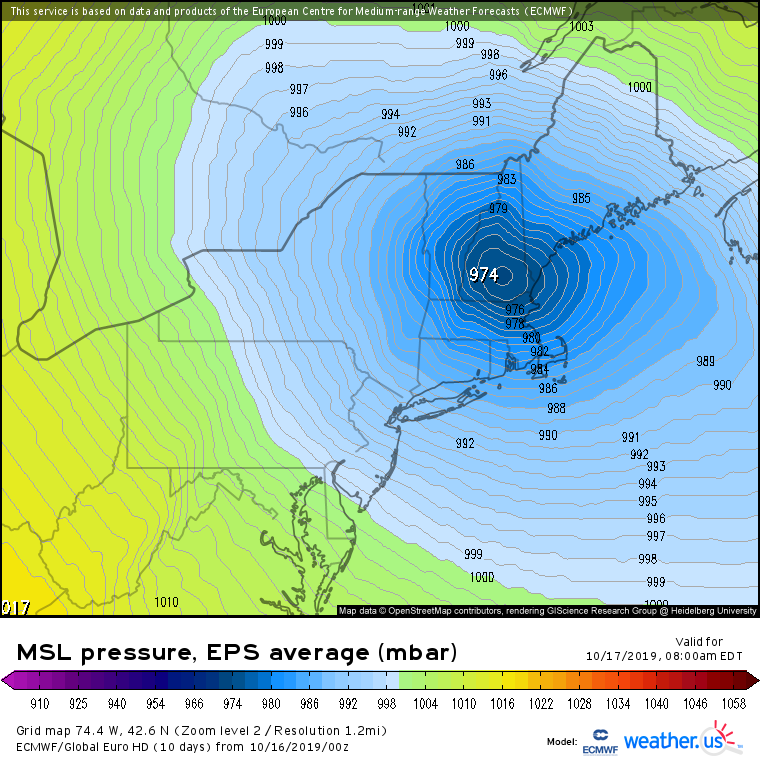
Given the favorable dynamical environment, it’s no surprise model guidance is expecting this system to rapidly intensify. By tomorrow morning, the EPS mean pressure forecast (most likely outcome) calls for a 974mb low over New Hampshire. The pressure gradient between that low and high pressure farther from the storm’s center will set the stage for some very gusty winds both ahead of and behind the storm’s center.
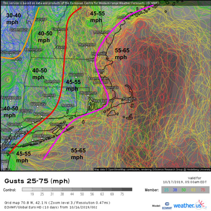
Sure enough, EPS ensemble forecasts show strong gusts moving onshore early tomorrow morning across New England. While the spaghetti map shown here is a bit noisy, the color coding lets some signal emerge after a close look. All EPS members will usually overdo wind gusts as they get too excited about winds just off the surface mixing down to the ground. Thus I take about 10 mph off the top of what’s shown, but keep the same spatial distribution. The eastern New England coastline will likely see gusts between 55 and 65 mph while winds slowly taper off as you head farther inland. While these winds aren’t unusual for a New England winter storm, they will be strong enough to cause some power outages, so take a few moments today to stock up on any supplies you might need in the event that the power does go out.
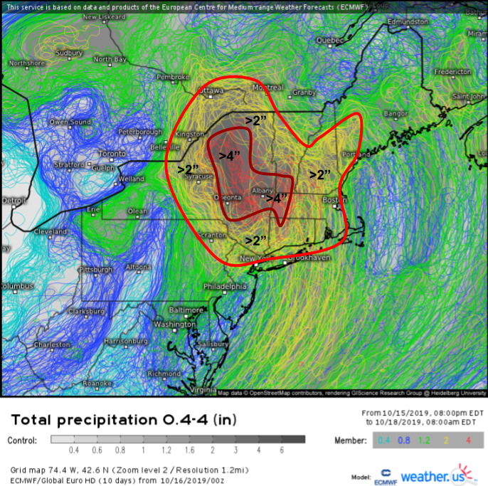
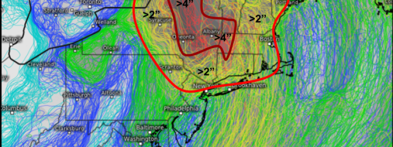
Heavy rain will be the other big story with this system as it taps a deep supply of tropical moisture. Much of New England and adjacent parts of New York will see over 2″ of rain, while localized amounts over 4″ are possible in the Berkshires, southern Green Mountains, Adirondacks, and Catskills. This won’t be enough to cause widespread flooding, but small streams will see sharp rises and minor flooding is possible.
Rain and wind will taper off as the system weakens over Maine during Thursday and Friday.
-Jack
