Flash Flooding Expected This Week Across Parts Of The Plains
Hello everyone!
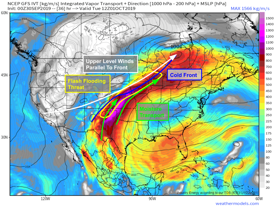
The trough responsible for the major winter storm up in Montana will team up with the ridge responsible for record heat in the Southeast and a tropical depression off the Mexican coast to bring very heavy rain to parts of the Plains this week. While the tropical depression itself will dissipate over the Mexican mountains without bringing any direct impacts to the US, strong southwesterly flow between the ridge and trough mentioned above will take the system’s moisture and bring it northward where it will interact with a cold front, setting the stage for the heavy rain.
This process is already underway this morning as seen on GOES-East WV satellite imagery. The trough is clearly visible over the Pacific NW with the ridge located over the Southeast. TD Narda can be seen off the Mexican coastline with a plume of moisture extending NE from that system all the way unto the Plains. This general pattern will continue for the next 2-3 days and will support repeated rounds of very heavy rain over the same locations, the perfect recipe for flash flooding.
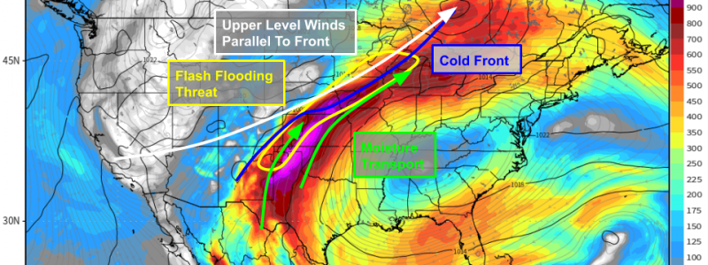
This process is shown well by the GFS’ Integrated Vapor Transport parameter, which is a way of looking at how much water vapor is moving from one place to another in the atmosphere. As you can see, plenty of water vapor will be moving from the Eastern Pacific and Gulf of Mexico up into the Plains this week. Additionally, winds in all levels of the atmosphere (except right at the surface) will be out of the southwest in this area. The cold front that will be focusing the shower/thunderstorm activity will be oriented roughly NE-SW, which means its axis will be roughly parallel to the deep layer wind field. Why is that important? The deep layer wind field (i.e. the average wind speed/direction over a deep layer of the atmosphere) determines where showers and storms that pop up along the front will go. In this case, showers and storms developing along the front will stay close to the boundary, thus bringing heavy rain to the same places repeatedly. Map via weathermodels.com.
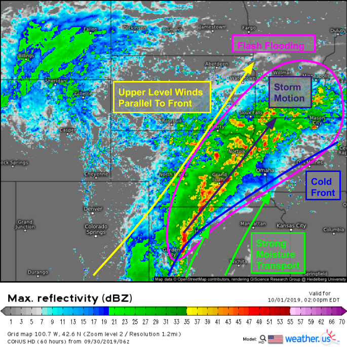
This simulated radar map may help show the process I’m talking about a little better. Notice how the thunderstorms near Garden City Kansas will be tracking over the same areas impacted by the Grand Island and Norfolk, Nebraska storms as each cell follows the same SW-NE path. That means that if you happen to be under the axis of heavy rain near or just NW of the frontal boundary, you’re in for hours of heavy rain as the parade of storms continues until the whole front slides slowly east.
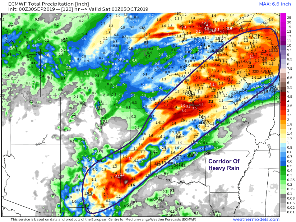
The net result of all this will be a corridor of heavy rain extending from New Mexico all the way up into the Great Lakes region. In this corridor, which may set up slightly farther to the NW especially over parts of E NE, SE SD, and S MN, expect repeated rounds of heavy rain with storm total rainfall amounts likely exceeding 2″. As you can see in the map, not everyone in that region will get 2″ of rain. Some spots will dodge many of the storms and end up with less. Others will see particularly strong storms and will pick up more than 2″ of rain. The bottom line is that if you’re in this area and your location is susceptible to flooding, now is the time to be preparing for high water. Note that this event won’t be substantial enough to raise the main-stem rivers (Mississippi, Missouri, etc.) to flood stage. The flooding concerns here are primarily along the smaller streams/creeks as well as in urban/poor drainage areas. Map via weathermodels.com.
Follow along with the storms as they develop using HD radar imagery as well as station precipitation observations. Click either map to zoom in, or navigate via the menus to the left of the map.
-Jack


