Major Hurricane Dorian Continues Approaching The Carolina Coast, Major Impacts Will Continue Through Tomorrow
Hello everyone!
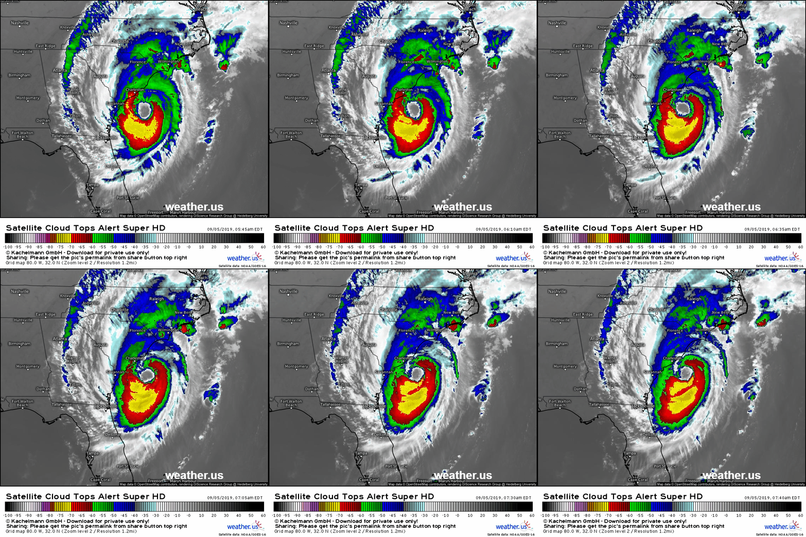
Major Hurricane Dorian continues moving northward towards the South Carolina coast this morning. Its eyewall is now just 45 miles from Charleston as of 5:15 AM EDT. The storm has picked up a slight easterly component to its motion this morning, a sign that the long-awaited turn to the northeast is underway. Over the past few days, I’ve focused most of my posting on the tracking blog, following the storm’s every move and explaining how the observations we’re seeing now will change (or not) the eventual impacts of the storm. Now that the impacts in the Carolinas are well underway, there’s not much to be gained by focusing on 5-10 mile track wobbles either towards or away from the coast. The hurricane force winds are coming, the flooding rains are already falling, and the storm surge is already in progress.
With that in mind, this post will be a state-by-state look at what to expect from the rest of Dorian. It will include info on expected impacts as well as timing, and when your area will be “all clear” weather-wise. Note that just because you’re in the clear weather-wise doesn’t mean it’s safe to go back to the shore if you evacuated. Roads may be washed out, debris will need to be cleared to make roads passable, there may be structural damage to homes and/or bridges, etc. Please continue heeding the advice of local officials who will allow re-entry into evacuation zones when it is safe to return, even though that may not be exactly when the sun comes out and the winds/surge subside.
The order of states here will be from south to north, so if you’re in NC or VA or MA, scroll down to find the information relevant to you.
Florida
Florida has basically gotten to the “all clear” point as of this morning. Some breezy winds will continue near Jacksonville over the next few hours, but Dorian is now well NE of the state and any impacts from here on out will be limited to heavy surf along the beaches.
Georgia
Savannah Georgia will continue to see rain and tropical storm force winds over the next few hours, but as soon as you get 20-30 miles to the west of the city, rain has ended and winds will remain below 45 mph. Note that you can still get power outages with 40-45 mph winds, so keep an eye out for that over the next few hours. With NW winds pushing water offshore, surge will not be a concern for the rest of the storm and the NWS Storm Surge Warning previously issued for the state’s coast has been dropped as of the 5 AM NHC update.
If you’re in Savannah or the immediate vicinity, expect this morning’s gusty winds to continue through the midday hours before tapering off this afternoon.
South Carolina
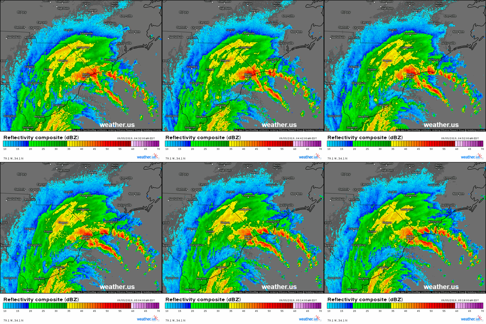
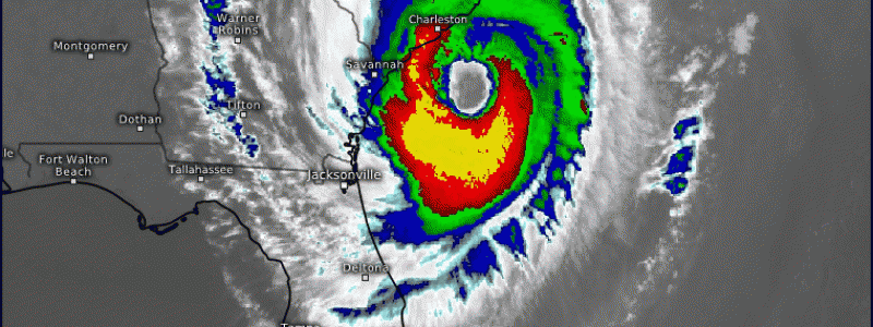
The impacts from Dorian in South Carolina will only get worse over the next few hours. This radar loop shows two intense outer bands blasting the Myrtle Beach area with torrential rain (over 3.5″ in just 6 hours!) as well as a parade of supercellular thunderstorms which have a history of producing tornadoes.
Additionally, the storm’s eye and eyewall show up as the last band S of Charleston. As the eyewall moves onshore, which it is likely to do near Charleston before moving up the coast to the NE, expect winds to increase well above hurricane force, with some parts of the coastline experiencing winds over 100 mph. This is quite consistent with forecast expectations from recent days.
Heavy rains are also moving farther inland as the jet streak we’ve been discussing so much in recent days draws moisture from the storm’s center back up to the northwest. 
By 2 PM today, the time shown on the map above, the storm’s eyewall will be moving along the coast between Charleston and Myrtle Beach. This afternoon will be the time of peak impact for these areas in terms of intense winds, flooding rainfall, and storm surge. As far as storm surge goes, the next high tide to watch in Charleston will be the 2 PM high tide, though given that water levels in Charleston are currently running about 3.5 feet above normal as of 5:45 AM EDT, flooding will occur well before that high tide peak.
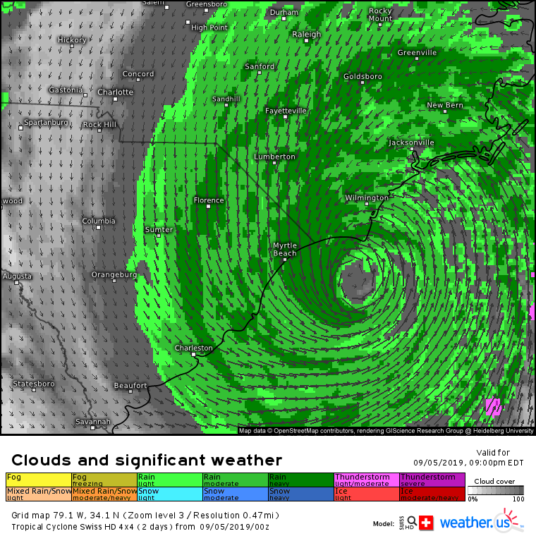
By 9 PM today, the storm’s center and eyewall will be moving into the Wilmington NC area (more on NC impacts below). Myrtle Beach will continue to see winds near hurricane force, and torrential downpours will continue on the coastal plain northeast of a Charleston-Sumter line. That being said, by this time the storm is basically over in Beaufort and Charleston will be seeing the last of the rain bands. Winds will turn to the NW as the eye passes by, which means that the storm surge threat will rapidly decrease from south to north this evening.
If you’re looking for the “all clear” times for South Carolina, my best guess as to the end of TS force winds is 3-5 PM for Beaufort, 10 PM – 12 AM for Charleston, and 6-8 AM tomorrow for Myrtle Beach. Remember that these times just represent the end of the dangerous present weather conditions. Many hazards will continue to exist well after the storm passes including damage to roadways, flooding, damage to the electrical grid (wires down, wires energizing floodwaters, power outages, etc.), as well as many others.
The flooding rains will wind down from SW to NE this evening into the early half of the overnight hours.
North Carolina
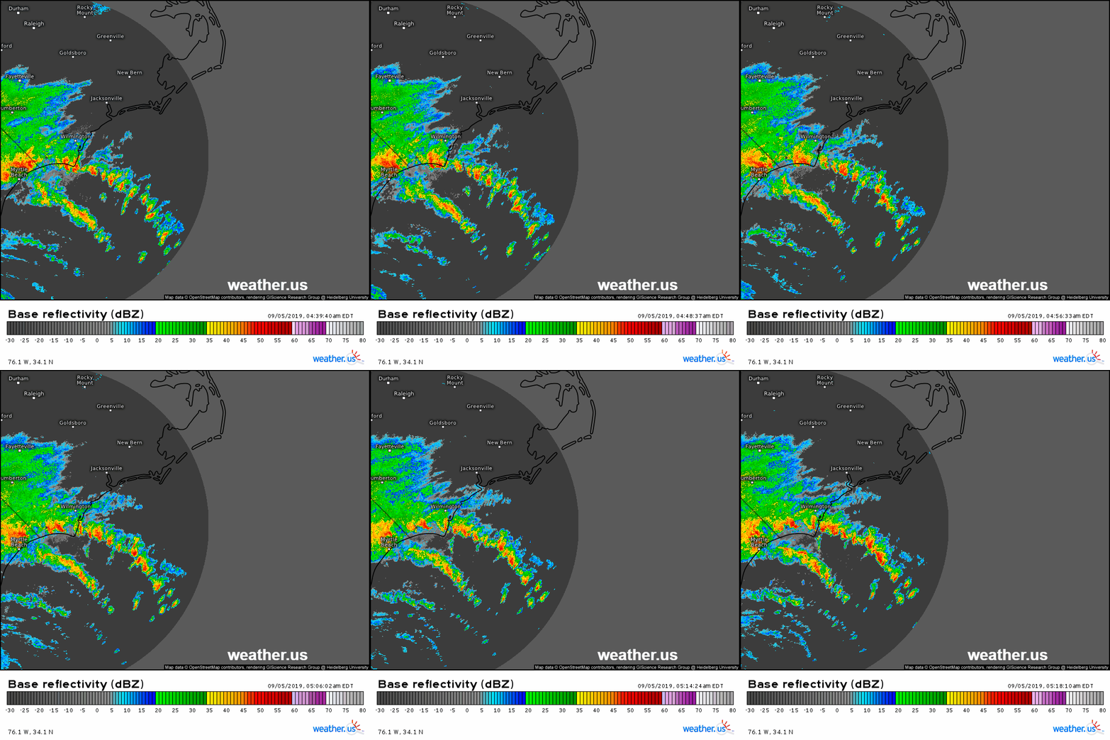
Dorian’s outer bands are just now making their way into the SE part of North Carolina this morning. These bands contain extremely heavy rain and embedded supercell thunderstorms that are capable of producing tornadoes as they move onshore. These bands will slowly lift northeastward over the course of the day today. If you’re on the Outer Banks or adjacent parts of the eastern NC coastal plain, you’ll be getting into Dorian’s rain bands within the next few hours.
As the outer bands move northeast, so too will the storm’s core. The first NC city to experience Dorian’s core will be Wilmington where hurricane force winds will arrive later this evening. By the early hours of tomorrow morning, the storm’s center will be approaching Bald Head Island. Whether or not the geometric center of the eye, where the exact lowest pressure is and thus the center of the storm, actually touches the island to count as “landfall” is unclear and will depend on tiny wobbles that are both impossible to predict ahead of time and also entirely meaningless as far as the impacts go.
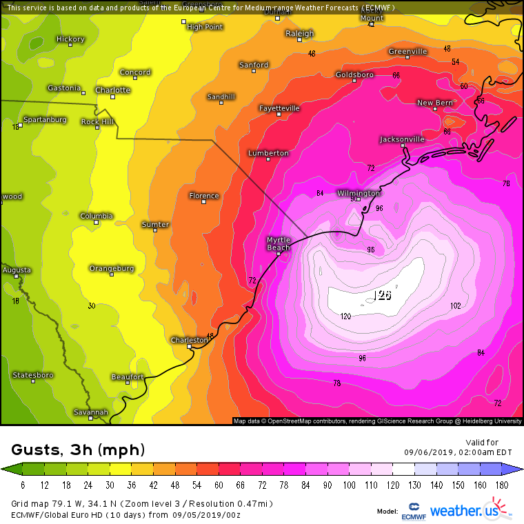
This map of the ECMWF’s wind gust forecast for 11PM – 2AM tonight shows a wide swath of hurricane force wind gusts impacting the coastline and adjacent inland areas of SE NC. TS force winds will extend well inland of the center, and will cause tree damage/power outages even in parts of the state farther from the coast. The storm surge will also peak tonight in this area with the 4 AM high tide of particular concern in the Wilmington area.
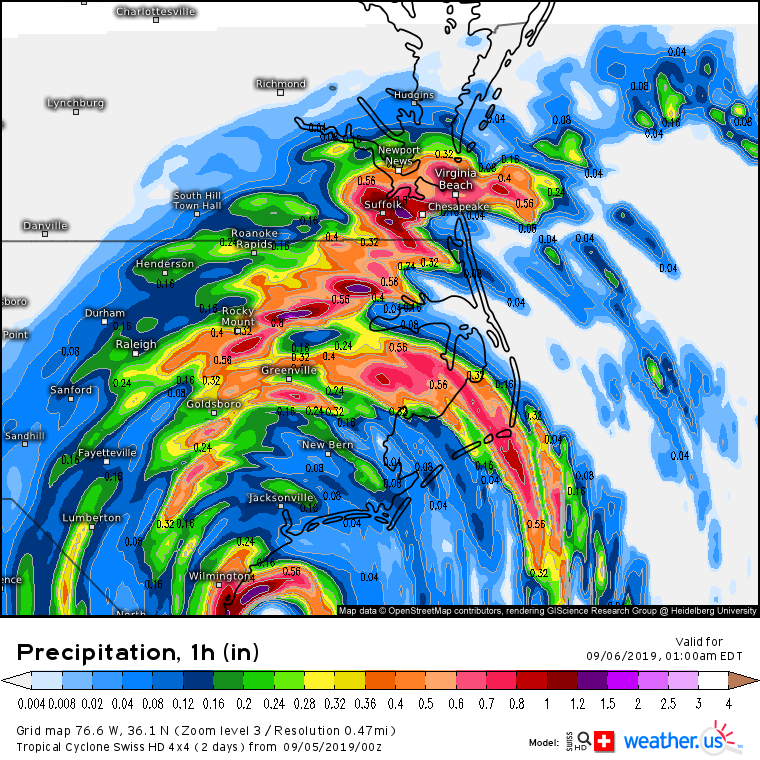
The overnight hours tonight will also see the expansion of extremely heavy rainfall up the eastern half of North Carolina. Flooding rains will begin well before the strong winds, and the storm cells bringing the rainfall will also pose a significant tornado threat given the tremendous wind shear in the northeast quadrant of a hurricane. The threat for flash flooding in Eastern NC is just as high as it is in parts of SC!
By the time we get to tonight and Dorian’s core begins impacting NC, the storm will be accelerating off to the northeast.
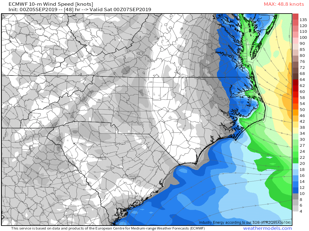
Wilmington NC will see winds quickly taper off tomorrow afternoon, with this map valid at 2 PM showing the back end of the TS force winds (35 knots sustained, so 40-45 knots on the gust map is a good approximation) moving through SE NC. Tomorrow afternoon will be the time of maximum wind impact for Cape Hatteras and the sounds of NE NC. Hurricane force winds will impact much of this area with the strongest 100 mph+ winds moving over the Outer Banks. Ocean-side and inland sound storm surge will peak tomorrow midday across this area as well.
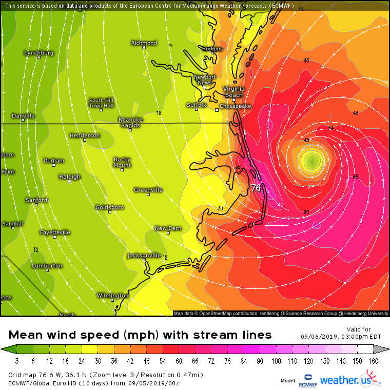
By 3 PM tomorrow, the storm’s center will be racing away to the northeast and winds will be dropping outside of the Outer Banks. On the Outer Banks, we’ll be watching for a big burst of NW winds to develop right on the storm’s back side as its transition to a non-tropical storm begins. Parts of the Outer Banks will also need to be extremely concerned about sound-side flooding tomorrow afternoon/evening. Tomorrow’s high tide is 4 PM and all the water the storm will have pushed into the sounds and bays over the preceding couple days will be attempting to escape back out into the Atlantic. I strongly suspect that the Outer Banks will see much more sound-side surge flooding than ocean-side surge flooding from Dorian, though of course the first should not be taken lightly as storm surge is dangerous regardless of where it’s coming from.
TS force winds exit North Carolina by tomorrow evening though sound-side surge flooding could linger into Saturday given continued NW breezes and the lag time involved with emptying an entire bay through a few small channels.
Virginia
Virginia’s southeast corner will experience substantial direct impacts from Dorian as the storm’s core moves through eastern North Carolina. It has been pointed out to me several times on twitter that perhaps I didn’t cover this aspect of the storm nearly as much as I should have. While I did mention it in Periscope updates over the past few days, these folks are probably right and I apologize if I gave the impression that SE VA is out of the woods here as that is not true.
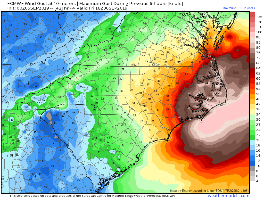
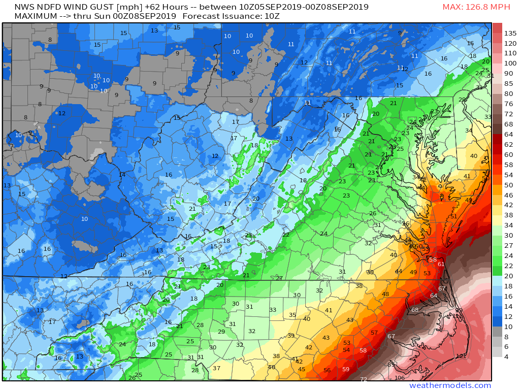
Here’s a look at the NWS forecast for max wind gusts across the VA/NC area as Dorian passes by. Parts of Virginia Beach and the coastline south to the NC border could see hurricane force winds while Norfolk is likely to gust in the 55-65 mph range. This isn’t strong enough to cause widespread damage, but trees will come down and power will be knocked out, so you should be ready for that. If you aren’t, most of today will be ok to get any last supplies you may need before TS force winds arrive later tonight/early tomorrow morning.
Keep in mind that the storm’s outer bands will bring torrential rain and the threat for tornadoes well ahead of the TS force winds associated with the storm’s main circulation.
As far as storm surge flooding is concerned, strong northerly winds down Chesapeake Bay Friday afternoon will push water into low lying parts of the Tidewater region. The surge idea here is fairly similar to the Outer Banks; while the ocean-side surge on the front end of the storm will be serious, it’s the sound/bay-side surge on the back end of the system that will probably end up being worse. Parts of the southern Chesapeake Bay are under a storm surge warning meaning that residents in those areas should check to see if they’re in a flood zone and move to higher ground today if so.
Winds and surge will subside across SE VA Friday evening before calm weather returns Saturday.
Massachusetts
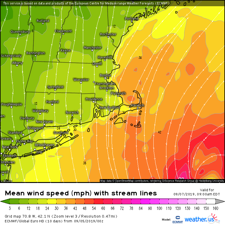
As Dorian races towards Nova Scotia on Saturday, its wind field will continue expanding. This will bring tropical storm force winds to parts of Cape Cod and the surrounding islands beginning early Friday morning.
While some power outages are possible here, this is no more serious for Cape Cod, Nantucket, and Martha’s Vineyard than a garden-variety winter storm. If you’re a summer resident not familiar with winter storms here, get ready for some wind-swept rain and high surf. Areas that typically flood from storm surge in nor’easters will likely see water on Saturday morning, but I can think of several winter storms over the past two years that were much worse in these areas.
Any rain will clear out early Saturday afternoon though gusty winds will continue into Saturday night before tapering off on Sunday.
