Deep Summer Weather Continues Across The Country This Weekend
Hello everyone!
We’re deep in the heart of summer here in Mid-August and the weather pattern certainly understands that. Several rounds of severe storms are in the forecast for various areas as we move into the weekend. I’ll briefly highlight in this post the areas of storms most likely to produce severe weather (damaging winds, large hail, and/or tornadoes) though it’s always good to remember that any thunderstorm is dangerous due to lightning and heavy rain/potential flash flooding.
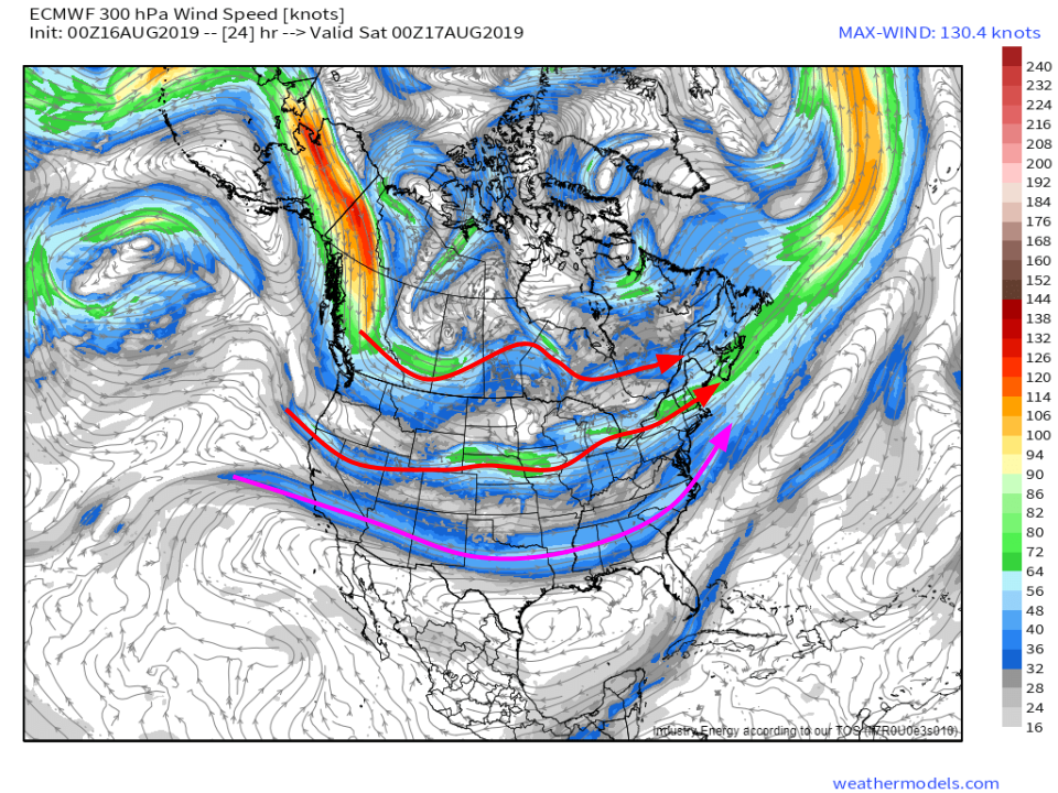
A look at 300mb wind forecasts for this evening shows an interesting three-jet pattern across North America. The subtropical jet is well-defined from Southern California all the way across to North Carolina while the polar jet has split into two segments. The northern segment runs from British Columbia east to New Brunswick while the southern segment runs from northern California to Maine. All three of the jets are relatively weak (<70kts) and mostly zonal (flowing from west to east). That means that we won’t see any big storm systems, but instead will be focusing on much smaller and weaker features associated with the small ripples in the jet. Map via weathermodels.com.
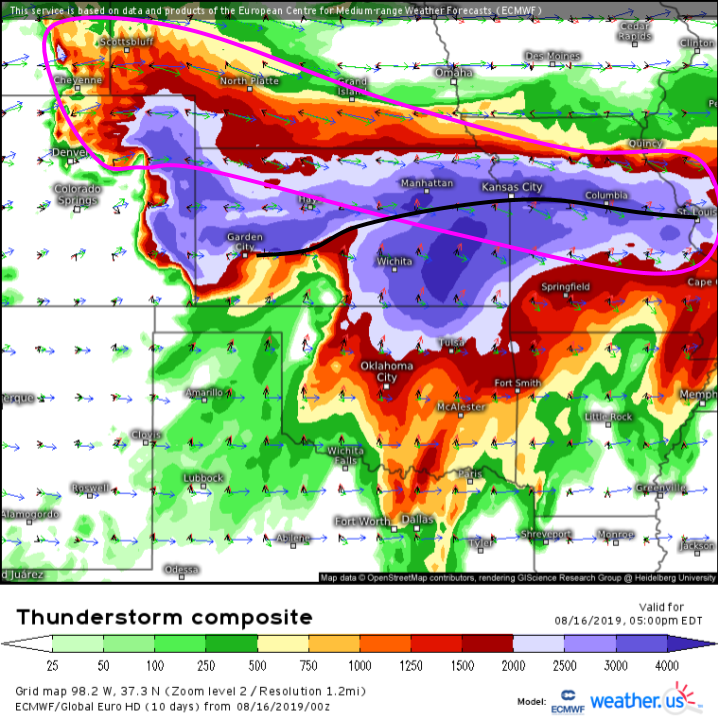
Today, we’ll be focused on the area between the ripple in the jet over the Rockies and that over IL/IA. The ECMWF’s Thunderstorm Composite map quickly highlights an area of favorable wind shear and instability (I’ve circled the overlapping area in pink) near a stalled frontal boundary (black). Expect storms to develop along that boundary this evening across eastern Kansas. The storms will then move slowly ENE into Missouri. Storms will likely begin as discrete cells given the weak forcing for ascent (lift) and winds in the mid/upper levels oriented not quite parallel to the boundary. All modes of severe (tornadoes, damaging winds, and hail) will be possible with these storms. As more storms develop and interact, storm modes should shift towards linear later in the evening which means the threat for damaging winds will become greater than the threat of a tornado (though still possible) or large hail (quite unlikely).
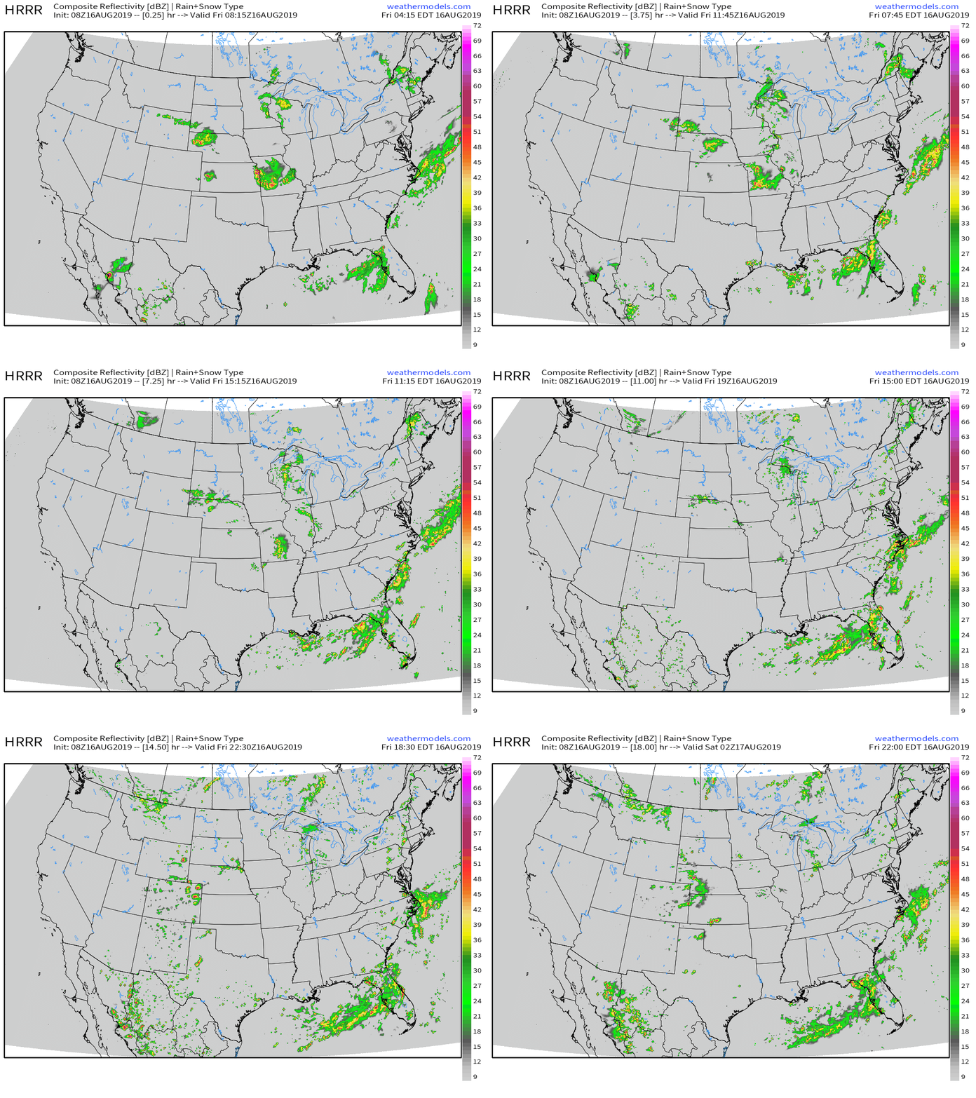
Many other thunderstorms will develop today even before the Kansas storms get going (which probably won’t happen until after sunset). The highest chance for severe storms outside the KS/MO area will be in the High Plains of WY/NE CO/W NE/SW SD. Storms developing in interior parts of the Northeast could produce a stray damaging wind gust, but their primary threats will be lightning and heavy rain. The same can be said for persistent thunderstorm activity over Florida and spottier activity over Wisconsin/Michigan as well as NM and W TX.. GIF via weathermodels.com.
Precipitable water (moisture) forecast loops are a great tool to take a look at many of the features important to our weather. The disturbances responsible for the Kansas, Wyoming, and Wisconsin storms discussed above are all visible fairly easily in this loop. You can even see the Kansas storms themselves reflected as a sharp increase in moisture over KS/MO this evening. The other feature I’d like to highlight is the pool of deep tropical moisture (that’s PWAT values above 2″) extending from SE Texas through Florida and up into NC. A weak area of low pressure has formed in that pool of moisture near Florida and will be dropping a lot of rainfall this weekend. GIF via weathermodels.com.
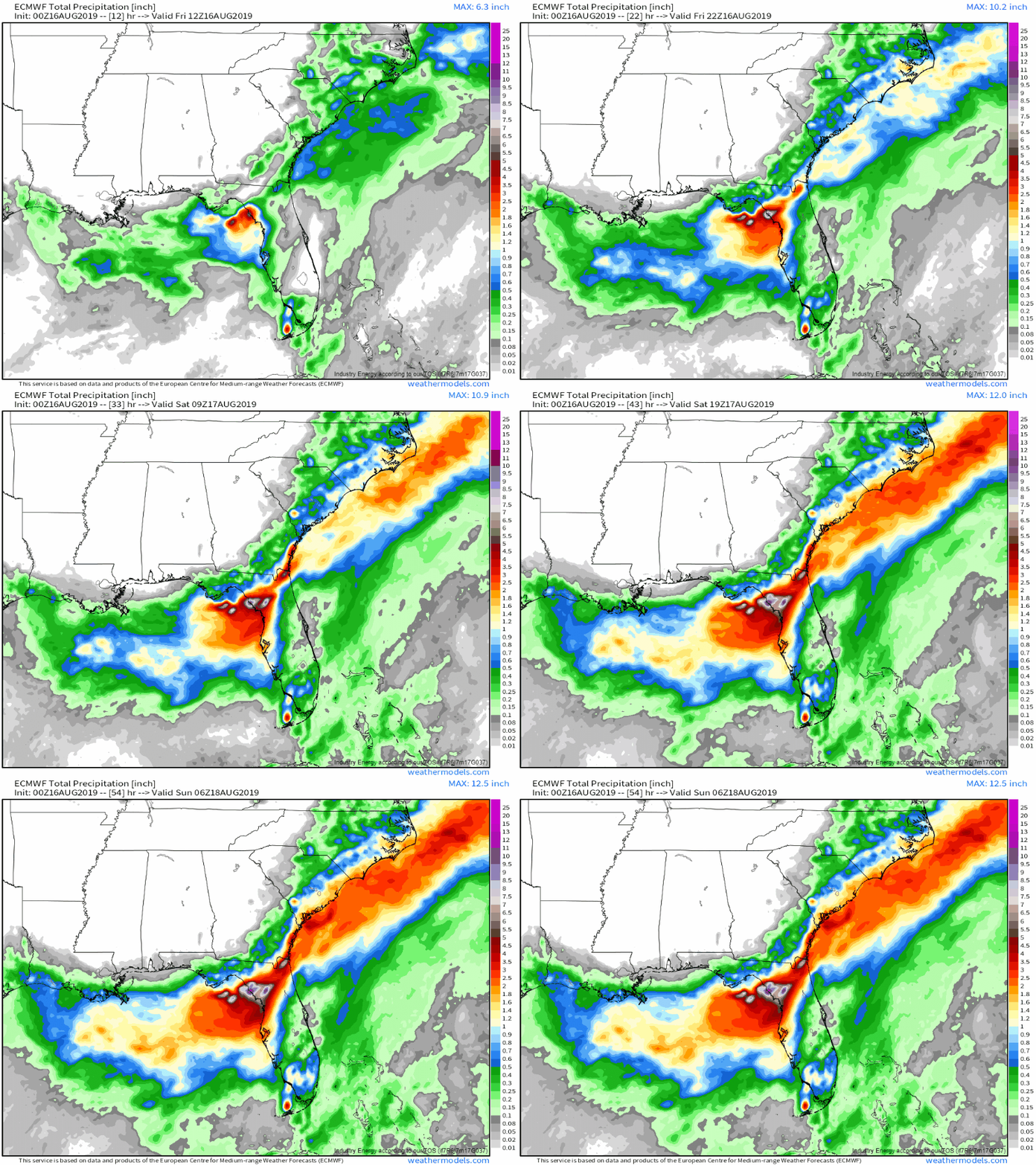
Here’s a look at how the ECMWF expects precip to pile up between this morning and tomorrow evening across the Southeast. The heaviest rains will be found in the northern part of the Florida Peninsula while lesser (but still high) totals can be found elsewhere in that plume of deep moisture including the coastlines of NC, SC, and GA. It’s important to note that the ECMWF will not be able to predict convective precipitation (i.e. rain from thunderstorms) very accurately or very precisely due to the problems it has with figuring out how thunderstorms work. While your town may or may not get as much or as little rain as the loop above shows, if you live in N FL or coastal parts of the Southeastern Atlantic states, you should be ready for very heavy rain and possible flooding problems. GIF via weathermodels.com.
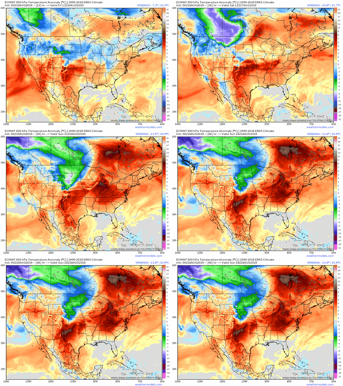
What will temperatures look like this weekend? The ECMWF’s 850mb temperature anomaly forecast is a good place to start when figuring out who will be warmer or cooler than average. Temps will generally be seasonably warm across the East (that means slightly above average, but not unusually so) while the West will be near/slightly above average and some seasonably cool weather will filter into the NW corner of the Great Plains. GIF via weathermodels.com.
Curious about the tropics as we head later into August? Things are looking pretty quiet across the Atlantic Basin this weekend, and that trend should continue into next week. Looking for more info? I talked about the tropics in a bit more detail back on Wednesday and the info presented there is still timely.
-Jack
