Severe Storms Expected In The High Plains Today
Hello everyone!
Today will feature the return of widespread severe weather chances to parts of the High Plains as a seasonably strong upper level trough rotates northeast through the Rockies. Large scale upward motion ahead of this trough, combined with warm temps and high humidity, will contribute to an environment favorable for severe thunderstorms this afternoon/evening. This post will outline what to expect from these storms as well as some of the science behind the setup.
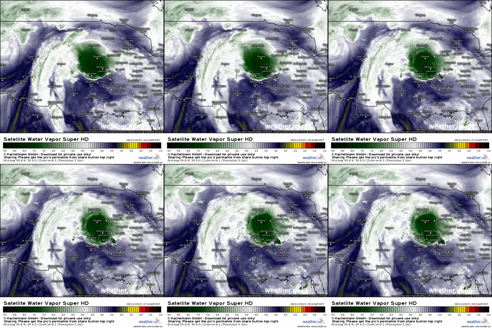
As always, GOES-East WV imagery provides a great look at the large scale pattern going into a severe weather setup. The trough I mentioned above is clearly visible west of Salt Lake City while clockwise flow over the Deep South indicates the presence of an upper level ridge in that area. Southerly flow on the west side of that ridge (visible from Mexico north into NM/CO) will be bringing moisture northward from both the Gulf of Mexico and the Gulf of California. That moisture will help fuel storms this afternoon. The feature that probably grabbed your eye most quickly, the large thunderstorm complex over Kansas City, will play only a limited role in the evolution of storms today though it will remain a flash flood threat as it moves SE this morning.
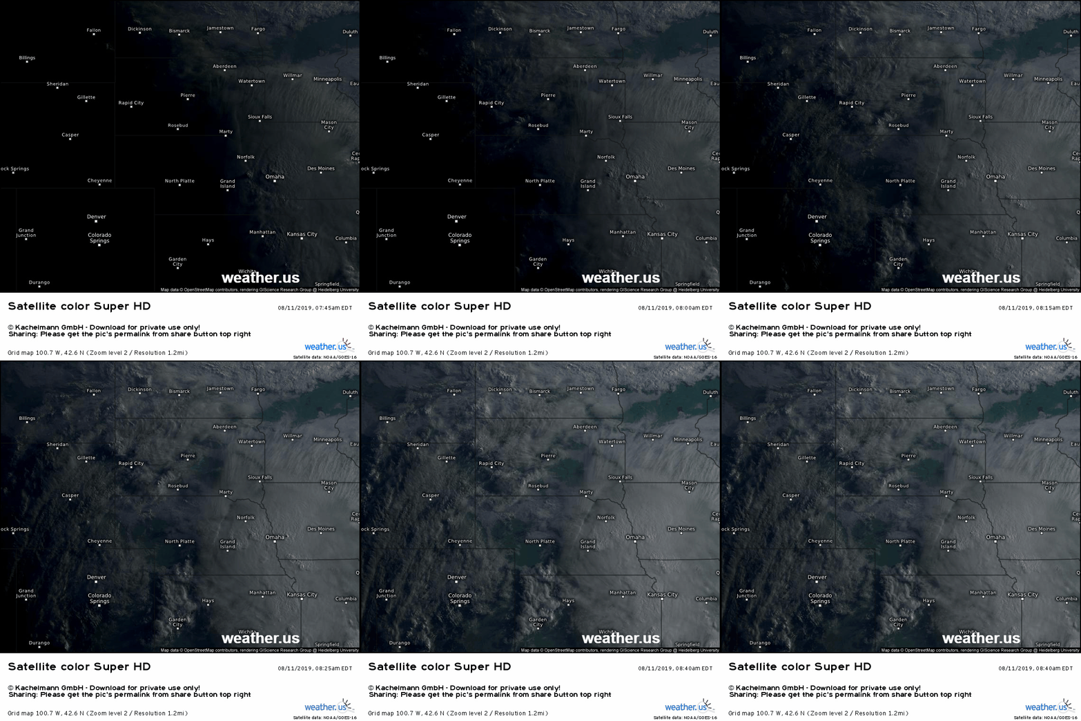
Visible satellite imagery shows a break in the cloud cover across parts of SW Nebraska to the west of the ongoing thunderstorms in the Omaha/Kansas City area. The sunshine will allow surface temps to warm into the mid to upper 80’s this afternoon. Those warm temps combined with the moisture we saw moving north on WV imagery will provide plenty of fuel for strong thunderstorms this afternoon if we can find something to give near-surface air an initial shove in the upward direction. While there aren’t any strong surface boundaries in the area to do this, the Rocky Mountains are certainly capable of firing off thunderstorms, which is exactly what’s expected to happen as we move into the early afternoon.
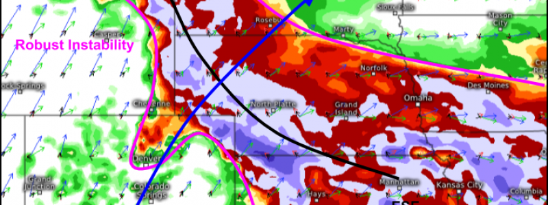
As these storms move east off the mountains, they will be encountering a very favorable environment as shown above by the ECMWF’s Thunderstorm Composite map. Instability on the order of 2-3,000 J/kg will support strong storms, and wind shear (change in wind speed and direction with height) will be strong enough to support storm organization. Initially, storms are likely to be discrete, with some cells evolving into supercells. Later on this evening, the storms will likely “clump up” into larger clusters. Hail, damaging winds, and tornadoes are all possible with the initial discrete storms while damaging wind will be the primary threat associated with the later lines.
Keep an eye on the storms as they develop with GOES-East satellite imagery, HD radar imagery, and our Lightning Analysis tool. Looking for a quick tutorial on how to keep tabs on severe storms with the tools we have at weather.us? We have just that here.
-Jack


