Monsoon Thunderstorms To Continue Dousing The Southwest Today
Hello everyone!
The summer monsoon season is in full swing across the Desert Southwest as we move towards the end of July. Lots of thunderstorms have already brought rain and wind to Arizona and adjacent parts of California, Nevada, Utah, Colorado, and New Mexico over the past few days and more storms are expected to develop this afternoon. This post will briefly outline the meteorological setup behind the monsoon, and what to expect in terms of storm coverage over the next few days.
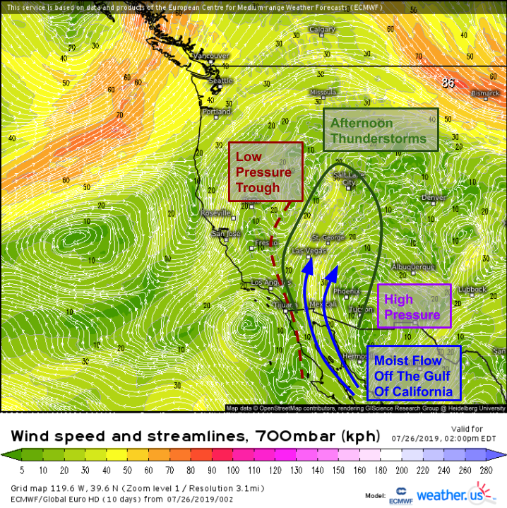
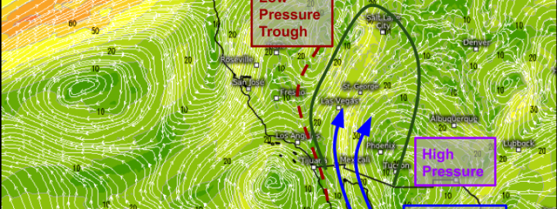
The low/mid level setup (the map above shows winds at the ~10,000 foot level) is very favorable for transporting moisture into the desert. High pressure is located over far SE AZ while a trough of low pressure stretches down the Southern California mountains. Between these features, southerly winds will be drawing moisture northward out of the Gulf of California and into the interior Southwest. As the air holding that moisture gets heated by the strong summer sun, it rises to form thunderstorms.
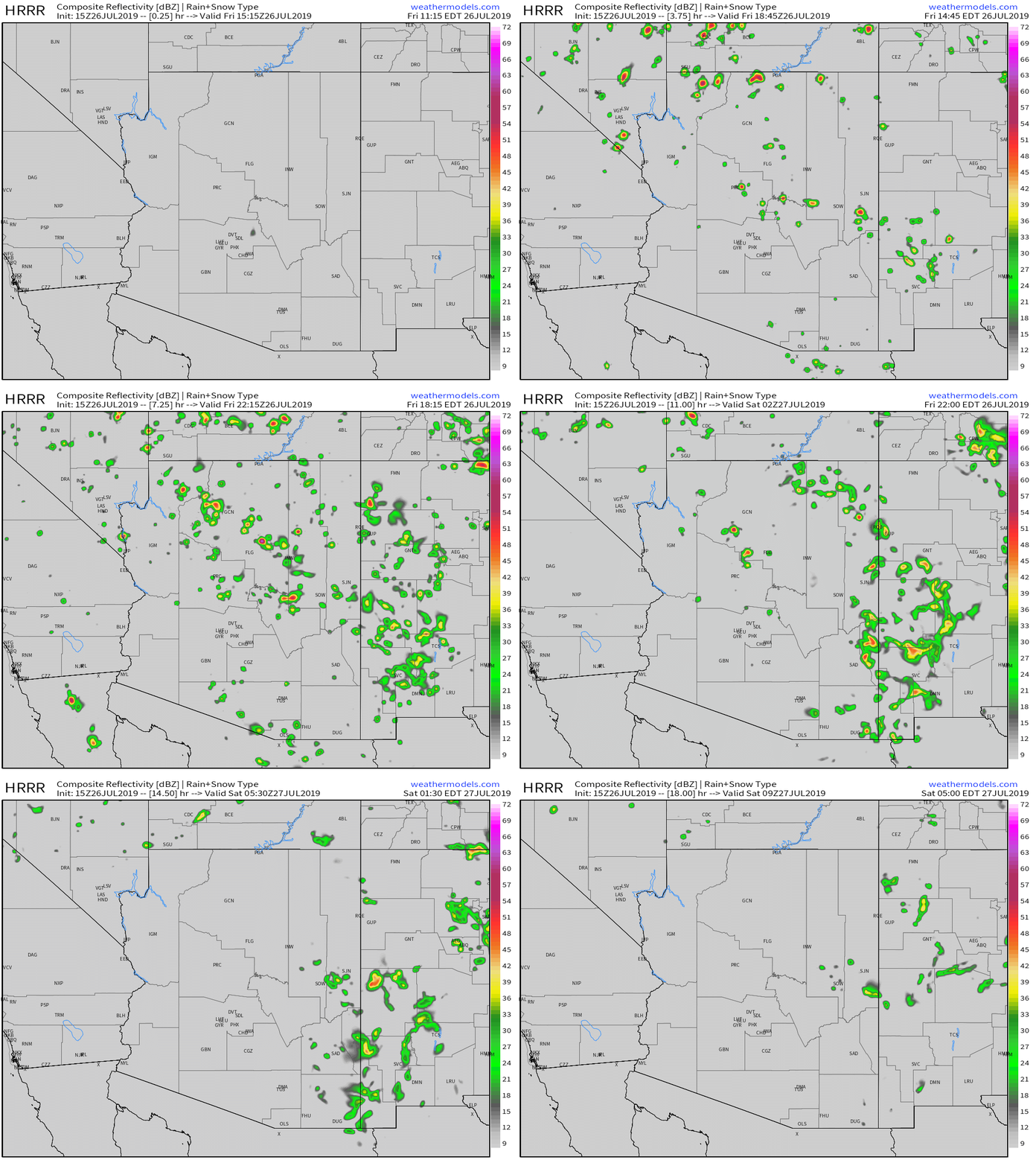
This is the latest run of the HRRR model which shows thunderstorms rapidly developing in the next few hours across Arizona and adjacent parts of the Desert Southwest. These storms will primarily be of the ‘pulse’ variety as there are no strong upper level winds to let the storms organize into big lines. That means that storms will be short-lived, with the biggest threats being torrential downpours that could cause flash flooding, lightning, and briefly intense wind gusts as the storms collapse. Those strong winds can also kick up dust if the conditions are sufficiently favorable, and dust storms are a possibility especially with any of the stronger and longer-lived cells. GIF via weathermodels.com.
What does the forecast look like going into the next few days?
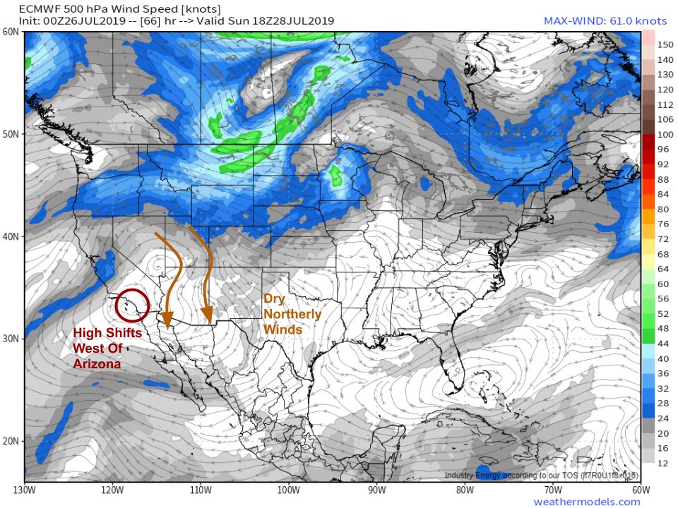
Storms will diminish in coverage and intensity tomorrow as the ridge of high pressure mentioned earlier shifts towards the west. By Sunday, the ridge will be centered near L.A. and dry northerly winds will be present across Arizona and the surrounding areas. As a result, there won’t be much moisture and few if any thunderstorms are expected. Map via weathermodels.com.
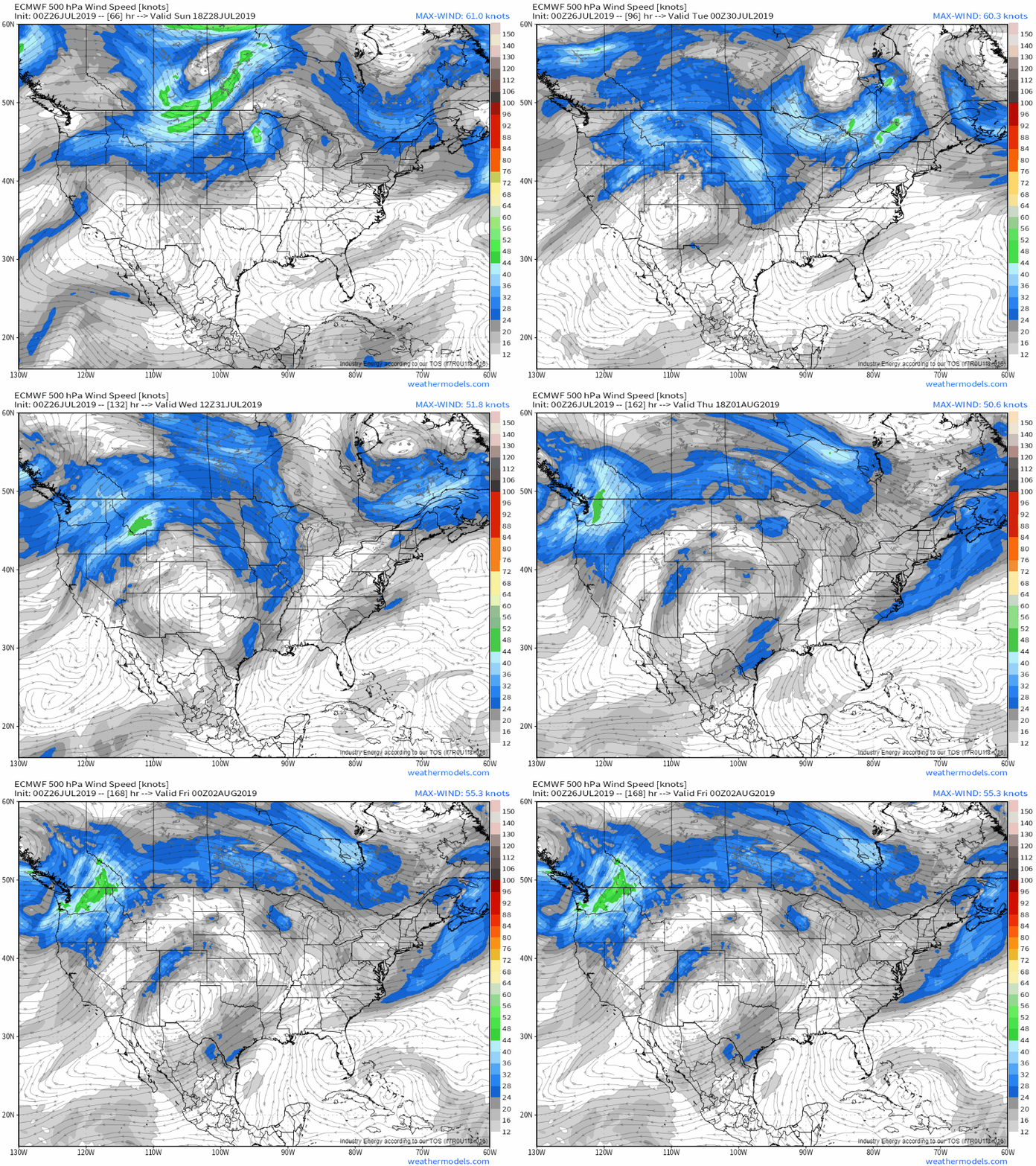
As we move into the upcoming week, the ridge will once again shift back towards New Mexico and southerly flow will redevelop from the Gulf of California through the Southwestern US. As a result, expect many more afternoon thunderstorms beginning on Tuesday. GIF via weathermodels.com.
Curious when exactly the thunderstorms will develop at your place? Unfortunately because these storms are of the ‘pop up’ variety, it’s impossible to predict where and when any given cell will pop up. That being said, the monsoon storms follow a relatively predictable daily pattern, beginning over the higher terrain in the late morning/early afternoon before moving down towards the valleys in the evening. Make sure you keep an eye on GOES-East and HD radar imagery if you have any plans that take you outside in these areas! Our lightning analysis tool will also be valuable for determining where the threat of lightning is present.
-Jack
