Major Warmup In Progress For The Midwest And Northeast
Hello everyone!
Just a few days after dozens of record lows were set across the Midwest as temps dropped into the -20’s and -30’s, a major warmup is in progress with cold air retreating into Canada. This won’t just be a major warmup relative to the recent cold – even temps 40 degrees warmer than what they were this week would still feel frigid – it will actually feel warm as soon as Sunday. So what’s causing the warmup and how mild will it get?
Here’s a look at the dynamics behind the warmup. Each map shows the height of the dynamic tropopause (top of the part of the atmosphere where most weather happens). The higher the heights, the warmer it is (generally speaking). The first frame is this week as the Arctic airmass (white) dove into the US. There are a few things to note here besides that cold airmass. First is the lack of “traffic” in the Atlantic. There are no storms or strong areas of high pressure to block this cold airmass from just continuing on out to the east. Second, there is a strong shot of Pacific air headed for Alaska. Maps via weathermodels.com.
That Pacific air really wants to move east instead of work to displace the Alaskan cold. Thus it exerts an eastward “push” on the Arctic airmass. If there were a big storm out by Newfoundland, or a strong area of high pressure by Greenland, the Arctic air wouldn’t be able to move, and that Pacific air would just go up into Alaska. However in this case there’s nothing stopping the Arctic airmass from moving east, so that’s exactly what happens in the middle image (today). The Arctic air swings out towards the Atlantic and the Pacific air crashes into the Western US instead of Alaska. It’s only a matter of time then before that Pacific air makes its way to the Midwest, which happens this weekend (right image).
So how warm is it going to get?
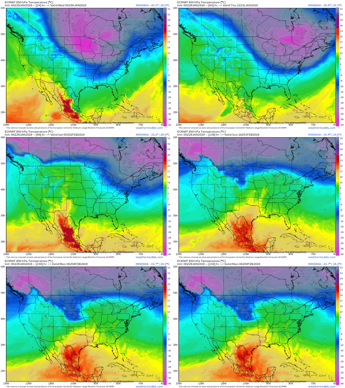
This animation shows how temps at about 5,000 feet are evolving. The -35C temps this past week will give way to +10C temps by Sunday. That’s a rebound of 81F! Despite the fact that most of us don’t live at 5,000 feet, rest assured the rebound in surface temps will be equally dramatic. GIF via weathermodels.com.
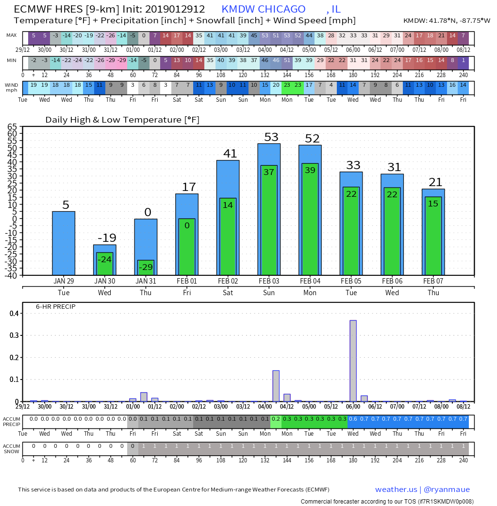
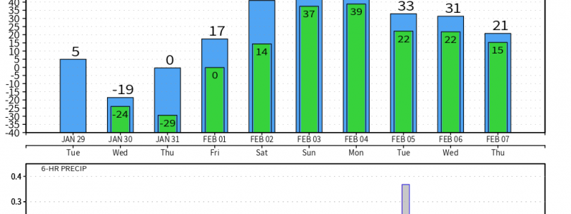
Here’s an ECMWF forecast (from a couple of days ago so it included the cold, updated forecasts paint the same picture) that highlights the remarkable warmup. Temps will rise from the low of -24 yesterday morning (areas just outside the city got even colder) to a whopping 53 by Sunday. Parts of Minnesota and Wisconsin that saw lows below -40 during the height of the cold will make a run at a 100 degree temperature increase over just 84 hours! Chart via weathermodels.com.
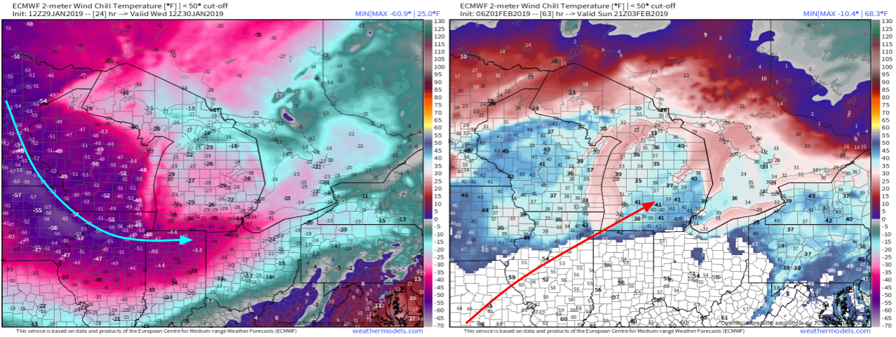
Even more remarkable will be the reversal in apparent temperatures (what it feels like to your skin). After wind chills bottomed out in the -50’s and -60’s, it will actually feel like +40 to +50 by Sunday afternoon. Break out the shorts! Maps via weathermodels.com.
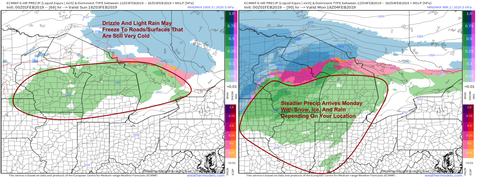
If you were making plans for a beach day, unfortunately a nearby frontal boundary will keep the threat for precipitation around even as temps warm up. On Sunday, precip will be of the lighter variety as no strong dynamics are present to produce heavier rain. This could cause problems with drizzle/light rain freezing to roads that are still extremely cold from this past week. Even if the air temperature is 40 degrees, the pavement might be 15 or 20 degrees, which is plenty cold enough for freezing. Be aware of the potential for slick spots even if air temperatures are above freezing! Heavier precip arrives with a more consolidated storm on Monday. That storm will have a wintry side to it across the UP of Michigan, as well as Northern Wisconsin and Minnesota. The spring-like conditions can’t last forever, it is still January after all! Maps via weathermodels.com.
-Jack

