Major Storm Moving Ashore In California Today And Tomorrow
Hello everyone!
This post will focus on the major Pacific storm moving ashore in California over the next 48 hours or so. The system will bring with it a full menu of impacts from heavy surf at the shorelines, to strong winds in exposed locations, to heavy rain in the valleys and snow up in the mountains. Later this weekend, the storm will redevelop east of the Rockies and bring heavy rain, snow, and mixed precip to the East Coast. More details on that to come in subsequent updates.
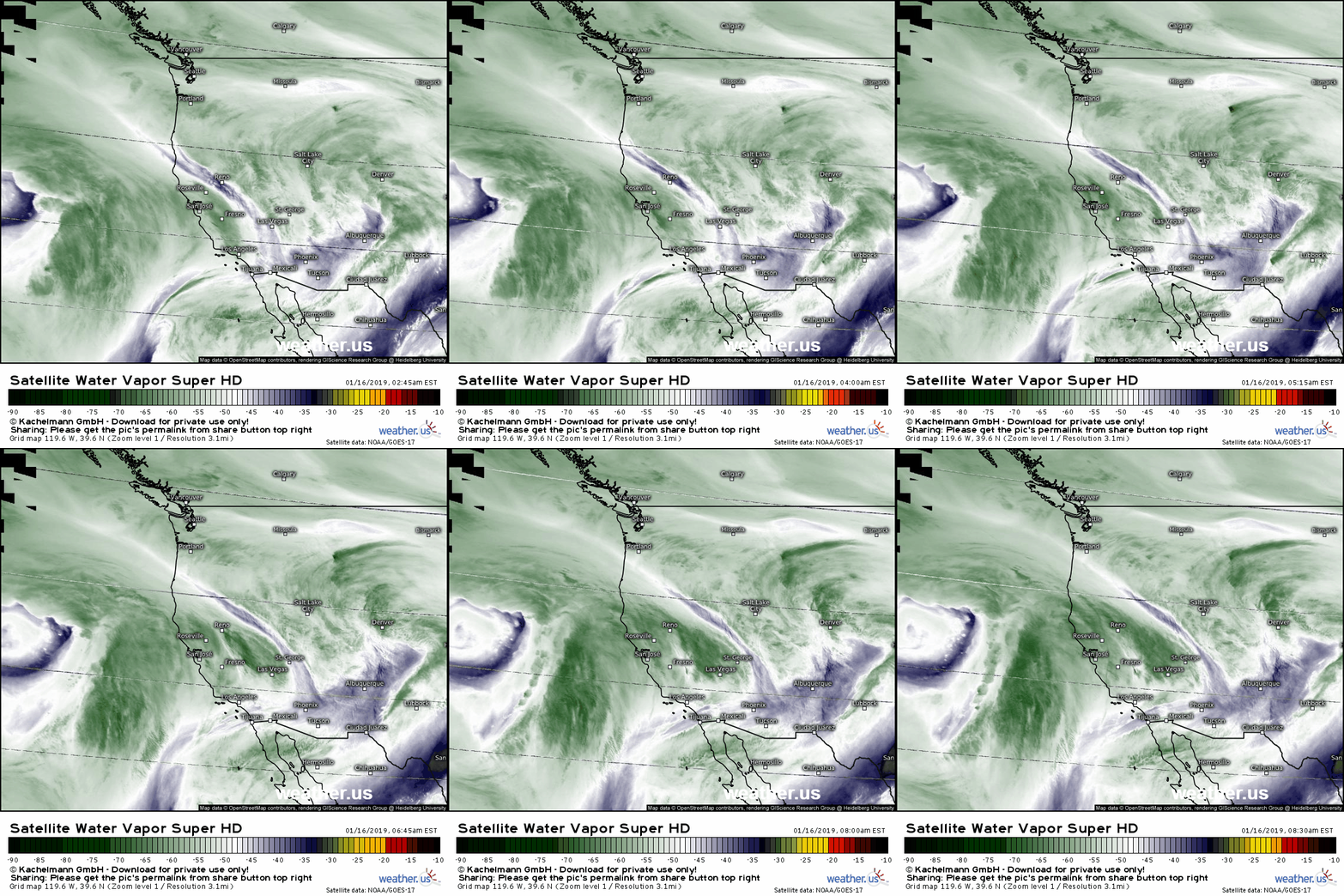
GOES-East WV satellite imagery shows the system spinning towards the West Coast this morning. The system has a deep tropical moisture connection, and the appearance at the end of the loop of speckled patterns in the dry slot (blue area) near the center is a dead giveaway that this storm is packing some serious upper level energy. This will be a fairly major storm for the state of California, but thankfully it will be a fairly fast moving event so no astronomically high rain/snow totals are expected. Generally dry weather will return by Friday.
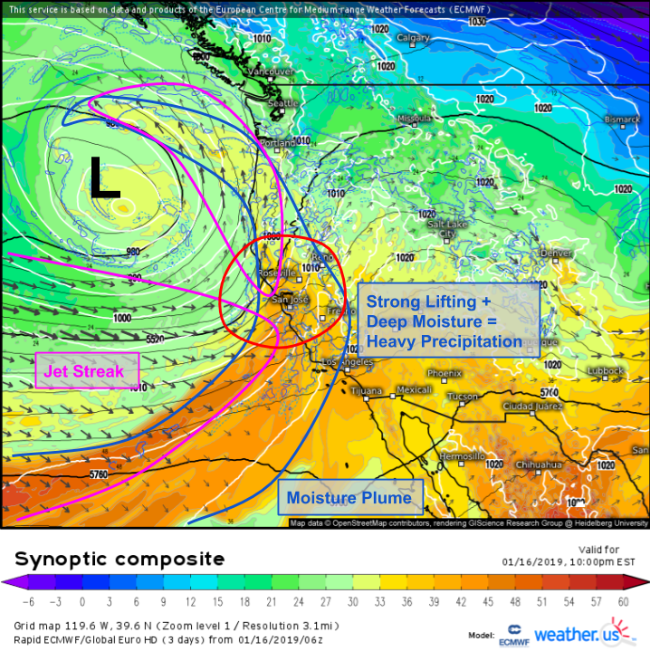
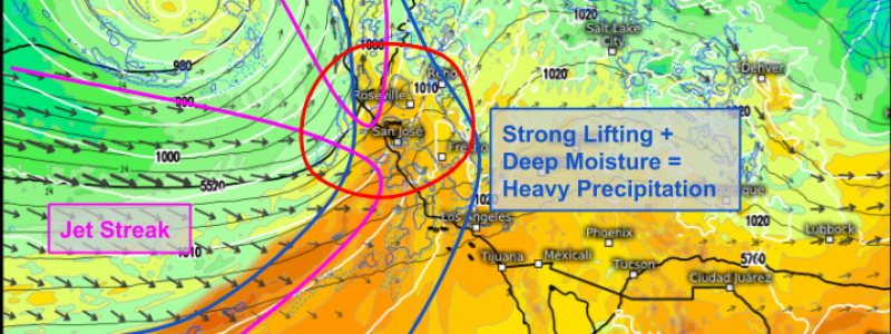
Here’s a look under the hood at some of the dynamics that will be powering the heavy rain/snow. Two jet streaks are noted, one stretching straight across the Pacific pointing at San Jose, and another extending up the coast from the Bay Area towards Victoria Island. The strongest lifting will be located near the transition zone between these two jets as air is forced to decelerate, rise, and accelerate again. Underneath these jets, a strong moisture plume will stretch from the Hawaiian Islands straight to the West Coast. Deep tropical moisture plus strong lifting from the jets (and the mountains too!) is a recipe for heavy precipitation!
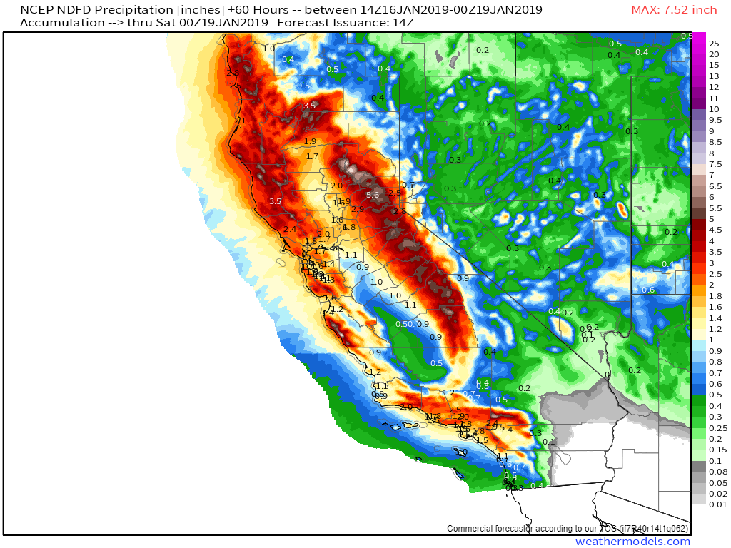
How much precip are we expecting? Here’s the NWS’s forecast which is about the most accurate you’ll get. The jackpot zones will be in the mountains of course, where 3-6″ of rain/liquid equivalent snow will fall. That will translate at the Sierra summits to around 4-6 feet of snow with much lesser amounts in the coastal ranges. Note the area of very heavy rain forecast in the mountains near LA. Plenty of burn scars are present in this area, and once the fires burn out all the vegetation, there’s nothing to hold the mountainside in place. Thus when the rains come, you get mudslides. The threat for mudslides and flash flooding will be very real over the coming days, so be alert if you’re headed near those areas. Via weathermodels.com.
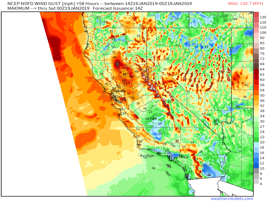
Given the dynamic power of this storm, it’s no surprise that things will get breezy especially up in the mountains. Forecast wind gusts shown here will top 40 mph for a wide portion of Central California, where the best dynamics (associated with the jet streaks) are located. The Sierra Summits will be gusting well over 100 mph, with calmer but still windy conditions down in the valleys. Via weathermodels.com.
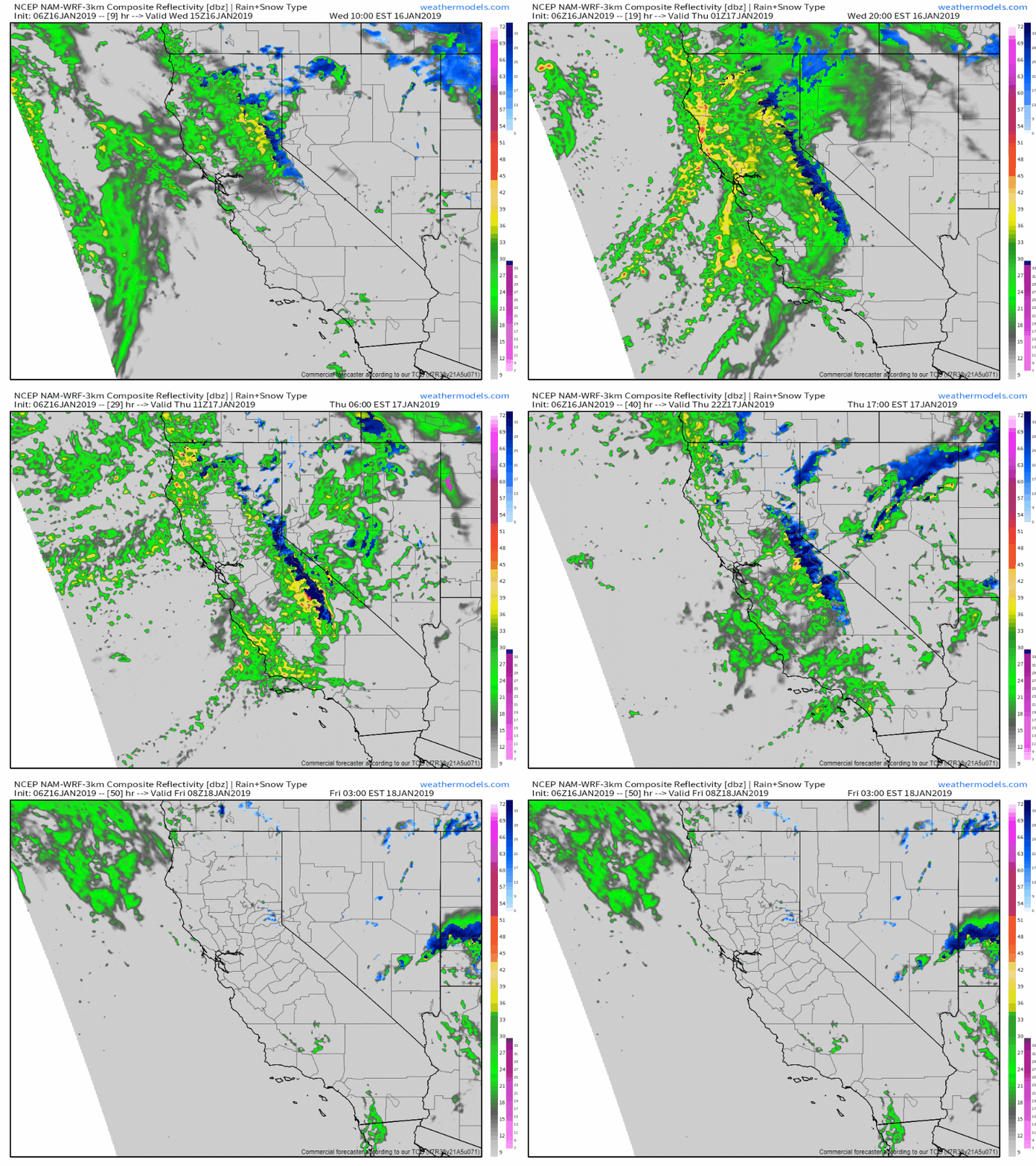
Here’s a look at the NAM model’s simulated radar imagery for the next few days showing the heavy rain and snow impacting California (and adjacent parts of Oregon/Nevada) through Thursday night. Because the core of the storm will remain offshore, widespread severe weather isn’t expected but some of the embedded storm cells that move ashore could bring gusty winds, small hail, and the chance for a waterspout. Drier weather will prevail by Friday as the system cruises east towards the Plains. Via weathermodels.com.
I’ll have details on the second phase of this system (along the East Coast) a bit later on today/tomorrow, but significant rain, snow, and mixed precip are all in the cards for the weekend. Curious about the forecast now? Our ensemble products at weather.us and weathermodels.com are the place to go. There’s still enough uncertainty that any one deterministic run may be pretty far off base, but the ensembles will give you a full range of possible outcomes to help you plan for whatever might happen.
-Jack
