Heading Into An Active Winter Pattern
Hello everyone!
Winter is in full swing from coast to coast as we have a number of storms set to bring rain, snow, and mixed precipitation to a wide array of locations this week. These smaller storms will set up a much larger system to impact the East Coast next weekend, though the details of that storm remain fairly uncertain at this point. This post will quickly run through the forecast for the rest of the week, before taking a brief look at the weekend.
Wednesday
After a quiet day of weather on Tuesday, we’ll see our first signs of action on Wednesday. The day will start out with two systems to watch, with a third developing later in the evening. The first system will travel through Southern Canada, dropping an Arctic cold front south through the Northeast. That cold air will reinforce the existing Arctic airmass and set the stage for another system to arrive on Thursday. That system can be seen developing over the Central Plains late in the loop above.
Meanwhile in the West, a powerful storm will wind up west of California with heavy rain and mountain snow developing later Wednesday night. Midslides will continue to be a threat while the base gets deeper and deeper up at the ski areas. Winds will kick up out of the south west, especially along the coast and at higher elevations. GIF via weathermodels.com.
Thursday/Friday Clipper
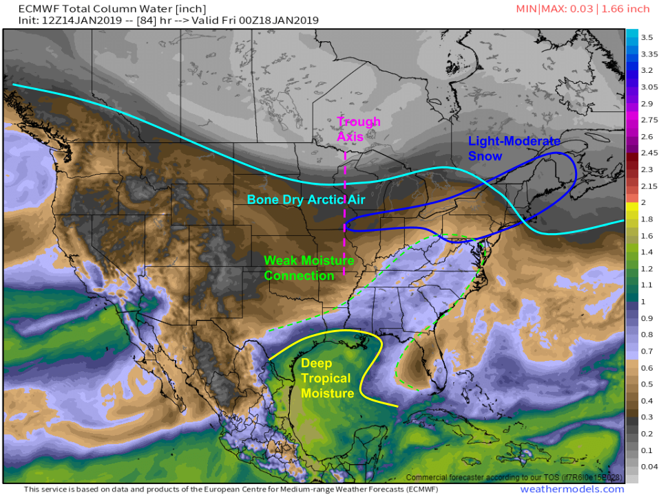
Here’s a look at the ECMWF’s precipitable water forecast for Thursday night. The clipper system to note can be seen pulling some shallow moisture north from the Gulf, while the deeper pool of humid air remains confined to coastal TX/LA. That shallow moisture will encounter some very cold and very dry air seen across Canada. A narrow stripe of snow will result from the clashing airmasses, stretching from the Chicago area towards the Northeast. Amounts from this system will be on the lighter side, generally ranging from 1-3″ on the southern/western sides of the system to 2-4″ across parts of the Northeast. Map via weathermodels.com.
Weekend Storm Setup
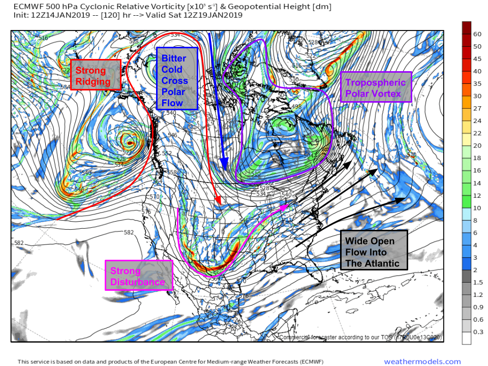
Heading into the weekend, a storm threat is likely to emerge from the Southern Plains out towards the East Coast. Here’s an ECMWF upper air map that highlights some of the key features to watch over the next few days. The storm itself will move onshore in California on Wednesday with heavy rain and mountain snow. To its northwest, a strong ridge will build towards the North Pole, forcing deep cold air southward through Canada. A lobe of the Tropospheric Polar Vortex will be centered near Hudson Bay with wide open flow into the Atlantic. How all these elements interact will determine the track/intensity of the storm, and unfortunately that picture is still a bit blurry. Map via weathermodels.com.
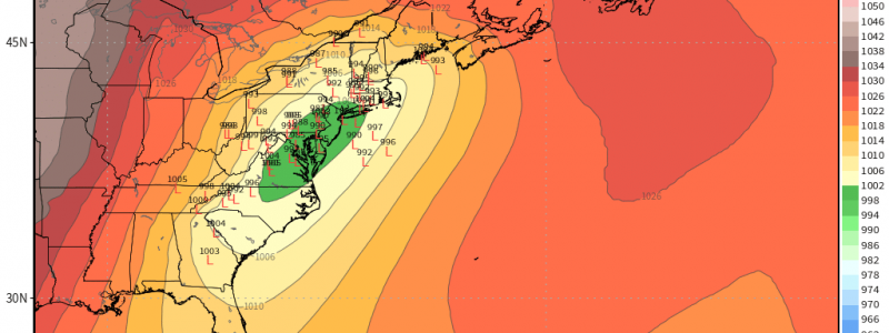
Here’s a visualization of that “forecast blurriness” via the EPS ensemble system. Each “L” on the map marks one possible location of the storm. As you can see, the range of possible outcomes includes somewhere along/west of the Appalachians (mainly rain east of the mountains), somewhere along the coastal plain (big mountain snows, mix/rain at the coast), and somewhere offshore (less precip in the mountains, big coastal snows). The extreme solutions (rain for all or snow for all) both only have a couple members supporting them, so are on the less likely side. Our best guess as of now is that the system will track somewhere along the coastal plain with a mix of heavy rain, snow, and mixed precip from Georgia to Maine and everywhere in between. More details on this storm to come. Map via weathermodels.com.
-Jack


