Pacific Storm To Bring Heavy Rain And Mountain Snow To California Today And Tomorrow
Hello everyone!
A strong Pacific storm will approach California today, bringing heavy rain and mountain snow to the state through tomorrow. Several inches of rain are expected in the coastal mountain ranges, which could cause mudslide problems in areas affected by recent wildfires. Up in the mountains, heavy snow will be falling with several feet expected for the peaks of the Sierras. The storm will move east on Thursday evening, bringing snow to the Southern Rockies Friday and Saturday before moving out into the Plains.
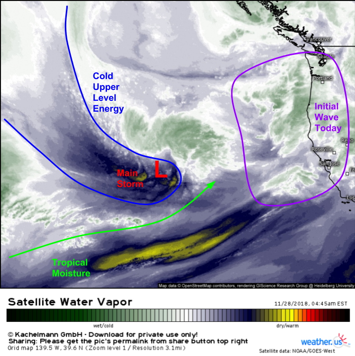
To start off, let’s quickly take a look at WV satellite imagery along and off the West Coast. Two systems are visible, a weak initial wave close to the CA coast, and a much stronger storm farther offshore. The lead wave will bring an “appetizer” round of rain and snow today before the main event arrives tomorrow. That main storm is tapping both cold upper level energy from the Aleutians as well as tropical moisture from near Hawaii, meaning the setup is ripe for heavy precipitation.
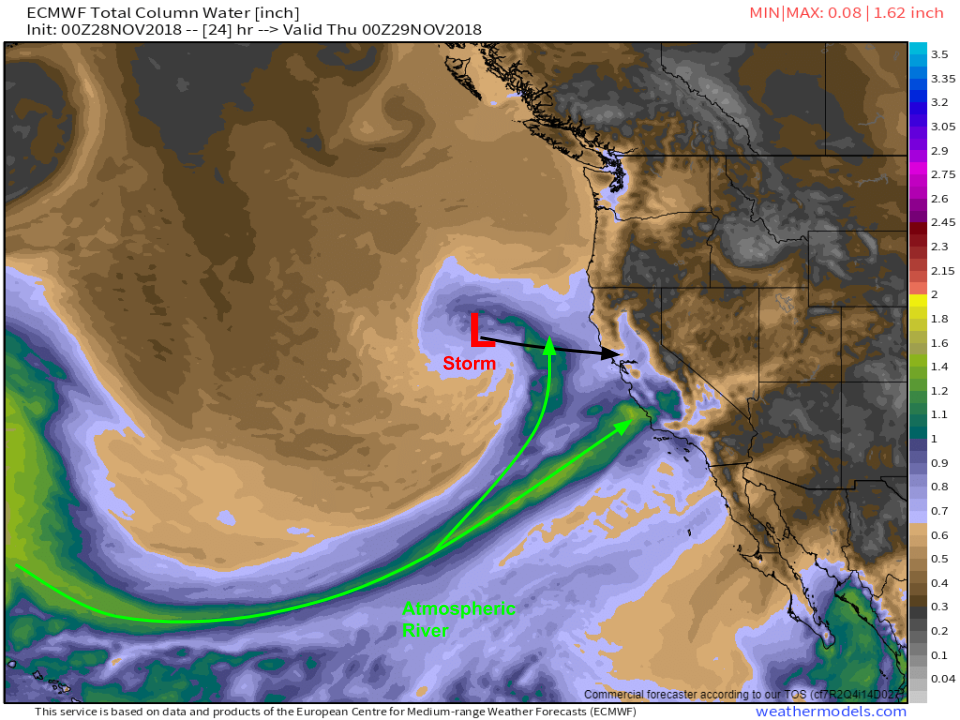
The ECMWF’s moisture forecast for tonight shows the stronger storm moving closer to the coast, with a deep tropical connection stretching down to Hawaii. The moisture plume will be split into two branches. The northern branch will be the weaker of the two, heading for the Bay area and Northern Sierras, while the stronger southern branch is pointed closer to the LA area/Southern Sierras. Map via weathermodels.com.
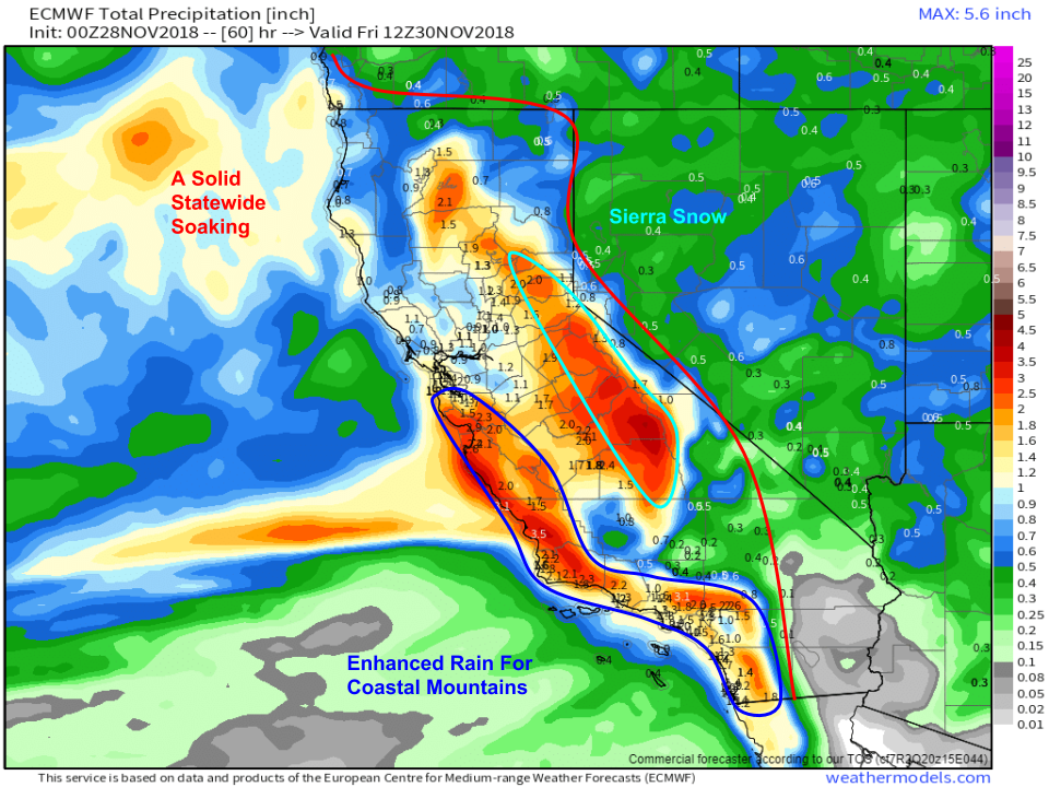
The two-branch structure of the moisture plume will heavily influence precipitation totals. The heaviest rain will fall along the coastal mountain ranges south of the Bay Area where a general 2-5″ is likely. Localized totals will likely be a bit higher depending on how individual showers/rain bands set up. Farther north, lighter totals are expected but the only part of the state likely to get less than a half inch is the far southeastern corner. Overall, this will be a good state-wide soaking. Map via weathermodels.com.
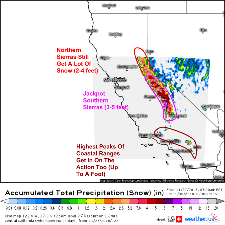
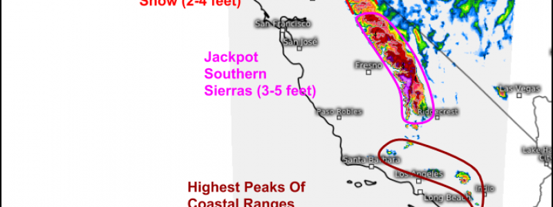
Up in the mountains, there will be plenty of snow as highlighted by our Swiss Super HD model. As with the rain totals, snow amounts will be influenced by the two branches of the moisture plume. The Southern Sierras, in the path of the stronger southern branch of the moisture plume, will see the most snow, likely in the 3-5 foot range for the summits/passes. Farther north, 2-4 feet is likely for the Northern Sierras with the northern, slightly weaker moisture plume branch. Additionally, some snow is expected even as far south as the summits of the coastal mountains near LA, though totals will be considerably less there.
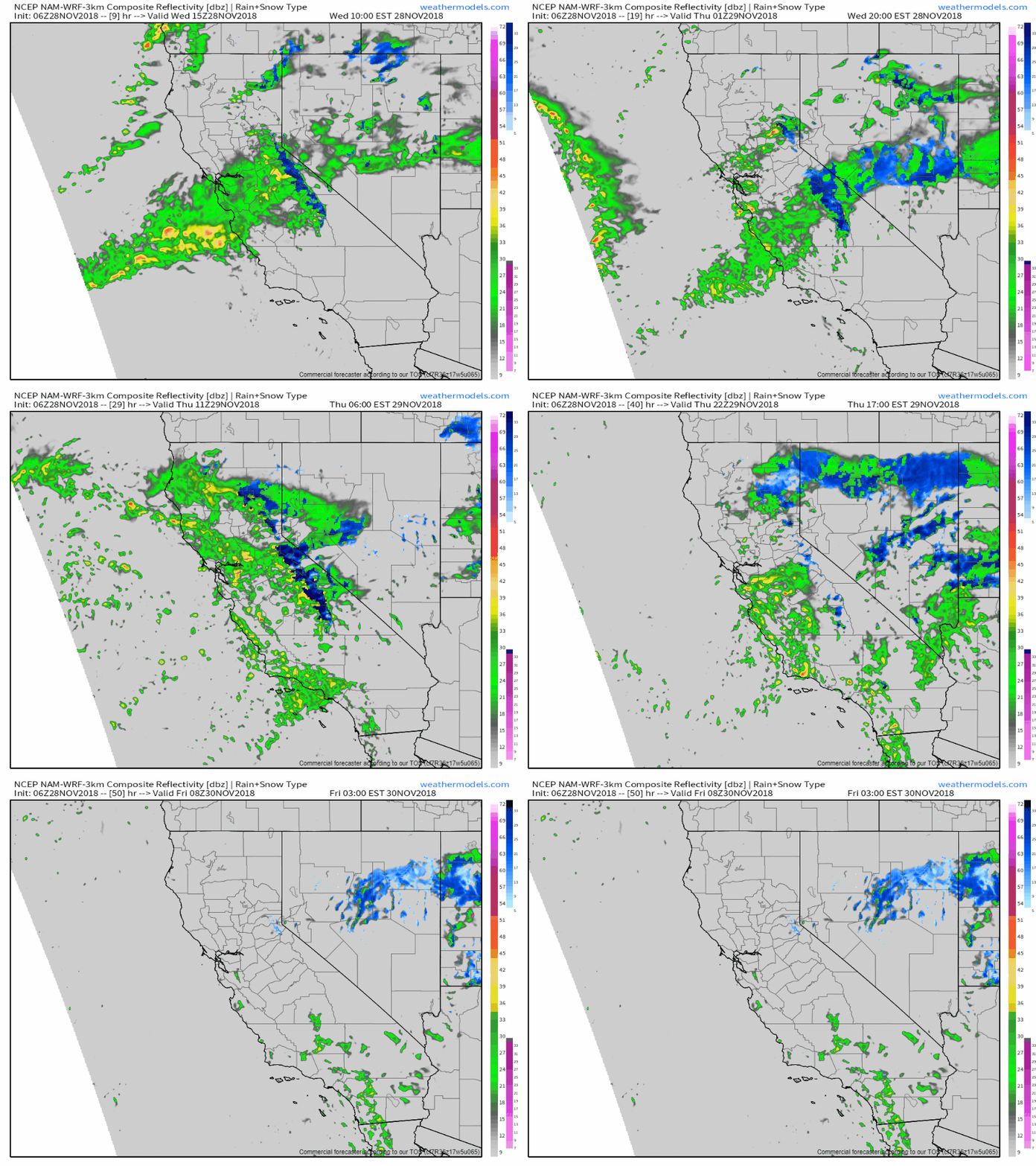
Here’s a general overview of the system’s evolution through Thrusday. Note the lighter rain/snow today due to that lead disturbance, with the heavier bands of rain and snow arriving with the main storm tomorrow. You can even see the swirl of the storm’s circulation drifting southeast, “making landfall” south of San Francisco. GIF via weathermodels.com.
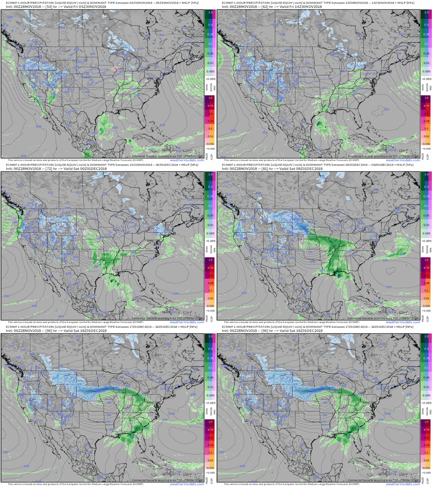
After the system exits California, it will move through the Rockies bringing moderately heavy snow accumulations on Friday. The storm will emerge out onto the Plains Friday night, with more widespread Midwestern impacts moving into Sunday. These impacts will include severe weather in parts of the southern MS valley, and snow up in the Dakotas, Nebraska, Minnesota, and Iowa. More details on “Act Two” of the storm will be posted here tomorrow. GIF via weathermodels.com.
-Jack
