Quiet For Thanksgiving Travel Wednesday, Turning Stormier In The West Later In The Week
Hello everyone!
With the holiday week upon us, it’s time to take a quick look at the conditions for folks travelling to see friends and family for Thanksgiving. Historically, the day before Thanksgiving is the busiest travel day of the year, so of course any weather interruptions will be magnified. Thankfully, the active pattern in the East will be temporarily on pause, and the shift to stormier weather in the West will wait until Thursday/Friday.
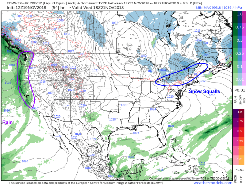
As a result, Wednesday looks to be fairly quiet from coast to coast with any travel interruptions being non-weather related. The two exceptions to this will be in the Northeast where snow squalls are expected along an Arctic cold front, and the West Coast where some rain will arrive in advance of the first storm in a cycle expected to bring heavy rain and mountain snow heading into the weekend. Map via weathermodels.com.
Here’s a look at each element of that storm cycle, visualized by the ECMWF’s precipitable water (moisture) parameter. Notice the surges of tropical moisture paired with cold upper level energy on Wednesday, Friday, and Sunday. This combination will result in heavy rains for the valleys, and heavy snow higher up in the mountains. The exact timing of each round of rain and snow will depend on the exact location of each of those disturbances. Roughly speaking however, expect a period of stormier weather from Wednesday afternoon through Sunday evening. Map via weathermodels.com.
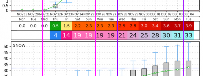
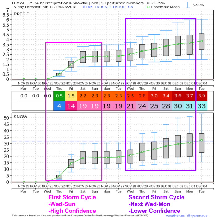
What will the results of this storm cycle look like? Here’s a look at the forecast for Tahoe California where up to two feet of snow could fall this weekend. While the snow will be fantastic for the ski areas, heavy rains at lower elevations could cause problems for areas burned out by the recent wildfires. The combination of heavy rain and vegetationless slopes will result in a mudslide/debris flow threat. Be aware if travelling through or near these areas! Another storm cycle is possible next weekend, but the details are still yet to be determined as that system remains 7-10 days out. Map via weathermodels.com.
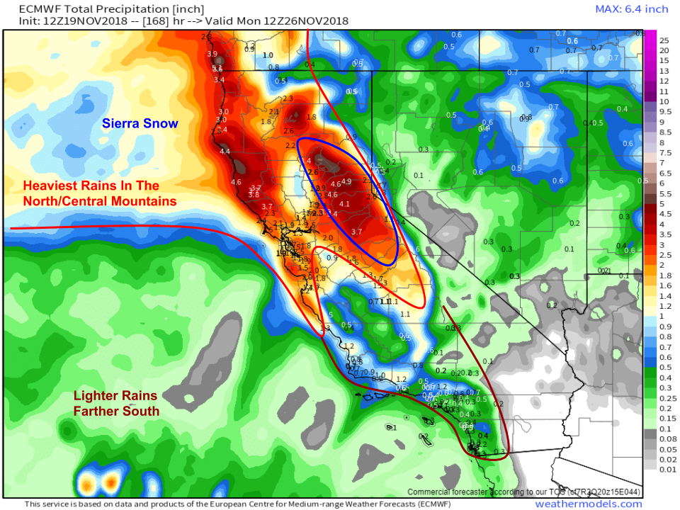
Total precip amounts could exceed 5″ in the mountains of Northern California where the most rain/snow is expected to fall. Lighter amounts are expected farther south, away from the best upper level dynamics. Note though that even 1-2″ of rain on the Whoolsey/Hill fire burn scars could be enough to cause mudslide problems. Map via weathermodels.com.
As always, detailed forecast info for your town can be found at weather.us.
-Jack


