Why Upper Level Ridges Can Reduce Air Quality
Hello everyone!
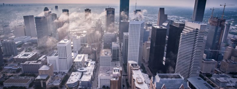
This post will talk about upper level ridges and how their effects on something called the Planetary Boundary Layer can lead to decreased air quality. To illustrate this, I’ll be talking about the forecast for this week in the Pacific Northwest where a large ridge of high pressure is forecast to develop early this week, resulting in poor air quality for parts of Washington and Oregon.
So why do high pressure systems result in bad air quality?
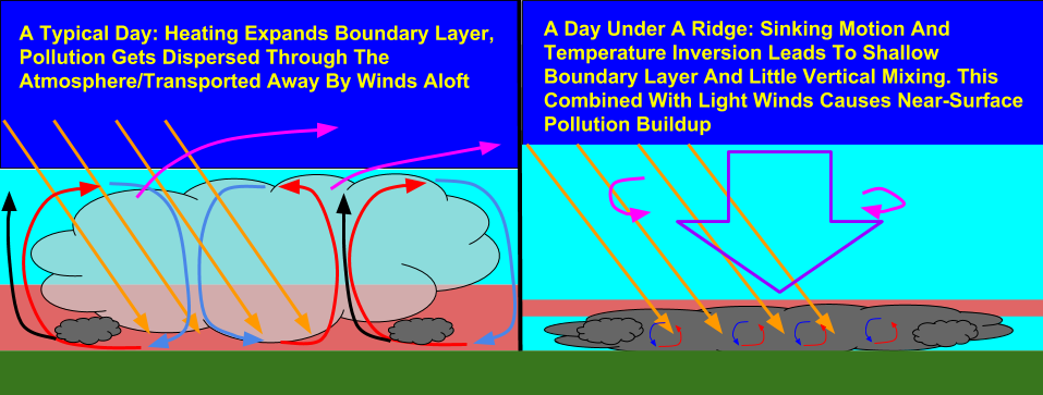
Here’s a quick schematic showing theoretical cross sections of the atmosphere under two sets of conditions. The first is a “typical day” without any sort of strong high or low pressure. Pollution generated by vehicles, factories, and other sources at the surface gets mixed through what’s known as the “Planetary Boundary Layer”, or PBL for short (also referred to as the mixing layer). In the PBL, thermal circulations develop due to daytime heating, with warm air rising, then cooling, and sinking again. These circulations, known as convection currents, vertically mix the air in this layer.
So how does that relate to air pollution? From chemistry, we know that the concentration of any substance is how much of that substance you have, divided by the volume through which that substance is distributed. On a typical day, however much pollution we generate is distributed through a fairly deep layer, leading to a fairly low overall concentration of pollutants. One other factor helping to spread pollutants out over a wider area on a typical day is winds. Usually, winds will transport pollutants away from their source, with the concentration of those pollutants decreasing over time.
Under a strong ridge, the mechanisms that usually disperse pollutants are not present. Strong sinking motion suppresses any thermal circulations that attempt to develop. Additionally, there is often a temperature “inversion” present, where the temperature rises with height, further suppressing vertical motion. Finally, the winds that typically disperse pollutants over large areas aren’t present, so all the pollution we generate ends up getting trapped in the very low levels, which unfortunately is where we live and breathe.
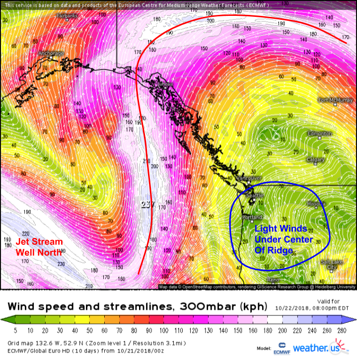
A look at a few forecast parameters for Monday evening show all the ingredients in place for poor air quality in Northern Oregon and Eastern Washington. Upper level wind forecasts show a strong ridge pushing the jet stream well north of the region, with light winds located over the Northwest.
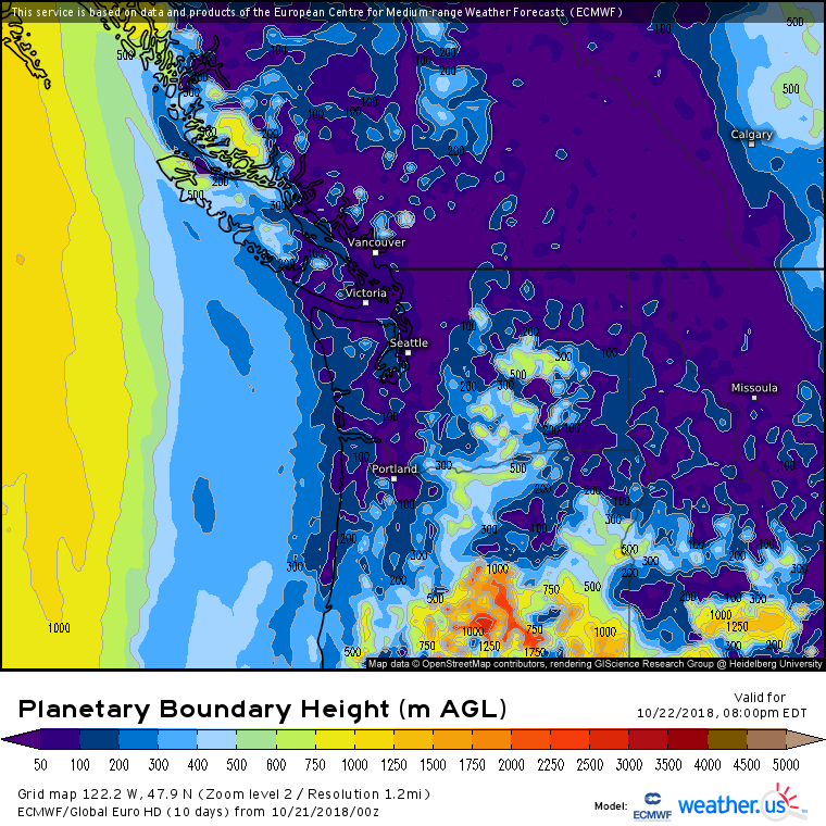
Our newly added PBL maps from the ECMWF model show very low PBL heights across the region we’re looking at. The height of the PBL usually depends largely on the time of day. During the daytime hours, heating from the sun generates warmth at the surface. This warm air then rises, cools, and sinks back down again, where it is re-heated and the cycle repeats. As this process takes place, the layer expands, and thus the height of the top of the layer (which is what’s displayed on the map above) rises. At night, there is no heating, and thus no mixing, so the layer disappears (height = 0m). The map above is valid at 5 PM Pacific Time tomorrow. This is at the tail end of the heating cycle, so typically the PBL would be fairly deep (which is what you see over Southern Oregon). However, over Washington, the PBL is very shallow, despite the presence of heating.
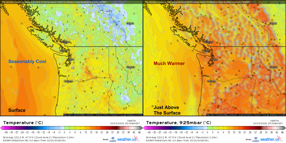
As night falls tomorrow, the temperature inversion in place will strengthen, concentrating pollutants even closer to the ground. Notice temps around 10C at the surface, and around 20C just above the surface (~1,000 feet for central/eastern Washington). Unfortunately, this rounds out our list of ingredients for poor air quality.
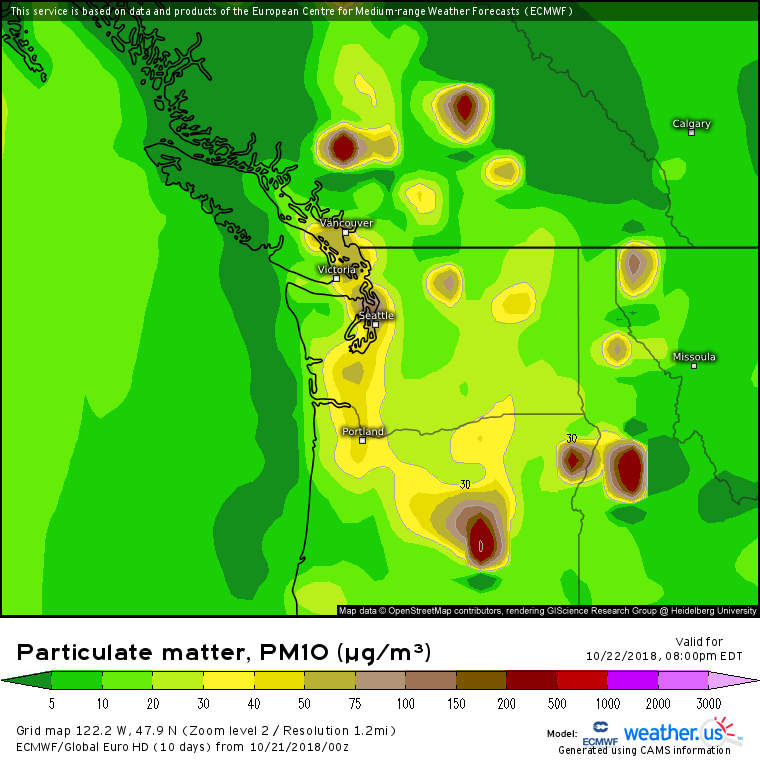
Sure enough, forecasts from the ECMWF’s Copernicus Atmospheric Monitoring Service (CAMS) show elevated levels of particulate matter (pollution) from north-central Oregon through Eastern Washington on Monday. Try to limit any strenuous activity while the air quality is bad, and if you have any respiratory problems, follow the advice of your doctor to mitigate the harm caused by poor air quality.
An incoming trough will clear the air (literally!) later this week.
-Jack
