10-17-18 Morning Roundup: Still Raining In Texas, Lake Effect Getting Underway Up North
Hello everyone!
More generally quiet weather today, so this update will be another on the shorter side. The two features to watch will be the same two general features we looked at yesterday, including rain in Texas and the lake effect developing as a result of a strong cold front in the Great Lakes. Neither will be overly impactful, though Texas surely doesn’t need any more in the way of rain this week.
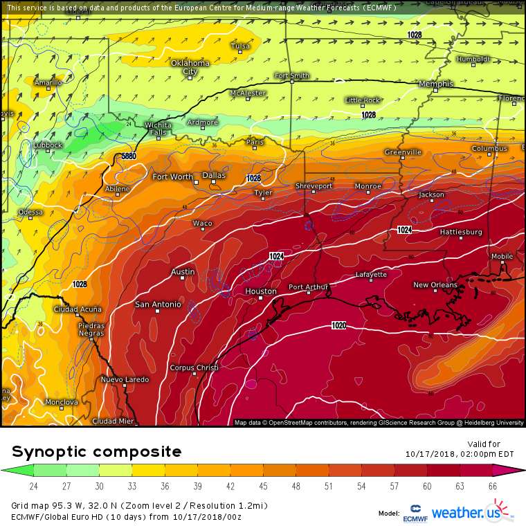
The ECMWF’s synoptic composite map shows a setup favorable for some heavy rain again today, as the features that contributed to yesterday’s rain have shifted little in position. A jet streak is still noted from the TX Panhandle through OK and into MO, with the right entrance region over NE TX promoting general rising motion. Tropical air is still in place over SE TX, and is getting drawn both north and up by the jet streak circulation. This will result in rain once again extending from San Antonio east towards Shreveport. Note though that surface features are much more muddled today than yesterday, and the jet streak is weaker/fragmented, so we’re not looking for a repeat deluge, just more rain that’s not really needed.
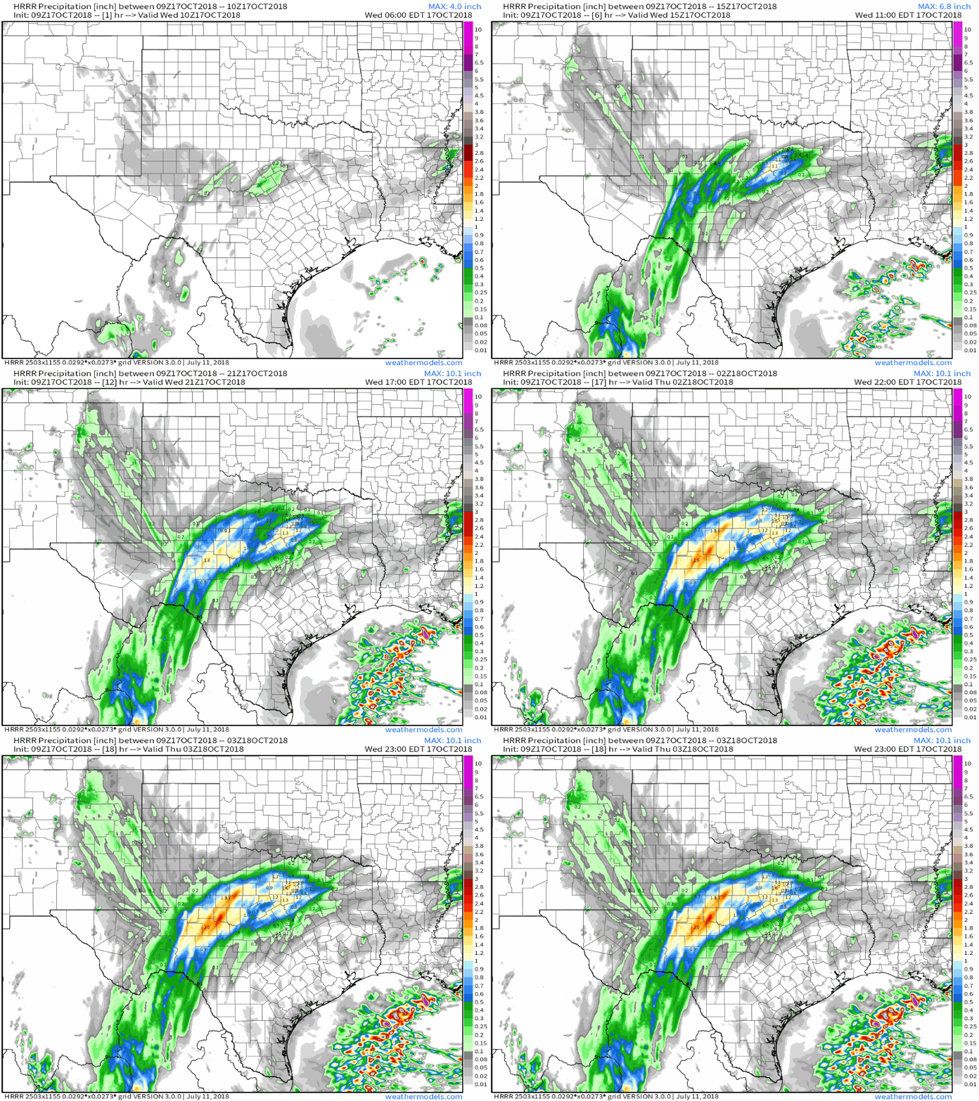
Here’s a general look at how rain should pile up through the day today. Note that rates won’t be as extreme as yesterday, but still another 1-3″ in places like Austin will be problematic in terms of continuing flooding. Rain will be spreading east towards Dallas and Shreveport later tonight, but less rain has fallen there in previous days, so widespread problems aren’t expected. GIF via weathermodels.com.
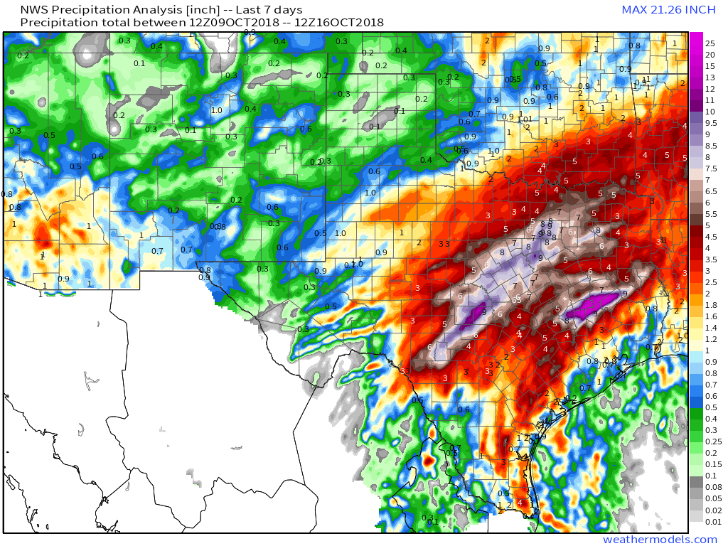
So just how much rain has fallen in parts of Texas over the past few days? A lot. Several places have seen over a foot of rain. This is the “backstory” so to speak. Without this rain already having fallen, there’d be little concern from 1-3″ spread out over the course of the day. But because rivers are already so full, and soils already so saturated, today’s rains will be much more impactful than we’d usually expect. Map via weathermodels.com.
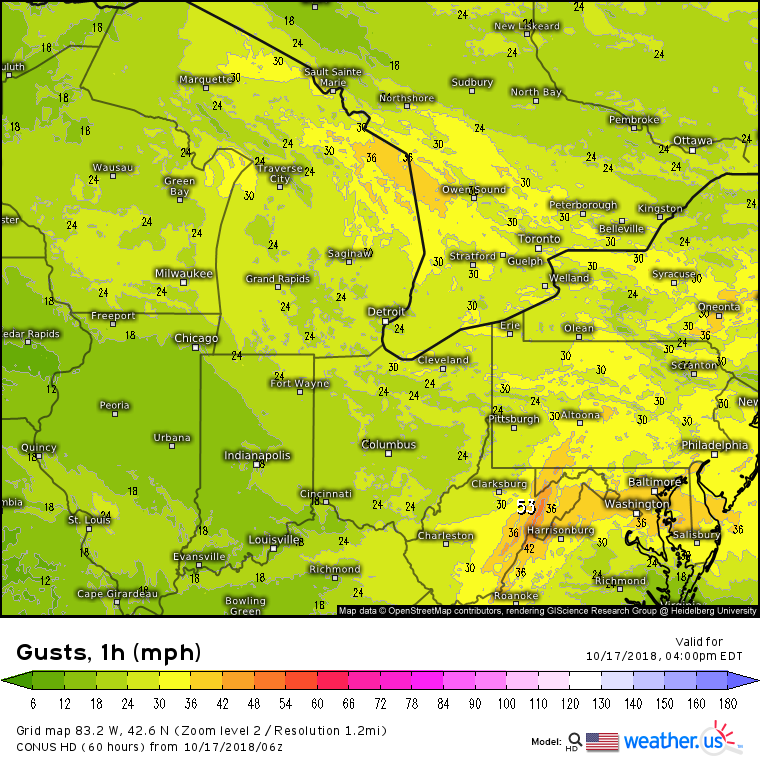
Meanwhile in the Northeast, winds will be picking up as a strong cold front rolls through today. The highest gusts will be in the high terrain of West Virginia, but plenty of locations will see breezes in the 30-40 mph range. That’s not enough to cause widespread power outage problems, but sure is enough to notice, especially when the wind is biting from the northwest.
Cold northwest winds also have other implications, namely lake effect. The lakes will kick into gear this afternoon/evening as the cold airmass moves in. Initially, much of this precip will be in liquid form, but as the sun sets and temps drop, look for rain to mix with/change over to snow, especially in New York’s higher terrain. A dusting to perhaps inch is possible in the more concentrated bands, but we’ll have to wait until later in the season to see any significant accumulations.
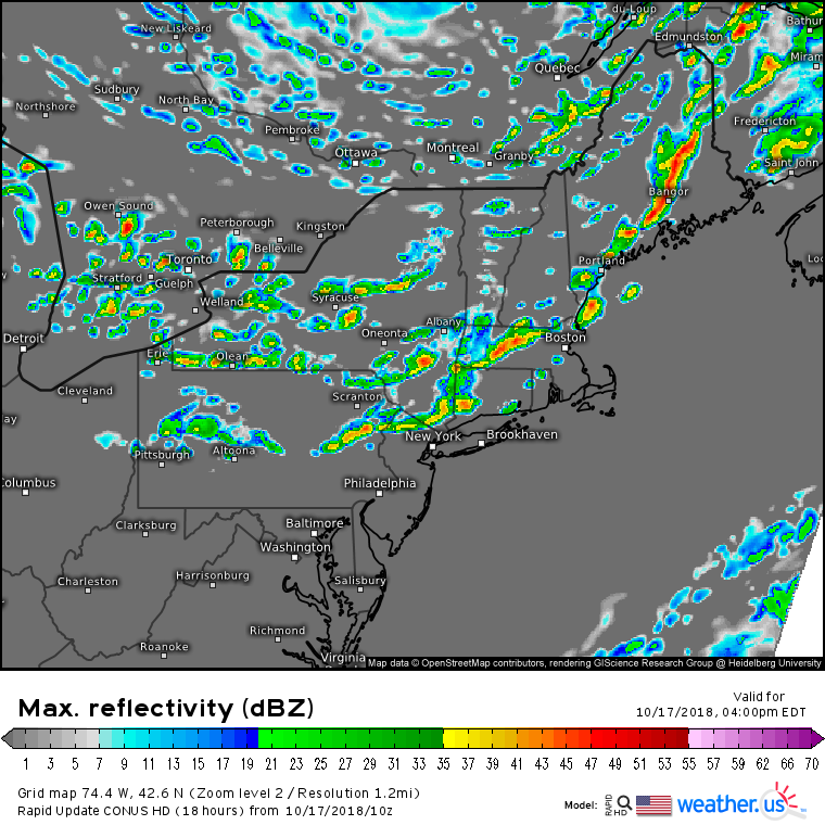
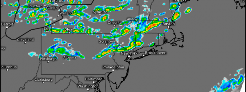
A quick note on the front itself, as the impactful weather won’t be limited to its aftereffects. High resolution modeling is picking up on the idea that the front will be marked by a line of squalls in New England this afternoon. This is supported by the strength of the front, and a tiny bit of instability that exists out ahead of it. These squalls could be fairly nasty with briefly blinding rain/graupel (snow grains) and wind gusts over 40 mph. A clap of thunder can’t be ruled out in the stronger cells. While these are unlikely to fall into the category of severe storms, they are something to be aware of as you head out this afternoon! They’ll likely be moving into Boston and Connecticut just in time for the PM commute.
-Jack
