10-16-18 Morning Roundup: Texas/Louisiana Rain, New Cold Front In The Great Lakes
Hello everyone!
With no substantial regionally significant storm systems to monitor this morning, this post will just be a quick roundup of a couple smaller, less impactful, but still neat features to note. The two main areas I’ll focus on will be Texas/Louisiana, where heavy rain is expected, and the Great Lakes where another cold front will be driving southeast.
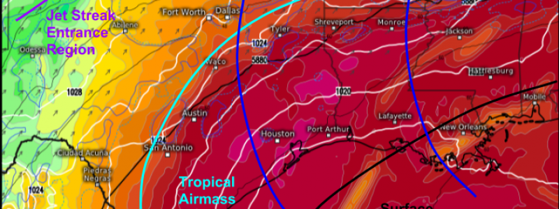
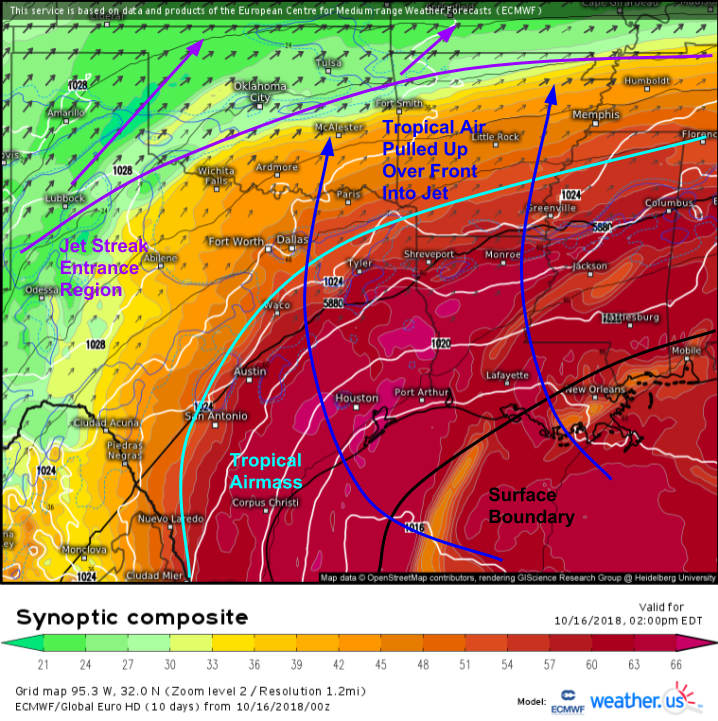
Here’s a look at the ECMWF’s synoptic composite forecast for this afternoon. The general setup is pretty straightforward. A surface boundary exists over the Gulf of Mexico. A jet streak extends from New Mexico up through Oklahoma into the Midwest. The entrance region of this jet is located over Northeastern TX/Southeastern OK/Northern LA. Tropical air from the Gulf of Mexico is getting pulled up over that front towards the jet. As this tropical air rises, it cools/condenses to result in rain. This rain will be focused by areas of convection that develop along that frontal boundary, as well as a surface trough marked by the kink in the isobars (white line) near Shreveport LA.
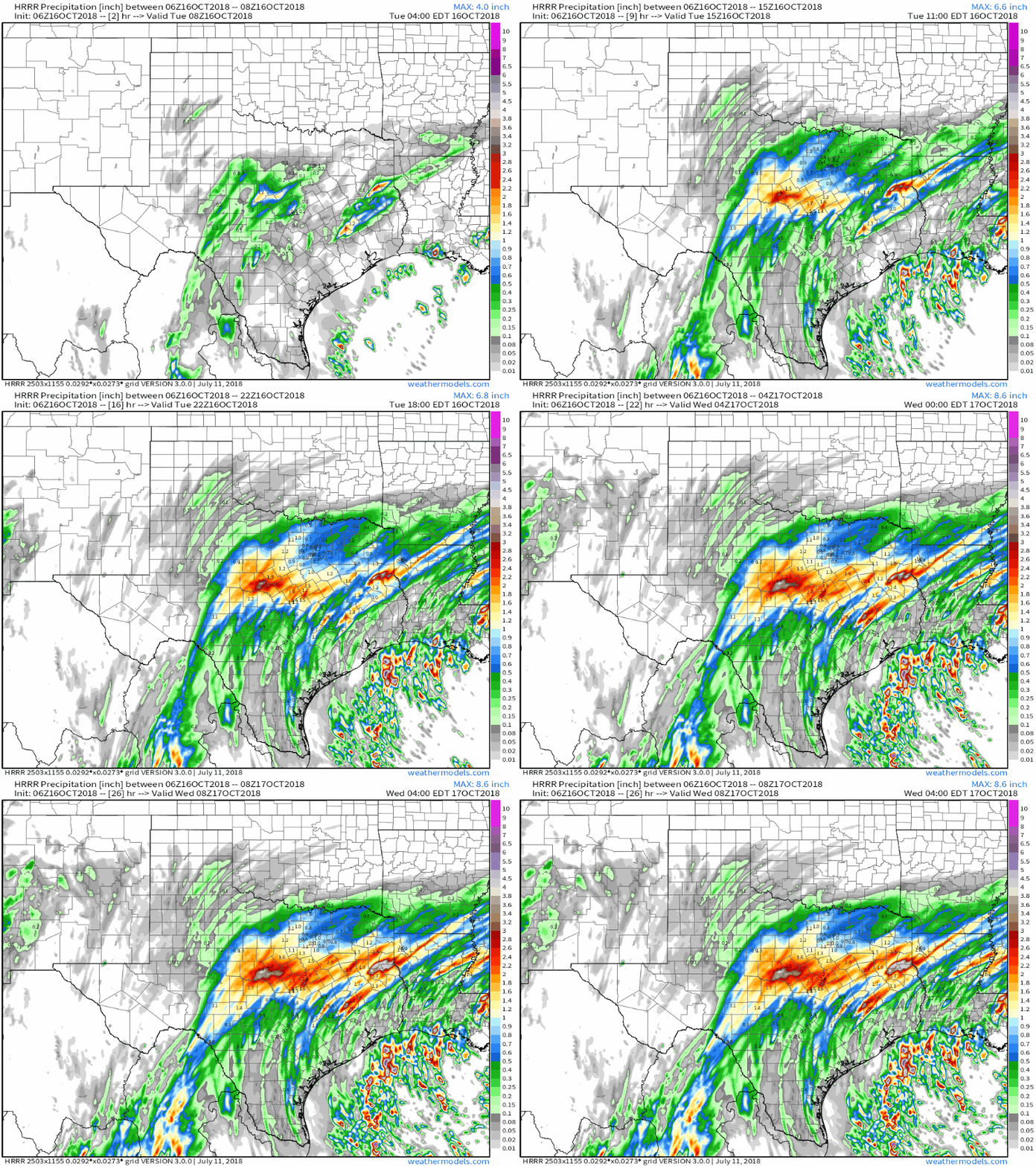
Here’s a look at the HRRR’s forecast for total precipitation between now and early tomorrow morning. Notice how totals just keep piling up in NE Texas/Northern Louisiana as that moisture streams north. You can even almost trace that moisture by looking at the streaks of precip that occur over SE Texas as storm cells develop and race north/northeast. The greatest risk for flash flooding will be in that corridor of very heavy rain from just north of Austin over towards Shreveport. Totals in this area could exceed 5″. GIF via weathermodels.com.
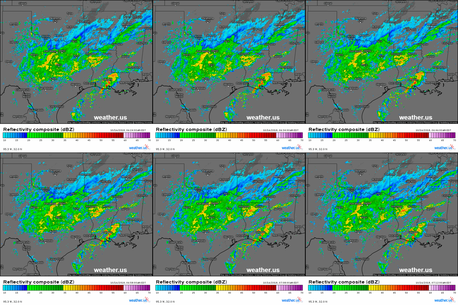
Here’s a look at composite radar imagery of this region, showing the area of heavy rain exactly where we’d expect it based on the pattern/setup outlined above. Track this rain through the day with both our radar overview and HD radar products at weather.us. Note that to see the latest loops, press the refresh button at the top left of the image. Click the map to zoom in, and click near the edge of the map to pan to exactly the area you want.
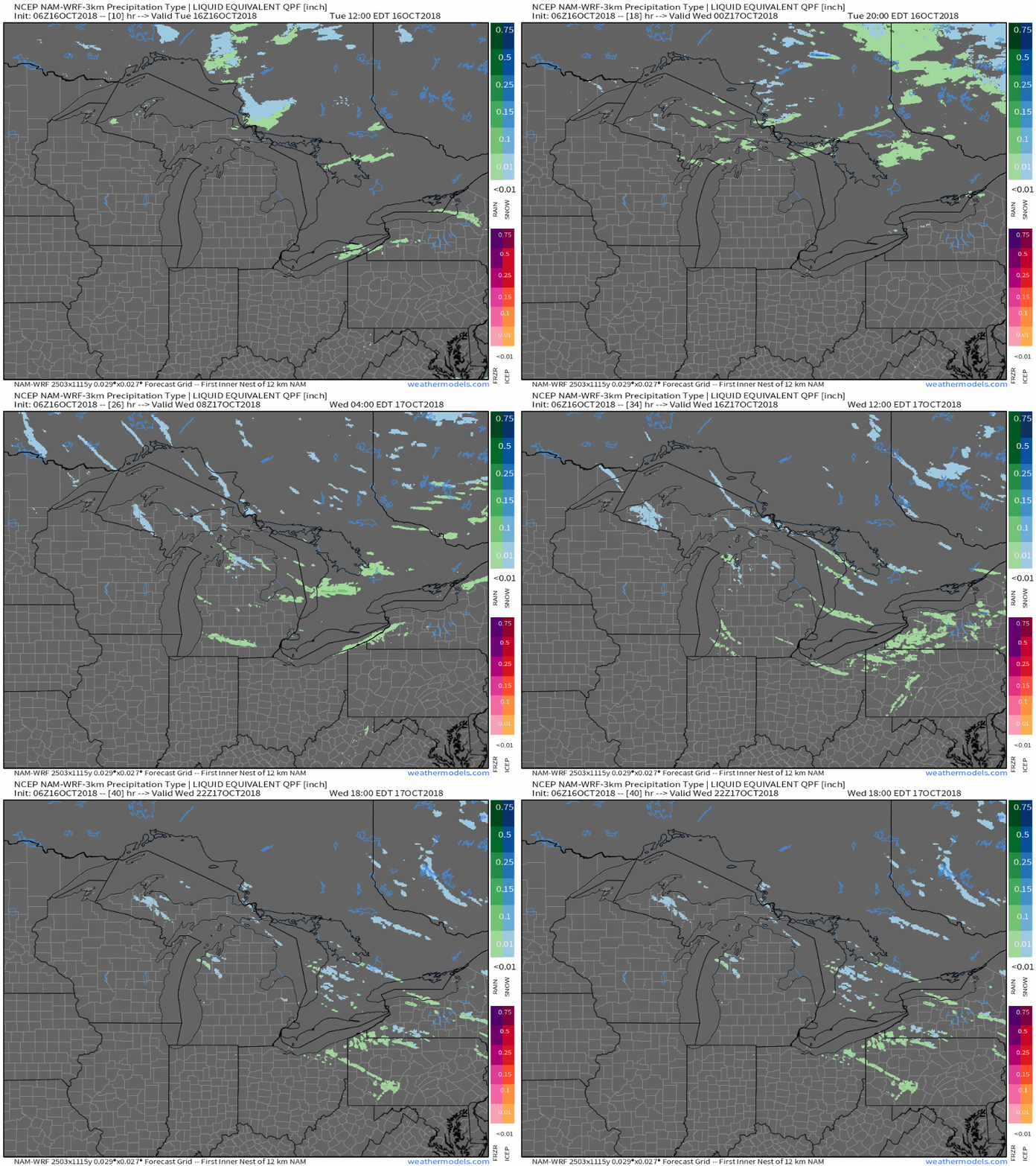
Meanwhile up in the Great Lakes, a cold front will be dropping south today, which will set up some lake effect rain and snow showers tonight/tomorrow. A look at the NAM’s precipitation type forecasts for the next 36 hours highlights these rain and snow bands. Not much in the way of accumulation is expected, being so early in the season, but it’s just another reminder that winter is indeed on its way. GIF via weathermodels.com.
Have a great day everyone!
Jack


I have seen well over 6” of rain in the last 7 days in Fort Worth. The Trinity River is flowing rapidly in the area, and many areas are seeing street flooding as he ground cannot hold any more moisture. We went for drought and trees dying in mid-August to flooding in September. This has continued in October.