Powerful Hurricane Michael Moving North Through The Gulf Of Mexico
Hello everyone!
Pinned Info:
This will be my primary blogging interface through the rest of Micheal’s time in the Gulf of Mexico. I posted a full-length analysis update at 11 AM EDT that dug into the setup for Michael, as well as expected impacts in terms of rain, wind, surge, and tornadoes. This will serve as a “live blog” of sorts, where I’ll post shorter updates on the storm more frequently (generally aiming for every few hours).
Some useful links for tracking the storm at weather.us can be found here:
Observations: Satellite Imagery – Radar Imagery – Lightning Analysis – Surface Observations
Models: Weather.us free ECMWF – Weathermodels.com – Weathermodels Lab – Weather.us free High Resolution models
Town Specific Forecasts: Forecast Essentials – Forecast XL – Forecast Ensemble
Blogs: Ryan’s Live Blog – Jack’s In Depth Analysis Blog
Any map can be clicked to zoom in, and latest data can always be found by clicking the refresh button at the top left of the map. The menus to the left of the image can be used to adjust parameters (WV vs IR vs Visible for Satellite for example, or Temps vs Winds vs Precip for models) as well as valid time for models. To get info for your town, select one of the town specific forecast links and just type in the location you’re interested in.
1:00 PM EDT Tuesday 10/9:
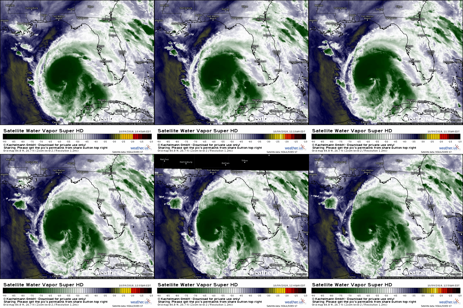
Michael remains a strengthening hurricane today, but is struggling. WV satellite imagery shows dry air filtering into the center on the storm’s southern side. This will limit how much more Michael is able to strengthen, though it still poses an extreme threat to the Florida Panhandle.
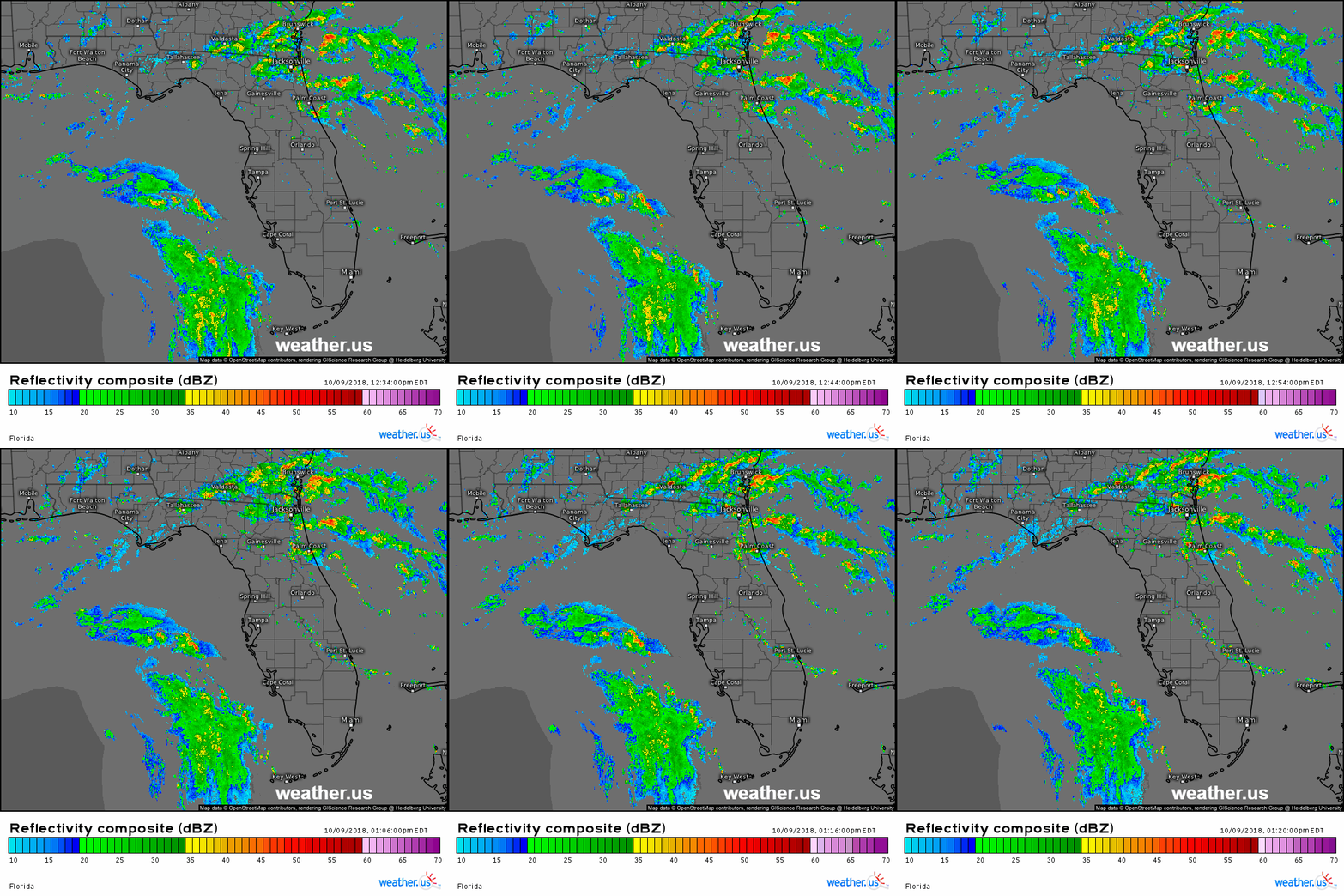
Here’s a look at SD radar imagery up through 1:20 PM EDT for the state of Florida. Michael’s outer bands are rotating through the Gulf of Mexico, with its inner core continuing to lurk just out of radar range. However, despite the fact that the storm is still well offshore, interaction between Michael and high pressure to the storm’s northeast is leading to heavy squalls moving onshore near Jacksonville. This sort of “big picture” look is what the SD composite radar is great for.
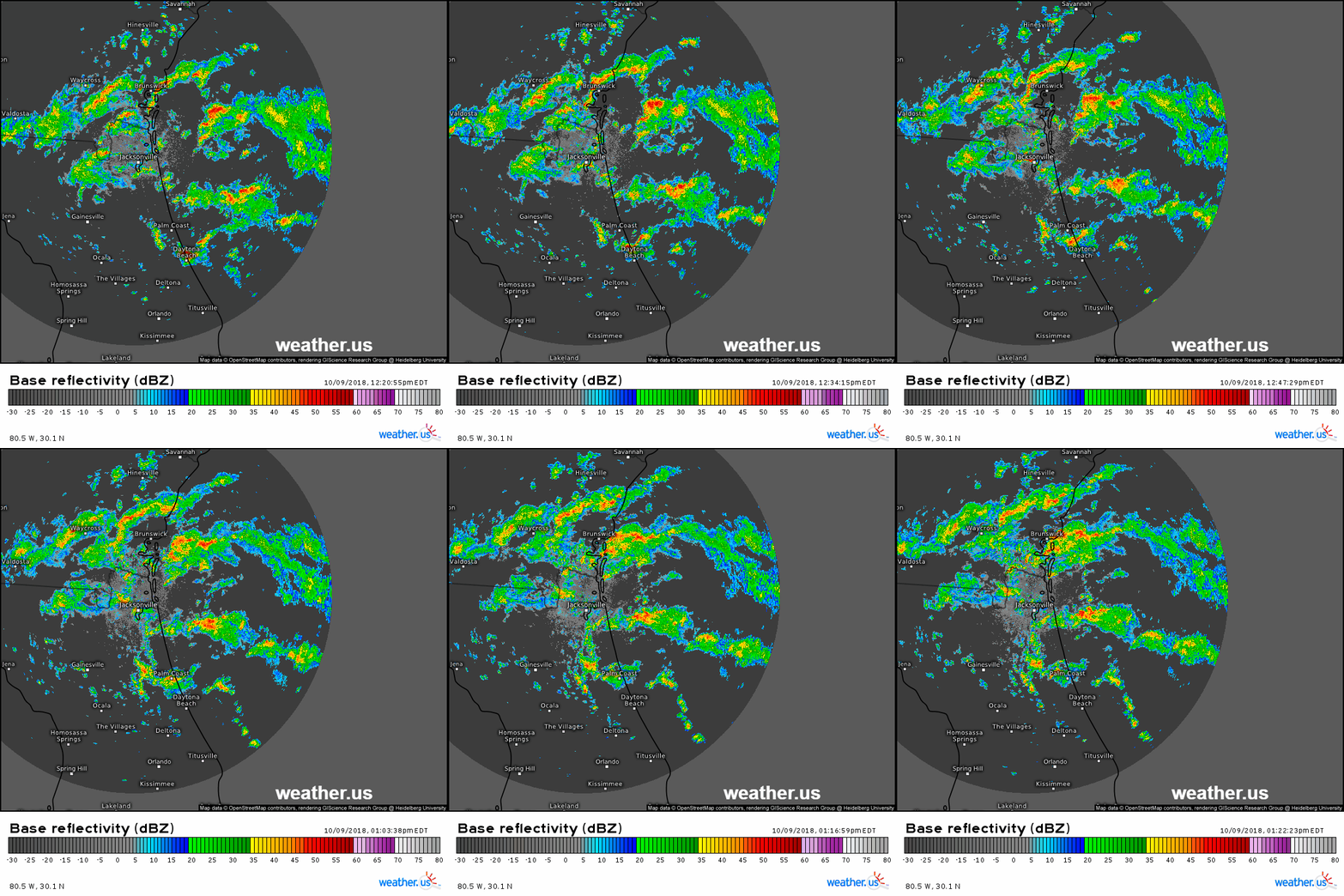
If you want to look at those squalls in more detail though, HD radar is the tool you need. The loop above shows radar imagery for the same timeframe, just zoomed into NE FL/SE GA. Notice the detail in which the squalls are visible, as well as the smoother animation quality (shorter timesteps). Both SD and HD radar data will be helpful in tracking different parts of Michael’s journey over the next few days!
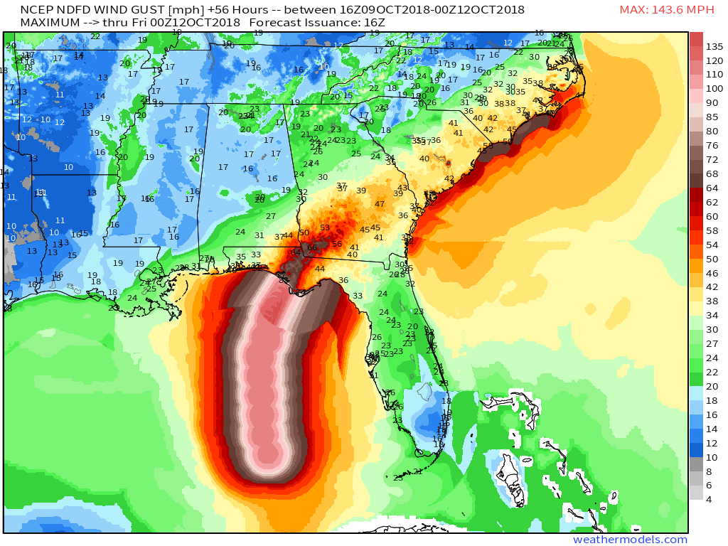
NWS wind gust swath forecasts show wind gusts over 100mph expected along the Florida coastline between Panama City and Port Saint Joe. Hurricane force winds will extend somewhat inland along the center’s track, but generally speaking Southern Georgia and the Carolinas will be looking at TS-force winds. However, don’t let that fool you, wind gusts of 50-60 mph can still cause plenty of damage!
7:45 PM EDT Monday 10/8:
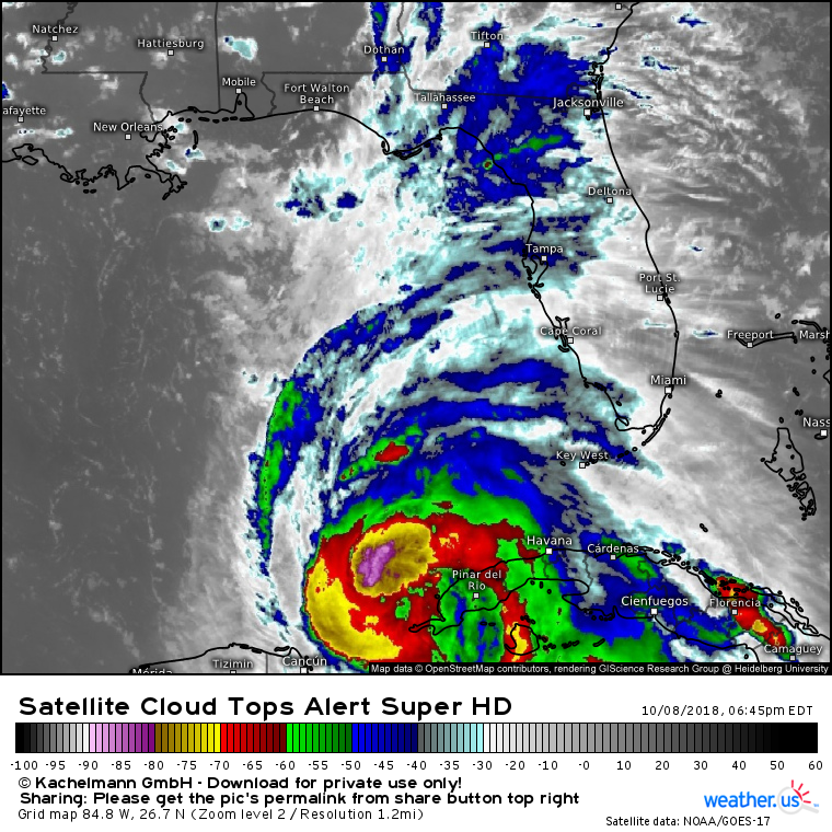
Satellite imagery this evening shows Michael continuing to develop, while also struggling with some dry air. The CDO present over the system’s center earlier this evening has eroded, with dry air working into the system’s southern side. However, intense “hot towers” continue to wrap around the center, as upper level outflow expands to the north. While the storm remains on the uptick, this dry air will slow the rate of intensification a bit in the near term. That does not change the forecast for the Florida though! Michael will still be an extremely dangerous major hurricane as it makes landfall on Wednesday.
12 PM EDT Monday 10/8:
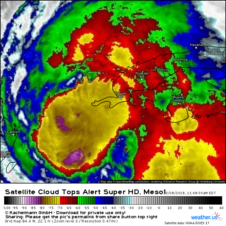
Satellite imagery shortly before noon eastern time shows Michael having successfully built what’s known as a Central Dense Overcast, or CDO for short. This is basically an area of consistently strong thunderstorm activity around the center. If you look closely, you can see the beginnings of an eye/eyewall about half way between Cancun and Manuel Lazo. The storm is moving slowly to the north, and no changes to the going forecast are noted.
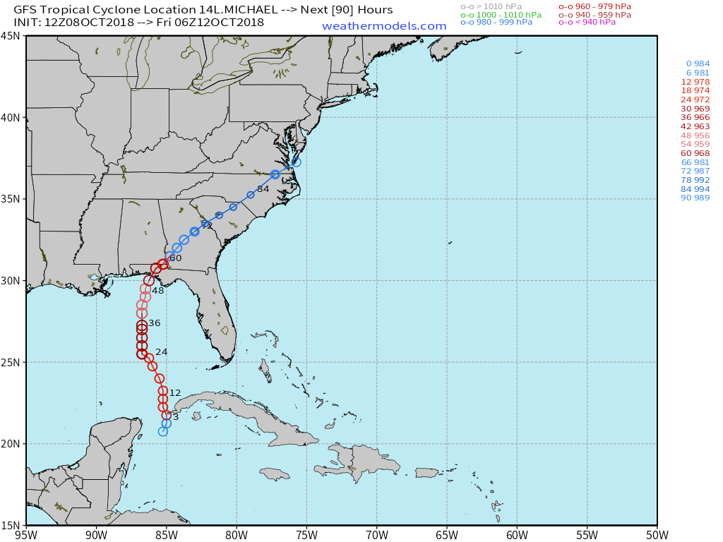
The very latest run of the American GFS model has arrived, and continues to show Michael approaching the Florida Panhandle as a strong hurricane on Wednesday before moving NE through Georgia and the Carolinas Thursday-Friday. The newest ECMWF data will begin arriving around 1:45, with live tracking available at the Weathermodels.com Lab.
