10-2-18 Morning Roundup- A Busy Day Of Fall Weather Today Part Two: West
Hello everyone!
There’s plenty of weather to discuss today as an active fall pattern gets underway. I’ll briefly go over each of the expected areas of active weather, and will provide plenty of links to the tools we have at weather.us and weathermodels.com to get more information specific to the system that might be affecting you. This post will focus heavy rain and mountain snow in parts of the Western US. My last post discussed severe storms and flash flooding potential in the Northeast.
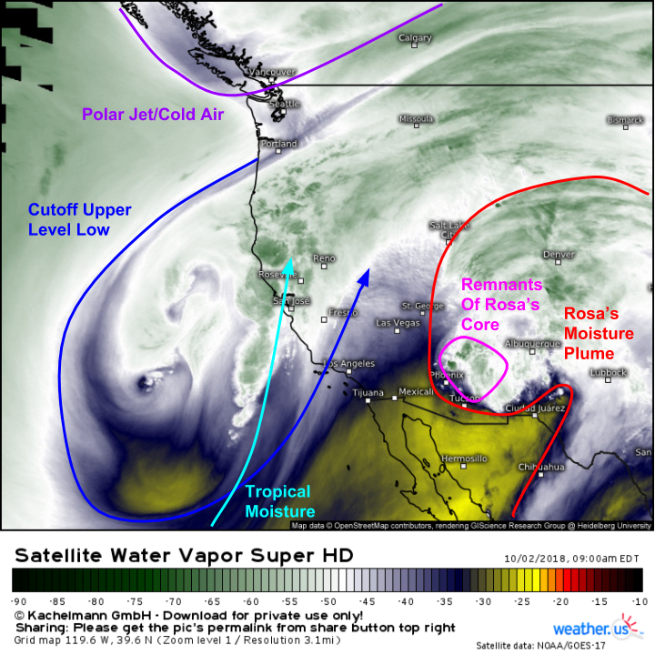
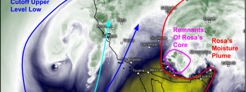
Here’s a look at the overall pattern as seen via WV satellite imagery. There are three systems to look at today: Rosa, an Upper Level Low (ULL) off the California coast, and a strong polar jet disturbance. Rosa will be the most impactful in terms of flash flooding, while the polar jet disturbance will bring the most in the way of frozen precip, in the form of both snow and freezing rain, to Montana. The ULL will bring showers to CA today, but its impacts will be relatively muted as the heaviest precip remains offshore. Click the link to see this imagery on weather.us, then click the map to zoom in for a closer look, and use the refresh button at the top left of the map to get the latest data.
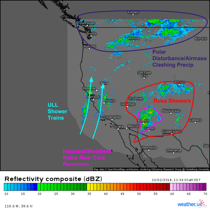
Composite radar imagery paints a similar picture impacts wise this morning. Rosa’s showers are spread out over a wide swath of the Desert Southwest, with the heaviest/steadiest rain concentrated near the remnant “center” in the vicinity of Phoenix. The whole system will be moving NE towards Colorado today. Farther west, trains of showers are streaming onshore in CA ahead of the ULL, but they’re not particularly heavy. Still, watch for localized pockets of “training” showers that could result in minor urban flooding and rapid rises of small streams. The steadier precip in the Northern Rockies is associated with that polar disturbance, and some of it is falling as snow over the high elevations of Montana. Click the link to see this imagery on weather.us, then click the map to zoom in for a closer look, and use the refresh button at the top left of the map to get the latest data.
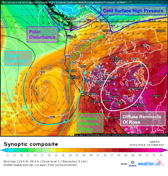
Many of the same features we’ve been talking about on radar/satellite imagery this morning are also visible on the ECMWF’s synoptic composite forecast for this evening. Rosa’s remnants will continue to fizzle out, but the moist airmass and lift provided by the mountains will continue to support rain. The plume of tropical moisture drawn north by the ULL will extend into the base of the polar disturbance, providing moisture to the system. This moisture, when combined with cold air from high pressure spilling down the eastern side of the Rockies plus lift from the mountains and dynamics from the disturbance will check off the ingredients list for snow.
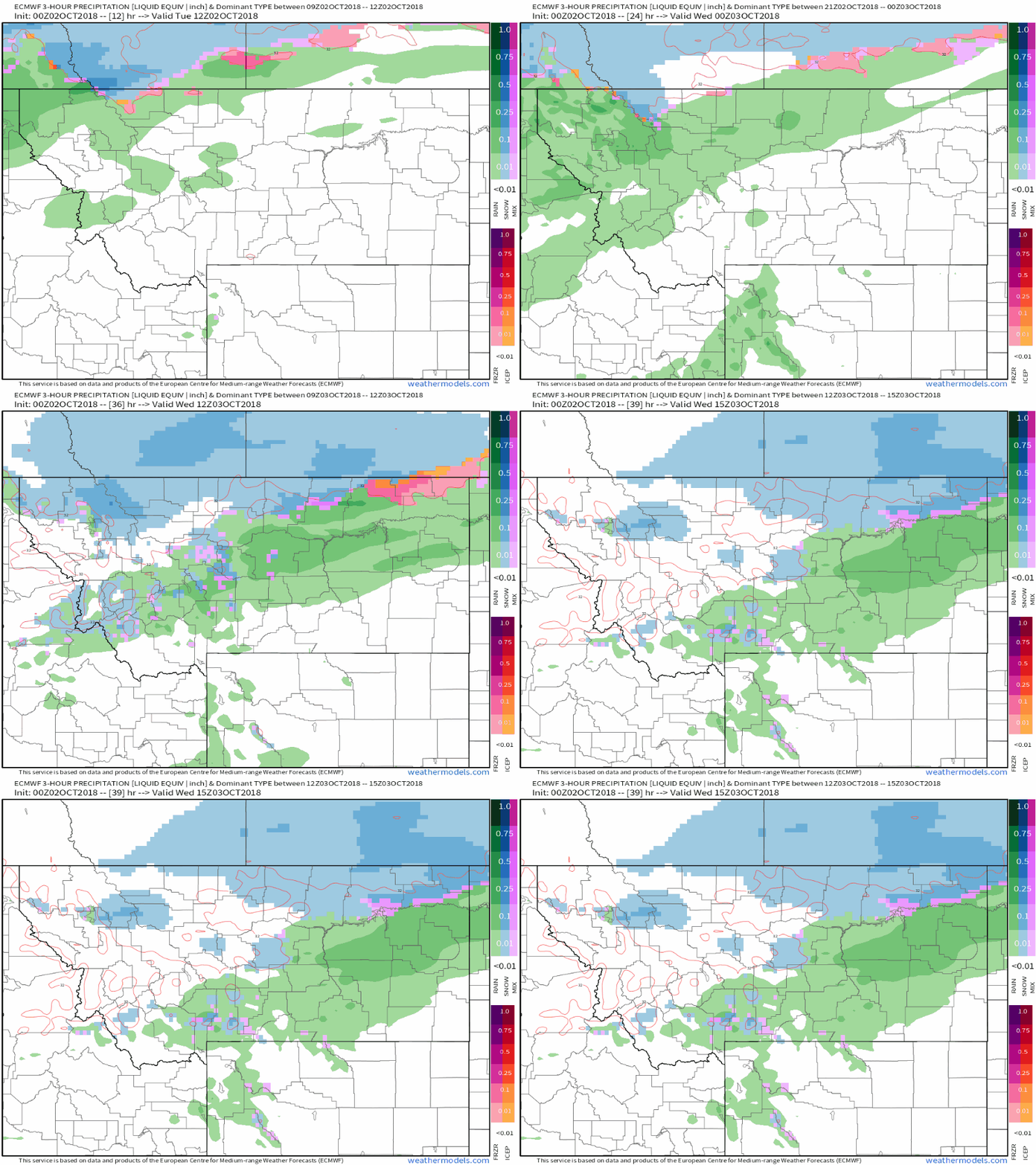
Here’s an animation of the ECMWF’s precipitation type forecast for today and tomorrow, showing the rain/snow line progressing south through Montana, with some freezing rain potential along the leading edge of that cold air. Precip isn’t expected to be overly heavy, and snow totals won’t be all that excessive, but slick roads are possible, and the first widespread snow of the season is always a landmark worth celebrating. GIF via weathermodels.com.
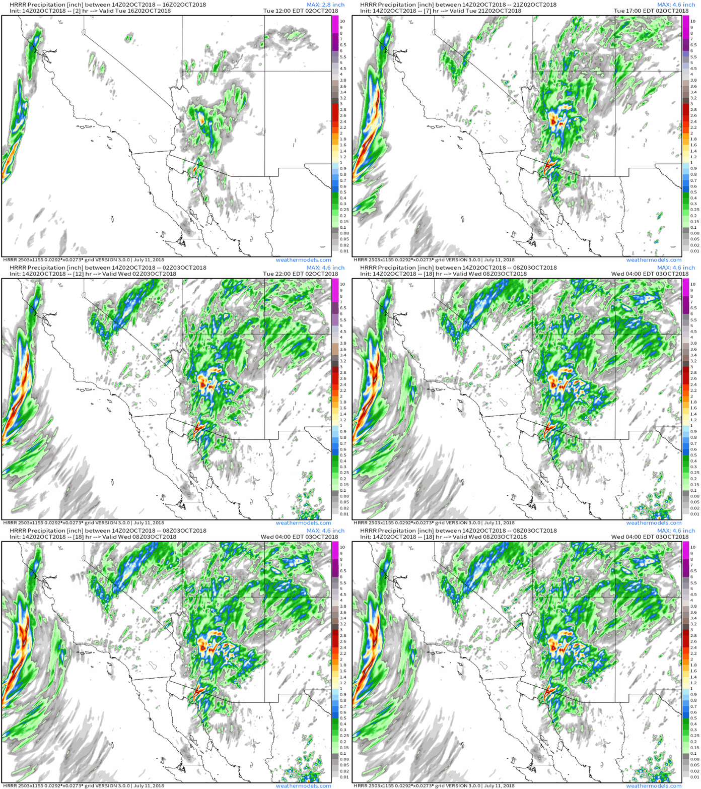
Looking farther south, Rosa and the ULL are both visible in this animation of HRRR simulated precipitation totals today. Note the rain piling up in the Four Corners region, particularly Arizona, in association with Rosa. The ULL’s rains will be focused near the Bay area, as well as in the Sierras where terrain induced lifting will help wring the moisture out of the atmosphere in the absence of the ULL’s dynamics, which will remain offshore. GIF via weathermodels.com.
Rosa will continue to fizzle out tonight/tomorrow, the ULL’s rains will become more widespread tonight, and snow across Montana will come to an end as that disturbance swings through tomorrow.
-Jack
