Stream Of Tropical Moisture To Result In Continued Flash Flooding Across Parts Of The East Today And Tomorrow
Hello everyone!
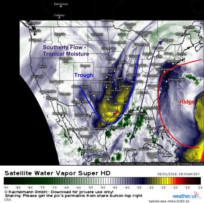
Tropical moisture has been streaming up the East Coast for much of the past several weeks, and that pattern shows no signs of letting up as we begin the month of August. A trough of low pressure remains anchored in the Mississippi Valley this morning, with high pressure near Bermuda. Southerly winds in between these two features is setting up a pipeline of tropical moisture that runs from the Gulf of Mexico directly to Canada. Beneath this plume of moisture sits a weak cold front, which will trigger more showers and storms as we move into this afternoon. Heavy rain will be the primary threat, along with the potential for some damaging winds especially farther north in the Mid Atlantic/Northeast.
GOES-East Water Vapor satellite imagery is a great way to visualize these features, which show up clearly as areas of drier air spinning counterclockwise around the trough, and clockwise around the ridge. These spins are especially evident on looped imagery, which is available on weather.us. It’s also easy to pick out the plume of northward-moving tropical moisture stretching from the Gulf of Mexico up into Canada.
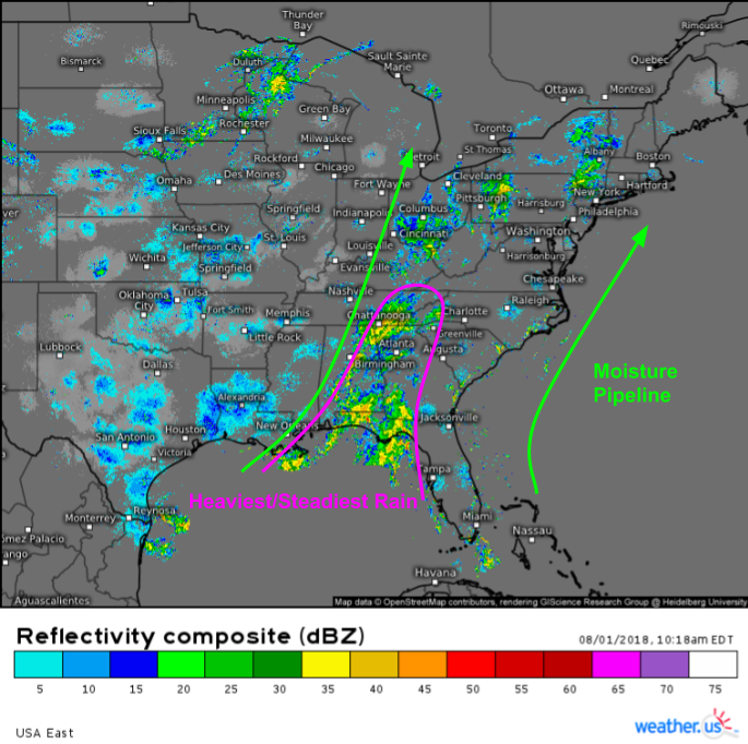
Radar imagery this morning highlights both the large-scale tropical moisture plume that spans most of the East Coast, and smaller scale features in the Southeast that are producing more widespread steady/heavy rains. If you head on over to the radar page at weather.us, you can click this map to zoom in for a closer look at HD data that will show you individual storm cells in much more detail.
The primary feature of note across the southeast is a very weak frontal boundary that is helping to focus lines of thunderstorm activity. This simulated radar animation shows storms in progress along that boundary this morning continuing through the afternoon, before waning in coverage/intensity tonight, and redeveloping tomorrow morning. These thunderstorms will contain very heavy rains, and repeated rounds of heavy thunderstorm activity will result in flash flooding concerns. This threat is greatest in and near the Florida Panhandle. GIF via weathermodels.com.
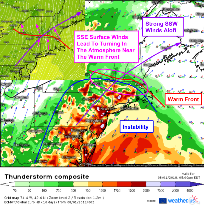
Farther north, in parts of the Mid Atlantic and Northeast, enough mid/upper level winds are present to generate severe weather concerns, in addition to heavy rain concerns (which are also present, especially across waterlogged parts of Pennsylvania, Virginia, and Maryland. The ECMWF’s Thunderstorm Composite product shown above, combined with a snippet of surface winds to highlight southeasterly flow not readily apparent on the composite map, shows enough wind shear and instability to support a severe weather threat from Southwestern New England and Southern New York all the way down through much of the Mid Atlantic. The one limiting factor will be the lack of a strong forcing mechanism given the absence of any well-defined frontal systems. Damaging winds will be the primary threat, though a tornado can’t be ruled out in New England where the warm front will contribute to enhanced low level rotation.
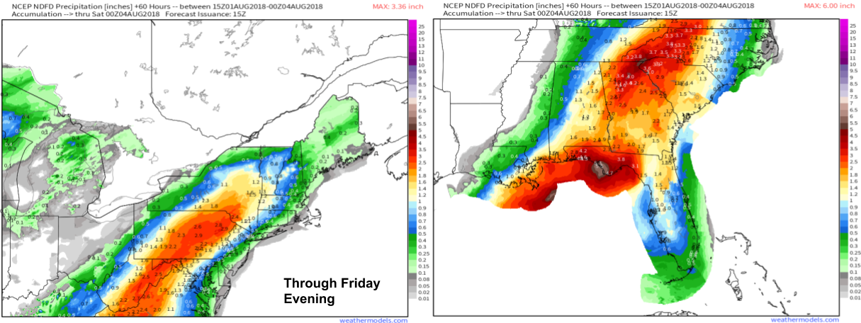
Rainfall forecast maps from weathermodels.com show several inches of rain forecast across the areas discussed above, from the Florida Panhandle up through parts of Pennsylvania. Places all along this corridor of heavy rain will be at risk for flash flooding, but areas including the Florida Panhandle (where the most rain is forecast) and the Mid Atlantic (where soils are already waterlogged) have the greatest risk. Rainfall amounts will drop off significantly towards the coast, farther away from the forcing of the front. These forecasts are valid through Friday evening, as the pattern will look pretty much the exact same tomorrow.
Track the storms with GOES-East and HD radar over at weather.us, and remember to take the proper precautions if your area is forecast to see flooding and/or severe storms.
-Jack


I would like to know what the weather will be like next Saturday in Boothbay Harbor, ME
just wondering how long the Bermuda High [current one], is expected to hold where it is? I live in WNC and 5″ rain already this week at my house- Frogs are startin’ to strangle…Dont have website–just email–found this today
thx, russ