91L Continuing To Bring Downpours To Texas And Louisiana
Hello everyone!
Today’s main weather feature to watch will be the tropical disturbance 91L as it meanders slowly through the western Gulf of Mexico. It will continue to bring periods of heavy rain to much of southern/coastal Texas, while the immediate shoreline sees intermittent breezy conditions. Flash flooding remains this system’s greatest threat.
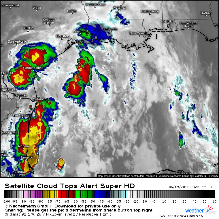
Here’s a look at GOES-East satellite imagery of the system this morning. Note its continued state of disorganization. Clusters of stronger thunderstorm activity pop up and dissipate with little to no discernible pattern. This is due to an upper level trough in the area that is preventing the system from taking on the characteristics of a tropical cyclone. However, even disorganized clusters of thunderstorm activity in a tropical airmass such as this one can bring flash flooding concerns, and that’s exactly what we’re worried about today and the rest of the week as this system becomes basically stationary just south of the Texas coast.
This GIF from the HRRR model via weathermodels.com shows periods of heavy rain rotating onshore across all of southeastern Texas today. Note that while many of the same areas get repeated rounds of storms, not everyone will see heavy rain at once. This means that the areas which see cells pop up overhead will get significantly more rain than the areas which happen to remain dry over a given several hour period. It’s impossible to predict where these cells will pop up ahead of time, so even though the event is already underway, exact rainfall amounts for any given town remain uncertain.
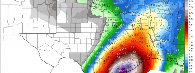
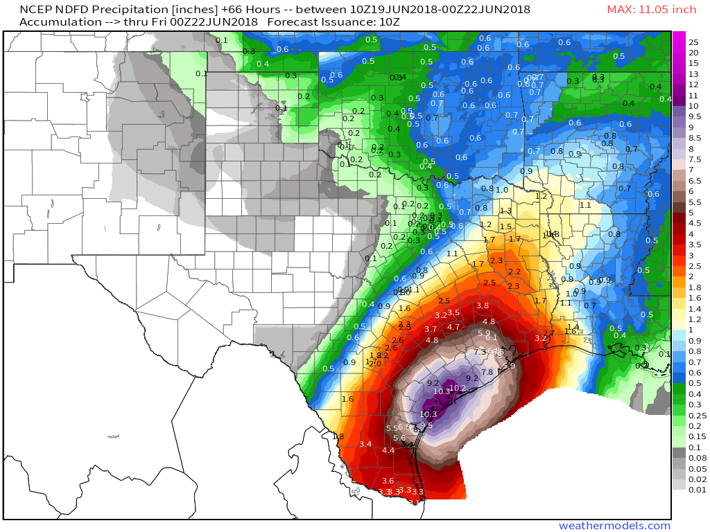
That being said, we do still have some idea of how much rain might fall across parts of Southeast Texas. This map via weathermodels.com of the National Weather Service’s precipitation forecast through Thursday evening gives a good sense of about how much rain to expect through the rest of the event (plus or minus a little for individual cells). Note that some areas could see almost a foot of rain! Also note that this map does not include rain that has already fallen which, in some cases, has been several inches.
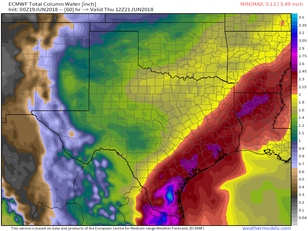
When will the rain end? ECMWF moisture forecasts via weathermodels.com show the plume of deep tropical moisture responsible for the heavy rains sticking around at least through Thursday, and possibly into Friday as well. After that, a drying trend should present itself for the weekend.
You can track the rain all day long with GOES-East satellite imagery and HD radar imagery at weather.us. Also explore our wide selection of model guidance products, from maps to point forecasts, to get a sense of what to expect in your town.
For more information about your local forecast, anywhere in the country (and the world): https://weather.us/.
For more information about the local forecast for ME/NH: https://forecasterjack.com/2018/06/19/clearer-drier-and-cooler-today/
-Jack


