Dangerous Fire Weather Expected In Parts Of The Southwestern Plains Today
Hello everyone!
As the storm system that has brought severe weather to much of the country over the past several days dissipates over New England, attention will shift back to the west again today as another storm develops in the lee of the Rocky Mountains. Due to a lack of available moisture, this storm won’t produce much precipitation until tomorrow, but it will bring gusty winds and dangerous fire weather to parts of the Southwestern Plains today.
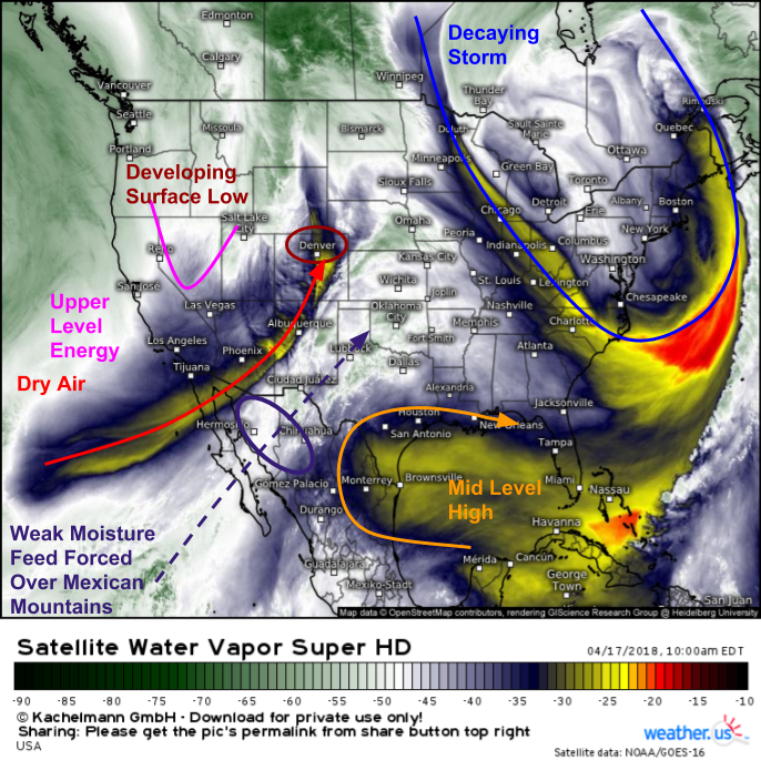
GOES-East water vapor satellite imagery (what’s that?) highlights the elements coming together for dangerous fire weather today. Upper level energy moving east through Nevada is driving the development of a surface low in NE Colorado. Winds will strengthen near this low today as it develops, setting up the first ingredient for our fire weather threat. The other ingredient will be dry air, which can help fires spread more quickly given the same windspeed. A plume of dry air is noted streaming northeast from the Pacific Ocean into the Desert Southwest. As the upper level energy shifts east, this plume of dry air will shift east as well. Typically with upper level energy emerging onto the Plains from the Rockies this time of year, we’d expect a severe thunderstorm threat. However, mid level high pressure over the Northeast Gulf of Mexico has shut that moisture supply off. The only moisture available to this system is a weak plume from the Eastern Pacific, the impact of which will be further tempered by the fact that it must traverse the high mountains of Northern Mexico before it reaches the Southern Plains.
Dew point observations this morning confirm some of the trends seen on GOES-East imagery. We can see some very dry air over New Mexico and Colorado with dew points near zero, while the air has a little bit more moisture to the east across parts of Oklahoma and Texas. However, while dew points near 50 are sufficiently high to mitigate any dangerous fire weather conditions in these areas, they won’t be high enough to support any thunderstorm threat. As the storm develops in NE Colorado today, southwesterly winds on its southern flank will strengthen and draw the dry air from New Mexico eastward towards the panhandles of Texas and Oklahoma, as well as parts of Southwestern Kansas.
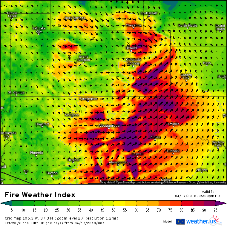
The results of the processes described above can be easily visualized with the ECMWF’s Fire Weather Index forecast map shown here. This index combines the moisture content in the air with the forecast wind speed to estimate how favorable conditions might be for the spread of wildfires. Values above 50 indicate a fairly substantial wildfire risk, while values over 80 indicate extreme fire danger. Index values are forecast to rise above 80 across much of New Mexico, as well as SE Colorado, the Panhandles of Texas and Oklahoma, and parts of SW Kansas. Any fires that develop in these areas will quickly evolve into serious situations!
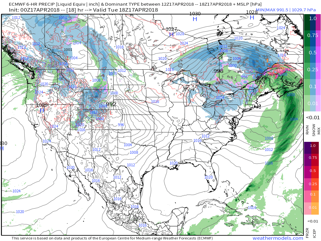
Elsewhere across the country today, most folks will see quiet weather as the storm that has brought severe weather to much of the Eastern 2/3 of the country over the past few days decays over Southern Canada. Some rain and snow showers are possible in the Northeast this afternoon due to the remains of that storm, but no major impacts are expected. Some rain and mountain snow is also possible across parts of the Rockies on the northwestern side of the storm developing in NE Colorado, though no major impacts are expected there either. Map via weathermodels.com.
For more information on your local forecast, head on over to weather.us.
-Jack


