Strong Thunderstorms Expected In Parts Of Florida Today
Hello everyone!
As quiet weather retains control of much of the country today, parts of the Florida peninsula will be in line for some strong to severe thunderstorms as a cold front drifts slowly south across the area. Damaging winds look to be the primary threat, along with torrential downpours and dangerous lightning.
The ECMWF’s Thunderstorm Composite map (what’s that?) is a valuable tool to analyze thunderstorm setups. We can see each of the three ingredients needed for severe thunderstorm development, a trigger, fuel, and strengthening/veering winds with height (shear), all on one map. You can see that we have the trigger boundary (sagging cold front), we have plenty of fuel (Gulf of Mexico and Gulf Stream airmasses are warm and rich in moisture), but we don’t have much in the way of winds aloft. This means that we’ll get plenty of thunderstorm activity, but storms will likely be more garden variety than severe. That being said, any storms that congeal into clusters as some of the high resolution models forecast could produce some damaging winds on the leading edge of their rain cooled outflow.
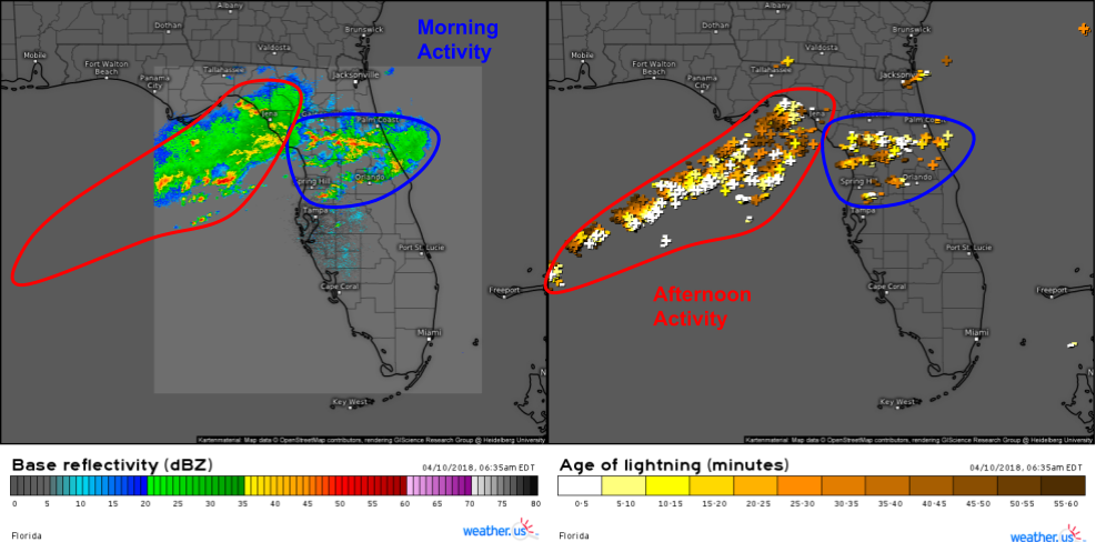
Storms will evolve more or less in two rounds today. The first round is already ongoing near and north of Orlando this morning, as seen by HD radar imagery and strike data from our lightning analysis product. While the radar beams from Florida don’t extend very far out into the Gulf of Mexico, lightning data shows plenty of activity offshore this morning, which will move onshore this afternoon as the front continues to drift south and east.
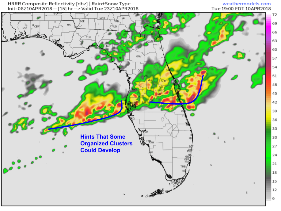
Here’s the HRRR model’s simulated radar forecast for this evening showing thunderstorm activity ongoing between Tampa and Cape Canaveral. While most storm activity today will be disorganized, the model is hinting at some signs of organization as rain cooled outflow helps individual storm cells merge into larger entities. Storms will wane in intensity this evening after sunset. Map via weathermodels.com.
Elsewhere across the country today, things are looking pretty quiet as high pressure is anchored over the Heartland. A storm system moving into Canada will bring some rain and high mountain snow to parts of the Pacific Northwest, but no major impacts are expected from that system.
For more information on your local forecast: https://weather.us/
For more information on the local forecast for ME/NH: https://forecasterjack.com/2018/04/10/cool-and-unsettled-today/
-Jack


