More Severe Storms Expected In Parts Of The South Today
Hello everyone!
It’s been an active couple of days for severe storms in the Southern part of the country as a slow moving frontal boundary crawls east. Storms are ongoing this morning in parts of LA and MS, and these storms will strengthen as they move East today and daytime heating adds fuel to the atmosphere.
A look at our SD radar composite product for Louisiana this morning shows a few elements that will be important to the forecast as this system moves east today. First is the cold front/outflow boundary that marks the leading edge of the storms. A line of storms will continue to exist along this boundary, and those storms will strengthen as instability increases this afternoon. Just out ahead of that line, some discrete cells have formed just west of New Orleans. Currently, these cells are little more than showers, but they are showing signs of rotation and could strengthen into stronger storms as instability increases. Any tornadoes that form today will likely occur with these discrete cells or as those cells merge into the larger line of storms. Meanwhile behind the line, a steady soaking is ongoing in NW LA and SE TX. These steady, heavy rains will cause some flooding concerns especially since this area is waterlogged already from other recent storms.
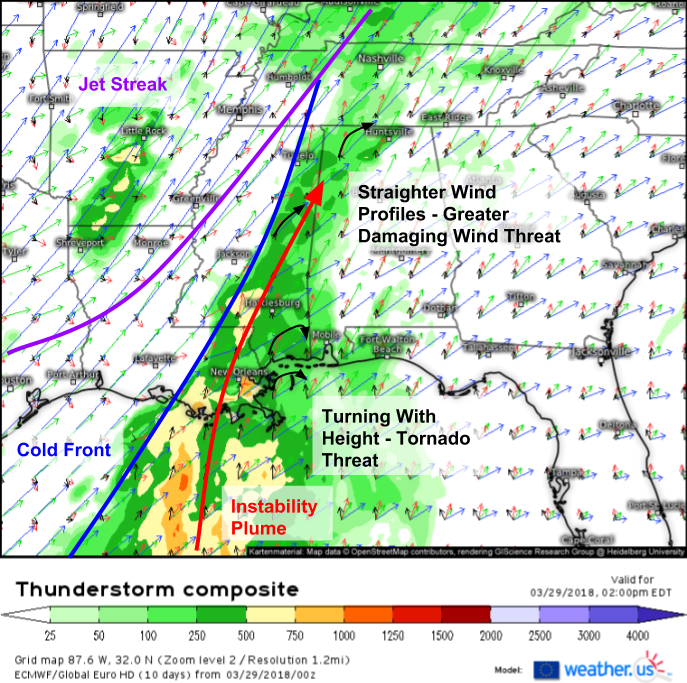
The ECMWF’s Thunderstorm Composite (what’s that?) product gives a good sense of the overall setup as we move into the afternoon. The right entrance region of a powerful jet streak will be located over the area of interest, which will help promote large scale upward motion. Focused upward motion for storm development will be found along the frontal boundary discussed earlier. A plume of modest instability will exist just ahead of this front, but won’t be enough to support a high end severe threat. Vertical wind profiles differ subtly but importantly from north to south in MS/AL/LA. There’s a decent amount of wind shear (turning and strengthening of winds with height) near the Gulf Coasts of LA, MS, and AL, which would support a nonzero tornado threat, especially with those discrete cells. Farther north, wind profiles are more linear which would promote much more of a damaging wind threat in places like Birmingham, extending as far east as Atlanta.
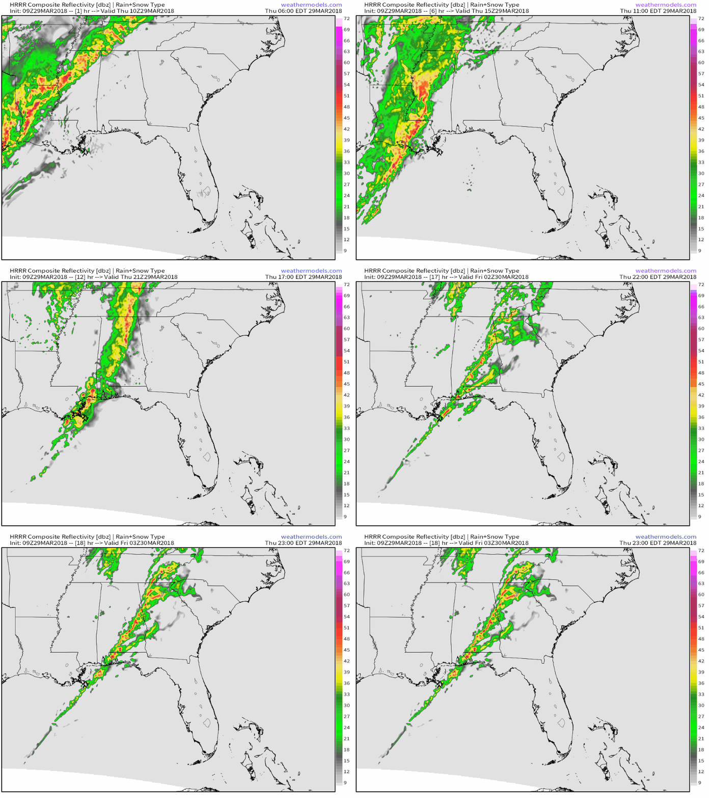
Here’s a simulated radar GIF from weathermodels.com showing the evolution of storms today into the first part of tonight. As always, these animations aren’t meant to pinpoint if a storm cell will hit your house or your neighbor’s, but they do give a good general sense of how things should evolve. Notice the more linear storm mode near the northern end of the threat area, with some more discrete/bloblike elements closer to the Gulf Coast.
Track each and every storm today with the tools we have at weather.us including GOES-East satellite imagery updated as frequently as one minute https://weather.us/satellite/louisiana/top-alert-superhd-5min.html#play (one minute options via menus), HD radar every five minutes https://weather.us/radar-us/louisiana/reflectivity/KPOE.html#play, lightning analysis every five minutes, and current observations every hour https://weather.us/observations/temperature-f.html. Click any map to zoom in for more details down to county level, and once you’re down to county level lightning data, be sure to click any individual strike icon for much more information about that strike.
For more information on your local forecast: https://weather.us/
For more information on the local forecast for ME/NH: https://forecasterjack.com/2018/03/29/mild-with-increasing-clouds-today/
-Jack


