Upper Level Low To Bring Rain And Snow To California Today
Hello everyone!
Quiet weather has returned to the East today following the passage of a strong storm system through the Ohio Valley this weekend. As a result, the focus of active weather will shift to the West Coast today where strong upper level energy diving south through California brings rain and heavy mountain snow to the state.
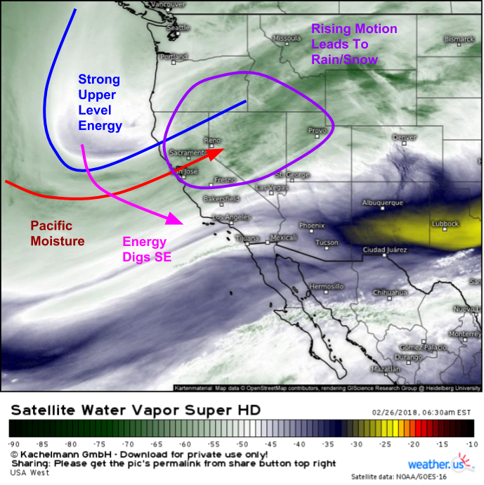
Here’s a look at GOES-East WV satellite imagery showing the ingredients for rain and heavy mountain snow all lined up for today. A strong upper level disturbance is noted off the Northern California coast, and it is digging SE towards the state. Pacific moisture is streaming onshore ahead of this disturbance, and moving into an area of lift caused both by large scale dynamics ahead of the trough, as well as by small scale dynamics such as orographic lifting in the Sierras where moisture rich air from the Pacific is forced to rapidly rise as it encounters the mountains.
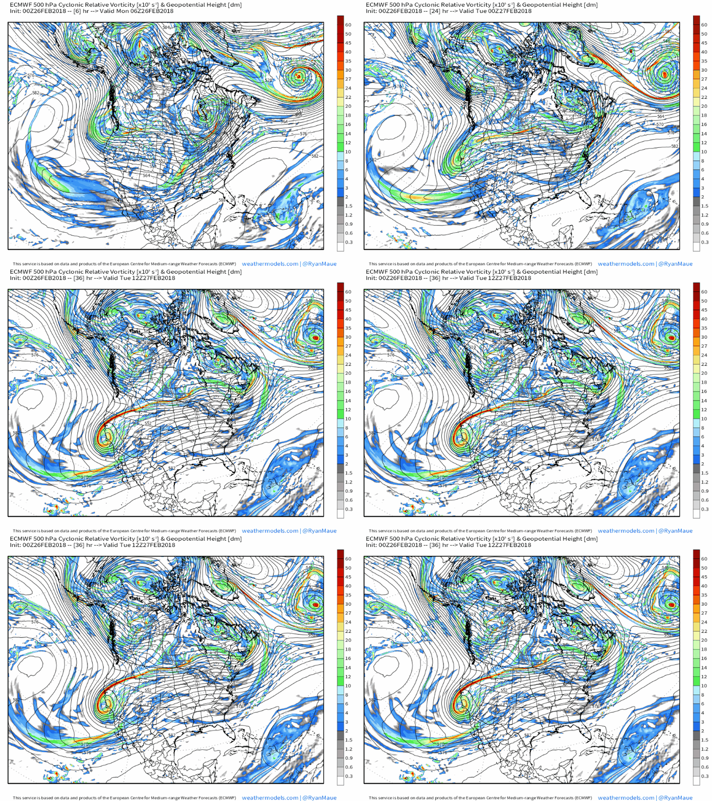
This GIF from the ECMWF model via weathermodels.com shows that strong upper level energy dropping south today/tonight, and intensifying into an upper level low as it does so. That intensification process will add to the dynamics available for precipitation, and also will add to the storm’s cold air supply as lower heights translate to a colder airmass. This will help bring snow levels down below where they usually are, and will help get some of the mountains near LA in on the snow action in addition to the typically favored Sierra peaks.
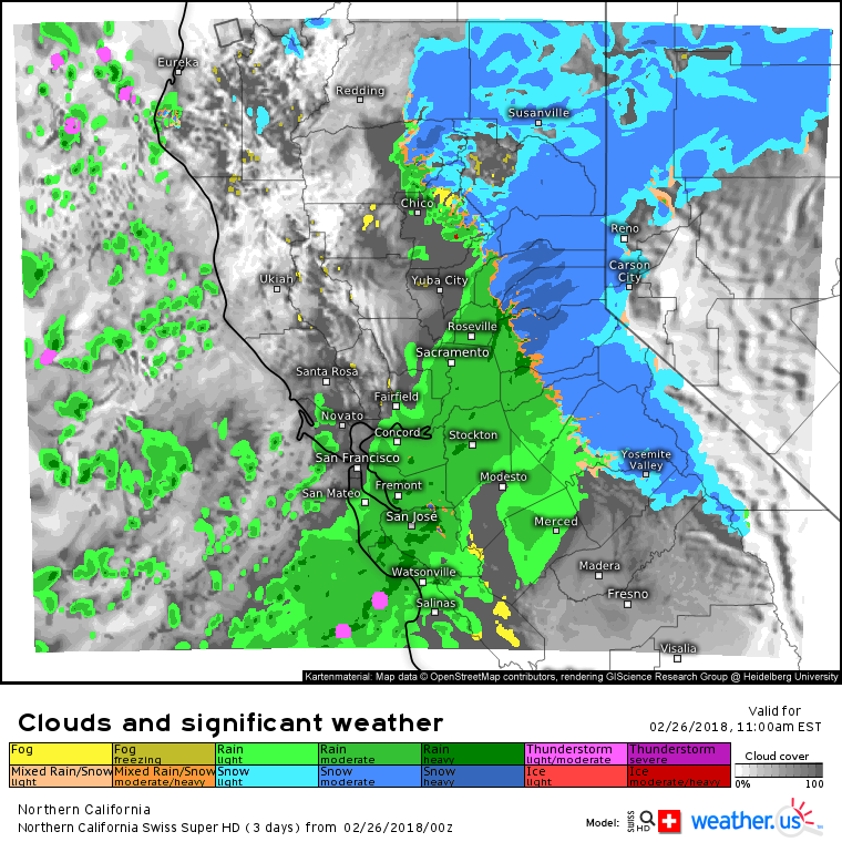
The Swiss Super HD model shows the sensible effects of the dynamics discussed above. A narrow band of moderate to heavy rain is expected to move south through the San Francisco area this morning, with some embedded rumbles of thunder possible. More widespread precipitation is expected where forcing will get a boost from the Sierra Nevada. Widespread moderate to heavy snow is expected in those mountains today, with significant accumulations likely. Click the map on weather.us to zoom in to county level, and use the menus to explore a wide range of other parameters.
By tonight, the Swiss Super HD’s southern California forecast shows rain and snow arriving in the LA area. Some of that rain could be heavy along the coast, with heavy snow expected in the higher elevations NE of LA and N of Santa Barbara. Accumulations in these mountains won’t be as significant as those in the Sierra, but several inches are still expected.
Here’s the National Weather Service’s forecast for total snowfall from now until this storm departs tomorrow via weathermodels.com. Notice the heaviest snow is expected in the Sierras, where 8-16″ is expected, with lighter 3-6″ amounts in the coastal ranges near LA. Also notice a widespread area of snow in Nevada. This is associated with the large scale lifting ahead of the trough, which will be enough to produce snow even without enhancements from terrain. However, these areas will be in the shadow of the Sierras and thus will have a more limited moisture supply resulting in lower 3-6″ amounts.
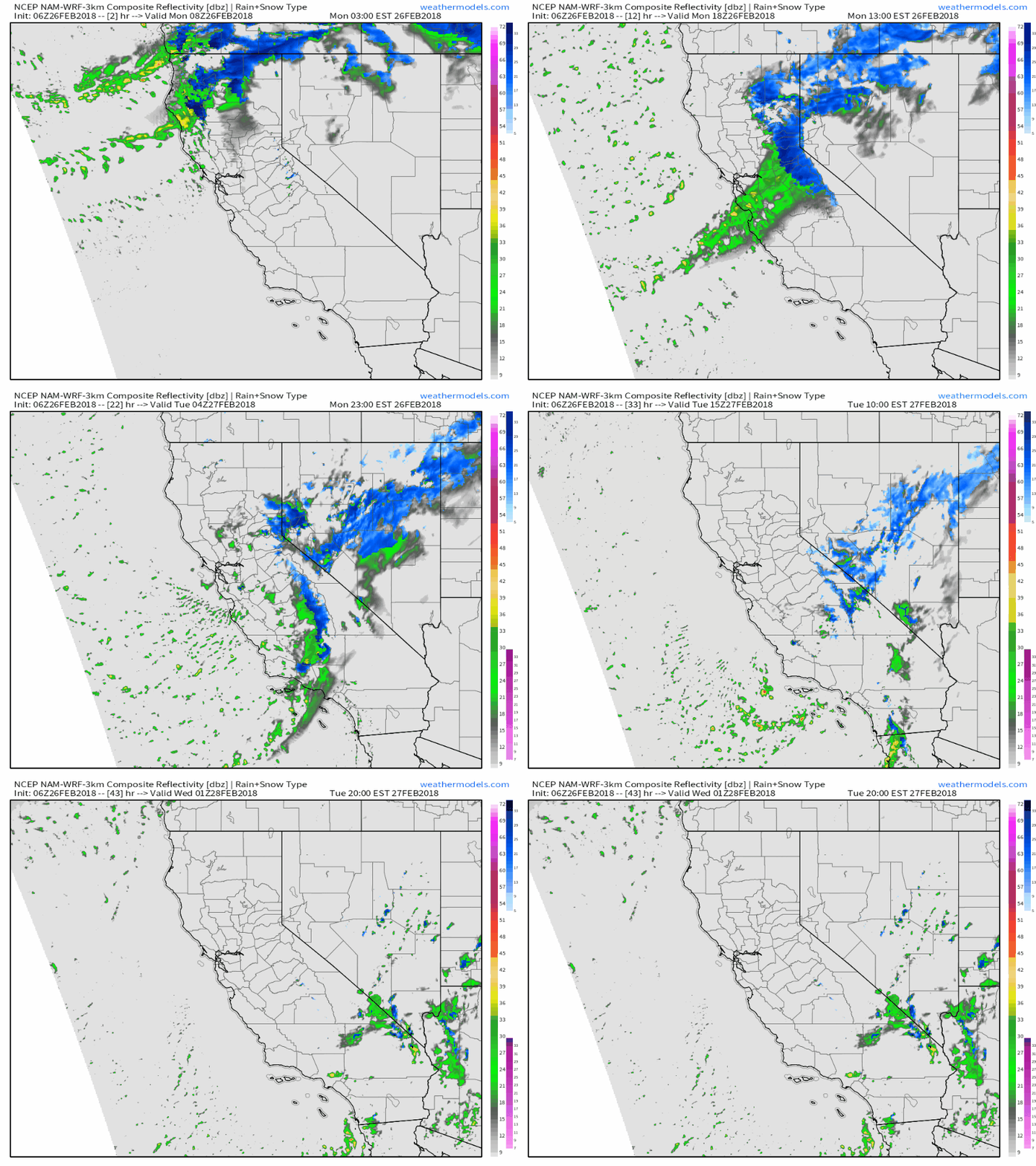
Here’s a complete look at the system’s evolution from north to south today and tomorrow from the 3km NAM model via weathermodels.com. While it won’t exactly nail the placement of each rain and snow shower, it does give a good general idea of what to expect as the system moves southeast in the next day or so. You can find many more images and animations like this at weathermodels.com.
Elsewhere across the country today, generally quiet weather is expected with just a few low-impact showers moving through the Southeastern states as the remnants of a cold front linger.
For more information on your local forecast: https://weather.us/
For more information on the local forecast for ME/NH: https://forecasterjack.com/2018/02/26/mild-and-clear-today/
-Jack


